Life on the road turned out to be different from normal day-to-day life in almost every way. By the end of the trip, we realized what had been the biggest change: for nine months, we didn’t have to deal with any bullshit. No interminable meetings, no irrelevant email threads, no forms to fill out, no middle school classes, no difficult associates. Every day, we had just a few fundamental, primal questions to answer: What should we eat? Where will we sleep tonight? How do we climb up that rock?
Other people have also recognized this salient aspect of travel. Jonathan Raban, in his essay “Why Travel?”, writes:
“If you admit the real reason, you’re liable to attract the attention of men in white coats, or the police. For travel is a kind of delinquency, more often rooted in the compulsion to escape the boredom and responsibilities of home than it is in any very serious desire to scale the Great Pyramid of Cheops or walk the length of the Great Wall of China. It’s kinder to say, ‘I’m going to Surabaya’ than just to say ‘I’m going’ – but as you wrestle your bags through the front door and into the street, it’s the leaving-behind, the going for the going’s sake, that quickens the blood and makes the street itself look suddenly different, full of promise even on this bleak morning.”
That was definitely true for us as we imagined the trip. I needed a break from the university – not from my students (who were often the one point of sanity in my work day), but from the institutionalized lunacy of the machine. Greta also saw no point in another year of middle school – the pace of learning was painfully slow, and the pressure cooker of young teen drama was simultaneously boring and wearying.
But while our motivation for the trip might have been avoiding-the-negatives, as we progressed the trip took on a life of its own, which was surpassingly positive. As we looked ahead, there were certain places we eagerly anticipated (Yellowstone! Chicago! New Orleans!), but there were many more about which we knew little or nothing, and it was that sense of discovery and surprise that dominated our lives throughout the year. We may have been fleeing large parts of our lives, but we discovered a different way of living that was often deeply satisfying.
This sense of discovery wasn’t just about natural wonders and cultural artifacts. One of the many goals for the trip was to expose Greta to different places, different people, and different walks of life. Oregon is a pretty homogenous place – it’s overwhelmingly white, and very middle class – not a lot of extreme urban poverty, but not a lot of very rich people either. Since we were travelling along the coasts, we necessarily saw a lot of places inhabited by the rich – big cities with wealthy neighborhoods, but also smaller, historic, affluent coastal towns. But driving through rural areas on two-lane roads, we saw a lot of small, poor towns, and in big cities, we necessarily came across a much broader swath of people.
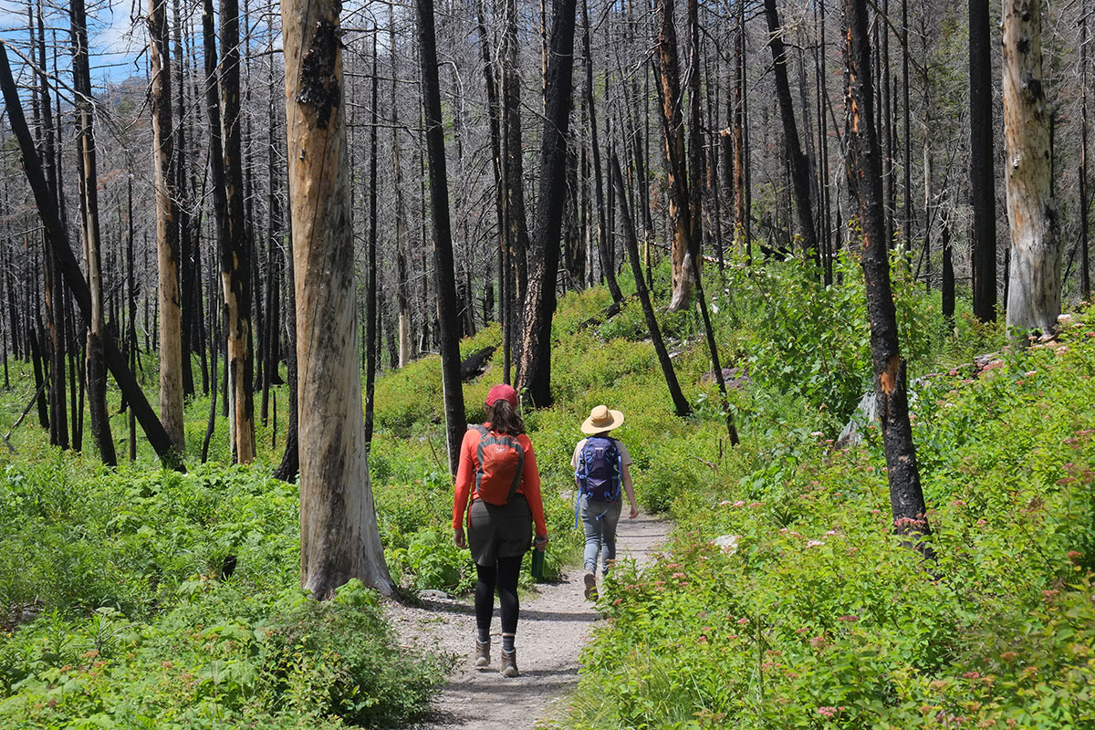
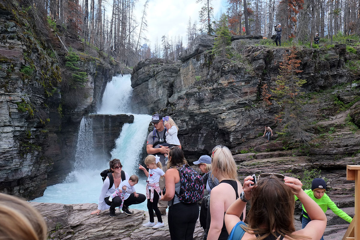
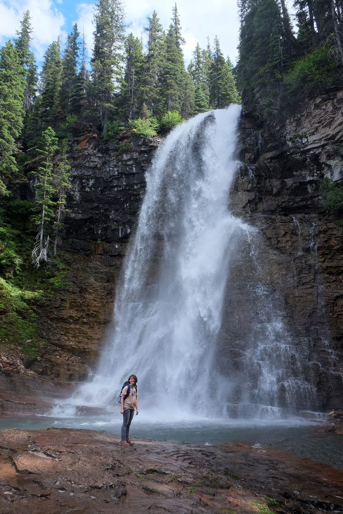
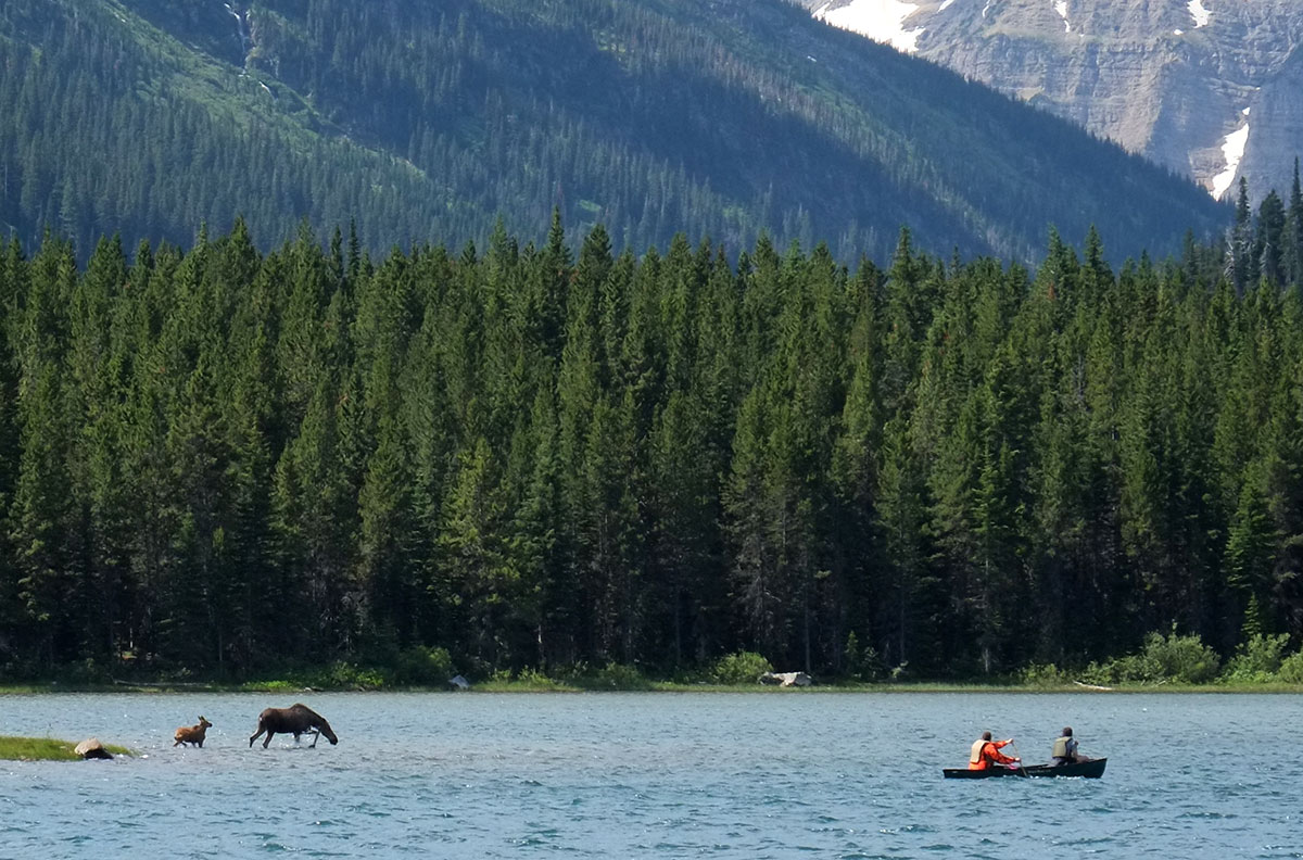
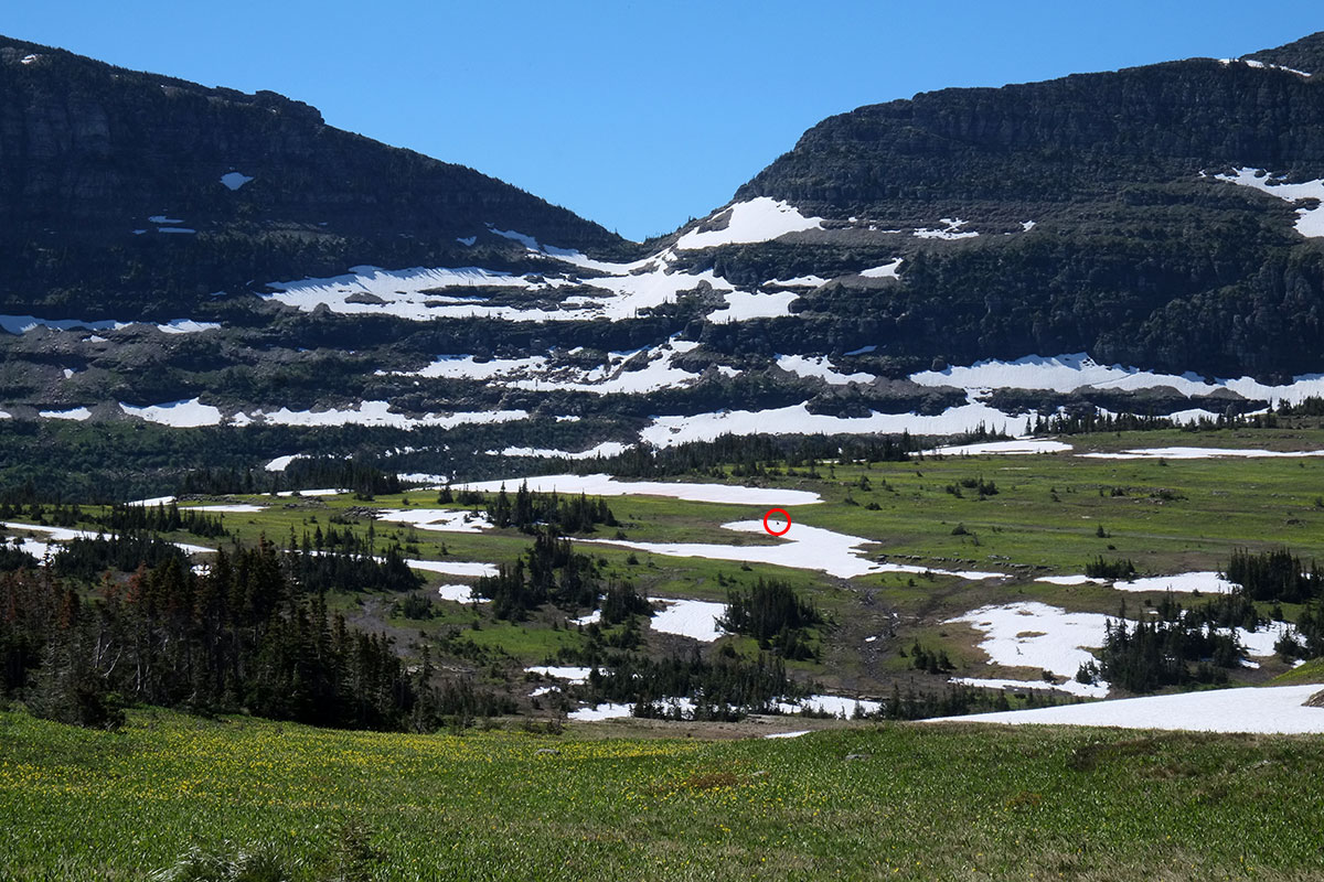
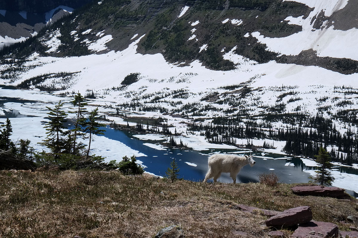
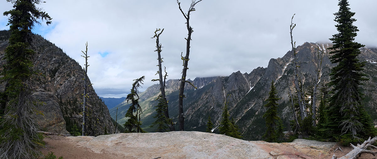
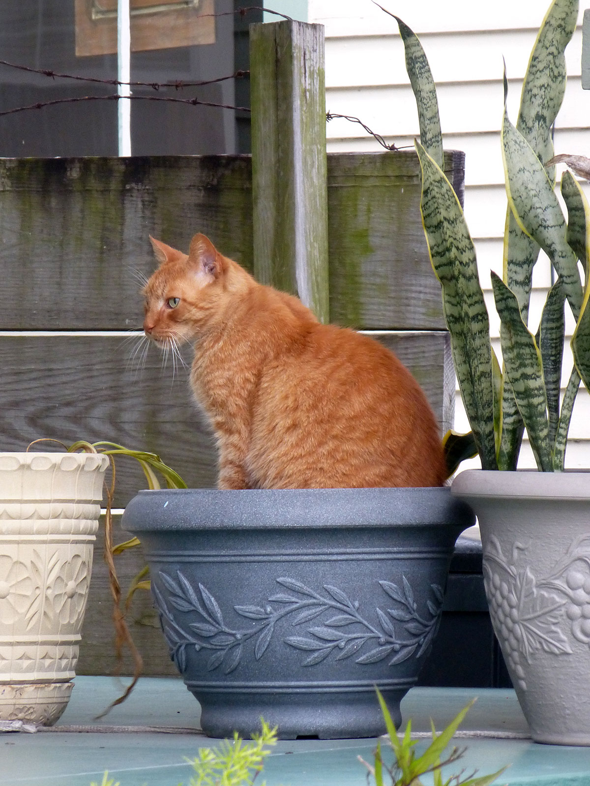
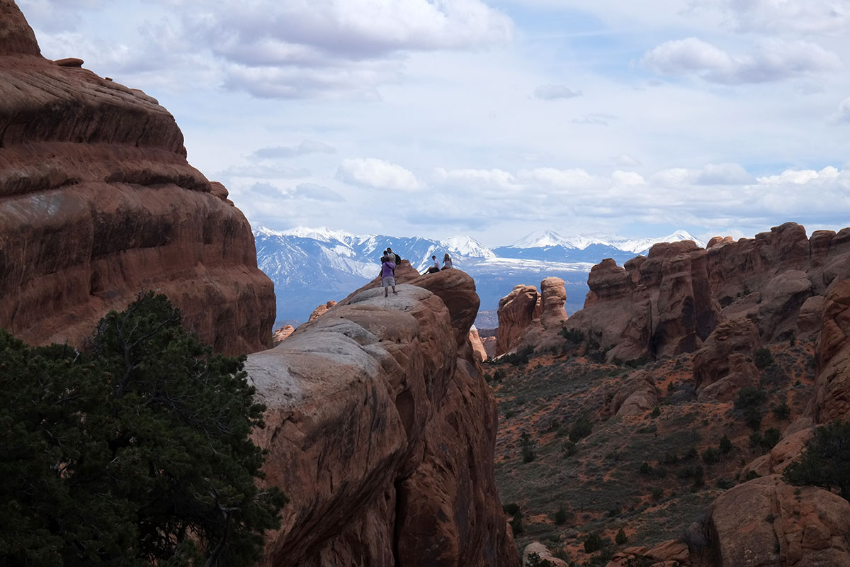
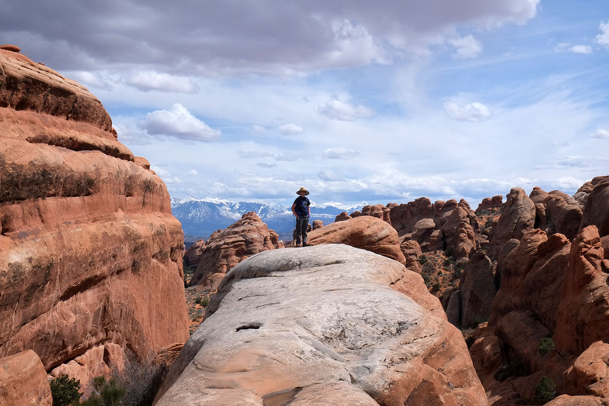
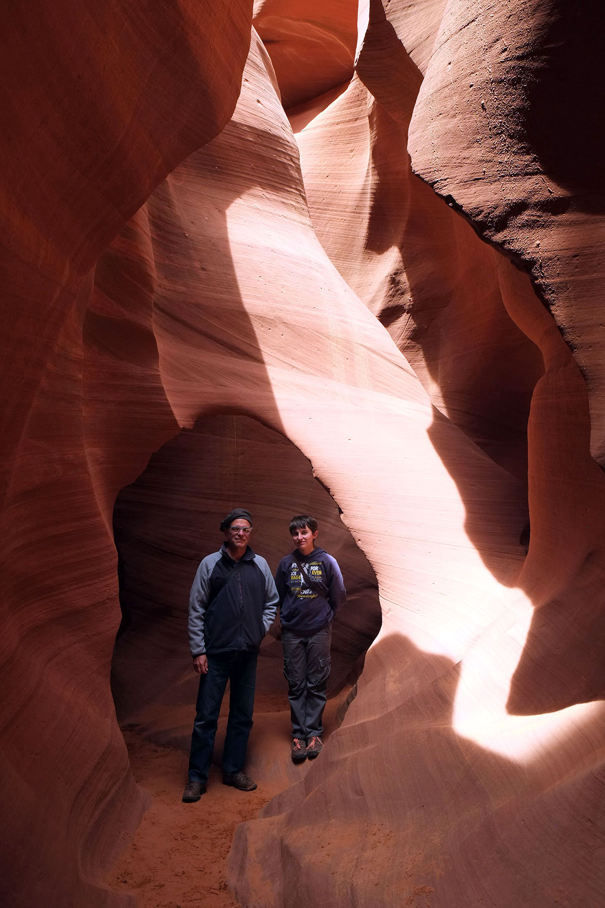
We made a conscious effort to get out of our comfort zone, to do things and go places that were different from what we were used to. Sometimes this pushing the boundary was out in nature, where we attempted some semi-scary climbs, or went down into caves until we felt that we had hit the limit of what we reasonably could do. In Arches National Park, Greta spotted this fin where other hikers were having their picture taken.

She clambered out there to so I could snap her picture – but as she moved further out on the fin, she reached a point where she looked at the fall-off and just didn’t want to go any further. It was a nice, precise plotting of her comfort level gradient (which was further out there than mine).
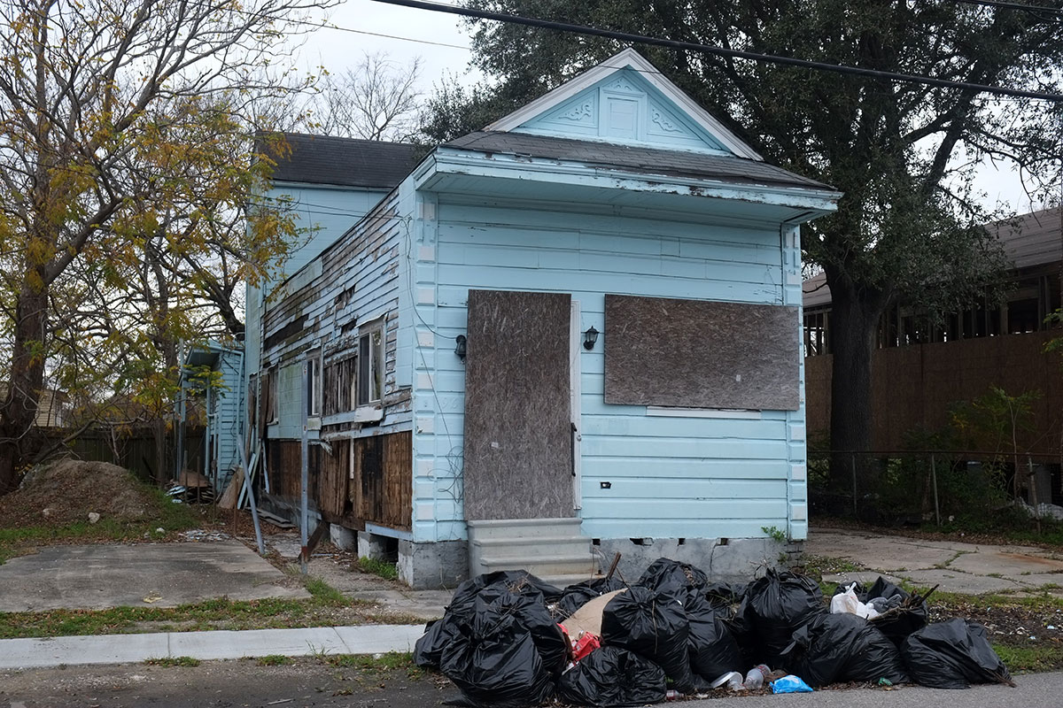
We tried to not categorically avoid any experiences (except when poisonous snakes were involved), but to give everything a shot and base our trajectory on how things felt, rather than preconceptions. Our third day in New Orleans, we wandered through the Lower Ninth Ward, much of which is still devastated and half deserted, ten years after Katrina.
Rationally I knew it was pretty safe, but much of it looked sketchy, so I would check in with Greta every once in a while, asking her if she felt comfortable. She always did, and pretty soon we developed some street smarts and felt at home all over New Orleans. One day we were walking home and I suggested going down a certain street. Greta said, Let’s skip that block, dad, there’s a couple of crack houses there. Apparently there were things she was learning from other kids in the neighborhood.
Travelling together
As I’ve mentioned, most of my travelling in the past had been by myself, but in the past decade I came to really enjoy travelling with Linda and Greta, both for the company and the new perspectives it opened up. However, this trip was qualitatively different from any prior travel we’d done – not a two-week vacation from our normal life, but a nine-month journey where we’d spend almost every waking moment together; it was more a new way of life than just a hiatus from our standard one.
As we were imagining the trip I thought back to prior long trips in my life, and tried to clue Greta in to what I thought would happen. I told her that on such a long trip there would days where everything was terrible – the weather would suck, and things we wanted to see wouldn’t be open, and the food would be awful, and she’d be bored and tired of me and wondering why we had done this and she’d want to go home. But that wasn’t an option: we’d be committed to this trip, we couldn’t bail out, and she would just have to believe that the next day would be great. So we were both prepared for the worst when it would arrive, and it just never did. There were a few days with more annoyances than enjoyment (not being able to find anywhere to sleep in the whole state of Wisconsin, blowing out a tire in the middle of the Mojave), but there was never a day where, on balance, either of us really wished that we were home.
Even more shockingly, we never had a fight. I would express annoyance once in a while when Greta wasn’t paying attention and made a navigational error, and she would get frustrated when I dragged her to yet more architecture, but it never escalated beyond that. At some point a friend asked if we were driving each other crazy, and I said no. Greta said, Yeah, he’s been driving me kind of crazy. I scowled at her, and she said, Dad, I’m a teenager – I have to say that.
I think a lot of our getting along came from recognizing our differing interests, and being willing to accommodate them. We didn’t see all the architecture and art I wanted to, but we saw all that Greta could stand. And I certainly spent way more time in natural history museums than I ever would on my own. Some of our favorite places were where we could diverge and indulge our own interests without having to worry about the other person, such as the Carnegie Museum in Pittsburgh or the Smithsonian, which have astounding collections in both natural history and art. In other places, such as Chicago, negotiations led to a good solution. When I had reached my limit on science museums there, I suggested that the next day I could drop Greta off at the Shedd Aquarium while I walked down to IIT to see the Mies buildings. Greta said that she didn’t know that she was comfortable being by herself in the big city, even if she had a cell phone and it was a controlled environment with guards, etc. I said okay, I understand, I don’t want you to do anything with which you’re uncomfortable, so why don’t we go to IIT in the morning, then we’ll head up to the Aquarium for the afternoon? Greta thought about it and replied, I’m fine being by myself.
We drove 20,859 miles together, and walked around cities and landscapes for days, so there was a lot of time just being together on the move, not at some planned destination. What we did was look around and talk. Wary of the horrors of the presidential campaign always just over the horizon, we never turned on the radio, and never watched TV. (The one time we did, sitting in a Jamaican restaurant in Savannah, where a Republican primary debate was on CNN, convinced us we’d made the right call.)
For the first six months we didn’t really have music – my truck is so old that we couldn’t plug our iPods or phones into the sound system, and a little speaker we bought was so bad we just gave up on it. Back home in March, we picked up a bunch of CDs to play, and I managed to achieve one of my unspoken goals: by the end of the trip, Greta was completely into the Clash, Joni Mitchell, the Allman Brothers, and the Cars. I walked by her room a few weeks ago, and she was listening to Aqualung. She has really weird tastes for a 14-year-old girl in 2016.
Greta almost never put on headphones and tuned out the world; a few times, when we were driving through an incredibly boring landscape, I’d offer that I wouldn’t be offended if she listened to music or a podcast on her own, but she usually demurred – she found looking out the window and observing this alien place to be entertaining. We’d comment on things we were passing, and we started noticing the same things, such as strange signs by the side of the road.
After so much time together, we were pretty attuned to what the other person would find amusing, and we always pointed things out. (We now have a large supply of in-jokes we can work for the rest of our lives.) Greta got so good as spotting barricades for me to photograph for my other blog that she demanded that I list her as a spotter if I ever get a book published on them.
This was our first big trip when cellular communication was constant, and it worked out incredibly well. We talked to Linda almost every evening. In general, Greta is a lot less obsessed with her phone than most other teenagers, and that carried through on this trip. She had a few friends with whom she texted a few times a day – I always knew when it was lunch time at her middle school, as the texts would roll in. But that was the extent of it – she was completely aware of being in places she might never visit again, and she always preferred to live in the moment, rather than staying wrapped up in her social life thousands of miles away. I think there was one occasion on the whole trip where I had to ask her to put the phone down and pay attention.
We realized that a lot of texting is like a lot of eating – our day-to-day lives are often rather boring, so we text or eat or websurf to amuse and distract ourselves. When life is interesting, we don’t need to do those things. On balance, the texting was a real positive. I had been worried that Greta would miss her friends, and that this would initiate feelings of wanting to go home. But the texting was natural enough, and constant enough, that she never really felt out of touch with them. She missed them a lot less than I expected, and she didn’t feel completely cut off from her life at home. And when her friends would text that they were heading off to a boring history class, she could send a text back saying, Well, I’m here:
As I’ve quoted before, Jonathan Raban argues that “…this kind of pure, serendipitous travel is a solitary vice…travelling in pairs and families is the continuation of staying at home by other means.” He may be right in his idea that certain kinds of disoriented experiences are only open to the out-of-contact, displaced, solo traveler, but I found this engaged travelling together to be preferable in most ways. I remember travelling in Europe about 30 years ago, and realizing that no one I knew had any idea what country I was in. That sense of literal alienation is intriguing at first, but becomes tiring. Having a constant, excellent companion, and bringing our own little home along with us, reduced the psychic wear and tear. We didn’t get lonely or homesick. There was a good balance between living in the moment, being attuned to what was different and new around us, and still being enough connected to our other lives that missing them didn’t interfere with our pleasure in the trip.
Daily schedule
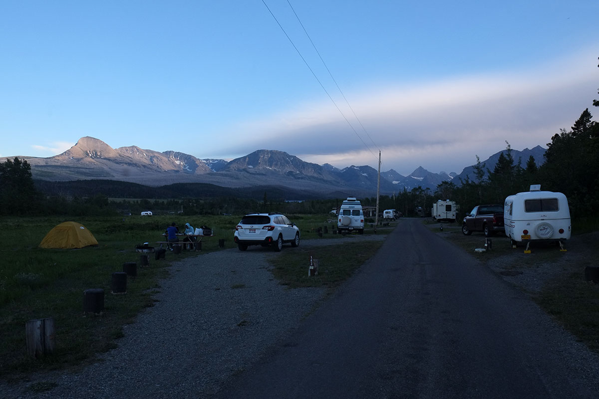
We settled into a consistent rhythm to our days fairly quickly. Travelling in the fall through the spring, the sun didn’t come up too early, and the mornings were often cold. Since neither Greta nor I likes to jump out of bed really early and head out into the weather, we devolved to hanging around the trailer for a while until the day warmed up. While we ate I’d scan the Times on my phone, and Greta would update her favorite web comics. Then we’d either write – blog posts and fiction (in Greta’s case). We’d firm up our plans for the day if we hadn’t already, setting our sightseeing or driving destinations, and we were always in motion by 10:00.
We’d spend the day out and about, driving, walking or sightseeing, and when it started to get dark, we’d eat some dinner and then hang around the trailer again, unless we were with friends. When we started the trip I thought I’d have a lot of free time in the evenings to read – I brought a big box of serious books; with nine months and no job, how could I not plow through them all? It turned out that almost every evening was spent hanging out with friends, blogging, planning the trip, or sitting outside looking at the stars. The big box of books is still sitting here.
Food
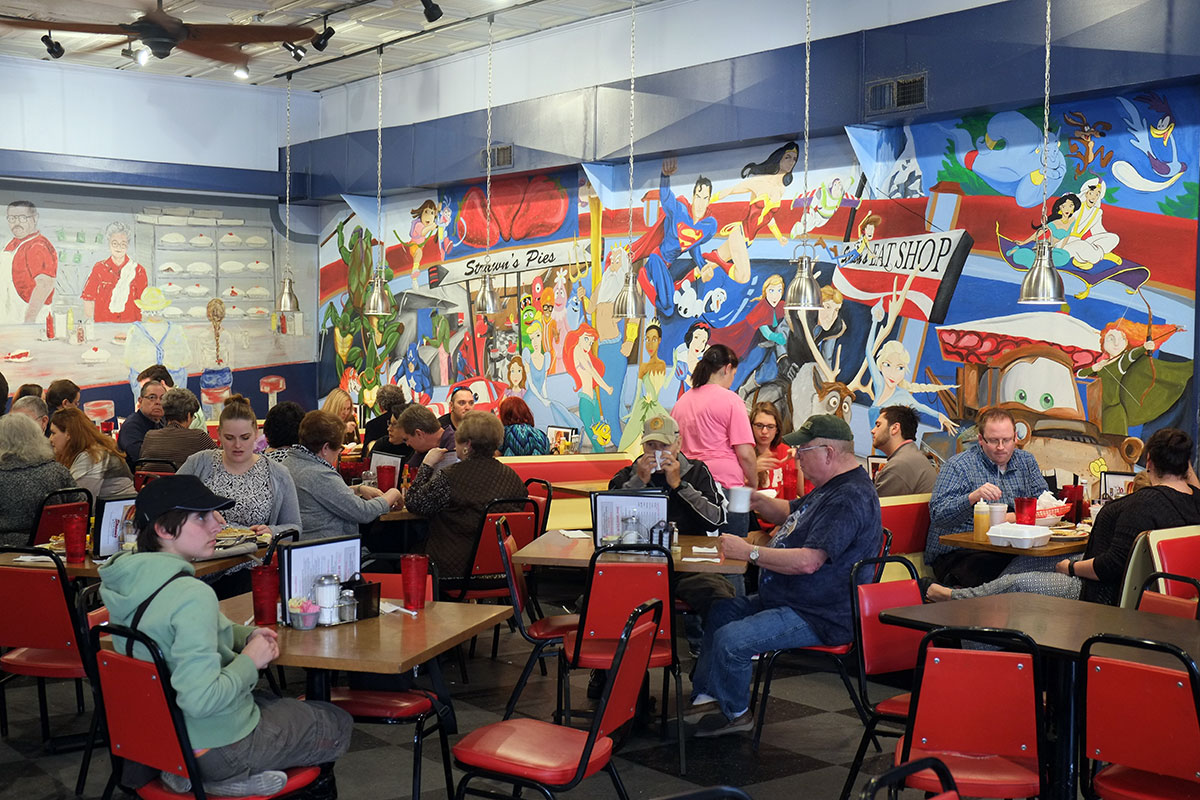
When I first floated the idea of this trip to Greta, I pointed out a number of aspects I thought she’d find appealing, but the one that cinched the deal for her was the plan to eat barbecue all across the South. Greta’s interest in good food has expanded incredibly in the past couple of years, so eating new and interesting food was one of our main goals from the start. Given that orientation, it didn’t make much sense for us to go to a lot of trouble cooking for ourselves. About the third day out we came to a fundamental distinction: there were meals which were an end in themselves (cooked by somebody else) and there were survival meals, which we often made ourselves. On average, we’d aim for one good meal and two sustenance meals per day.
The trailer cooking arrangements were adequate, but obviously not as accommodating as being at home. Our propane stove worked very well, and turned out to be shockingly efficient: in daily use for nine months, we never had to refill the 5-gallon tank even once. We used a 26-quart ice chest, which would stay cold for three days maximum on a recharge of ice. (It turns out that the only place in the country where you can buy block ice – which lasts longer than cubes – is in Utah. But the advantage of the cubes is you can make Manhattans.) Cleaning up was more problematic, with a 10-gallon water tank connected via a handpump to the sink, which then drained outboard into a 5-gallon bucket. This was a pain, so to minimize the washing up, we used paper plates and bowls, leaving just pots, glasses and silverware to be washed.
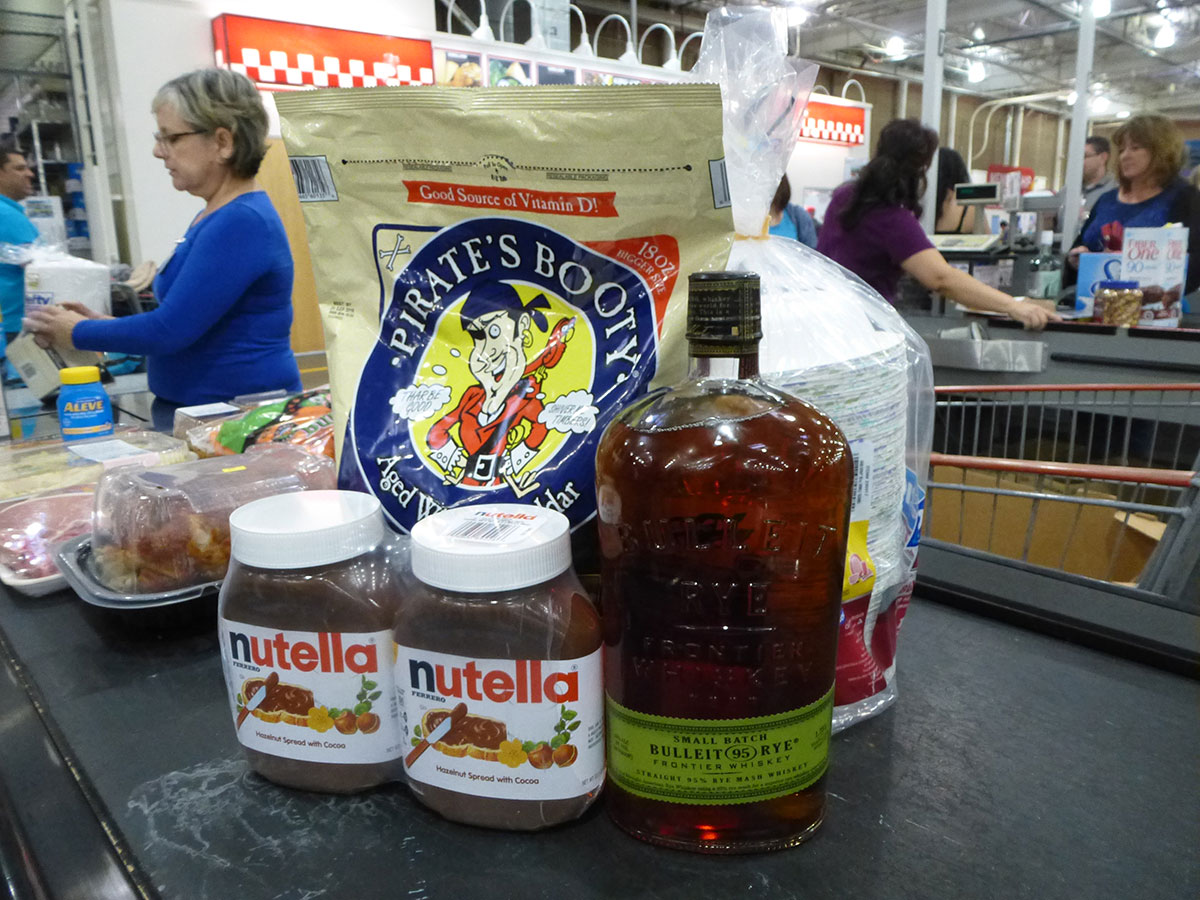
We kept the pantry stocked with a small assortment of staples: canned soups (not bad when you’re starving after a long hike and there are no other options), crackers and cheese, fruit, peanut butter and jelly, bread, cereal, milk, nuts, dried fruit, coffee, and of course, Nutella. We got pretty good at enhancing the basics, such as by adding fresh broccoli into a canned soup base.
I’ve never seen the point of eating breakfast out – it takes too long when you want to be doing something else, it costs too much money, and it gives you way too many calories. So unless there was a compelling reason to eat breakfast out (such as getting out of a freezing trailer into a warm restaurant, or having your pancakes delivered on a toy train), we made it ourselves. Coffee was first on the agenda, prepared with a manual grinder and the excellent AeroPress. Breakfast was always cereal and fruit, which presented a regional problem. About the only cereal that we can stand, as it’s not too sweet, is Quaker Oat Squares, which we buy in bulk at Costco. But in the South (which we learned is Costco’s Texas-centered region), Costco doesn’t stock this item (it’s probably too healthy for Southerners, and they’ve re-allocated that shelf space to liquor). We had to make do with inferior cereal for a few weeks, and then when we flew home for a visit at spring break, we picked up four giant boxes of cereal at our usual Costco, and that constituted our carry-on luggage on our flight back to Phoenix. The TSA technician did not raise any questions.
The two strangest things that happened on this trip were that we liked Texas, and that we became pretty dependent on Walmart. On Whidbey Island we might go to Walmart once a year to acquire some houseware that isn’t available anywhere else on the island, but otherwise we shun them, for aesthetic and political reasons. But when you’re in small-city America, a Walmart is your best hope for finding everything you need – food, ice and gear – without wasting a lot of time searching. You know what brands are available, the layout is close enough from store to store so you can find things, and the parking lots have lots of room for trailers. For camping, we are big fans of those 4 ounce sealed milk packages (like kids’ juice boxes) that don’t have to be refrigerated, and Walmart is the only place in the country that consistently stocks them.
Lunch was usually a subsistence meal too, unless there was a unique opportunity for something good. We were always doing something in the middle of the day – either sightseeing or driving – and we didn’t want to take the time to sit down in a restaurant. We might grab something quick if we were walking around in a city, but if we were driving or hiking, we always made our own lunches, mostly sandwiches. We ate a lot of peanut butter and jelly. I’d usually ask Greta whether she wanted a subsistence meal or should we look for a restaurant option, and she usually came down on the side of no-frills calories so we could keep going.
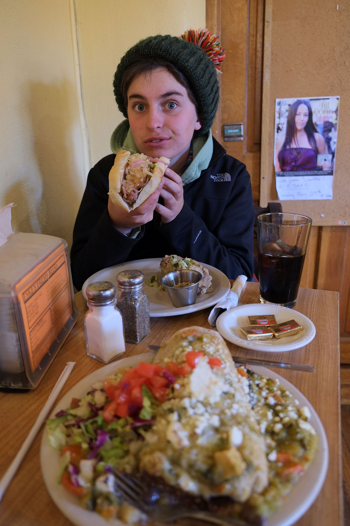
At the end of the day, when we were tired and it was usually dark and cold, a good meal was very appealing. Many of the friends we stayed with fed us wonderfully, but when that wasn’t possible, Greta was in charge of figuring out our options. She has become a master of interpreting Yelp recommendations. We were always looking for good food that wasn’t expensive, so the $ or $$ categories were our focus. Greta looked at the rankings, but she also became adept at digging beneath the surface, reading enough of the reviews to understand their basis. She might say, This restaurant has a good numerical rating, but all the people giving it a thumbs-up are idiots. (She also discovered that people from Colorado are never satisfied with anything.) She’d do her research, then lay out four or five options, which we’d discuss and then decide upon. We found a lot of very good places through Yelp, often places that our local friends hadn’t even heard of.
Last December, the Washington Post published an article on the 10 Best Food Cities in America, Ranked. Since we were visiting nine of them, we followed up on some of their recommendations (the cheap ones). There were some great ones we never would have found otherwise (such as Leon’s in Charleston), but some others were a disappointment (such as Nam Giao in Houston).
The other helpful source was Roadfood.com, a website started by Jane and Michael Stern, the authors of many fabulous road food books and frequent NPR contributors. The emphasis is on regional cuisine, often hole-in-the-wall places with long histories. Most of the recommendations were good, but sometimes the quality of the meals was less than impressive; Roadfood isn’t just about the taste, it’s mainly about the cultural experience. So we ate at a few places where the food was different but mediocre, while the ambience was notable.
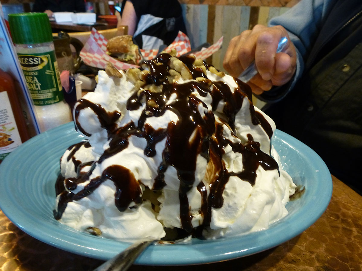
In a year of eating on the road, we discovered one constant: every meal served at a normal American restaurant is large enough to constitute two reasonably-sized meals. Except in Utah, where every meal (or desert) can make three reasonably-sized meals.
This may not be a problem when you’re at home and maybe over-eat out once a week, but when you’re eating in restaurants almost every day, it’s definitely a problem. We could have followed the Zimmer girl protocol of splitting entrees, but we always wanted to try out more than one thing on the menu. So we’d order two meals, and when the food arrived, we’d do a quick assessment of what half would work best as leftovers, and what half should be eaten immediately. We always had an ice chest in the truck, so we’d pack things away, and then eat them for lunch or dinner the next day. We got to eat a wide assortment of great food (Greta and I always shared our dishes), and we pretty much cut our restaurant budget in half by doing this. Having no microwave or toaster oven, we got to be really good at reheating things in a frying pan. Greta is thinking about writing a diet book, called Leftovers Keep Me Skinny.
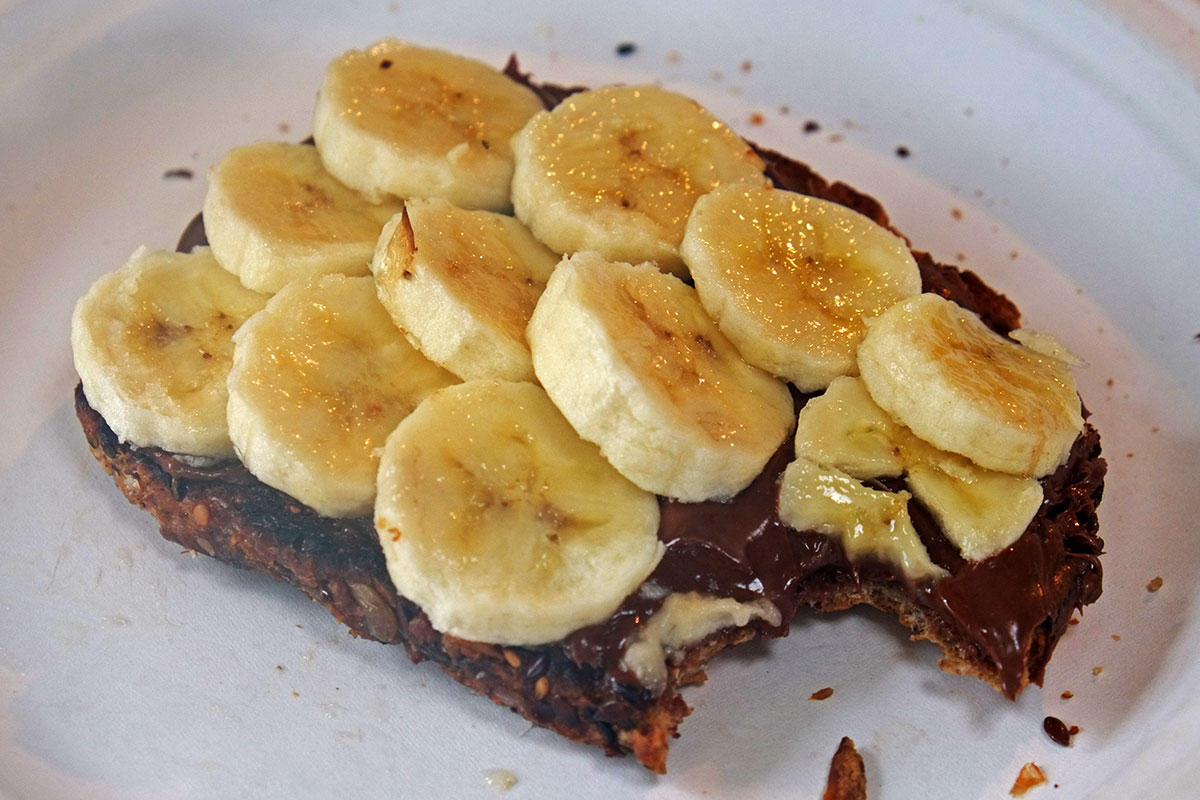
Left to our own devices, we came up with a few trailer-cooking recipes, which Greta hasn’t gotten around to blogging about. We think that cold s’mores, made with sliced giant marshmallows and Nutella, are actually better than the original. The precise method for making satisfying tuna melts in a frying pan took some experimentation to derive. A variation on the Piglet Deluxe, a sausage or hot dog with lots of onions, peppers and cheese, became a more frequent dinner when we were camping in the Southwest, far away from all restaurants. But our best invention was Banana Nutella Toast.
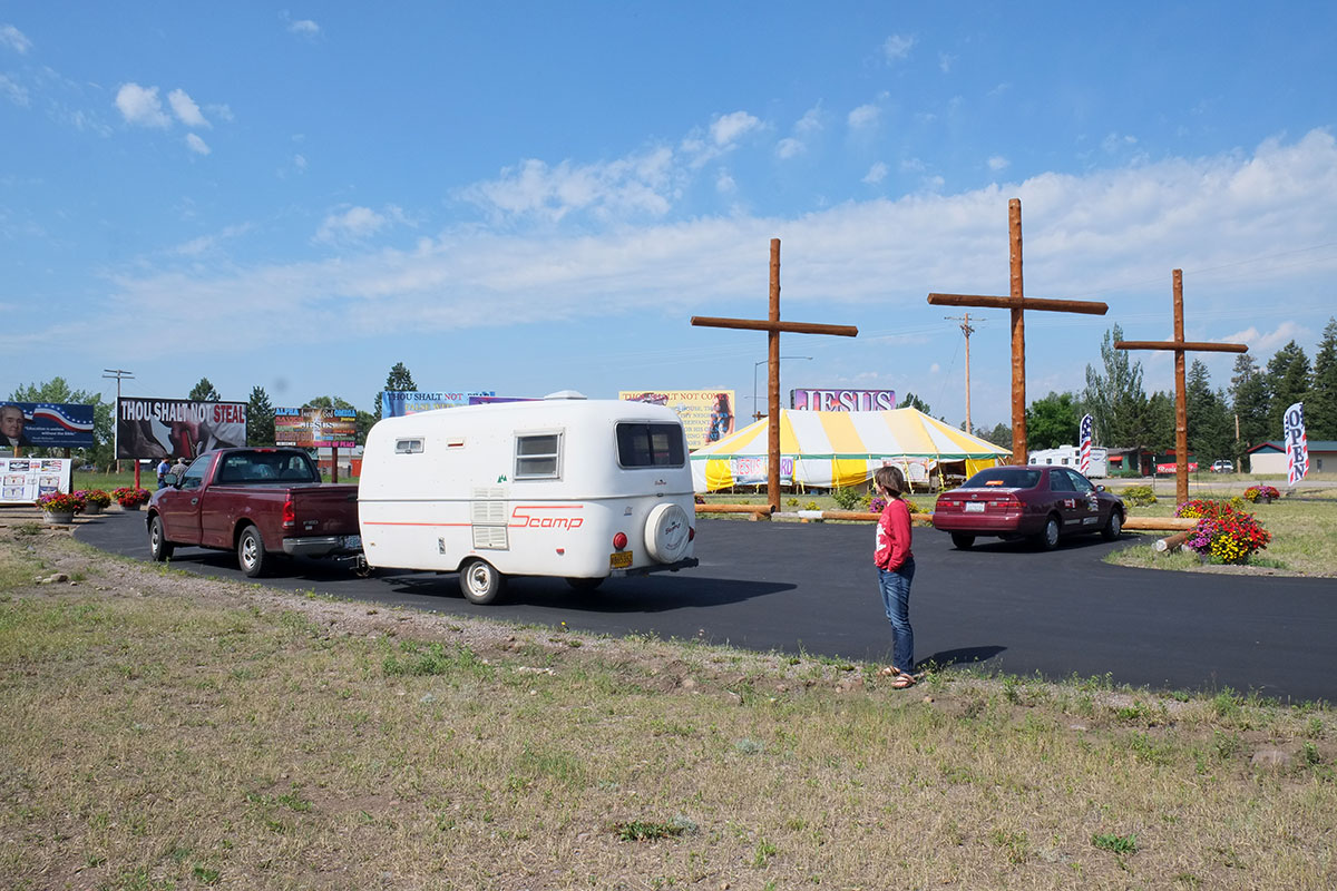
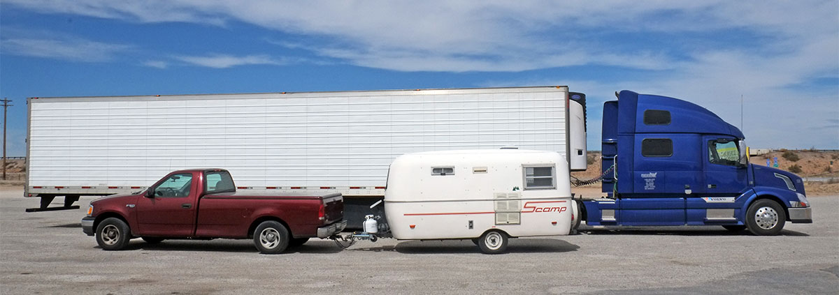
While the food was good in most of the places we went, the cocktails were generally terrible. To get a good cocktail you pretty much have to head to a bar where they care about these things, and hanging around in bars was not how I was going to spend my evenings with a 14-year-old in tow. I had notably good cocktails in a handful of places, but in general I made my own. I stocked rye, Carpano Antica vermouth and bitters in the truck, and would often spend the evenings with friends mixing Manhattans. My friend Ray suggested that we might reprise Jon Favreau’s movie Chef, where he travels with his son across the South in a food truck, but in our case turn the Scamp into a bar.
Driving
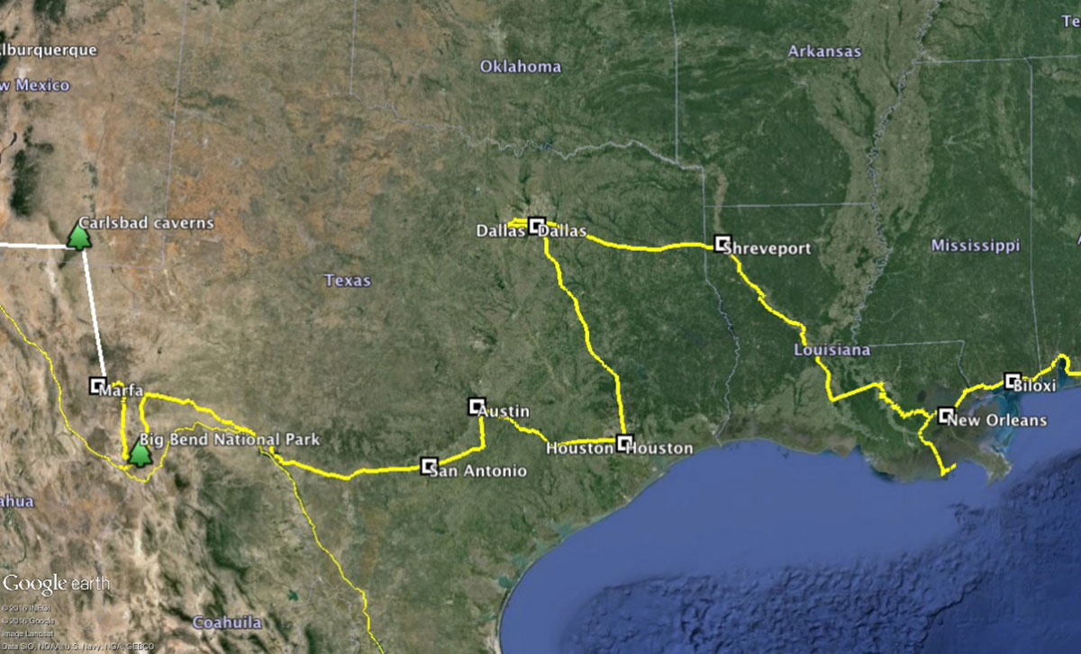
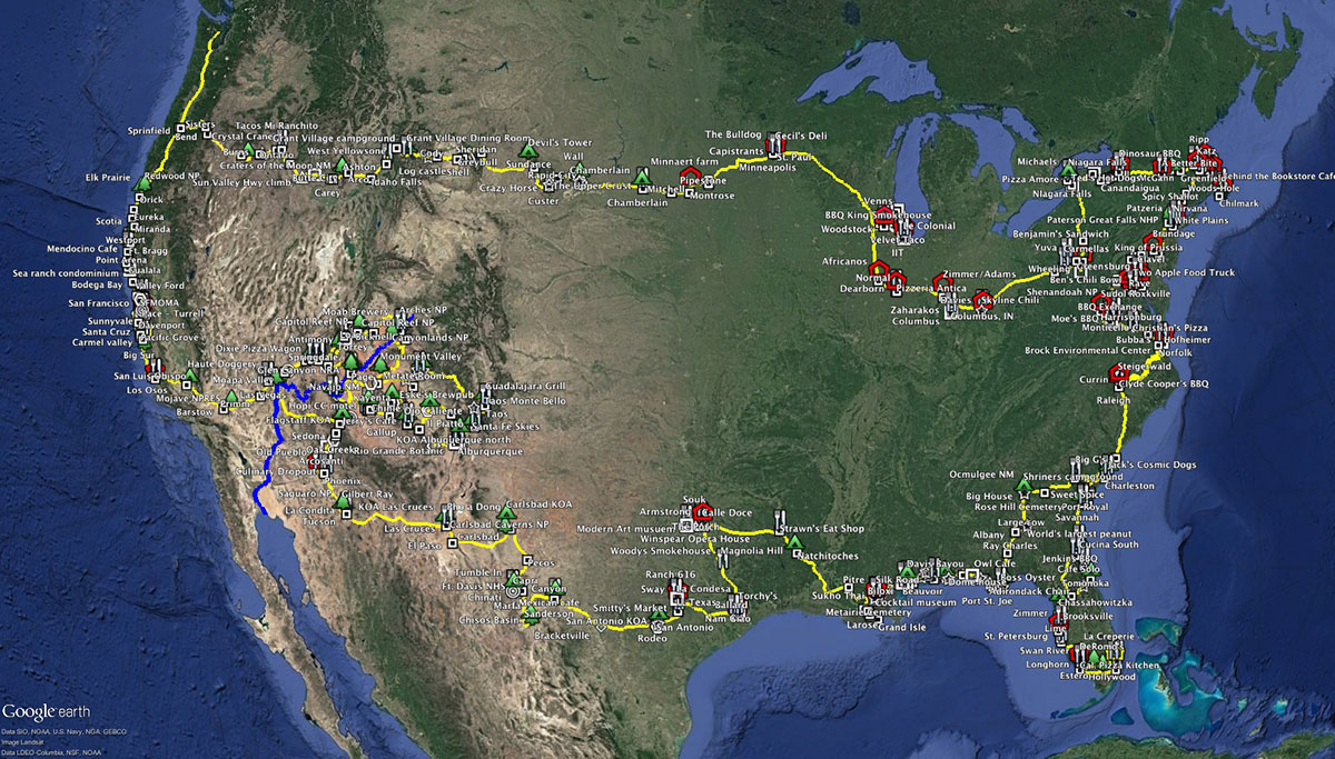
The driving itself was a big part of our experience, but not as much as you might think. 20,859 miles is only about 1.6 times the mileage the average American drives each year, and we averaged 93 miles per day over the whole trip. We never exceeded 400 miles in a day. On my solo cross country drives I had sometimes approached 1000 miles in a day, but we had no desire to turn any of this into a forced march. We were out to appreciate all of the trip, so we did everything we could to make the driving engaging.
We averaged 14 miles per gallon for the whole trip, about 2 mpg less than I get in the truck with no trailer. Our timing for gas prices couldn’t have been better – we paid an average of $2.15 per gallon (and as low as $1.22 per gallon). If gas had been $4.00 per gallon (which we expected), it would have cost us another $2700.
Whenever possible, we drove on two-lane roads. We all know how boring interstates are, but we never truly appreciated just how boring until this trip. Even travelling through an uneventful landscape, we’d sometimes be on a two-lane road, skirting around farms, going through banal little towns, and mildly interested in what we were passing. Then we’d get on a interstate, and be completely bored within half an hour. The zone of homogenization around an interstate guarantees that you can almost never see anything interesting – no amusing little sign, no decrepit vernacular building, no sign of life. There is always a big, straight vista ahead of you, and the act of driving itself is relentless.
There were two exceptions to this rule. When driving across big empty states where the landscape was pretty uniform (South Dakota comes to mind), there were sometimes no good alternatives to the interstate, and the experience was not that different. The other exception is driving though sprawl. Sprawl is basically the same everywhere, there is nothing really to see in it, and driving through it is absolute hell – stop and go traffic, stuck at red lights in front of Arby’s. So when we were in the countryside we always drove on two-lane roads. When we reached the postwar sprawl at the edge of a major metropolitan area, we’d jump on an interstate if we could. And if we were driving into the pre-war core of a city, we’d get back on the city streets.
Pulling a trailer through a big city downtown was not something I looked forward to, and in general we avoided it. In most of the big cities we visited (Chicago, New York, Boston, Philadelphia, DC, Miami, Dallas, San Francisco, etc.) we left the trailer with friends out in the suburbs, and either drove the truck or took transit into the city center. We did end up driving into and parking in a few decent-sized cities – such as St. Paul, Buffalo, Albany, Paterson, Baltimore, Houston, Santa Cruz, and especially New Orleans. Generally I disdain configuring cities for the convenience of vehicles, but we became pretty sensitive to whether it was or was not possible to park with a trailer; Rochester was great, but Buffalo was impossible.
After a few weeks, we worked out a method for navigating. We don’t have smart phones with GPS navigation which give you step-by-step directions in real time. We have Windows Phones, which we consider semi-smart, but they do have GPS-enabled maps in them. Every night I would draw what I thought would be our likely path for the next day. I would start with Google Maps online, and look at the range of options it laid out, such as going on a freeway or not. I would then open up Google Earth in my computer, and plot the preferred route, factoring in considerations other than just the shortest travel time. (We learned to not trust Google Maps driving time estimates, which must be based upon driving at precisely the speed limit and never hitting a red light. We started multiplying those estimates by 1.5.) When we were moving, Greta would follow that path on the computer screen (which was completely static, not showing our location), and also follow our progress on the map in the phone. She learned how to interpret many kinds of information – the road should be bending to the right then straightening out, we should be coming to a small town soon, we’ll be going over a bridge, etc. She would anticipate our next move (we should make a left turn soon, probably at that next light), and then check that we were still on track.
Sometimes she would have to improvise, adjusting our track to changing conditions. Her biggest test came as we approached Houston during the Friday evening rush hour. I had sketched a route to her cousin Joe’s house, using the I-610 loop. But that afternoon Joe texted us to never get on that highway, especially at rush hour, as it would be completely jammed for hours. So as we approached the city on I-45 from the north, I told her that we were just going to drive straight in to the center of the city against the rush hour traffic, and she would have to figure out how to get to her cousin’s in the southwest. She did it flawlessly, looking at the map and evaluating alternatives, moving us off the interstate and onto surface highways and arterials.
One of the goals for this trip was for Greta to learn things that she couldn’t if she had stayed home, and this could be one of the biggest: Greta may be the only member of her generation who has serious map-reading and navigational skills, and who won’t be lost if her smart phone goes on the blink. Past a certain point on the trip, any time I questioned her directions she’d get annoyed with me, and eventually I realized I should just trust her calls, they were right more often than my doubts. (I started calling her R2.) I’ve become completely dependent on her for getting through unfamiliar places, and I may have to stop travelling when she goes off to college.
We discovered a lot about American drivers on this trip, and here is the central insight: they are terrible everywhere, but in different ways. In Boston they are oblivious to everything around them and are just assholes. In the South they drive insanely fast, even when they can’t see ahead. We saw some very near-misses with cars passing on two-lane roads, and all the insanely dangerous passes were on the Navajo reservation. We couldn’t figure the drivers out in Albuquerque, until Mark Childs explained that no one in New Mexico is used to driving in a city, so they all drive as if they were still out in the desert with no one else around. In California they are incredibly aggressive, but also highly skilled. And when we were nonplussed at how people drove on our return to Oregon, Greta observed, Wow, they’re really slow and kind of stupid, but nice.
We tried to be considerate drivers on this trip, as we knew we were sometimes an impediment to other vehicles, and we were in no hurry. This was especially the case when we couldn’t be passed, on narrow, twisty roads, such as on the California coast. Most places have laws that say you have to pull over if there are five or ten cars stuck behind you, but we would do it as soon as we could if there was one car behind us. Every time we did this in California, the driver passing us would toot the horn and wave. Californians are aggressive, but they appreciate good driving.
Getting out of the vehicle
The most important thing about driving was to not do it, any more than we had to. We discovered very early that neither of us could really enjoy or understand a place from inside a car. (I recalled a conversation with my teacher, the landscape historian JB Jackson, who travelled from his home in New Mexico to his jobs at Berkeley and Harvard on his motorcycle, as he felt you couldn’t experience the landscape while sitting in a box looking out a window.)
There is a huge forward momentum driving in a car – you spot something interesting, but you have this impetus to keep moving. It’s partially practical (you’re going fast, there’s no place to pull over, you’re trying to get somewhere and any stop will add ten minutes to your trip), but its largely psychological – you are so in the mindset of the car and on the road that it’s hard to consider changing your mode of being. Pulling a trailer just made this even harder – you can’t make sharp turns, you don’t want to brake rapidly, you need a bigger space to pull over, you don’t want to park on a side-slope. So often we would keep going, and I would yell at Greta to grab her camera and snap a picture while we were moving. They’re not the best pictures, but at least they are a record of some weird moments.
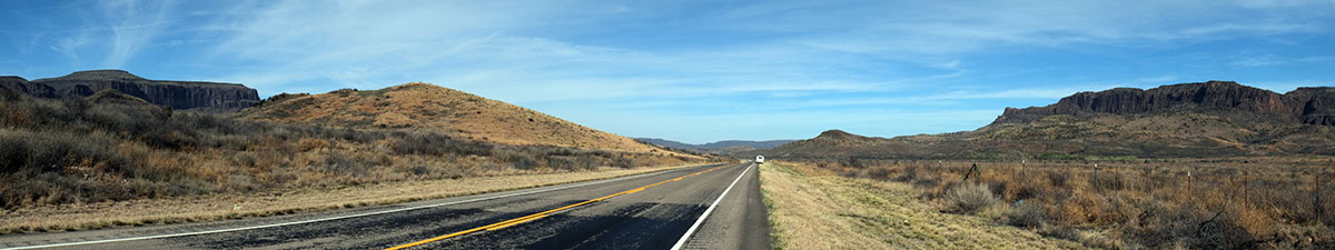
There’s also the problem of where to stop when you’re not at a specifically notable point, but just travelling through a fairly uniform, yet different landscape. (This also happens in cities – how to capture the typical cityscape rather than the iconic building.) Sometimes you don’t want a photo of the special view, you want a record of the typical view, but it is hard to figure out where to best capture that. Sometime I would just randomly stop, (such as here, north of Ft. Davis in West Texas),
but often I wouldn’t (knowing it would be a lousy picture anyway). The new technology that solves this dilemma for us is Google Earth Street View. As we have been reviewing the beginnings of our trip, one year later, we find ourselves remembering a little town or landscape, zooming in on the general area, then using Street View to give us the perspective from the road. This may actually be better than trying to record it ourselves – you can spin all around in Street View, look in any direction, then move up the road a few hundred yards and see what’s different.
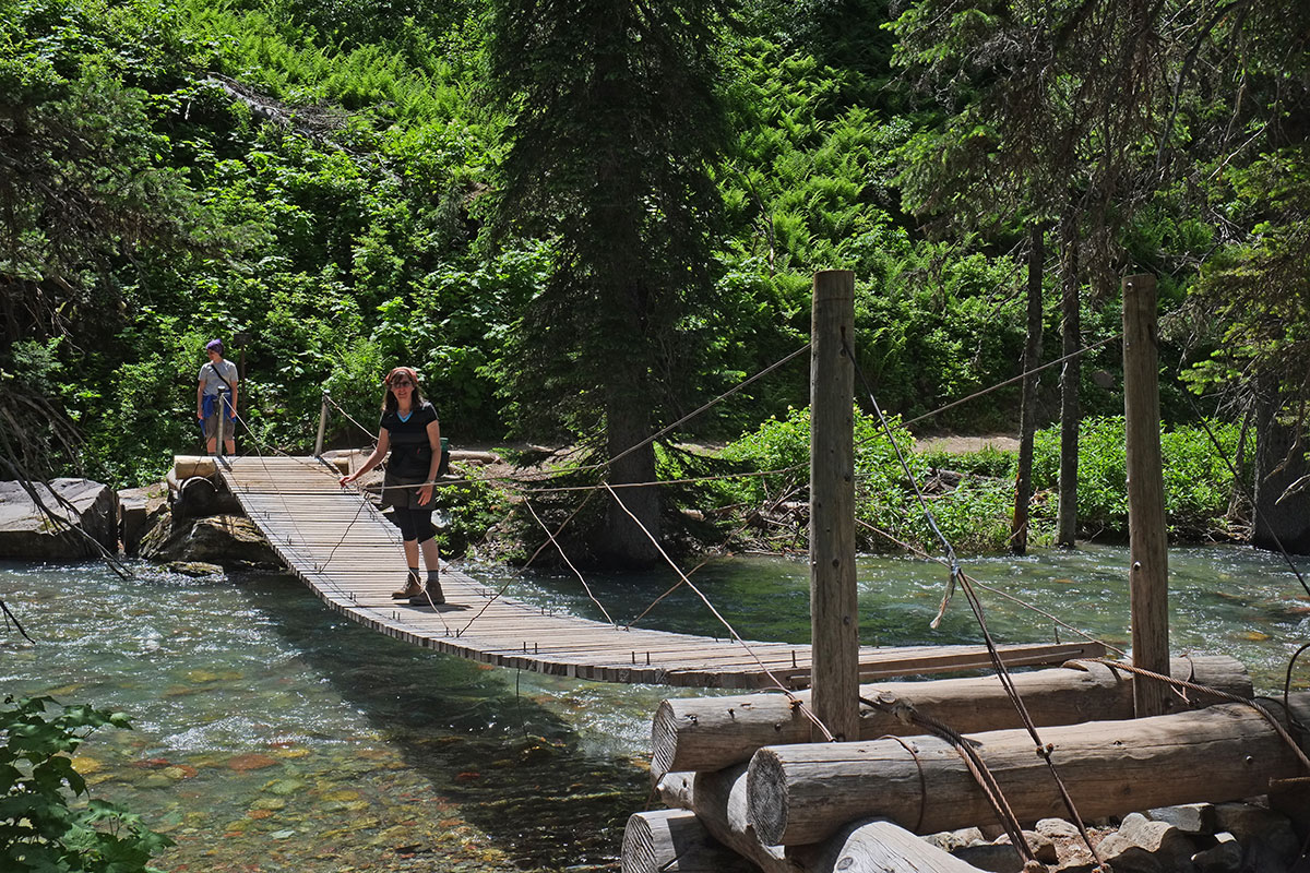
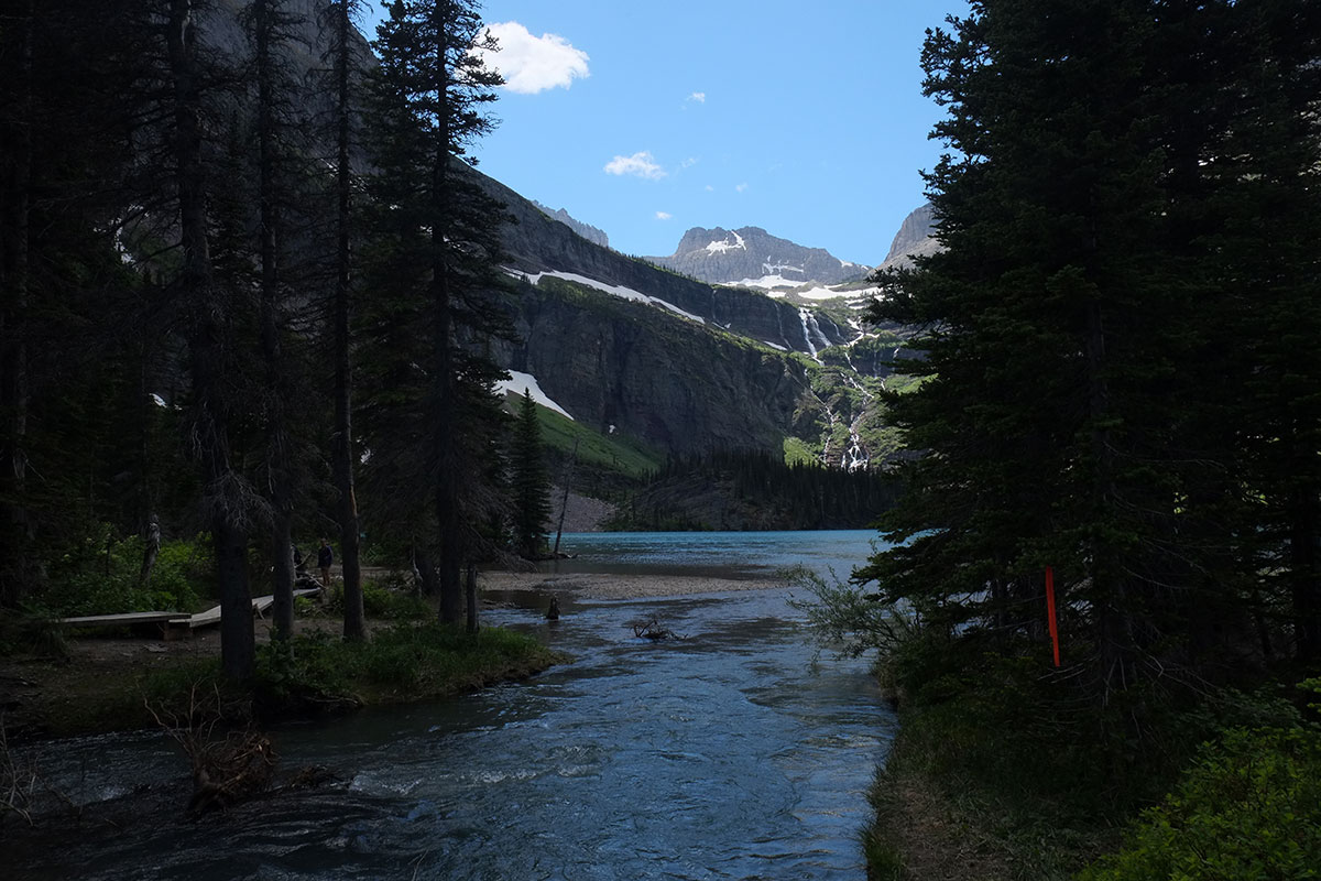
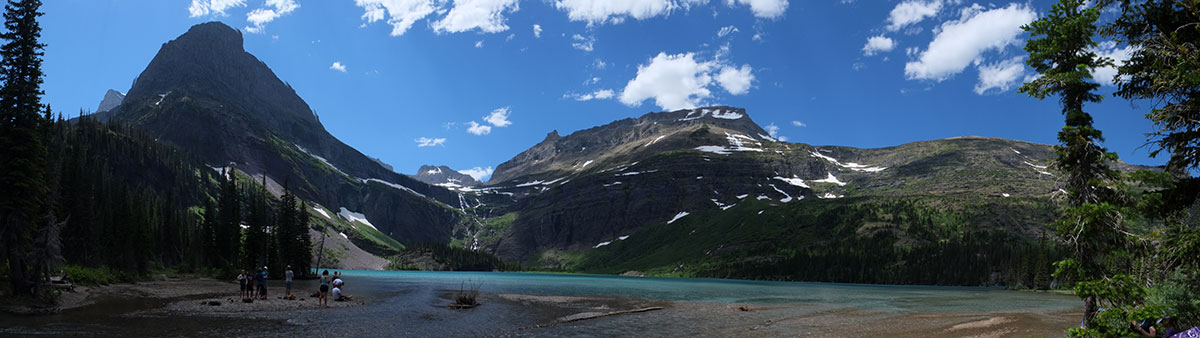
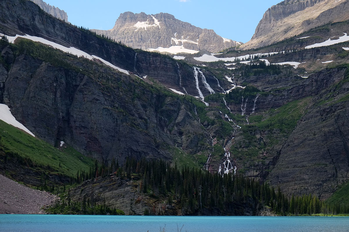
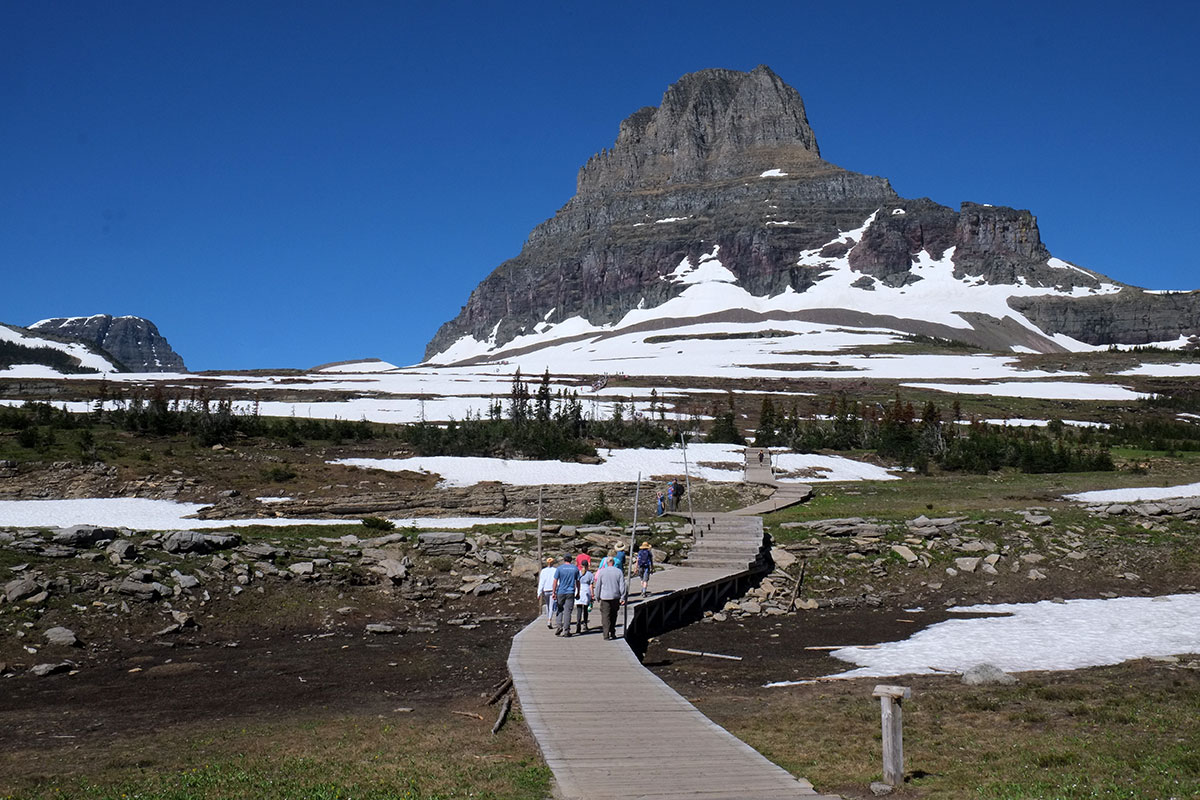
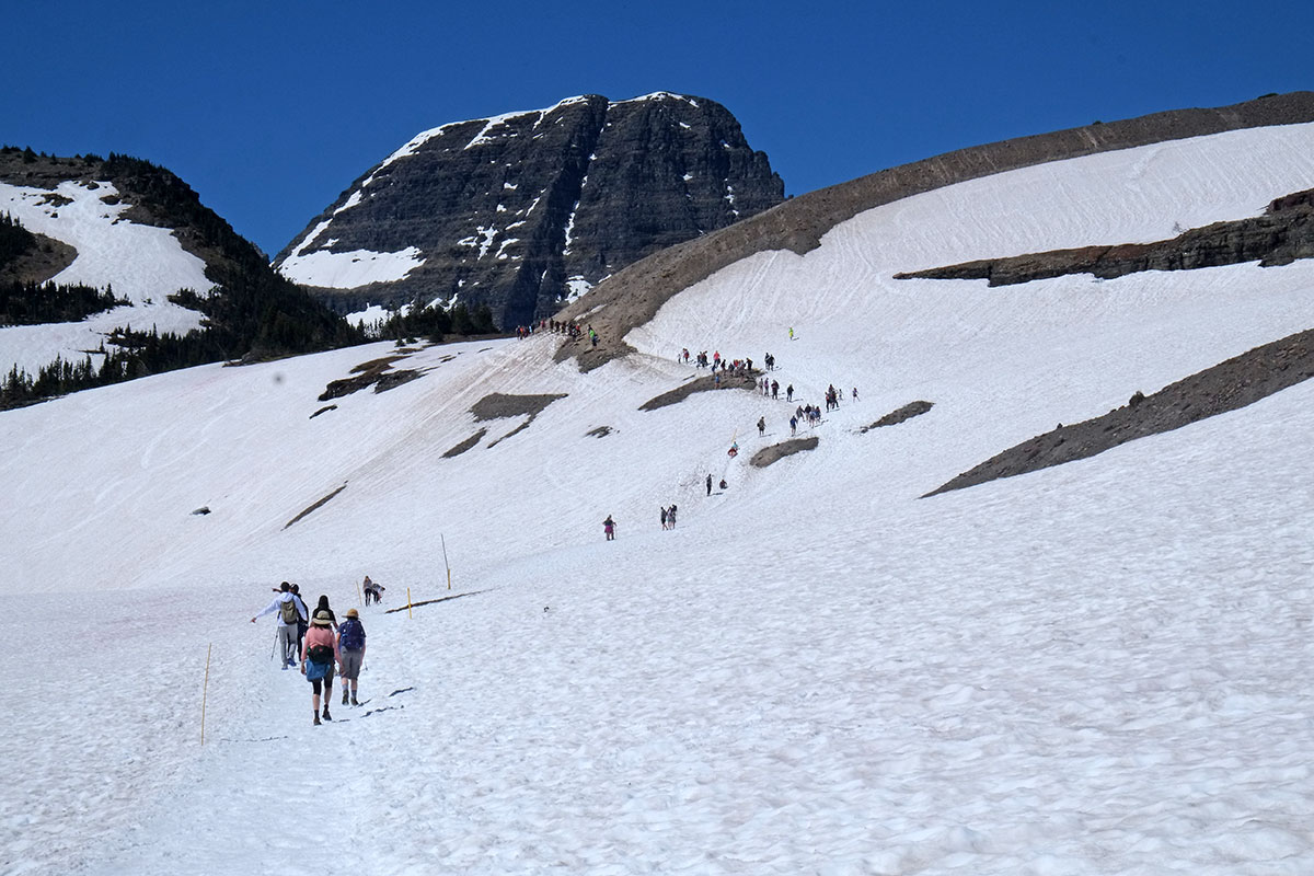
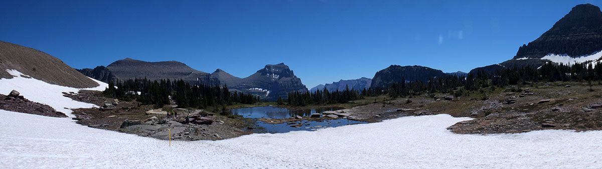
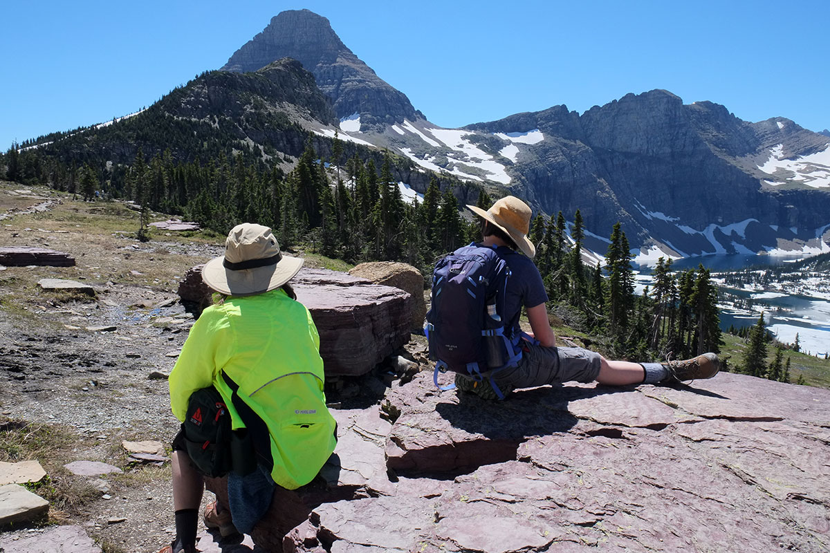
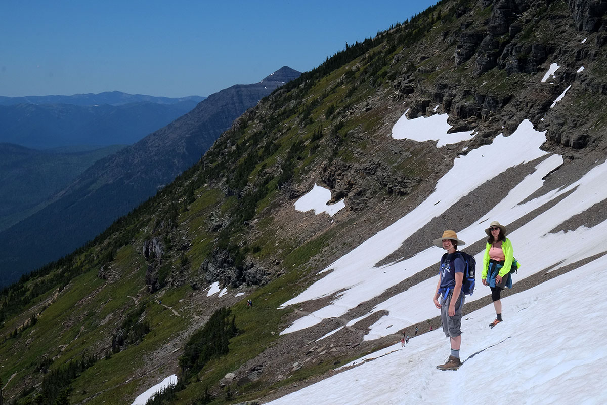
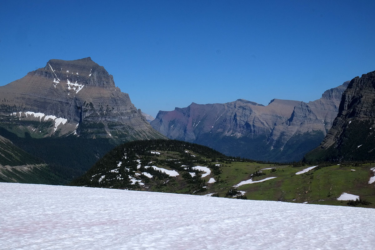
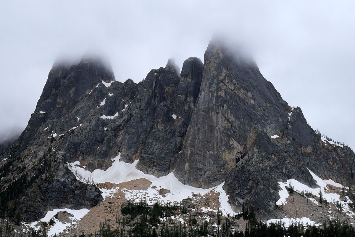
But even more critical than the issue of getting out of the car to see a spot is the issue of moving through the landscape on your own feet. Even when there are marked viewpoints and turnouts and lots of parking, we both found the experience of getting out, looking, taking a photograph, and then getting back in the car, to be less than satisfying. Often it’s the only thing you can do, and sometimes there are walks that don’t do much to change your perception of a place, but we found that our appreciation and enjoyment of a place, whether a building, or a landscape, or a neighborhood, was directly correlated with whether there was a good hike to be taken. In Desert Solitaire, Edward Abbey makes the case that National Parks should ban cars. Everyone should walk, or borrow a bike, or take a shuttle bus if they can’t self-locomote. We found this be true everywhere, and we often took long walks that weren’t on the official agenda. For example, at Zion almost everyone takes the shuttle bus, getting off to hike designated trails to specific destinations. But we decided to skip the bus (in one direction) and hiked 13 miles up the canyon, able to see the views unfolding and changing at a speed where we could comprehend them.
The same applied in cities. One day in Chicago I walked fourteen miles and Greta walked nine: we could have taken a bus, but we just wandered through the city, coming to an intersection and deciding which direction seemed more appealing. It is hard to capture the typical, but it is easier to experience it, if you move through a lot of it. Your understanding of a place becomes not a series of discrete points, but rather a summary or integration of an almost infinite number of places.
This way of travelling and seeing became our norm, and it led to a repeated conversation. We’d be approaching some place at a high speed, trying to decide whether we should pull over. I’d say, Should we stop? And Greta would say, Why not? And if we couldn’t come up with a good reason to not stop, we’d stop. Often we’d have a great experience, and we’d be bemused at how close we had come to missing it.
Documenting the trip
When we started out, we knew we’d be taking lots of photos and doing some kind of a blog, and maybe keeping a journal, but we really didn’t know what would be involved. Our first blog posts were pretty minimal – a few photos with captions to let people know where we were and what we were up to.
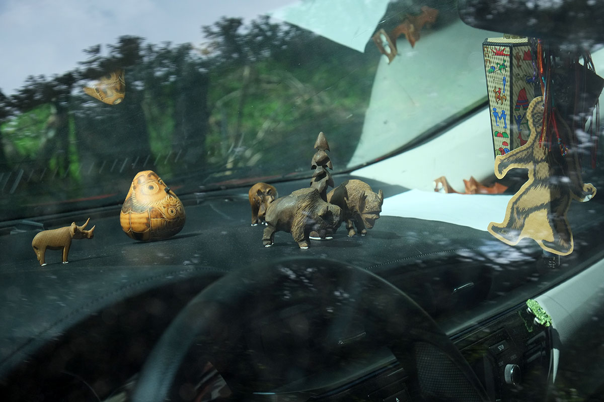
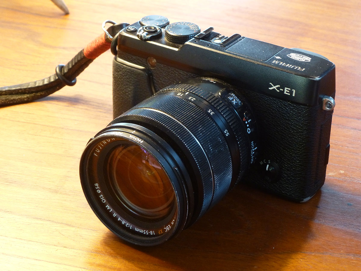
Some of you have remarked on the photos we’ve taken, so I’ll pass on a little basic information. I was using a Fuji X-E1, a spectacular “mirrorless” camera. It is relatively compact (the body is the same size as my old Leica CL), but it has a large APS-C sensor (important for dynamic range, not blowing out highlights or shadows), some of the best lenses being made, and a real, (albeit electronic) viewfinder, so you don’t have to use the screen on the back unless you want to. (I am old enough to feel that real cameras have viewfinders and dials, not screens and menus.)
I carried only one lens – the 18-55mm (equivalent to a 28-90mm range on a 35mm camera). This took care of almost all my needs. The camera plus lens weighed around two pounds. For wide angles, the in-camera panorama mode is one I liked and began to use a lot. If I wanted to zoom in closer, I could just crop a picture later in Photoshop (lots of extra pixels to throw away), or have Greta shoot it for me (she was using a Panasonic DMC-ZS15 point-and-shoot with a much longer telephoto, which she got for shooting wildlife). It’s an interesting strategy – instead of carrying a big, heavy telephoto that I would need infrequently, I just used Greta as my telephoto. The Fuji is by far the best camera I’ve used since going digital 15 years ago, and many professional photographers are ditching their 35mm full-frame cameras for the Fujis.
The format of the blog really changed about a week into the trip. We were so horrified by what had been done to Mt. Rushmore that I needed to analyze it and write it down, and from that point on our blog posts were more thematic, figuring out what there was to say about a place rather than just posting some information. I’d never blogged before, and I hadn’t really written that much in years – for my class lectures, I write out some notes on the points I want to make, and I select a lot of images, but I never fine-tune the writing, I just stand up and talk from notes. In contrast, Greta is a constant writing machine. She was working on a few novels throughout this trip, and in November she completed NaNoWriMo – National Novel Writing Month, cranking out 50,000 words on one of her novels.
I thought blogging would be like keeping a journal, but they have little in common. Whenever I’ve kept a travel journal, it’s been more just the raw material – notes jotted down on what happened, maybe a few observations. No one wants to read another person’s journal, and I’ve never been too excited about reading my own later. But just knowing that a few people are going to read what you’ve written changes everything – you have to take some care with organizing and expressing your thoughts. That act of paying attention changes everything again – you’re suddenly really thinking about a place, not just recording impressions. Having to come to a conclusion made me think much harder, and I think much of what we learned on this trip wouldn’t have occurred if we hadn’t made the effort to write for an audience. I’m very grateful for those of you who have followed this blog so closely – I was not just pleased to know that you cared enough about us to follow it, but also grateful that your attention motivated us to make the effort to think more clearly about everything.
Blogging took way more time than I expected. I thought I could throw up some pictures and dash off some ideas; I talk off the top of my head in class a lot, and that seems to work out pretty well. But actual writing was much slower. My usual writing speed was about 500 words per hour, although a few times I hit my stride and pushed it up to 1000. So by the time I figured out what I wanted to say about a place, selected and Photoshopped the photos, wrote the text and put it up online, each blog post was usually a full evening’s worth of work, then another couple of hours in the morning. I found that I could think, mess around with photos and rough out an outline at night, but I couldn’t produce finished writing then – that was better done when I was fresh in the morning. This is why the blog has been consistently months behind – it just took so much time, and our choice was always to do something cool if it were an option, rather than sit down and produce.
Things we would do differently
So much on this trip went better than we had ever hoped that it seems wrong to regret anything, but we did learn a few things en route that we wish we’d known earlier.
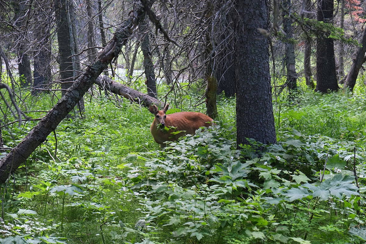
There were things that changed from place to place that we wished we’d documented more rigorously. Like road kill. The amount and nature of road kill changes dramatically – in Wyoming there is a dead mammal literally every 25 yards. Some places skewed more reptilian. Some places didn’t have any. (We never saw an armadillo by the side of the road in Texas.) Greta, with her junior naturalist viewpoint, thought this was fascinating.
Another weird change – those signs that warn you that the bridge you’re approaching might freeze earlier than the road you’re on – every state phrases this differently, and we spent some time discussing the semantic implications of every new one we came across.
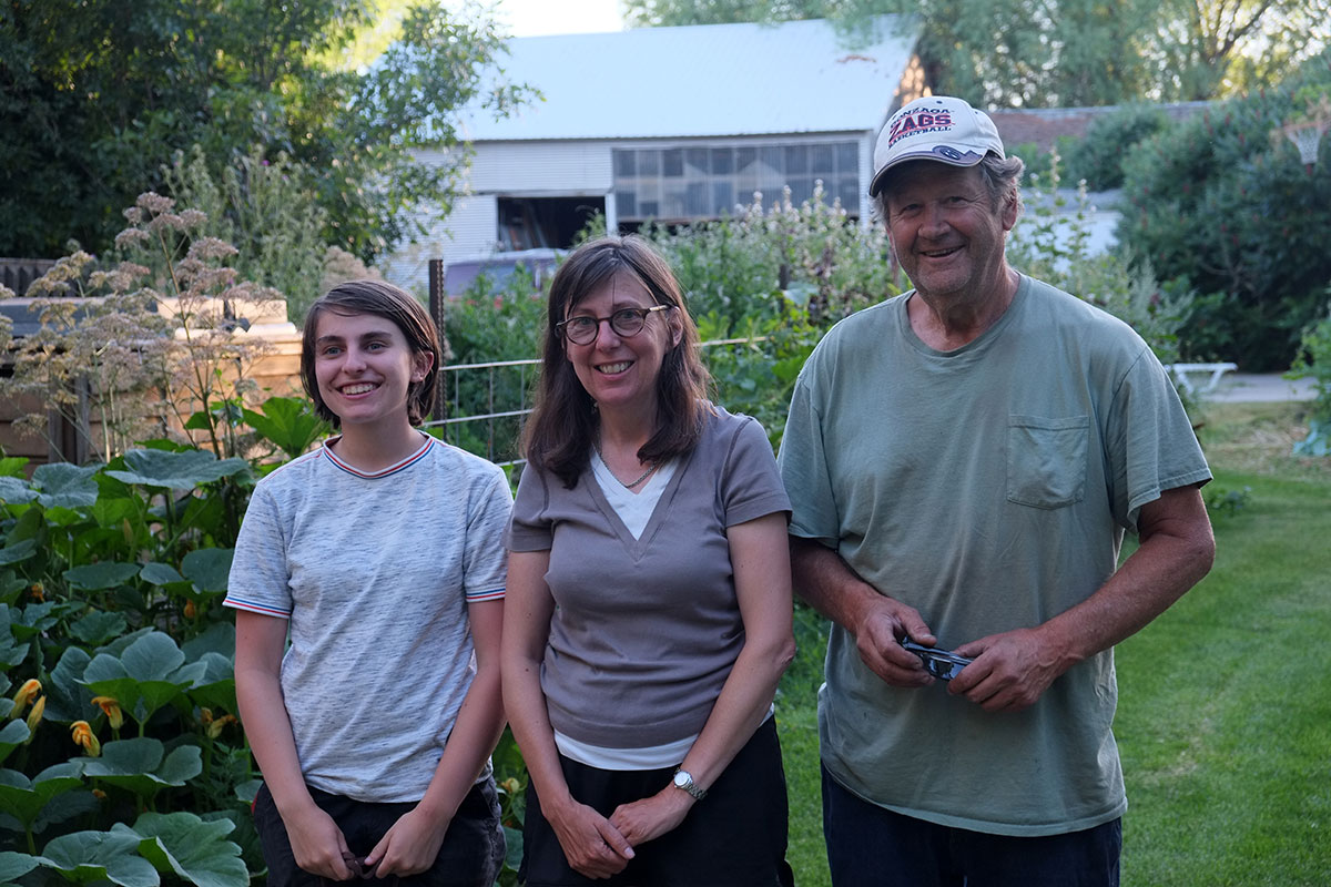
We wish we’d met more locals. When we were staying with friends we always had an entreé to the local culture, but when we were on our own, we found most of our conversations were limited to people who were providing travel services – waiters and clerks – or to other travelers we met in a campground or at a viewpoint. In Europe I had always attributed this to the language issue, but it wasn’t much different in our own country. I don’t know how to solve this – when you’re travelling you’re really in the travel zone, and sometimes the conversations with the locals working in that zone can be enlightening (I noticed this especially on Indian reservations). But we spent a lot of time in the South, and I can’t say that I understand Southerners any better than I did before we left. (Except in New Orleans, where we were introduced to many people and welcomed in. But they’re not really Southerners.)
We spent a lot of time talking with old friends, and I wish I’d taken notes on those conversations. I discovered that as my friends have aged, they’ve become even more insightful and wise. A number of people have suggested that I should write a book based on this trip (but a book just seems so 20th-century compared to a blog!), and the thing that absolutely keeps me from attempting it is not having any record of those conversations. They were a huge part of the trip, and a travelogue of observations about places would not be nearly as interesting as a book that incorporated those dialogues. It seems like a good excuse to do the trip over again, and just pay more attention next time.
Now that we’ve been home for a few months, life on the road is a distant memory. You come back from a trip, full of excitement, and determined to not fall back into the rut of your day-to-day life. I wish I could say that we’ve avoided that, but largely we haven’t. Greta and I touch on the Groundhog Day analogy – every day is the same, more or less. There are no big surprises in normal life, nothing to shake you out of your complacency. We don’t dislike our lives at all – we have many wonderful friends and colleagues, we live in beautiful places, we have interesting and meaningful work to do, and we are deeply grateful for all of that. (Frequently on the trip, I would ask Greta if she’d like to live in the place we were visiting, and she usually answered that she’d go crazy.) But the sameness numbs you out to a certain extent – it’s unavoidable. We were lucky to be on the road for long enough that it did become a way of life, not just a short break, and we became really comfortable and happy with that life. After a few weeks at home, Greta and I decided that the only two things that were much better about this return to normal life were seeing Linda, and indoor plumbing.
 But as summer began to wane, we realized it was our first summer ever without being by the ocean. The reported day-tripping crowds to the Oregon coast had kept us home during the pandemic, but as the forecast for the week after Labor Day was for temperatures reaching 100º for the third time this summer, we made some reservations at Oregon state parks, and took off. Oregonians are not notably gregarious, and we figured we could stay in our own bubble if we were camping.
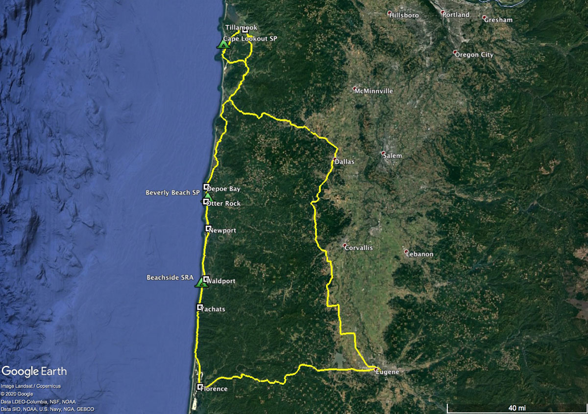 Our destination was Cape Lookout, one of a series of rocky capes that project out into the Pacific – this one about 2 miles. We stayed in a wonderful campground in the trees just behind the dunes, with a beautiful beach right there for walks along the Netarts Spit..
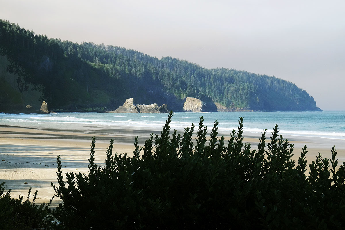 This might be a good point to explain the repetitive elements and nomenclature of the Oregon Coast to those who haven’t been there. There are a few basic classes of things: cities & towns, rivers, capes, bays, beaches, spits, and rocks. Each of these is named independently, usually without any reference to adjacent things in other classes, and in keeping with the general Oregon practice of having three different names for any given place, just to confuse things. For example, if you are going to a popular destination north of Florence, you might say you were going to Heceta Head (cape, lighthouse and scenic viewpoint), or Cape Creek (river, bridge and cove), which constitute the substance of Devil’s Elbow State Park. No matter what you called it, you would be at exactly the same place. (And I honestly don’t know what the big rocks just offshore are named.) To be fair, the bays and spits at the ends of rivers usually have the same name as the rivers, but it is never the same as the city that is situated at the mouth. A state park in the same locale might allude to any one of these reference points, or something totally different.
 with intermittent views back towards the Netarts Spit
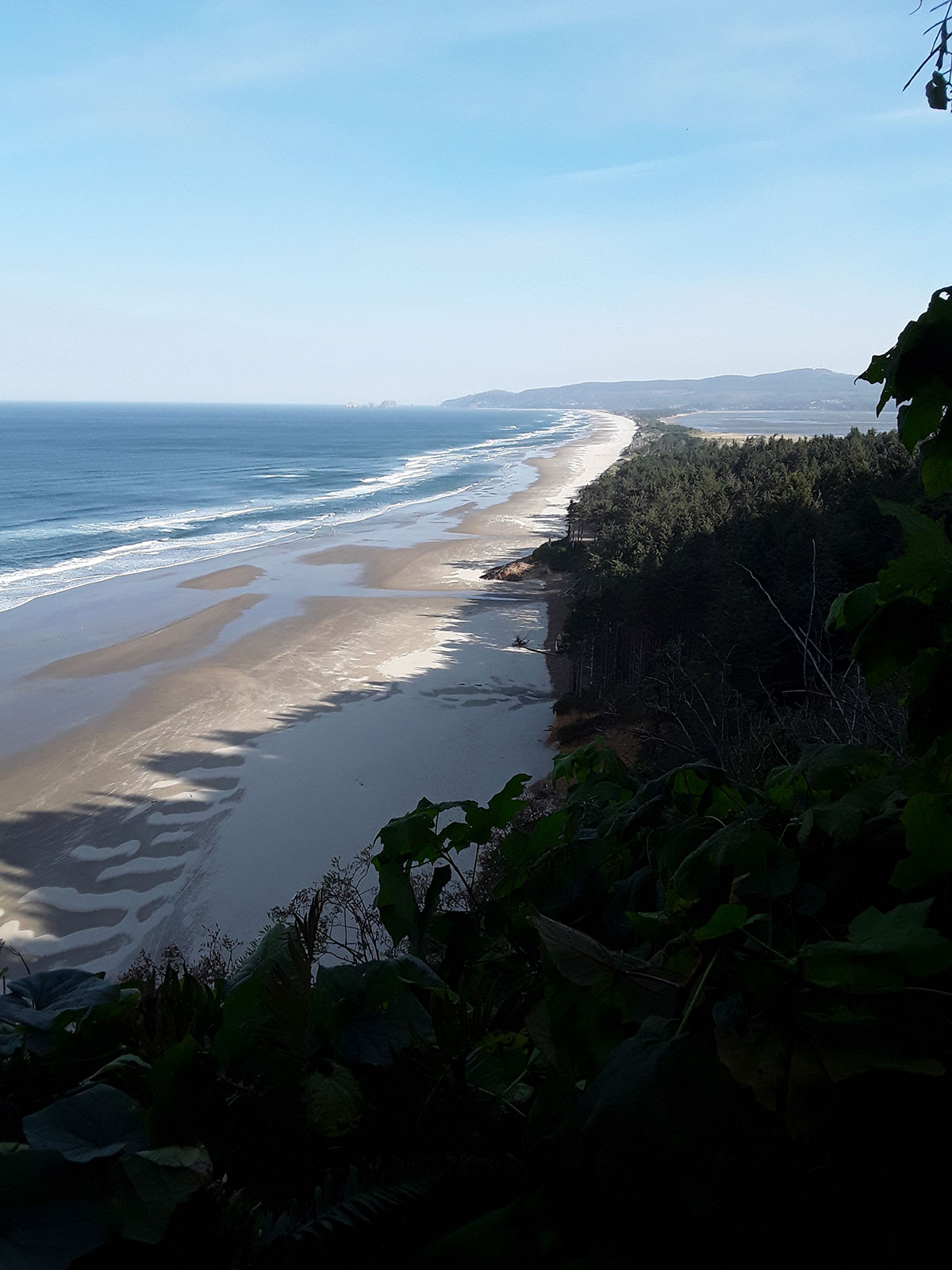 but then she ran into so many downed tress that the path was obliterated. We waited for her at the trailhead (annoying the rangers who had closed the whole area due to the windstorm), and eventually we drove back down the road, finding her hiking up, after bushwhacking off the trail.
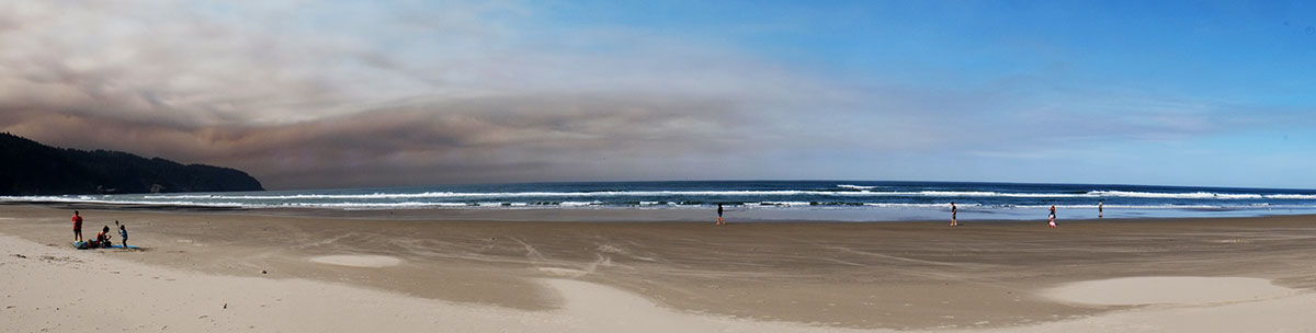 We knew there had been some fires east of Salem in the Cascades, but being out of cell and radio range, we had no idea that all of these fires had been supercharged by the unusual winds from across the Cascades the night before. We enjoyed the blue sky, not knowing that it was the last one we would see for weeks.
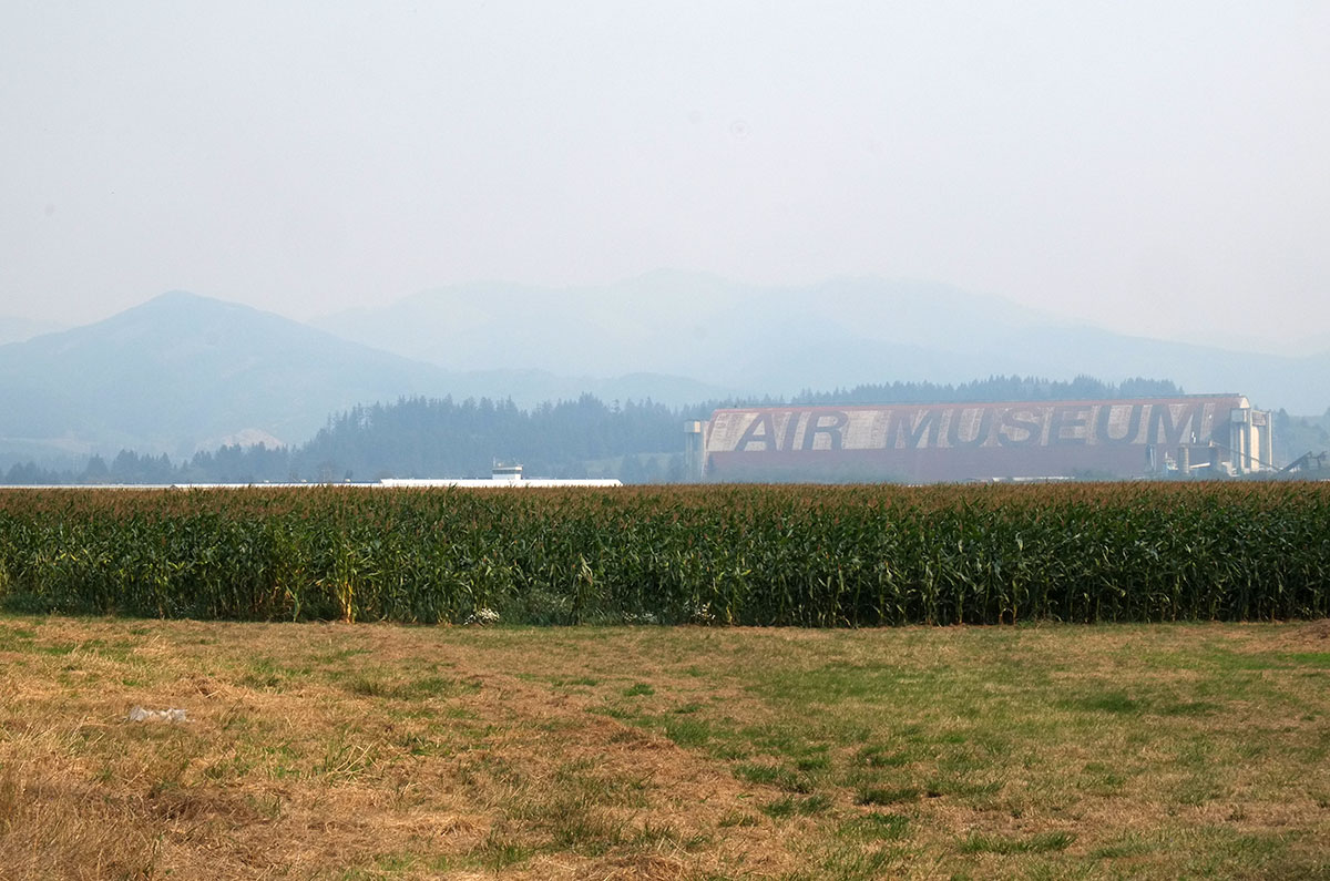
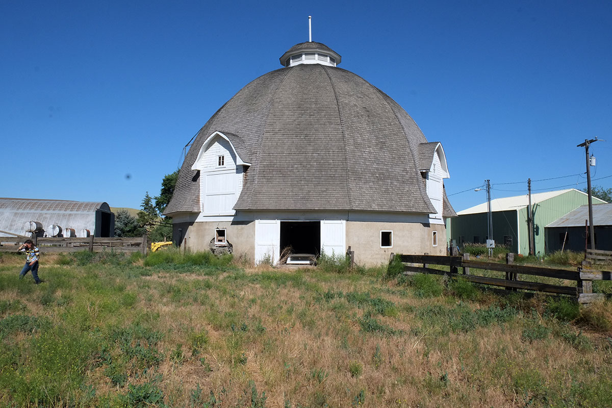
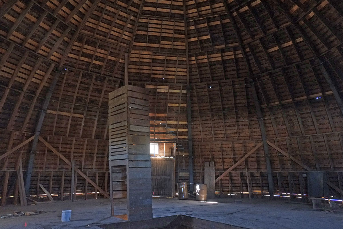
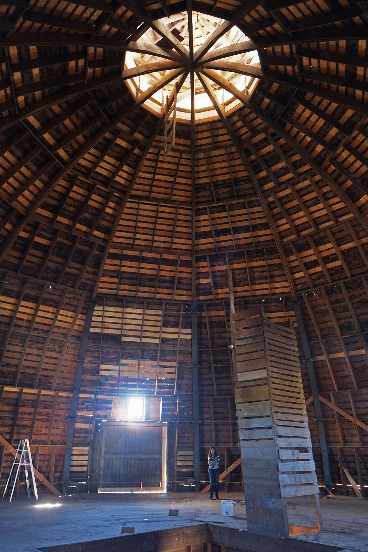
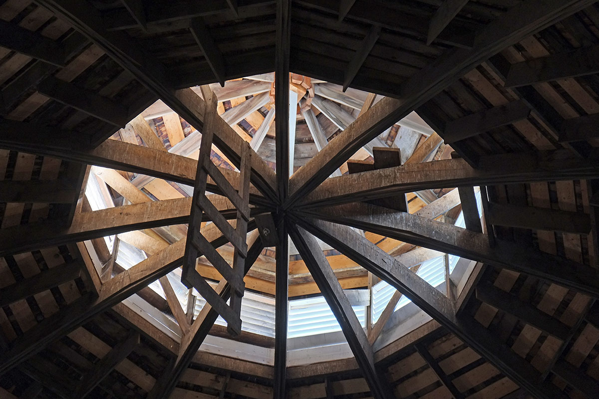
 The building is spectacular – an arched vault made up of wooden trusses, with a scale comparable to sports arenas.
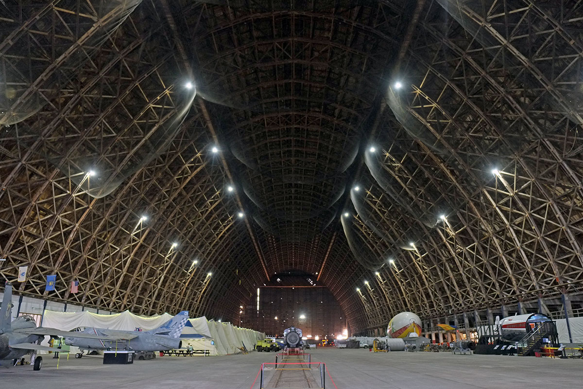
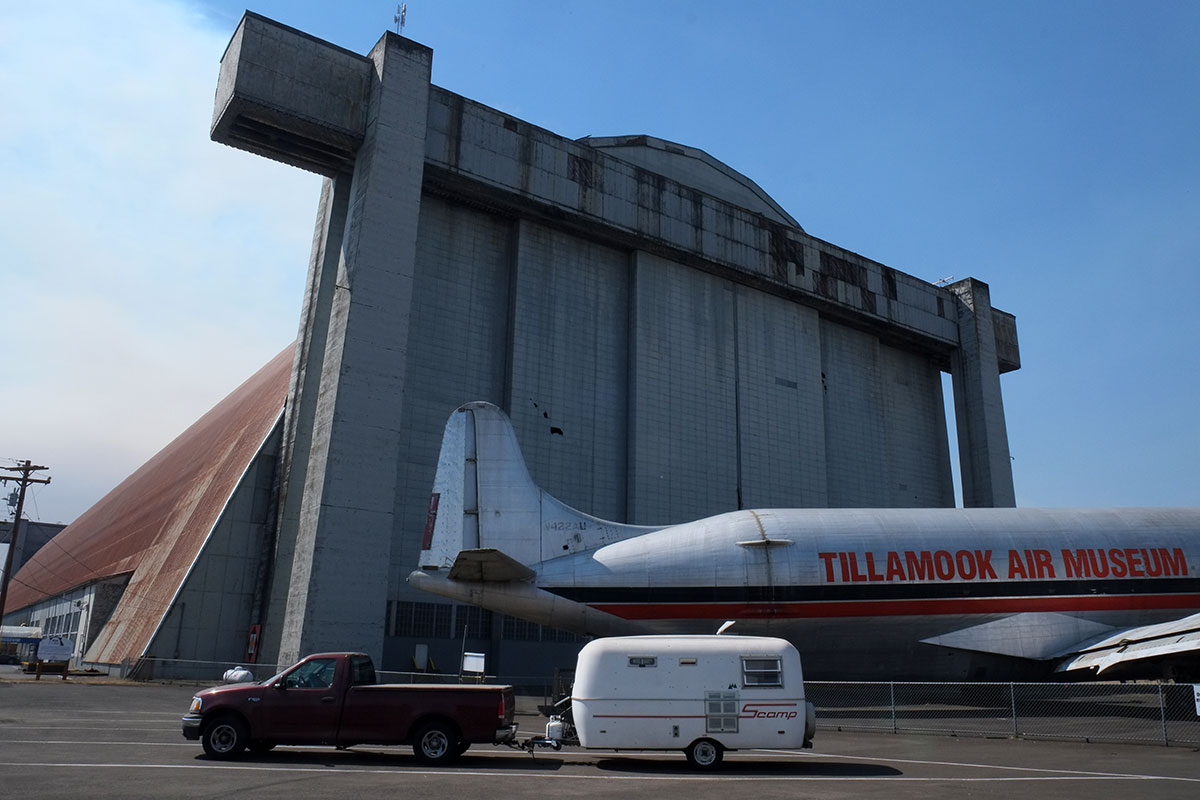
 This building had a twin, but it burnt down in 1992; they were using it to store hay. But now they are probably more careful, and it contains a variety of military and civilian aircraft.
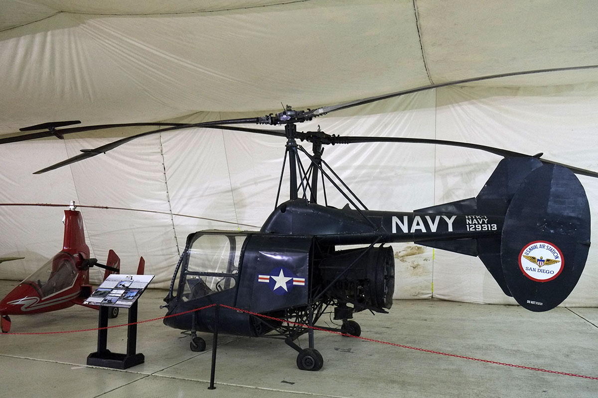
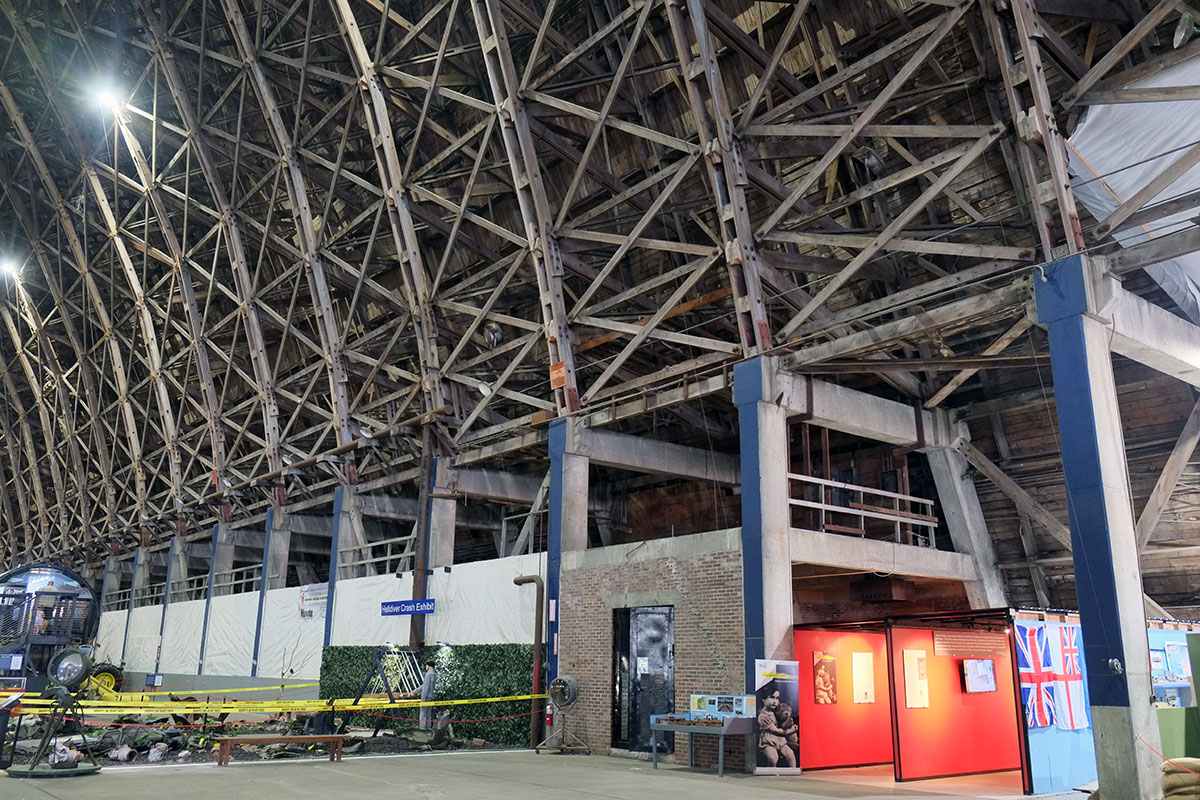
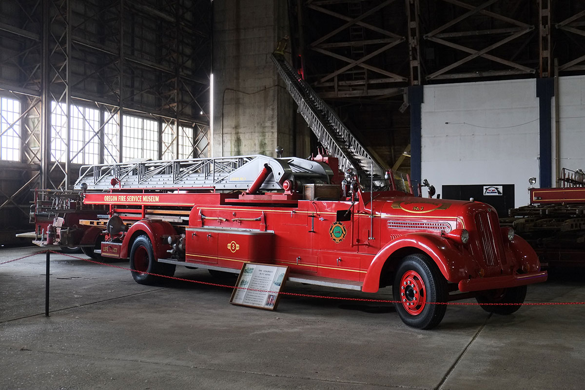
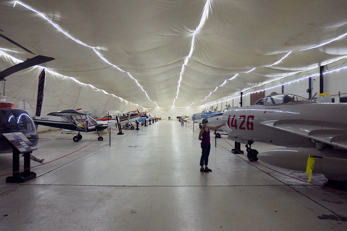 It’s a pretty eclectic collection, probably largely based on gifts. What we really enjoyed beyond the aircraft was the random assortment of other items – tractors, cars, train engines, stored RVs, etc. It reminded me of the Large Object Collection in Liverpool; Liverpool had saved all this cool stuff, but at some point realized that they were never going to have the money to build a new museum, whereas they had lots of abandoned warehouses. So they simply put everything in a series of buildings, with minimal attention paid to display and design – just let the objects speak for the themselves. Tillamook does the same admirably.
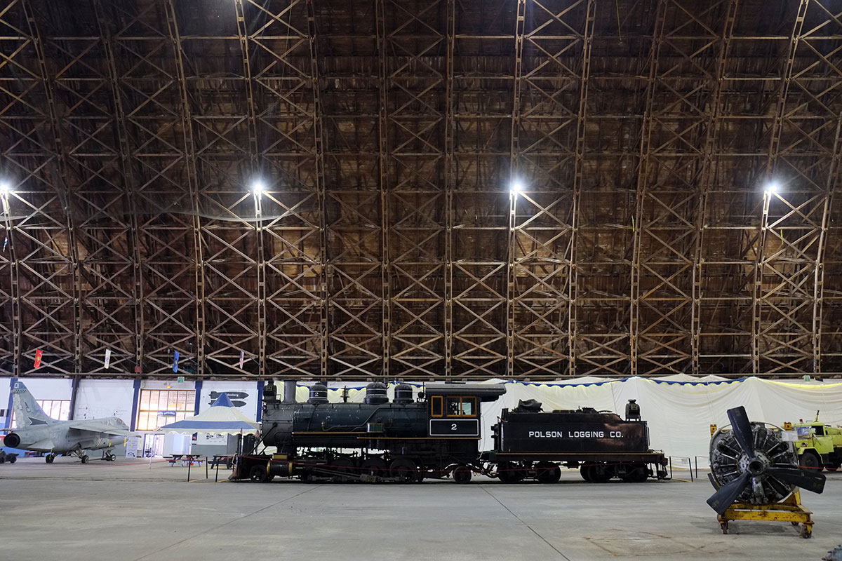
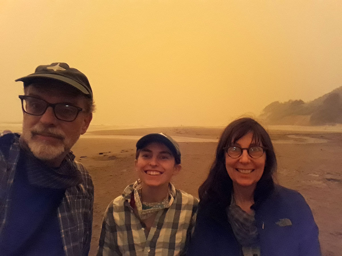
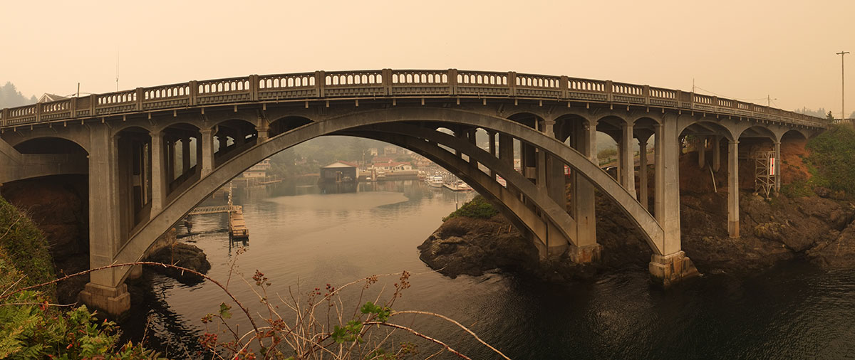
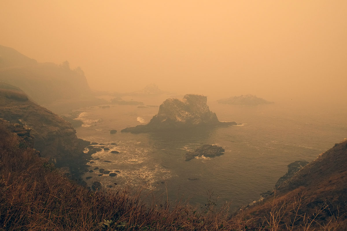
 We emerged into air whose quality had degraded rapidly, and drove south on 101. Familiar views took on a surreal quality.
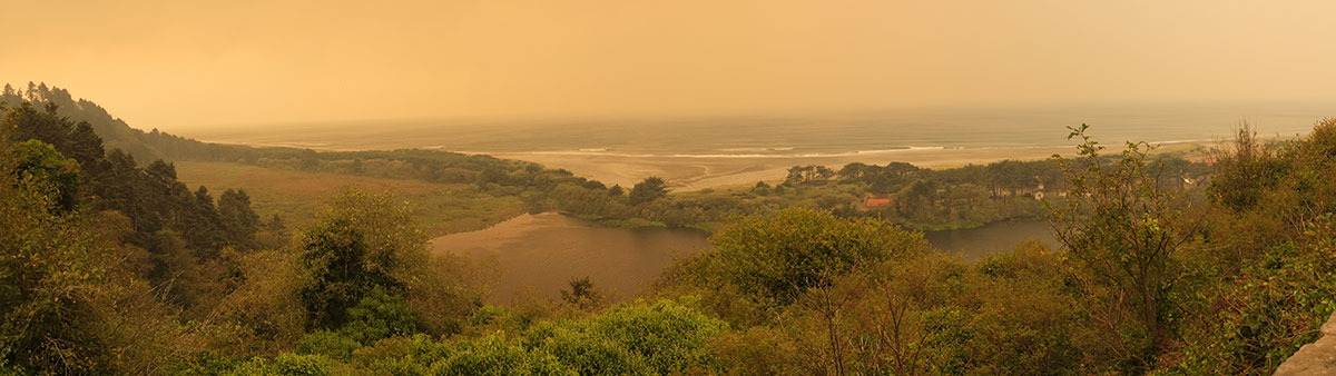
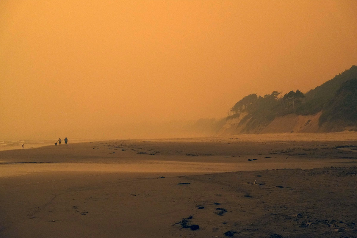
 At Lincoln City the traffic was strangely bad, with the right lane often blocked as cars lined up at gas stations. We later learned that a fire had ignited outside of town, and people were getting ready to evacuate if necessary. But we continued on our oblivious way to the Beverly Beach campground, where they were clearing away the downed trees from the night before, and the sky took on what was to become a familiar, apocalyptic glow.
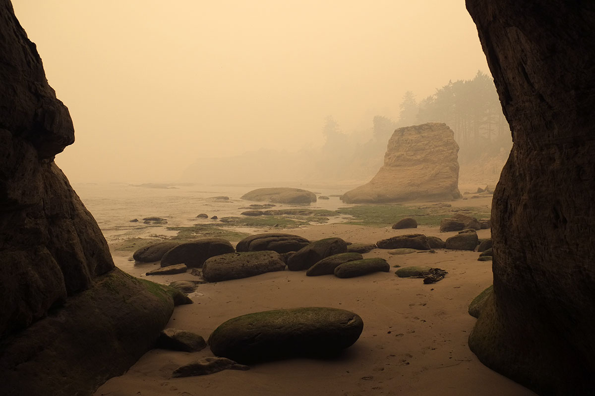
 The next day dawned even darker, and all the prominent viewpoints were blank. We spent our time at the points that offered smaller scale, closer-up experiences, such as Otter Rock (also know as Devil’s Punchbowl. Devil’s ____ is a favored naming convention on the coast).
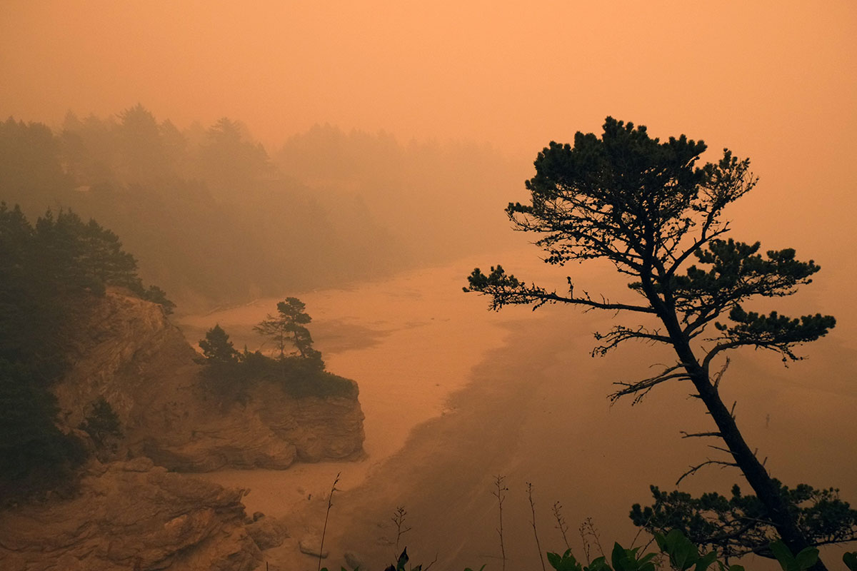
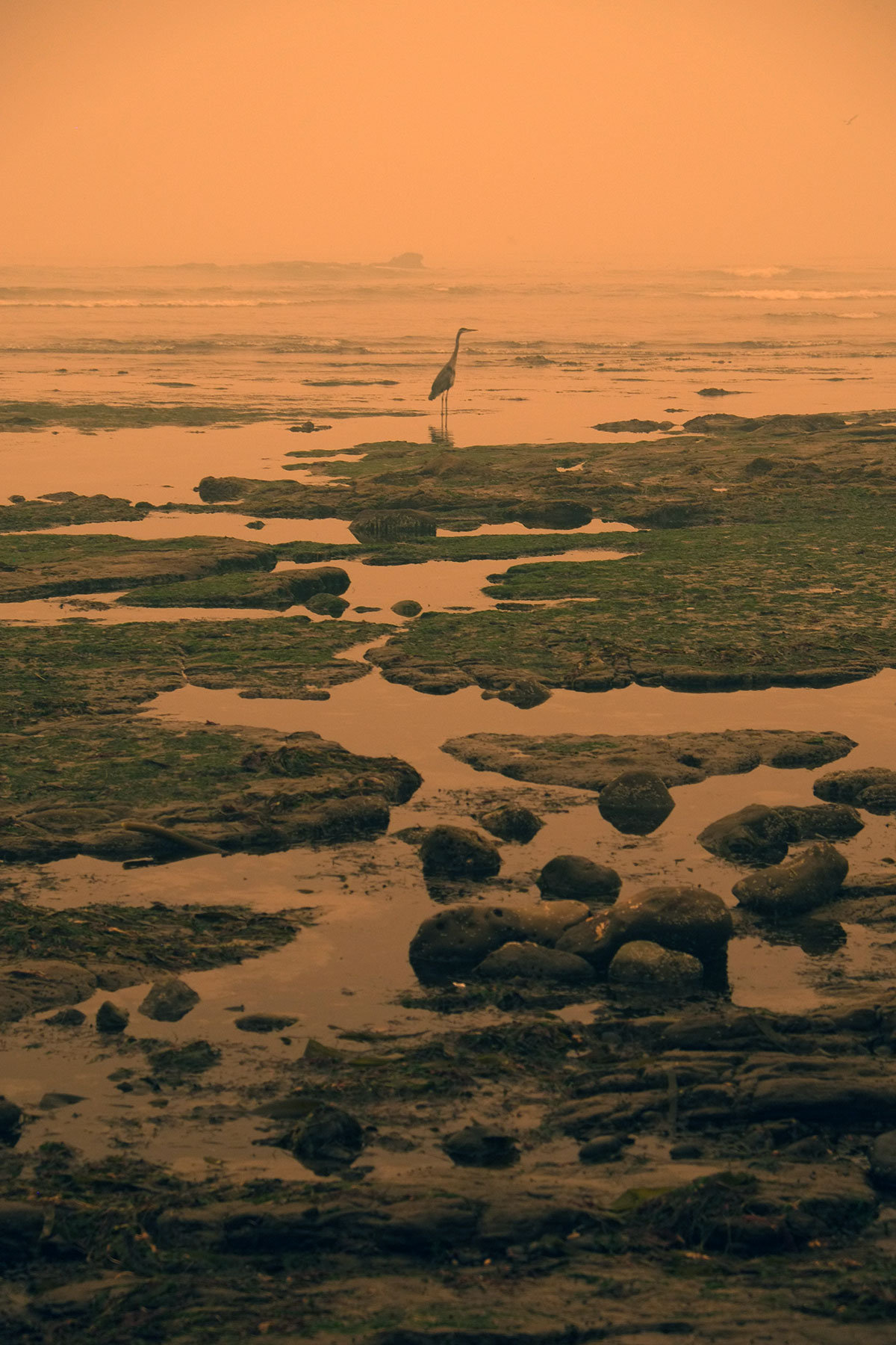
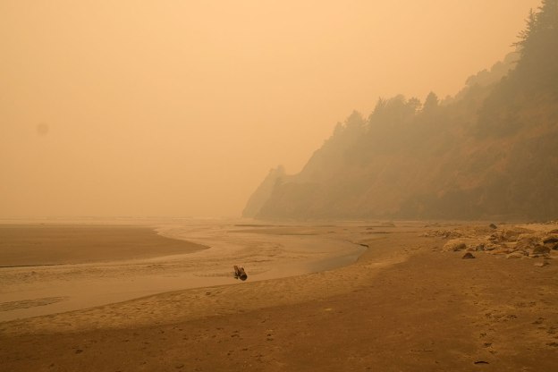
 It was surreal, like being trapped in a photo album of 19th century tourist sepias. Between the demands of social distancing, and the general eeriness of the day, we avoided the inhabited areas as much as possible, sticking to beaches and campgrounds. Yaquina Head was devoid of other tourists, and we had it all to ourselves (along with the flies).
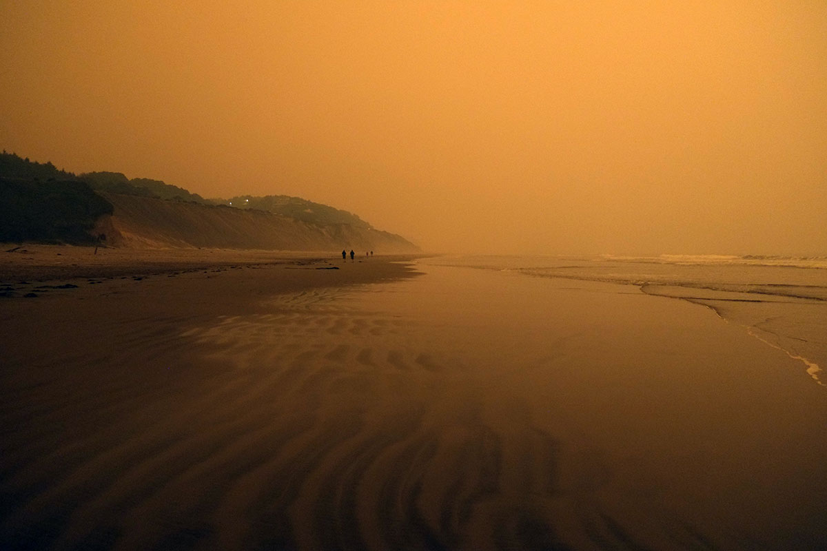
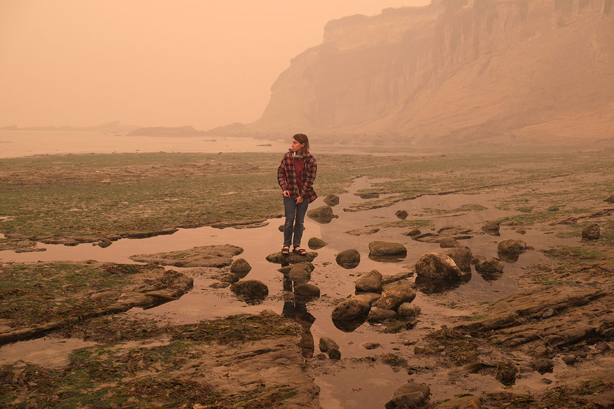
 On Wednesday afternoon we first heard of the Holiday Farm fire centered on the McKenzie valley just east of Eugene. It had grown to over 200 square miles in the two days since it started on Monday evening. We considered heading home immediately, but realized there was little we could really expect to do, that the heat and smoke would be worse in Eugene, and that we would either be homebound or evacuating in the near future, so we might as well stay one more night. We walked on Agate Beach,
  ate clams in Waldport, and spent the night at the Beachside State Recreation area, where we slept 100 feet from the beach, and listened to the surf through the night.