As I’ve observed, some National Parks are one-liners. Some are big and have many varied and interesting parts, such as Yellowstone. And a few are vast and almost impenetrable wildernesses, such as Canyonlands. I thought the name was kind of funny, more like a theme park than a National Park, as if it were some microcosmic, Disneyfied presentation of the ideal of “canyon”. But it is the opposite. It’s huge, and it comprises many distinct parts, all of which fit under the umbrella of a canyonland-type landscape.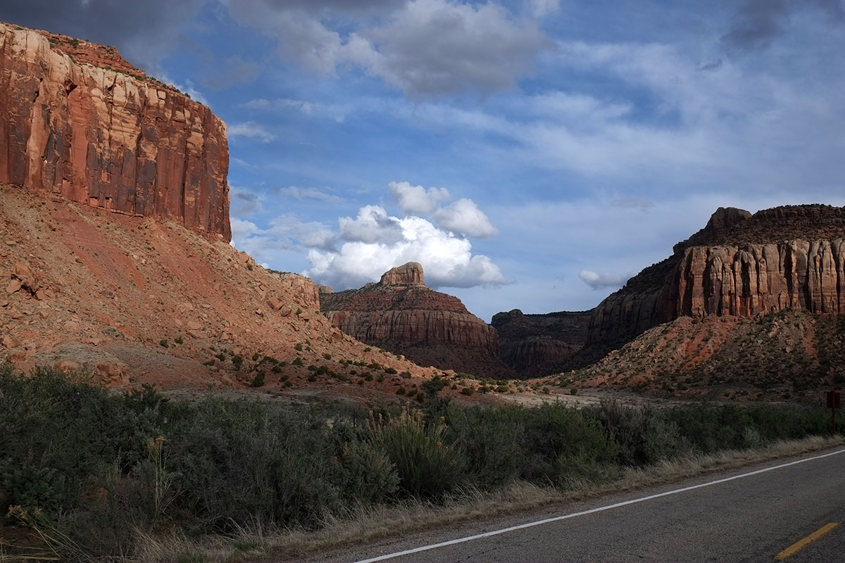
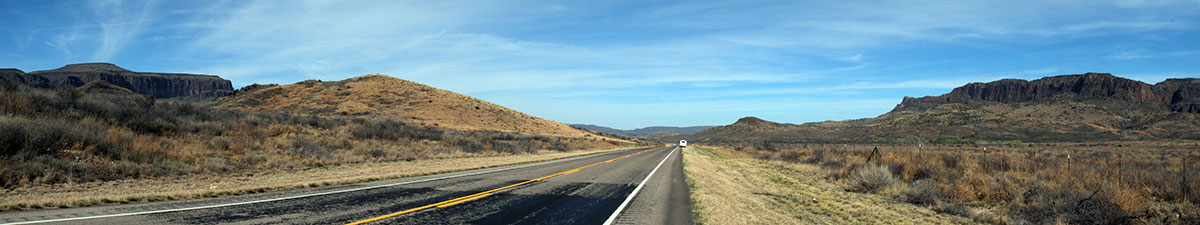
You can’t cross it, unless you want to mount a serious expedition. (I wish that before I began plotting this trip, I had been fully aware of the extent of all the Really Big Things you can’t cross for hundreds of miles out west, such as the Grand Canyon, the southern Sierras, and Canyonlands.) Dead-end roads enter Canyonlands from the sides, but they don’t go very far, and are really just jumping-off points for much longer explorations by foot or serious vehicles, or by boating through the river canyons. For example, we took a 40-mile dead-end road to get to the Needles area, but when the road ran out, the Needles were still miles away, 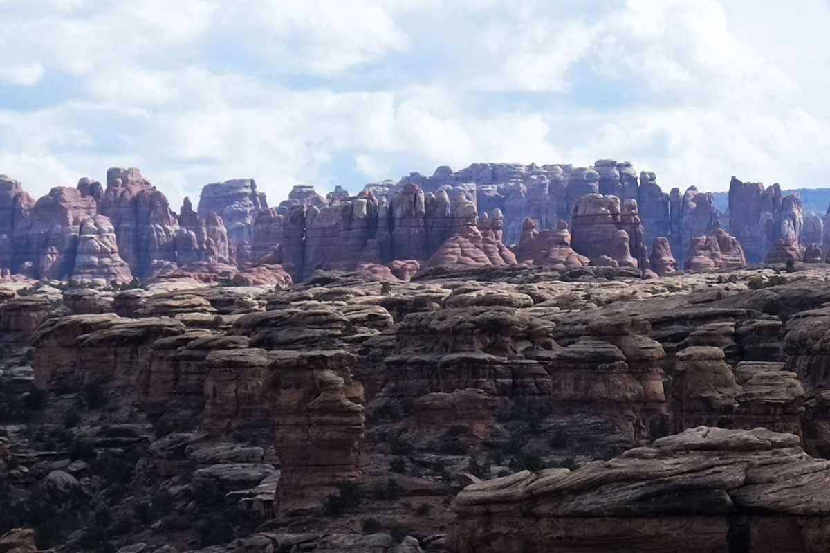 and to explore them you really need to backpack for a few days. From further north you can take a road that gets you within miles of the confluence of the Green and Colorado Rivers, but it’s still a hike to view it from the rim. The most amazing-sounding part is called the Maze, which is entered from the west side. I read Edward Abbey’s description of heading in there in the 50s, and quickly realized we should just stay the hell away, as it isn’t any more accessible now.
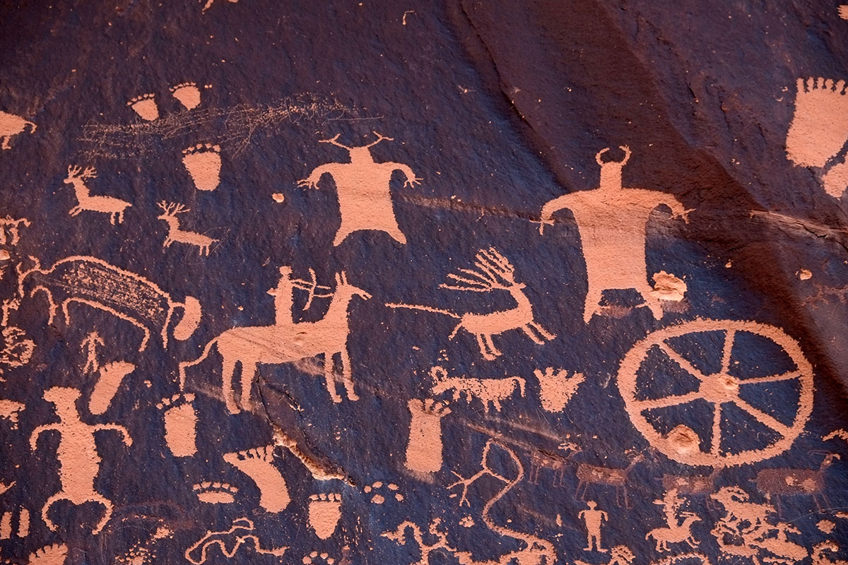
So we took the daytripper approach, driving in from Moab until the pavement ran out, and taking a few short hikes around. (We were still in altitude-wary mode, after the Zion incident.) First we came to Newspaper Rock, which is a large outcropping covered with petroglyphs. No one is sure when these images were produced, or over how long a period. Our attitude towards them is similar to our attitude on geology – we just don’t care to learn that much about them, we just think they’re cool.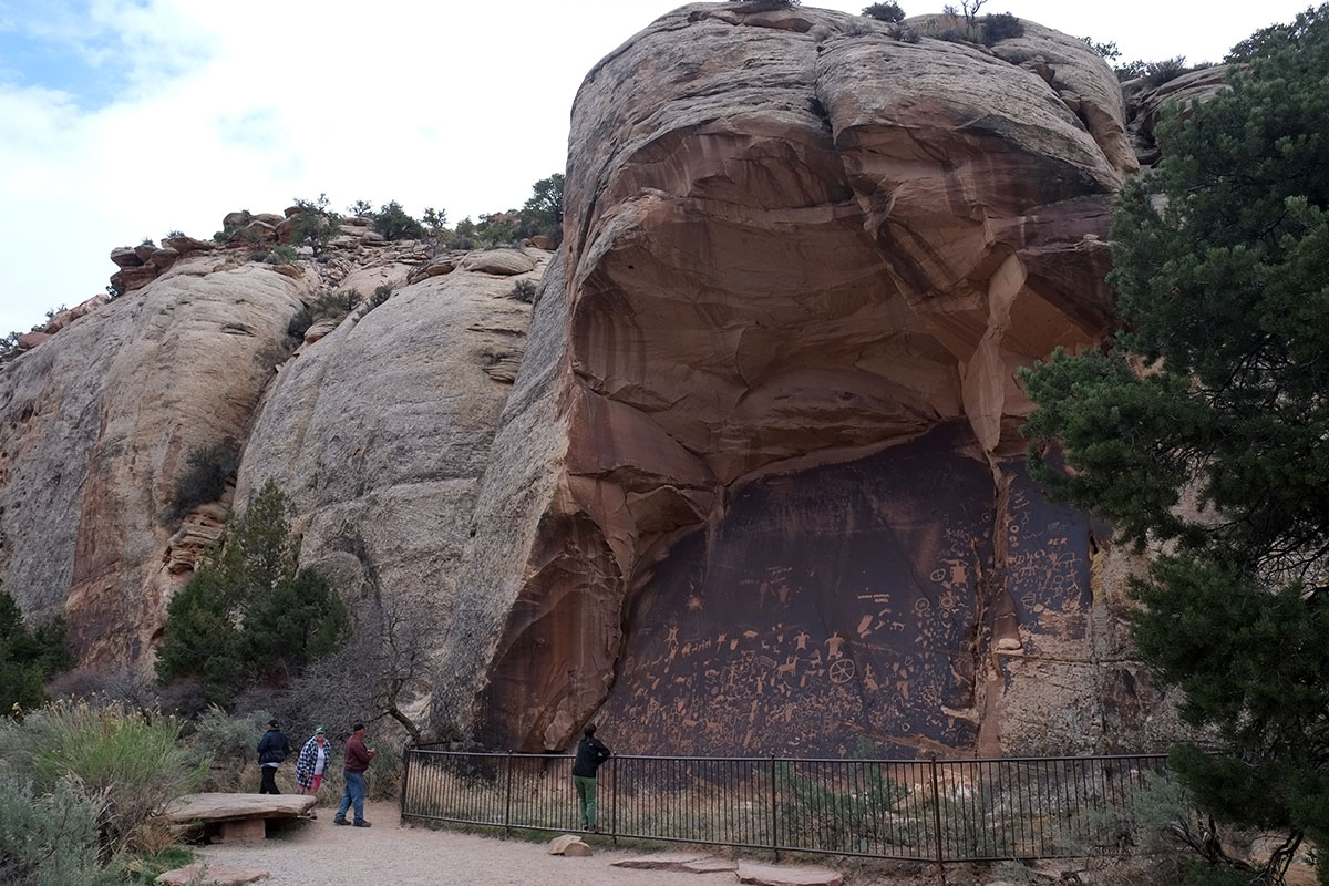
One hike was Slickrock Foot, on top of a mesa, with views out across the big landscape, to distant canyons, buttes, mesas, etc. 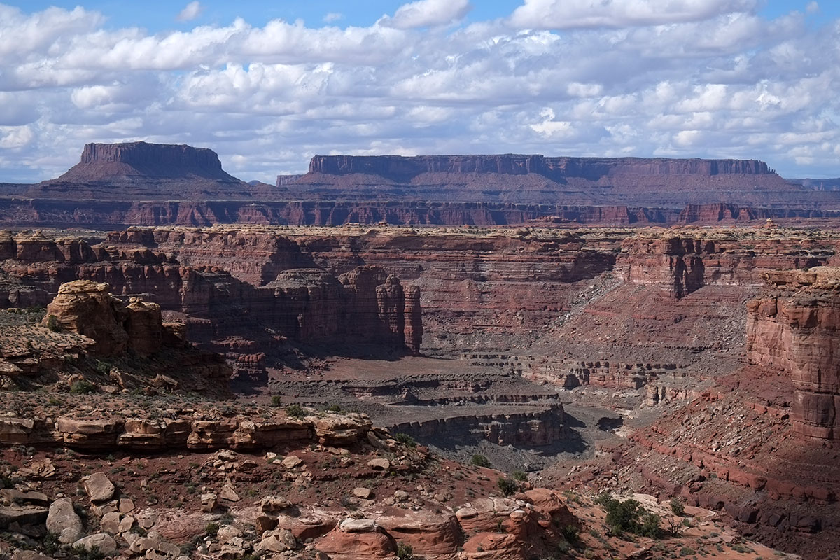 It was beautiful, and it was reasonably interesting hiking. We’ve discovered we like hiking over “slickrock” a lot. We come from a land where you’re usually hiking on dirt (or mud), with some rocks around. But to be in a landscape where the whole ground surface is exposed rock is a blast.
 You get a nice sense of how steep a slope will give you enough friction to just walk up, or when you have to start looking for flatter surfaces or handholds. We think of it as rock-climbing for older and more timid people. One of my worries when Greta was growing up was that she would fall in with Oregon’s large population of maniacal rock-climbers, and I have been very pleased to find out that she’s no more foolhardy than I am.
Another short hike was at Pothole Point, around some enormous rock-thingees that were too small to be buttes but too big to be boulders. 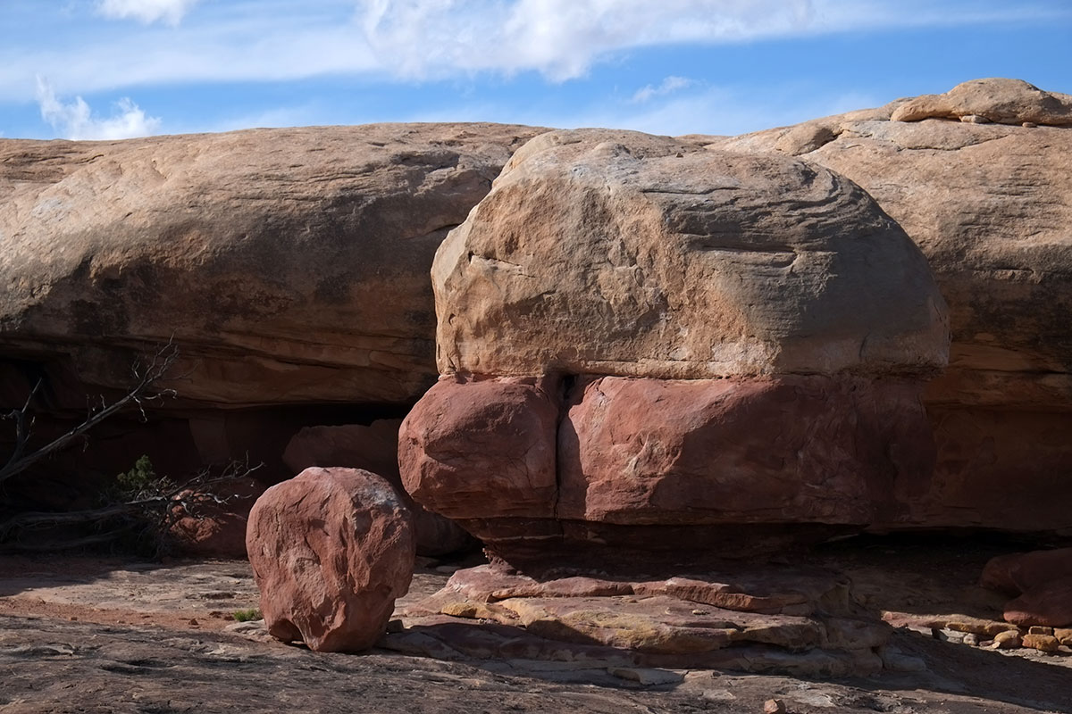 There were trees and smaller eroded rocks around, which looked like they had been placed there by some designer trying to achieve the world’s most overscaled Japanese garden.
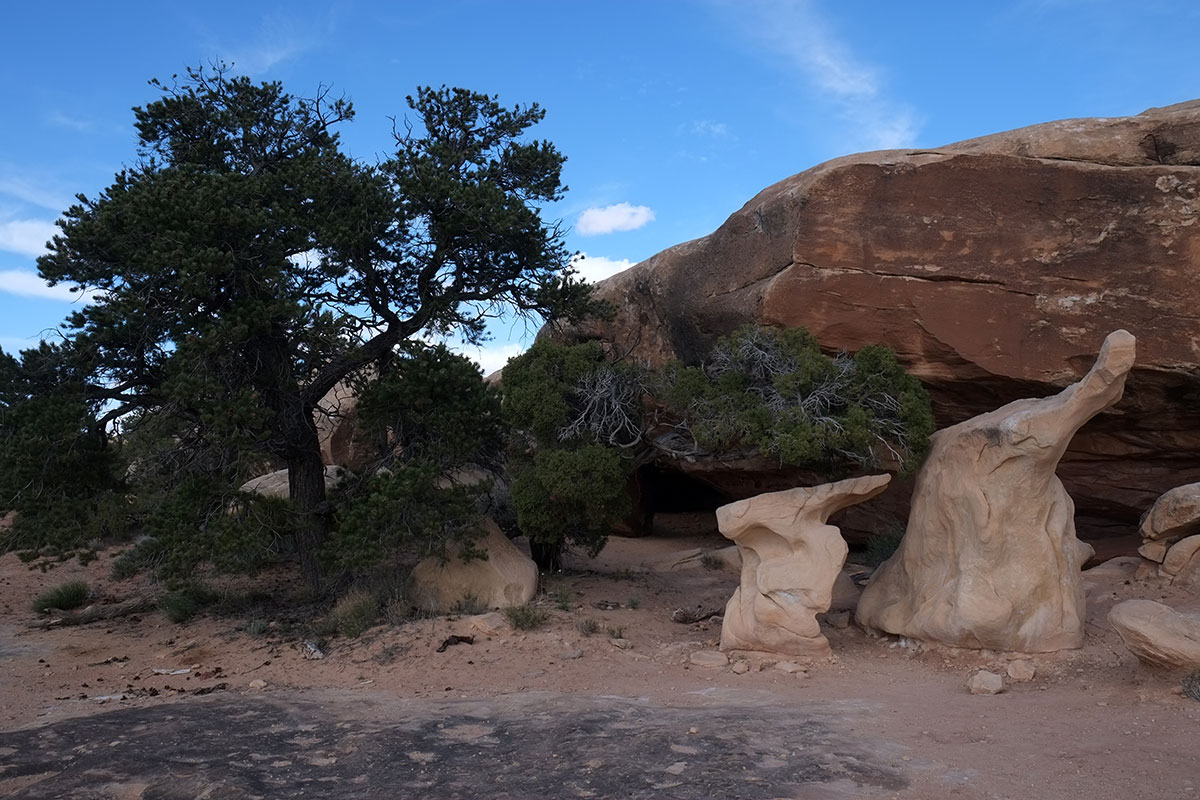
Our favorite part was the area called Cave Spring. Like many other places around here, harder rock was formed on top of softer sandstone, which erodes when exposed, leaving large overhangs of slickrock.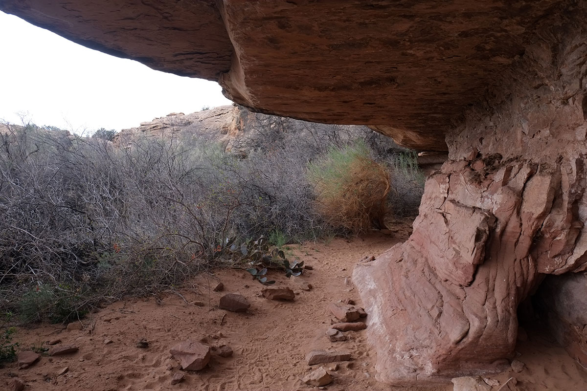
Some of which look rather threatening.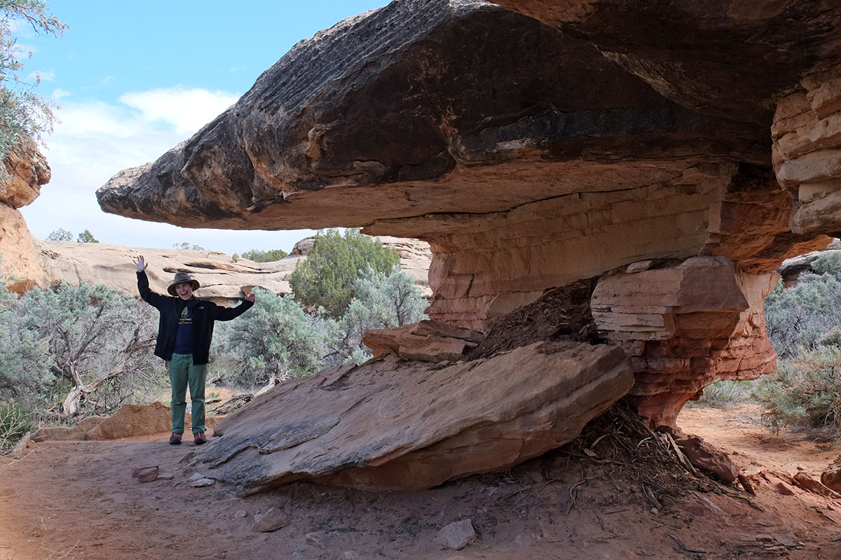
One area of overhang was used by the natives and later by cowboys as sheltered campsites and the remains of this have been preserved.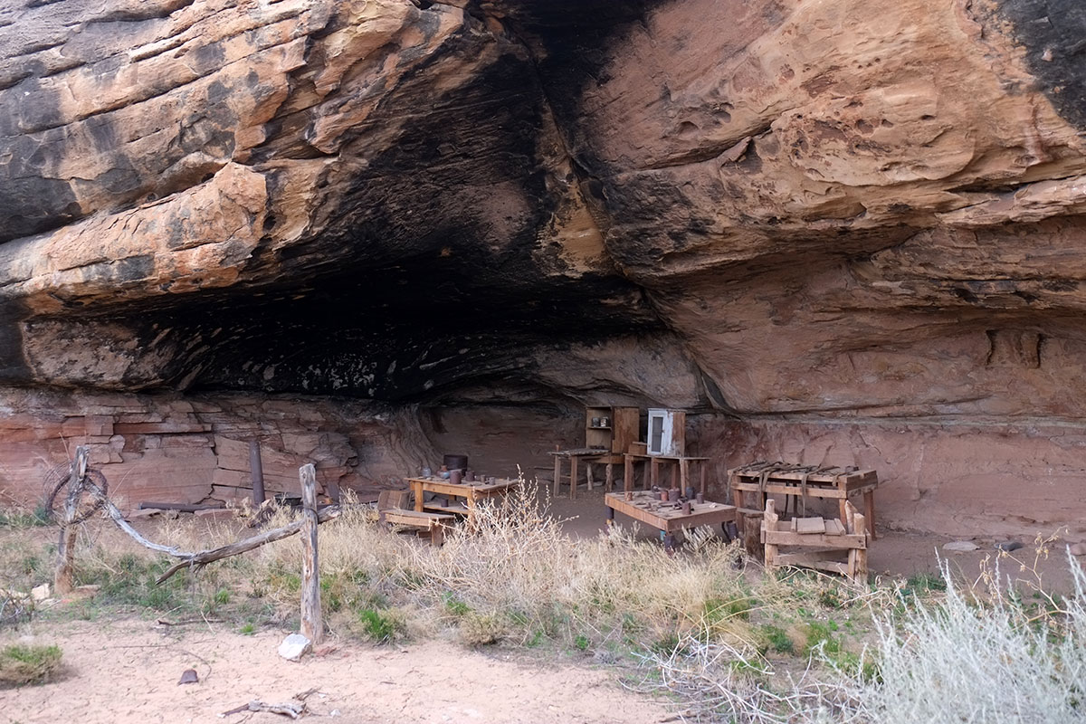
We climbed up on top, which was about a 100-acre landscape of slickrock. The small canyon where the spring emerges could be clearly seen between the rocky cliffs.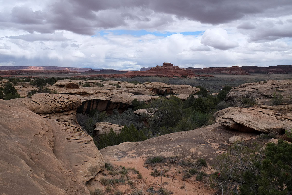
And there were large boulders on top of the rock surface too.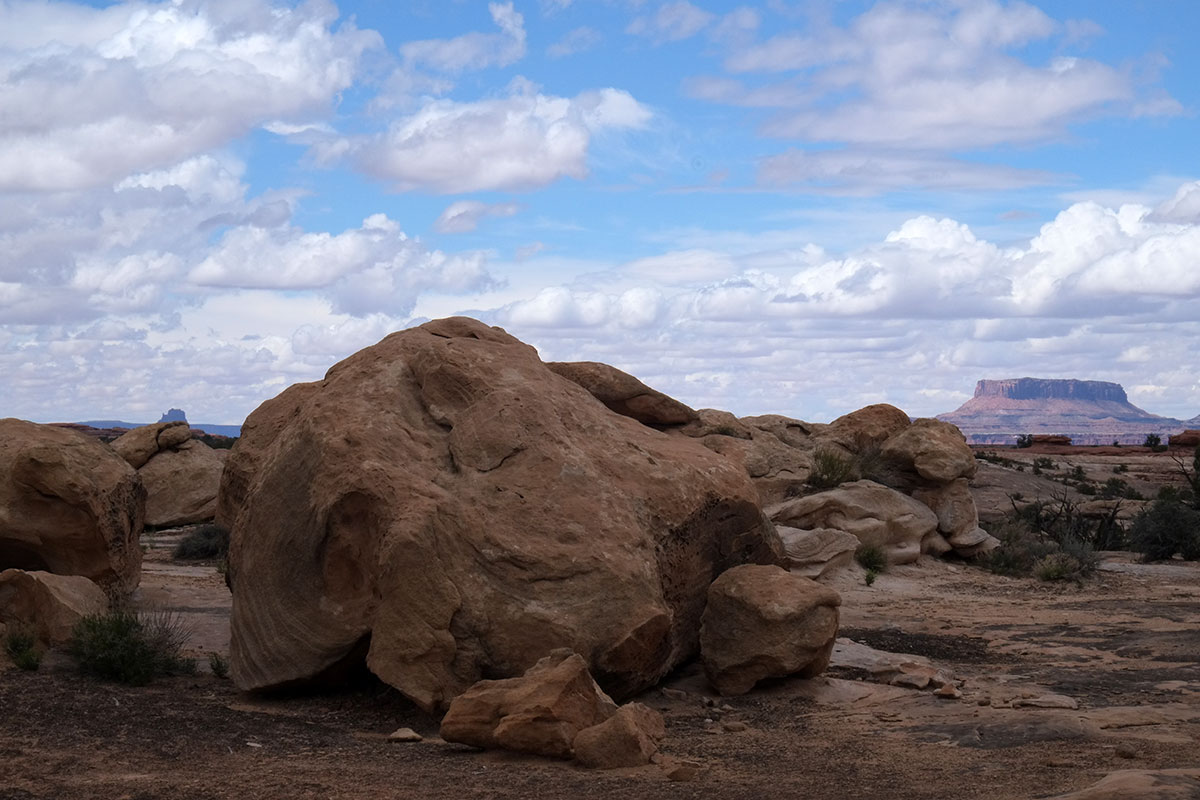
As we wandered around, we saw a squall approaching across the desert, which briefly soaked us, and then left all the rock surfaces shimmering in the light. This lasted about 10 minutes before it all evaporated.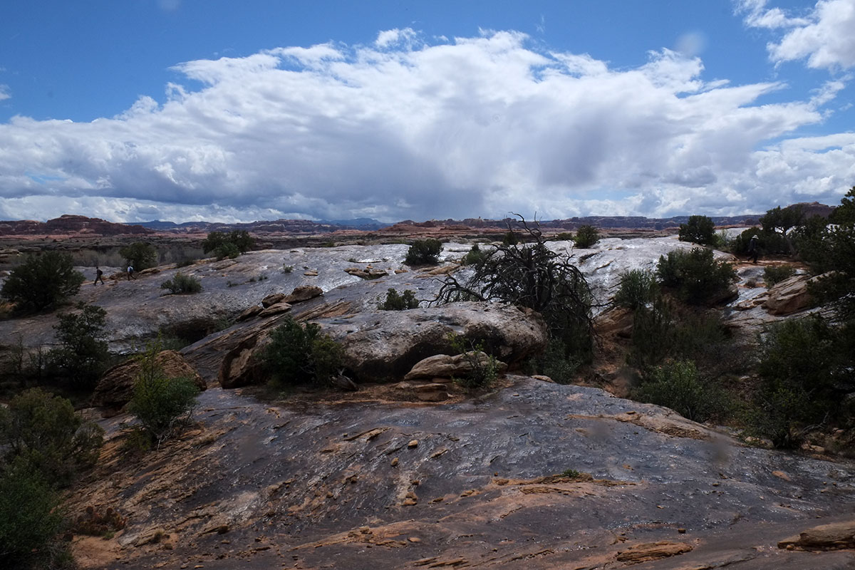
This was exactly the kind of environment we enjoy – a boundary which defines the place, while allowing views out to the larger world. Refuge and prospect, as they say, and this was a classic example. It is so much more satisfying to us than being out in the trackless space of the desert. As we travel, we are finding that lots of these places have been inhabited and named by humans over time. Most of them have been canyons or sheltered areas, but in this case being on top of the rock gave that sense of definition and place.
As we left Canyonlands we realized it fell into a certain category of park or landscape – if you visit it in tourist mode, it is interesting for a day – there are some short trails, but not much in the intermediate length. To experience it beyond what we did, you would really have to invest at least a week in exploring it on foot.
