The Holiday Farm Fire (2020)

The 2020 wildfire season in Oregon was the worst in history, with over 1700 square miles burned.  This year the season has kicked in earlier and more fiercely than ever before (following the driest spring in Oregon history), and it seems likely to surpass last year’s devastation.  I can’t add much to an understanding of the big picture, of how this is driven by climate change and will only worsen, but I thought I should post some images from our visit to the aftermath of the local Holiday Farm from last year, to detail the impact this will continue to have on our landscapes, communities, and people.  

Holiday Farm Fire is such an innocuous, almost twee name – the qualifiers of “holiday” and “farm” make the “fire” sound rather cozy.  But this fire burned over 250 square miles, killed one person, displaced thousands, and destroyed over 400 houses (including the home of writer Barry Lopez, who then died in a rental house in Eugene on Christmas Day).

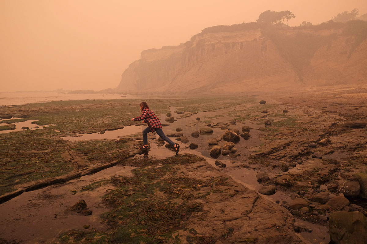
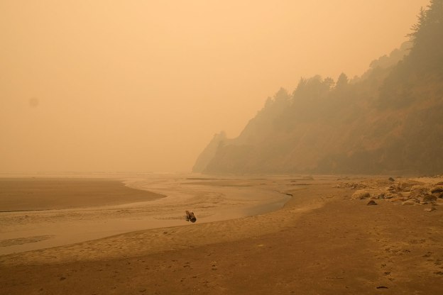
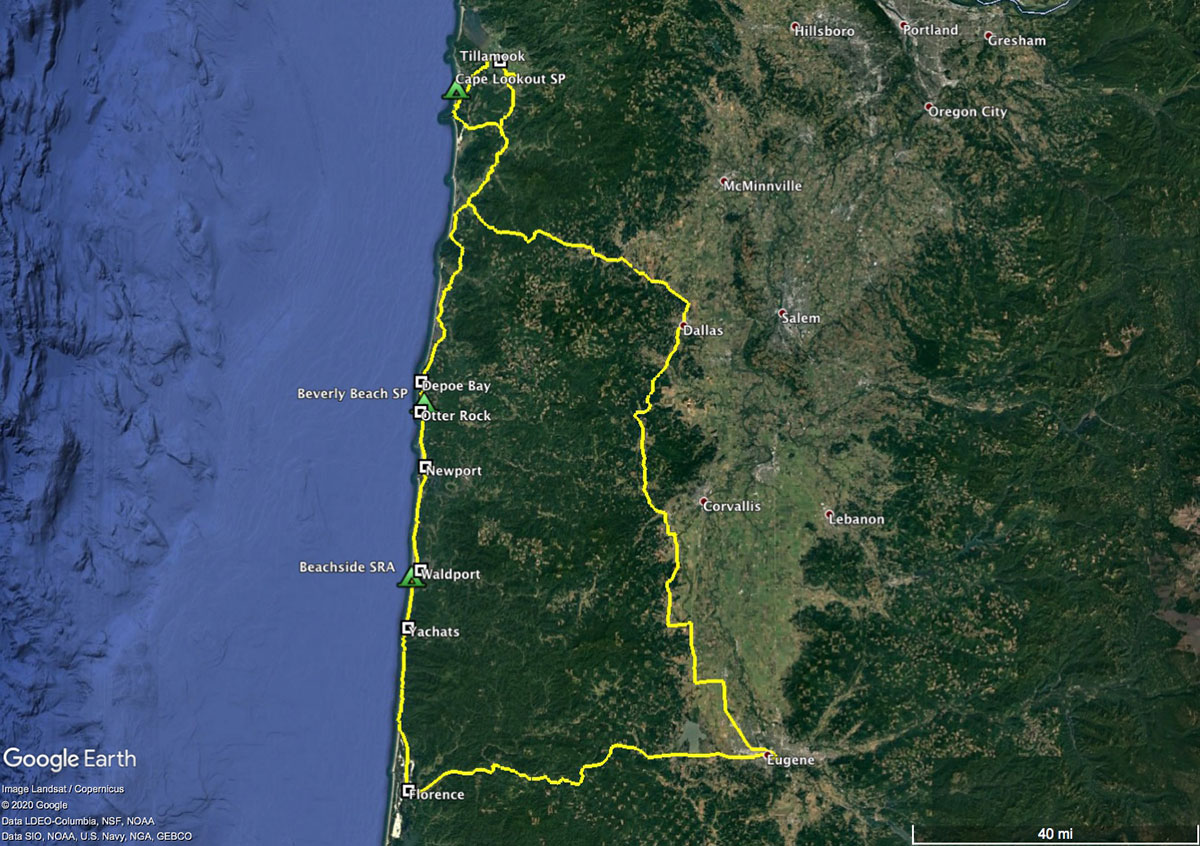
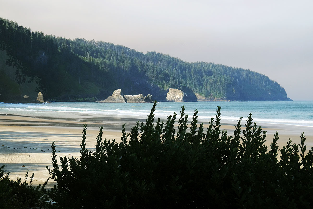
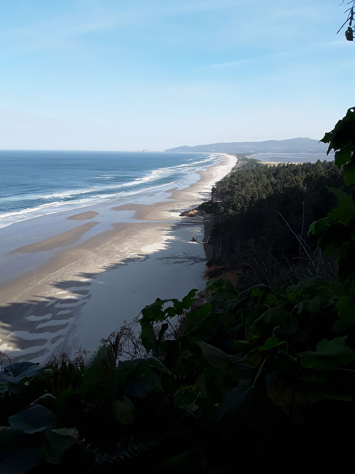
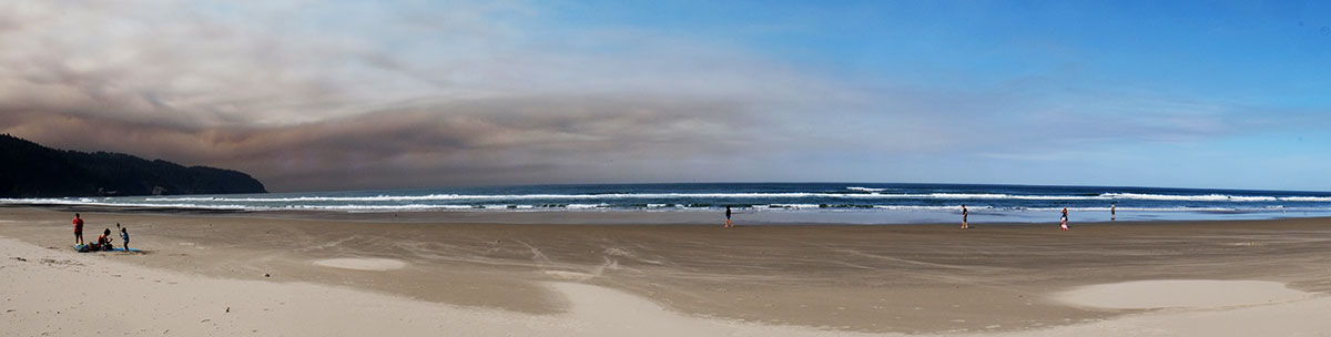
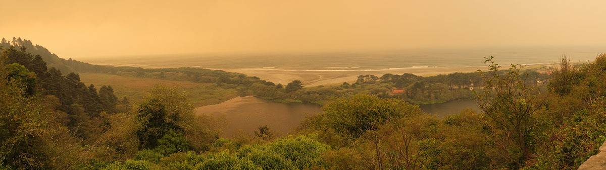
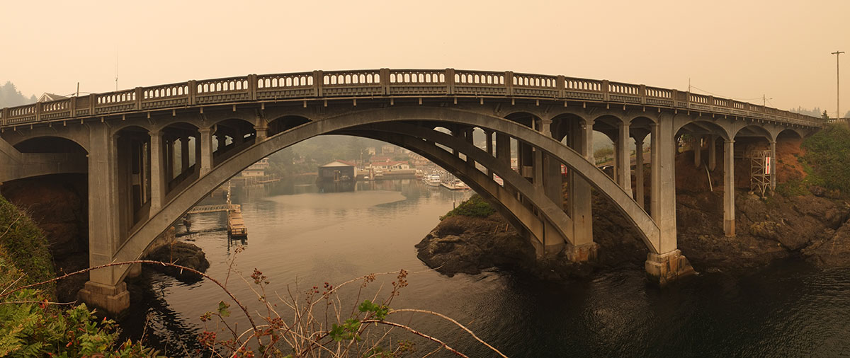
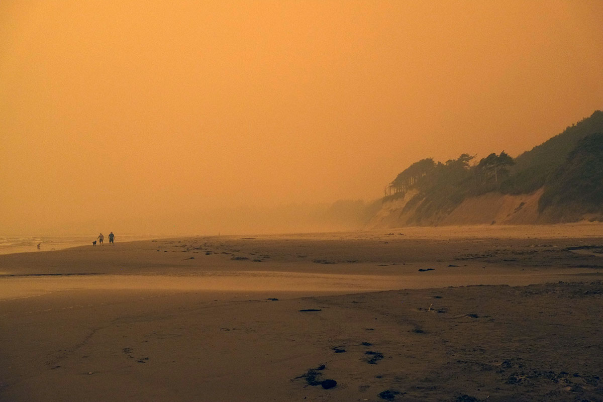
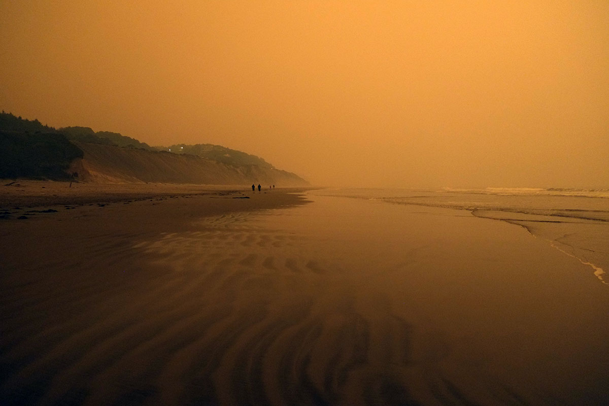
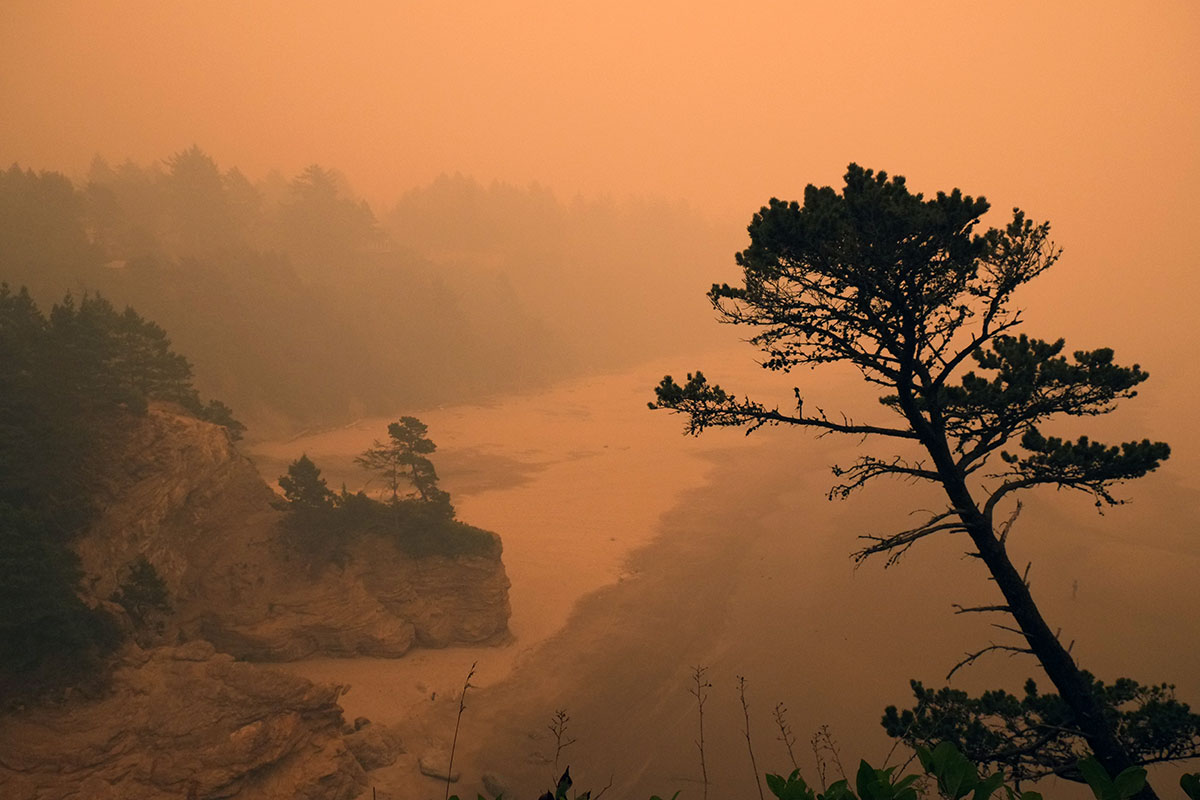
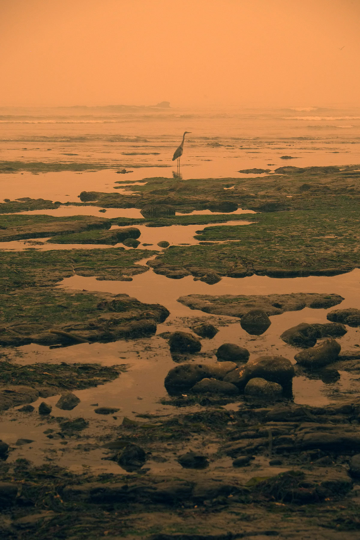
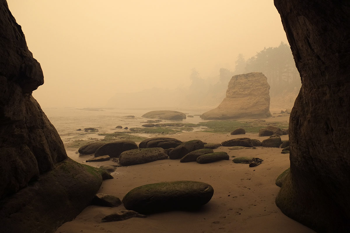
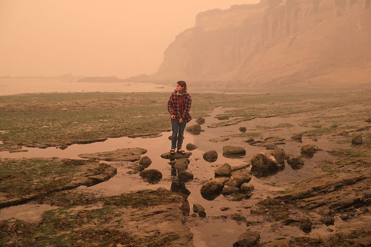
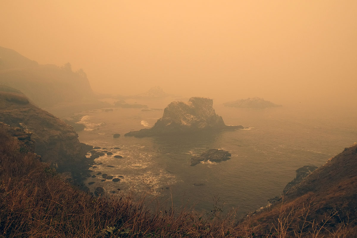
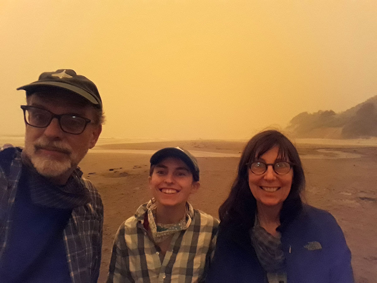
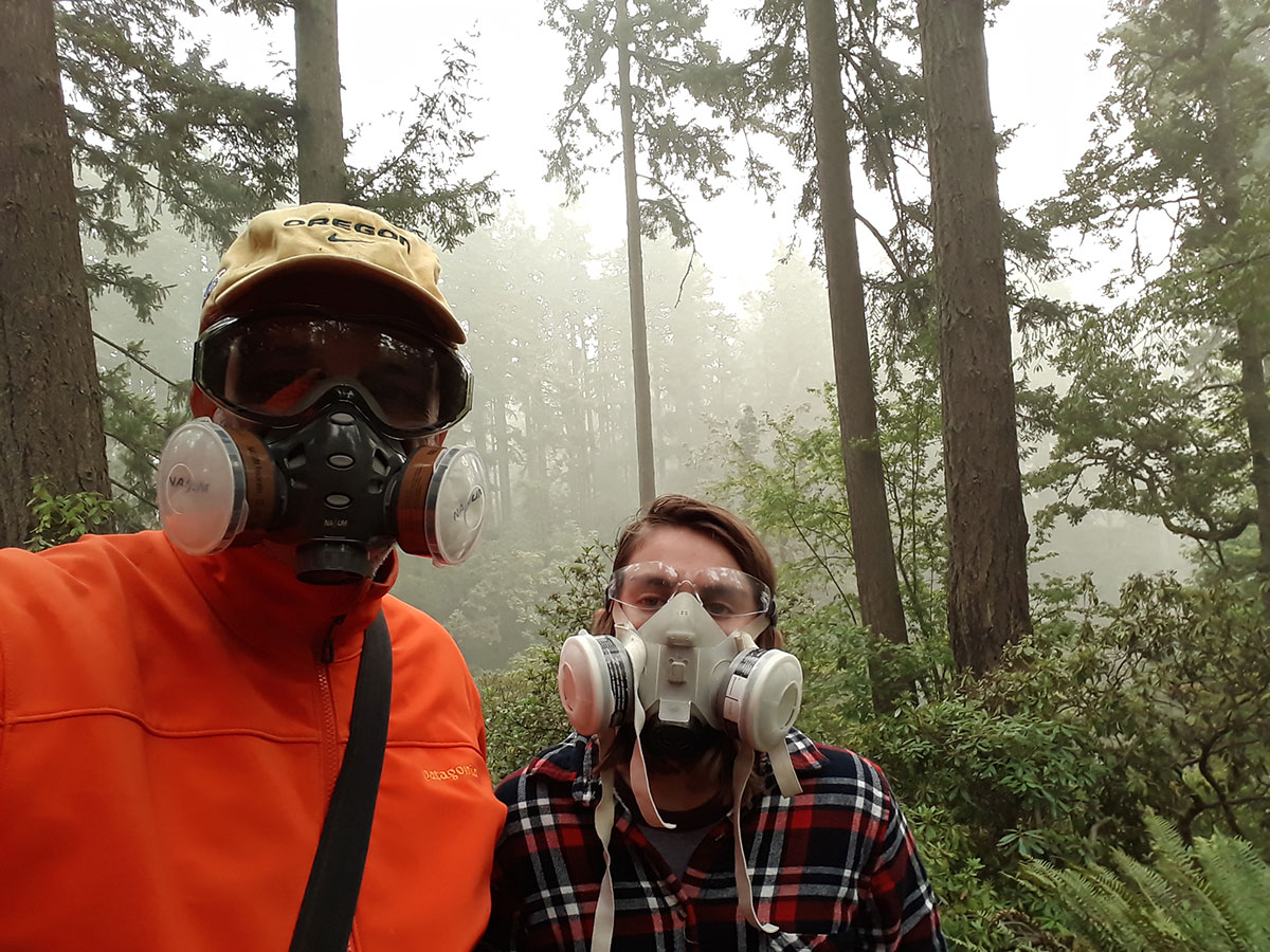
We were camping at the coast after Labor Day when this fire blew up, and even 100 miles away, the smoke from the Cascade fires was overwhelming.  We returned to Eugene for weeks of dangerously smoky air, and kept our telescope trained on the McKenzie River Valley, to check on the fire’s advance (which halted 15 miles from our  house).  The fire moved down the valley to the west, driven by winds from the high desert to the east.  (This wind pattern is unusual here, but more common in California, with the Diablo and Santa Ana winds). Eventually the winds returned to the more normal westerlies, and the fire was contained.  Here  you can see the location and scale of the fire compared to the Eugene/Springfield metro area.  

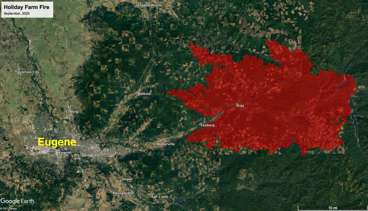
Then the school year started, Greta headed off for the fall with her Americorps team in Oklahoma, and a few other events transpired in the foul year of Our Lord 2020, with which we are all still coming to grips.  Greta came back for a winter break, and on her last day at home we took advantage of some good weather to visit the fire zone.  The first sign of the devastation was the constant traffic of logging trucks coming down Highway 126, removing all the cut trees.

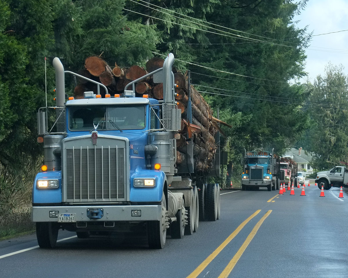
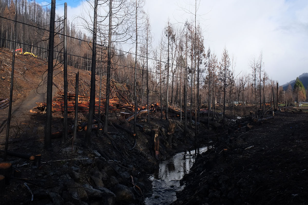
The effects of the fire are visible on the ridges above the river for a couple of miles before they reach down to the highway, but then you come to the first close-up view of the devastation, between the highway and the river.

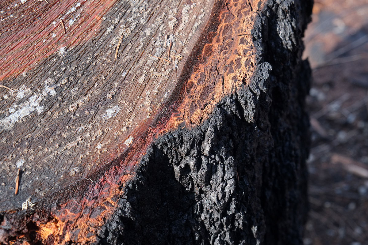
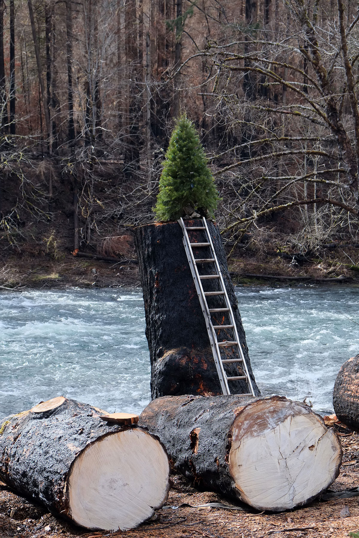
The cross-section of the cut trees shows how the far the fire penetrated through the bark and outer rings. 

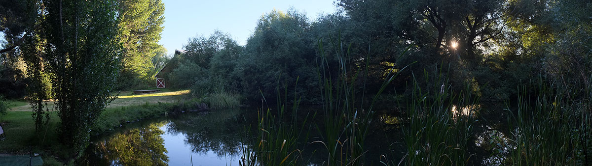
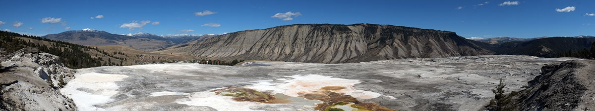
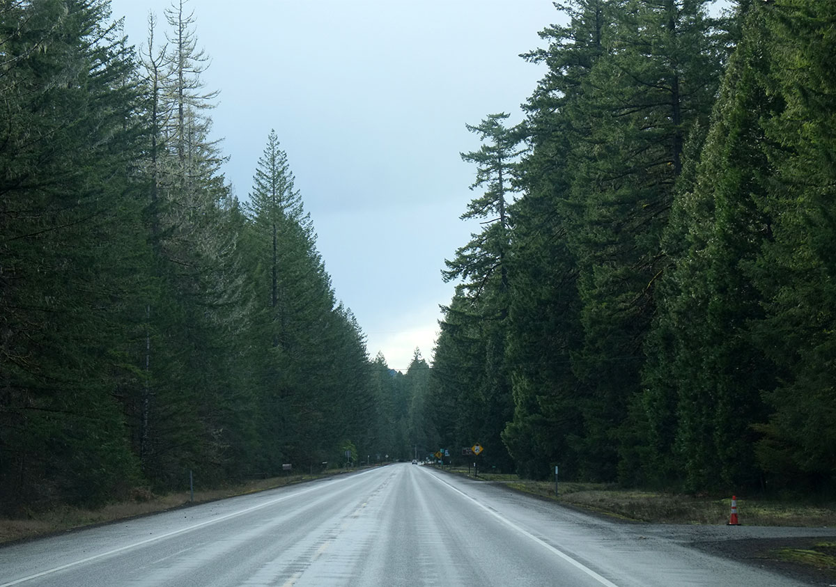
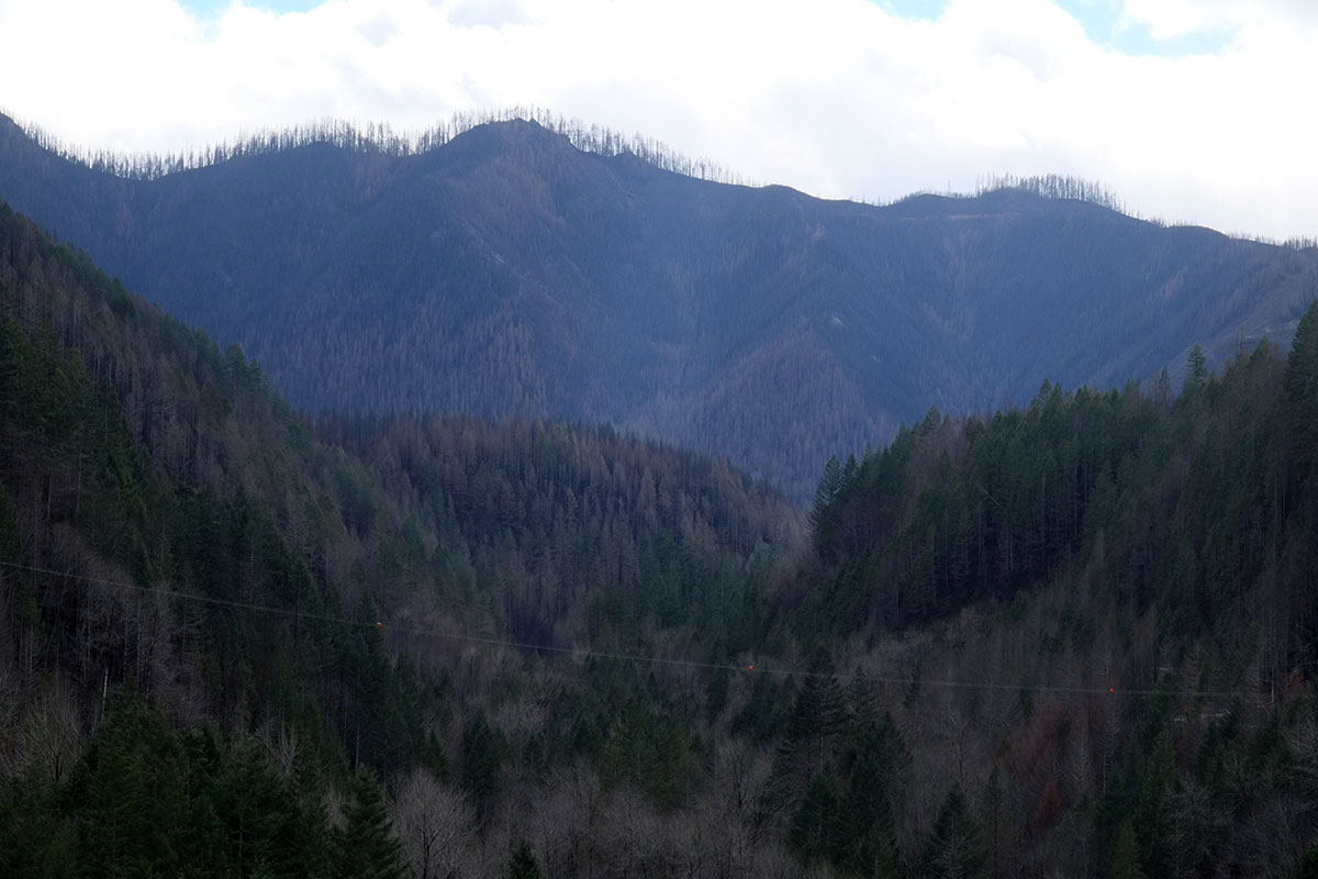
What immediately struck us was how dramatically this landscape had changed – previously the highway had been enclosed by trees on both sides, with views out to the river small and intermittent, similar to this stretch of highway further upriver:

Now the view of the river was continuous, as most of the wooded areas and houses along the river had been destroyed.

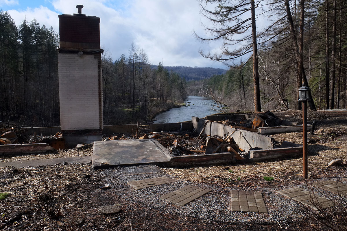
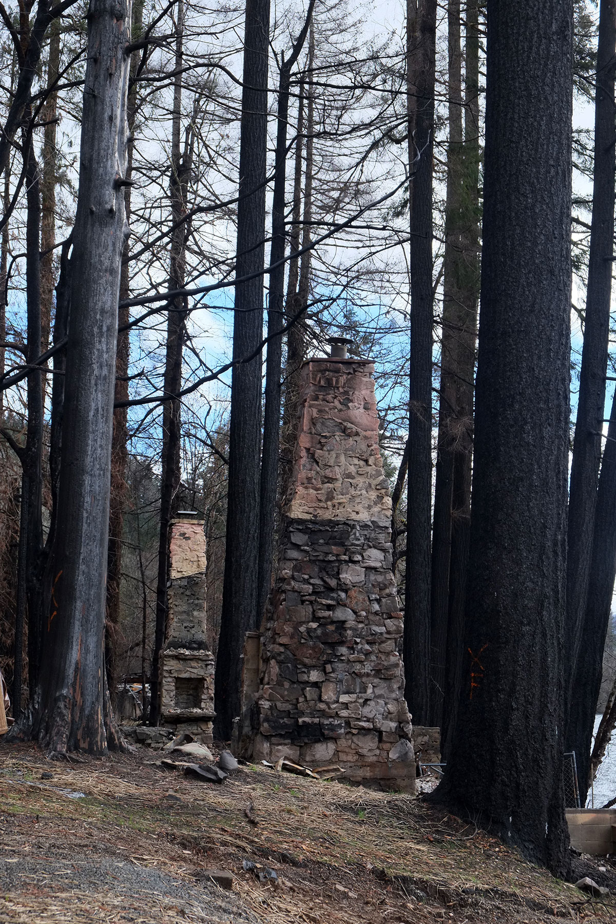
The houses located among the trees were all gone – not even metal roofing did anything to protect them.

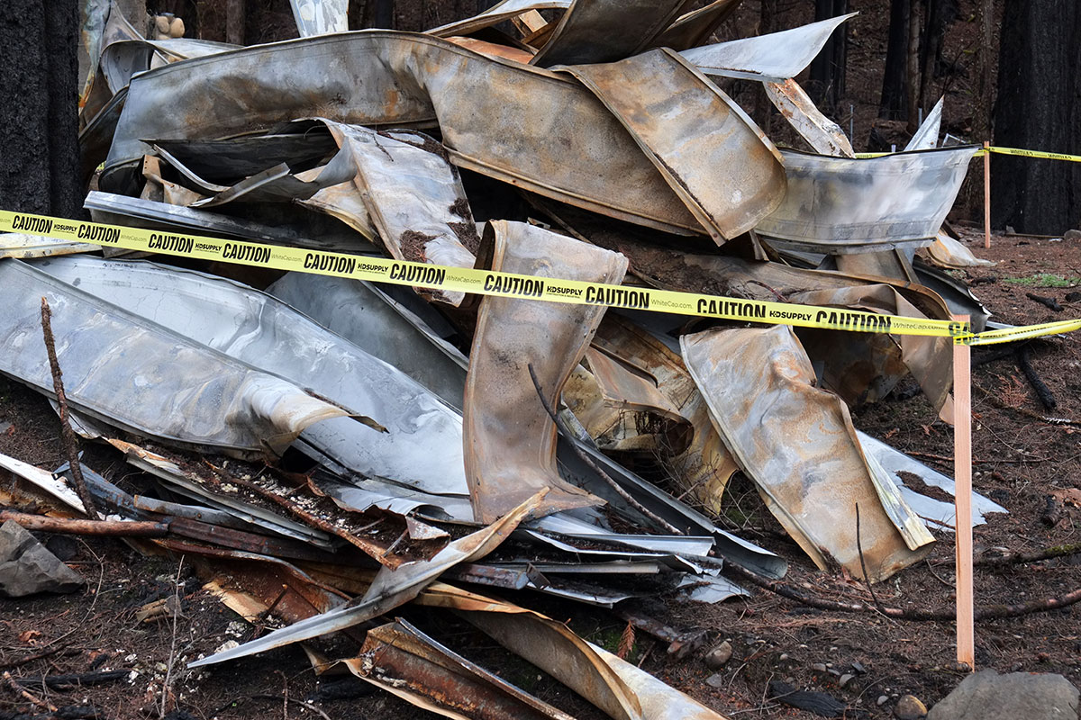
Whereas those that had clearings around them sometimes survived. 

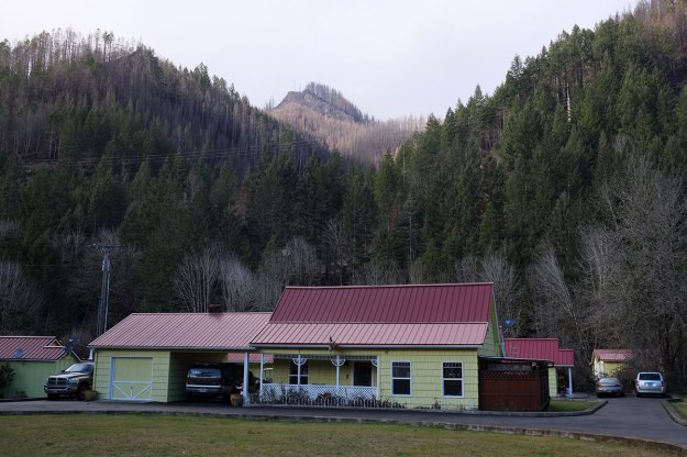
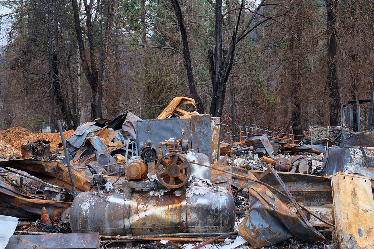
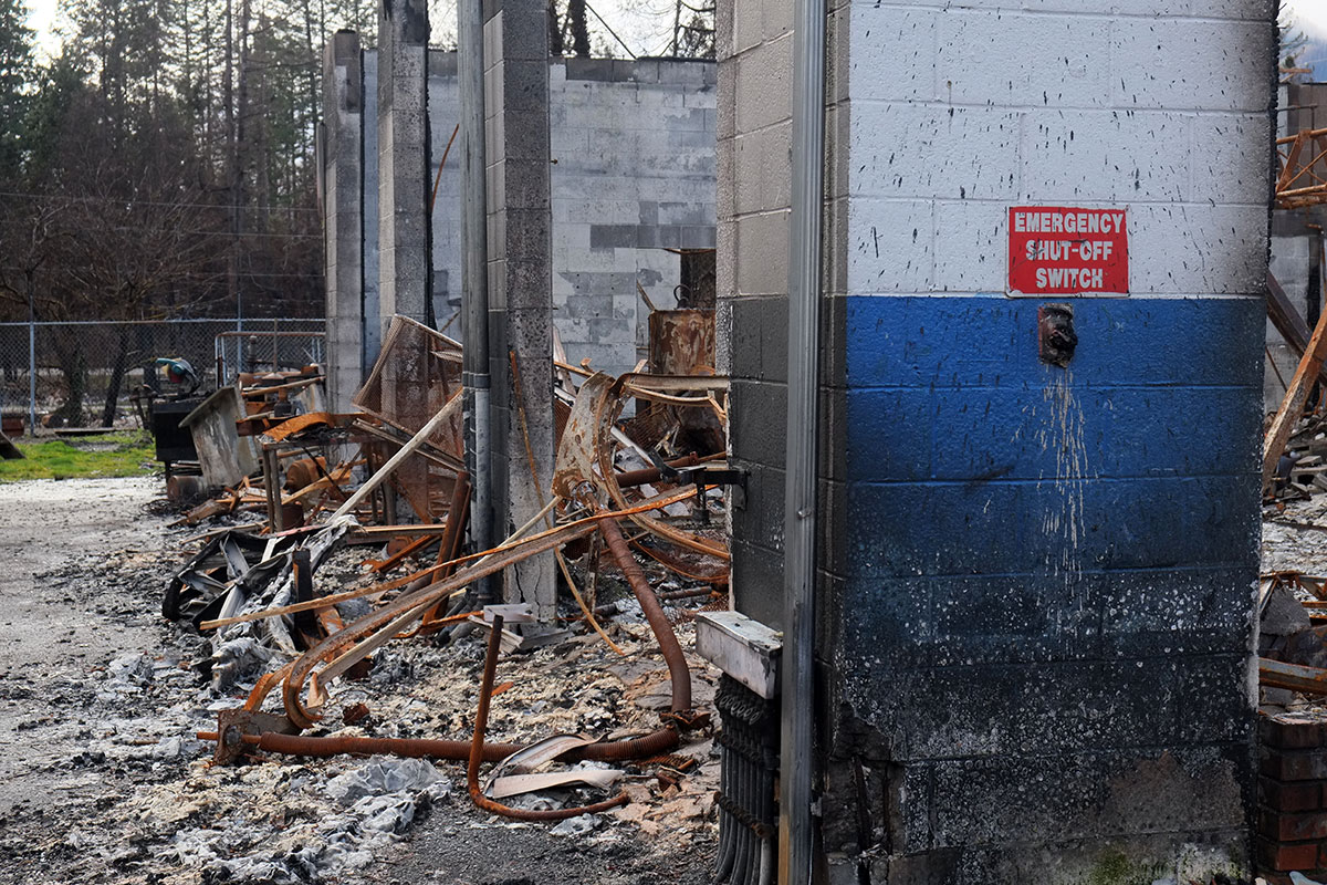
The most shocking prospect was the town of Blue River, which had been completely destroyed:

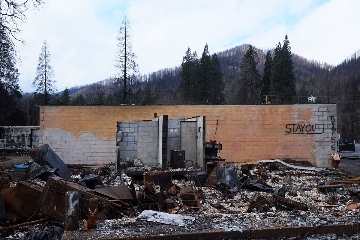
Concrete block survived, none of the roofs did.

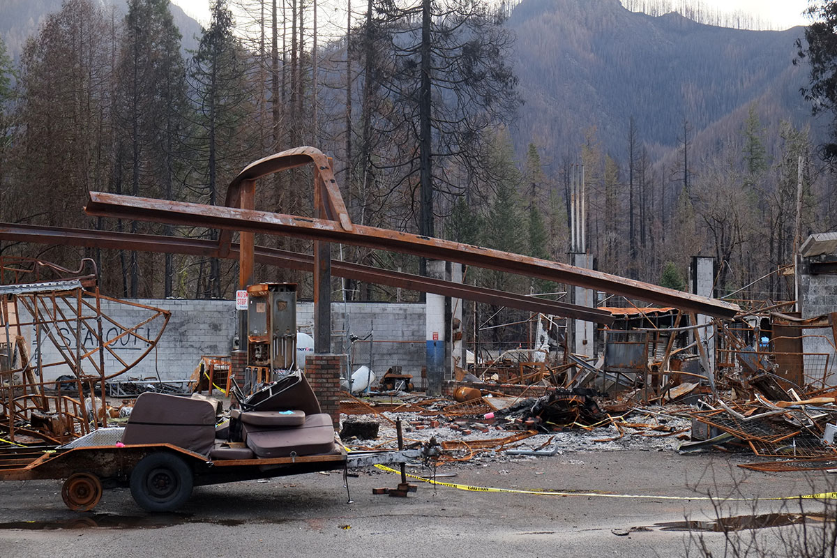
The steel structure of the gas station canopy melted.

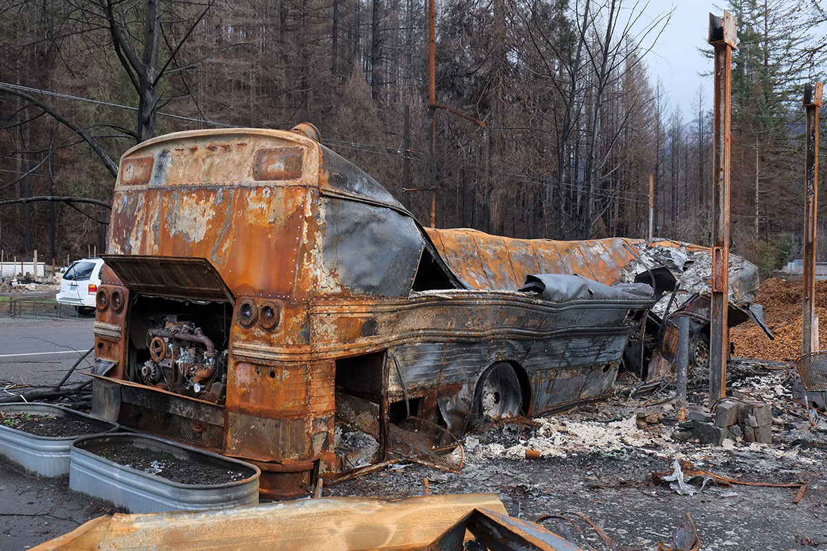
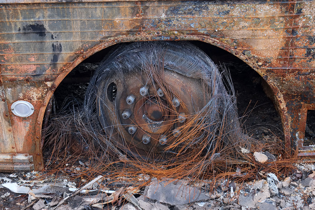
Steel-belted radials.

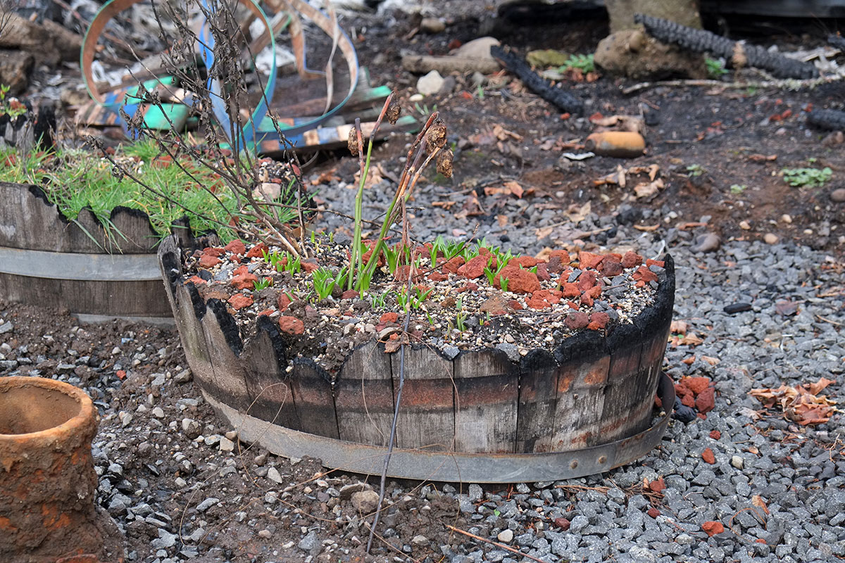
The fire burned the tub walls down to the level of the potting soil. Four months later, the plants attempt a comeback.

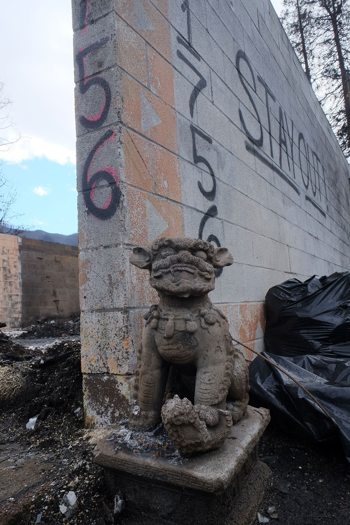
The guardian dogs also proved ineffective.

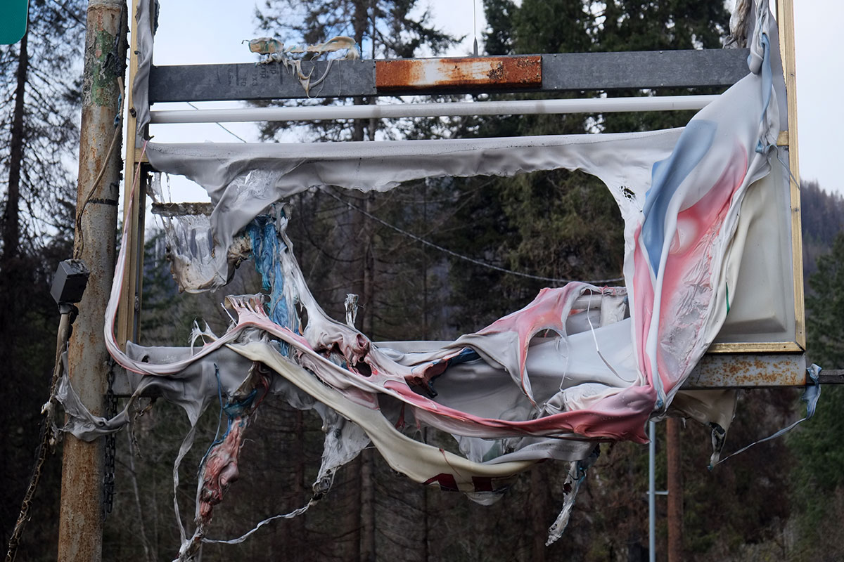
The convenience store signage.


We spoke to one woman, who was there helping a friend clear out his property. She lived further up the river near the fire’s origin point, and when she saw the fire’s trajectory, she called her friends in Blue River to make sure they evacuated. They had heard the warnings, but thought they had some time to pack up and clear out. She told them to drop everything and go; the fire arrived in about 15 minutes and took everything.

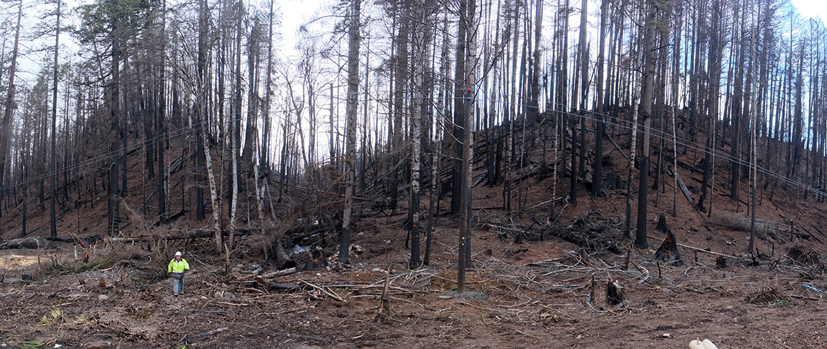
Away from the town, the devastation was extreme, but somehow harder to comprehend. A burned-out building is something we humans can relate to;  miles upon miles of burned forest is almost too much to grasp.  A scale figure helps. 

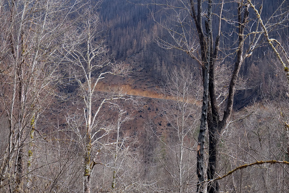
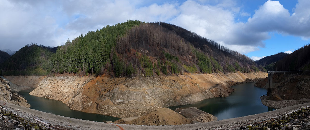
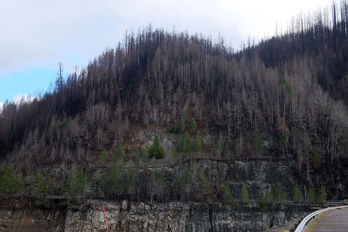
We turned off Highway 126 to the Blue River Reservoir, which is surrounded by burned hills. Here we could see how the degree of destruction varied with topography, extremely local conditions, direction of the fire, etc.

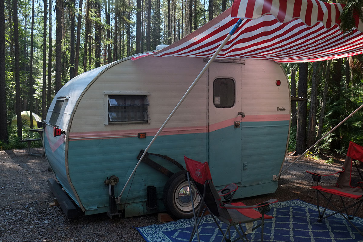
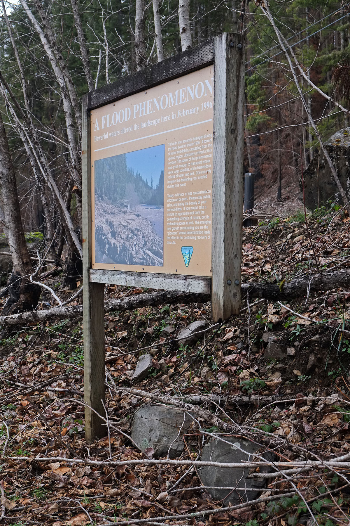
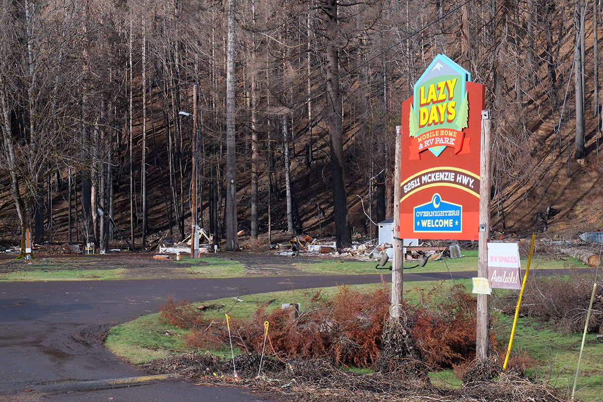
Then there are the strange anomalies and juxtapositions – the drift boat that somehow survived with a large, melted hole.  The sign missing just one leg.  The cheery trailer park sign.

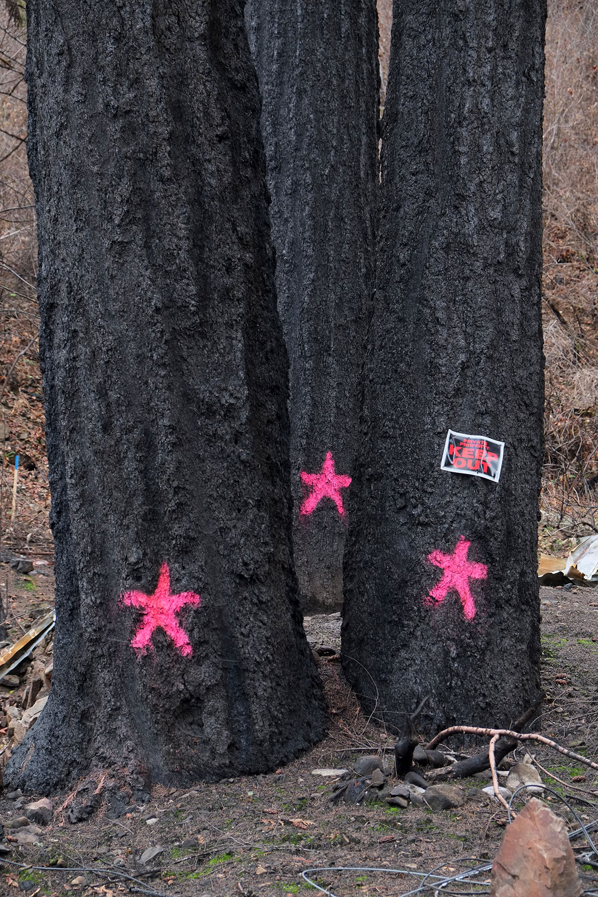
Four months after the fire, there were already signs of renewal, with plants springing up, and small acts of human resistance.

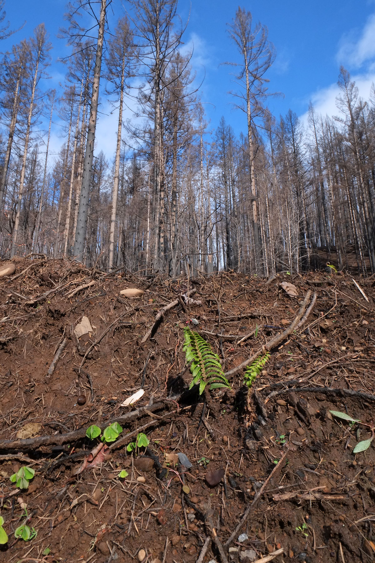
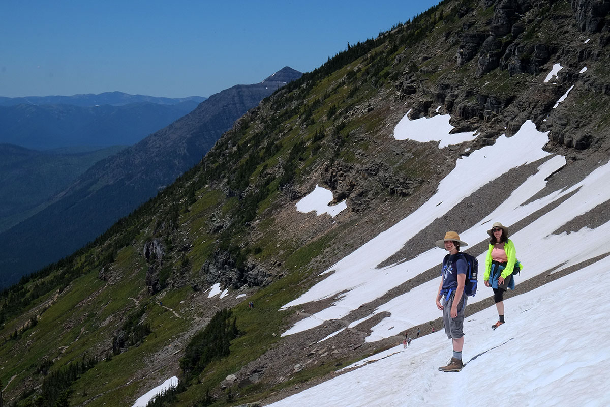
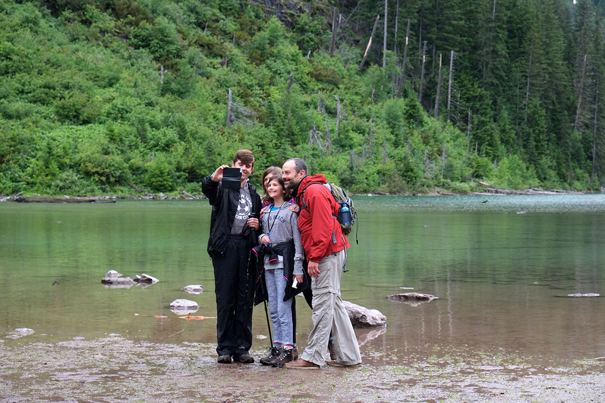
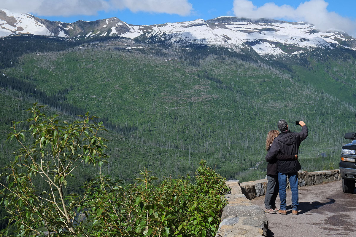
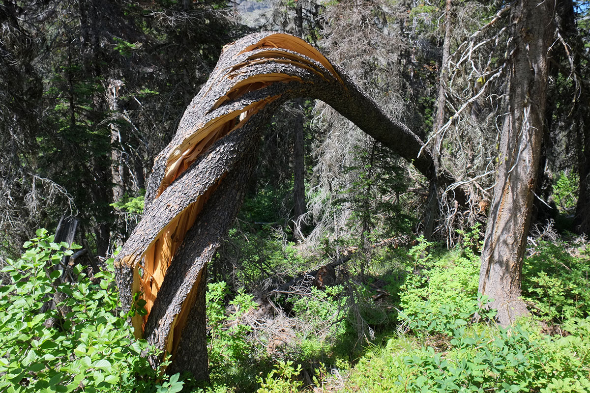
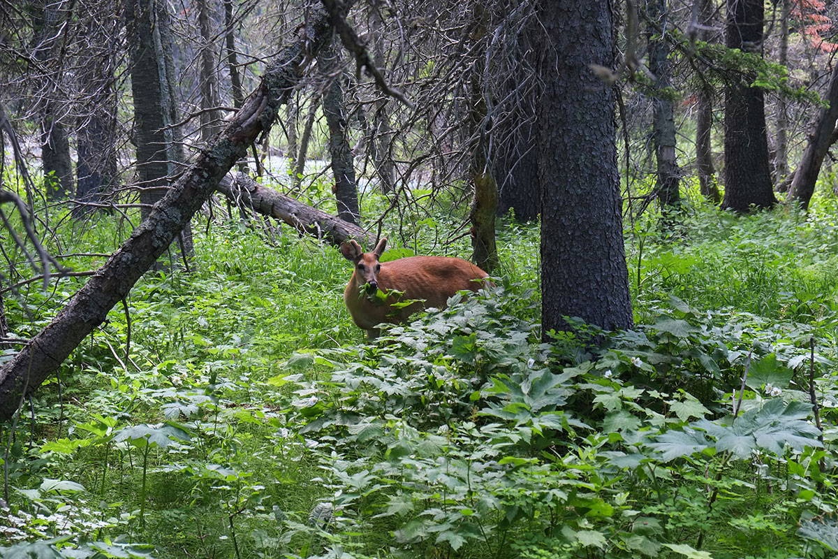
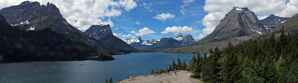
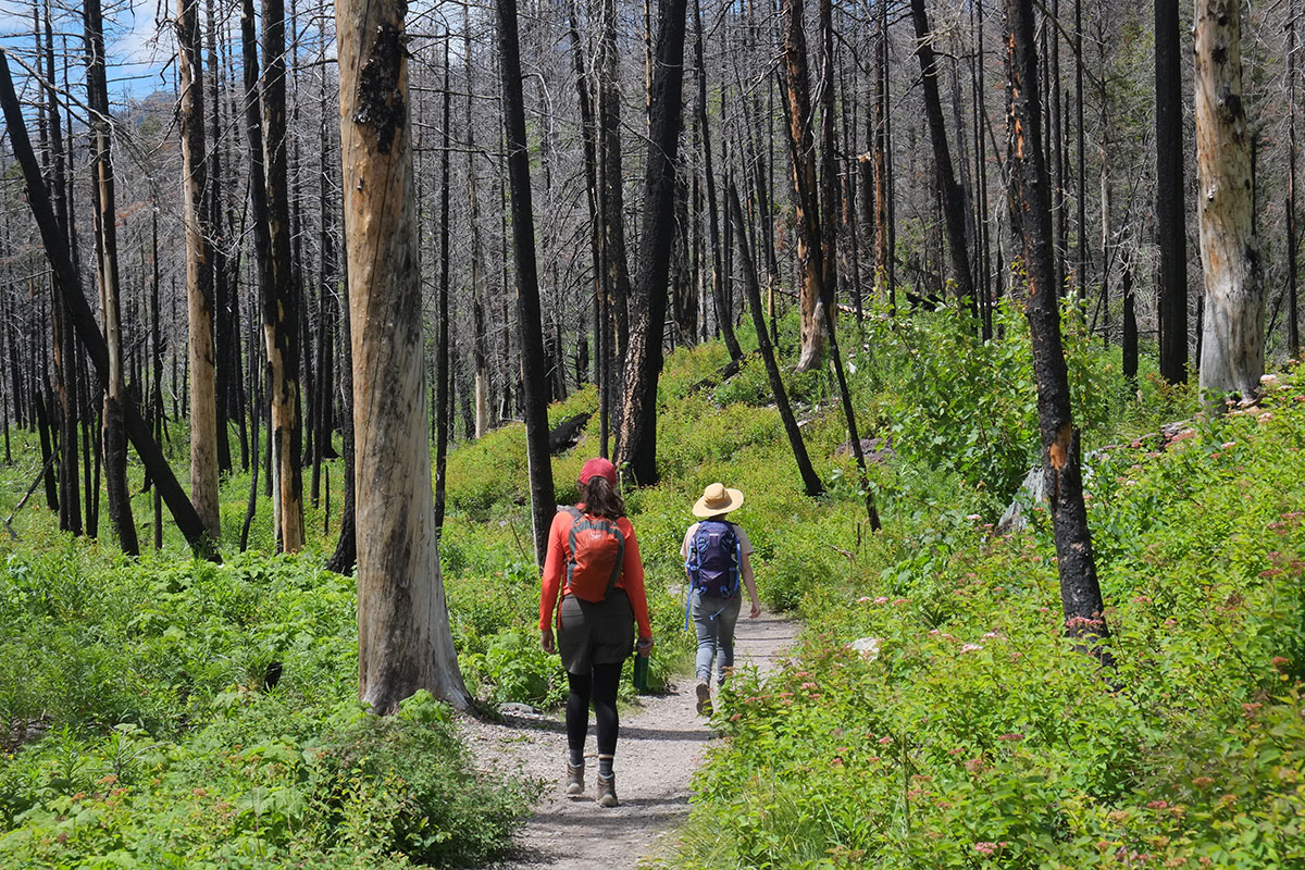
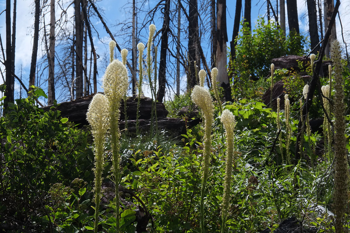
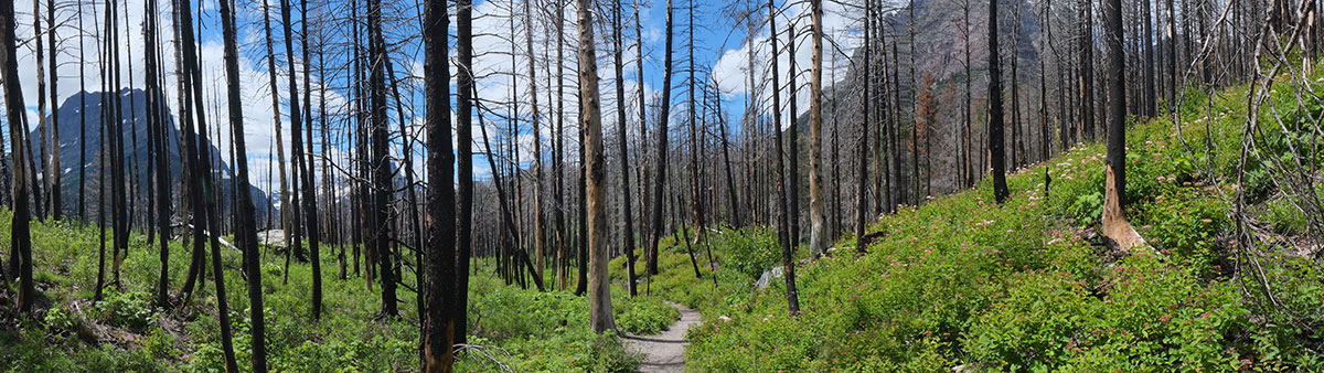
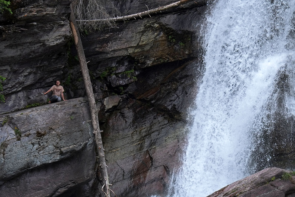
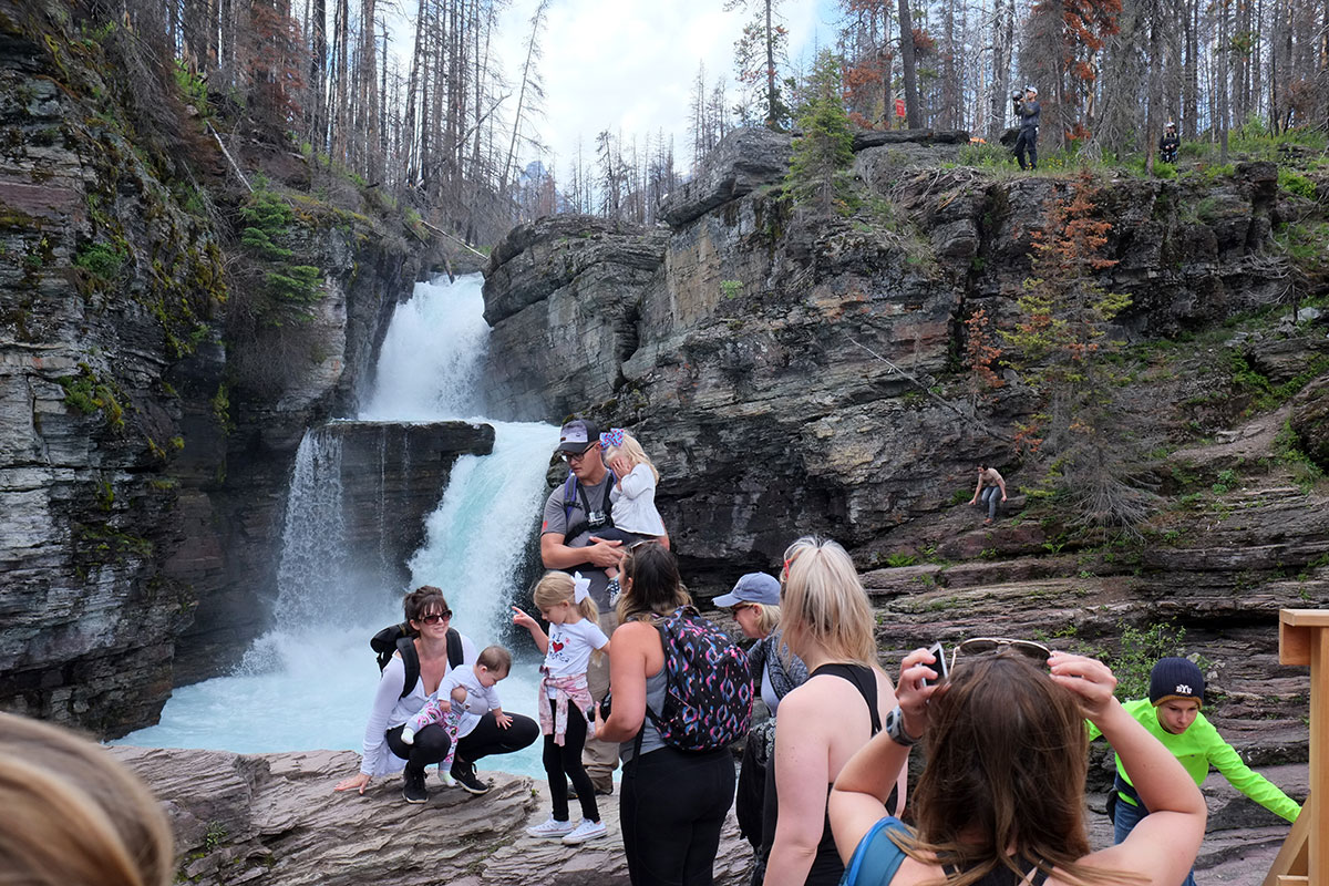
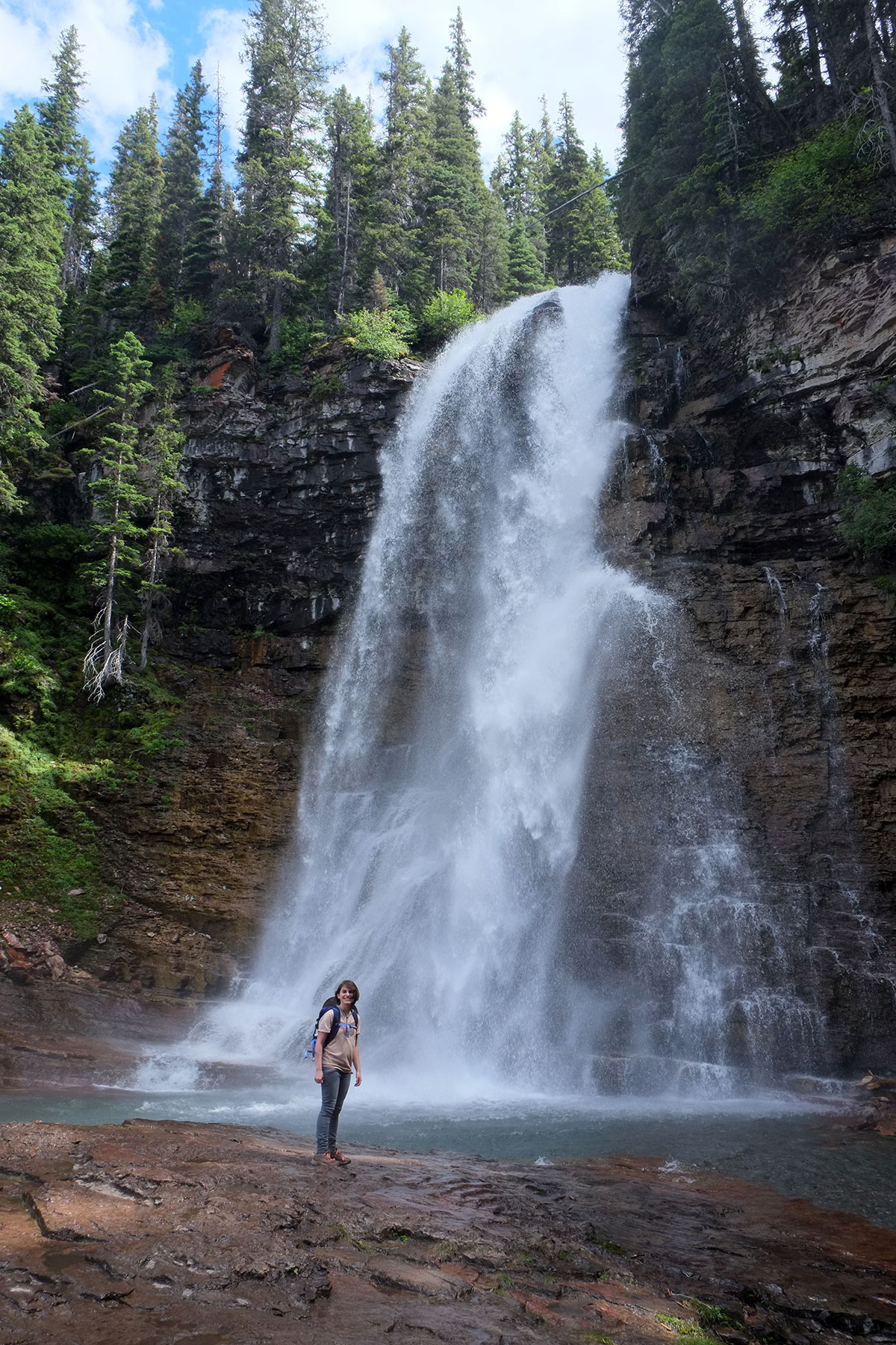
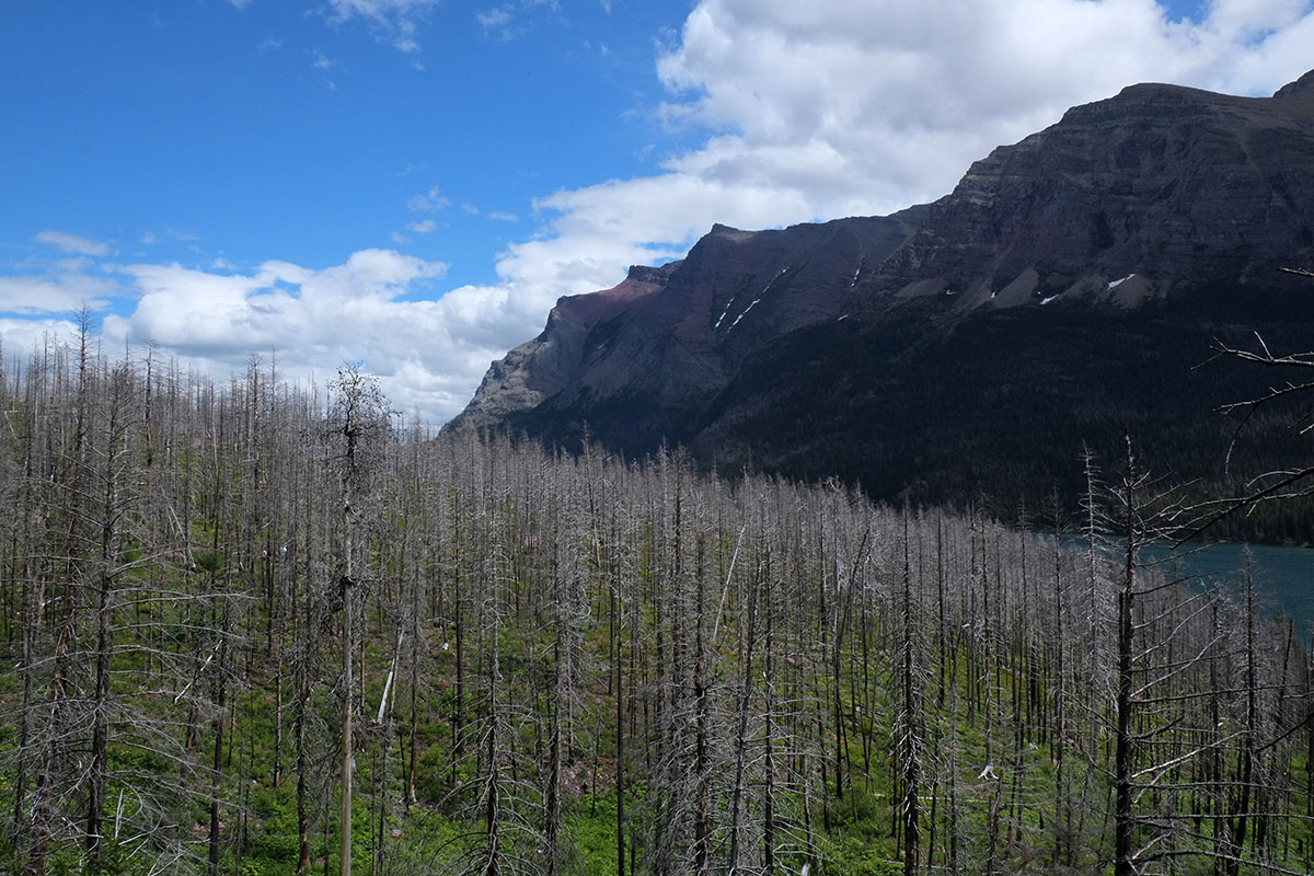
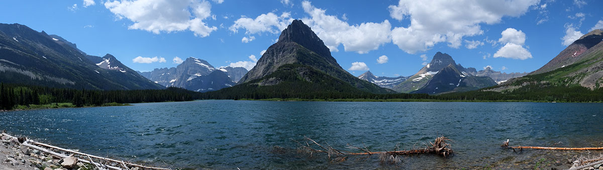
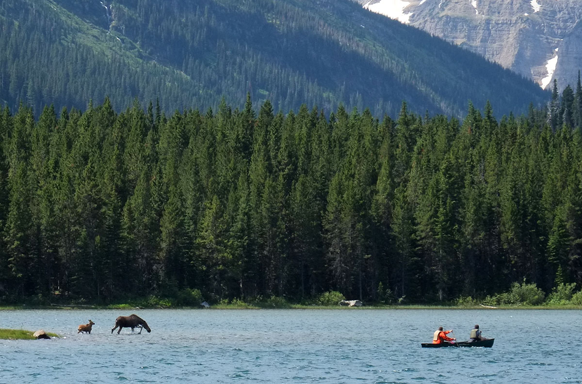
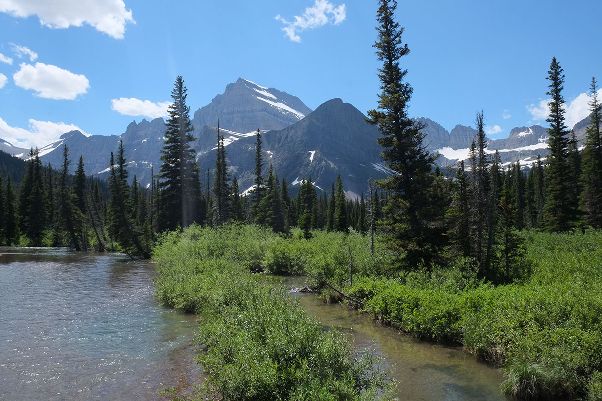
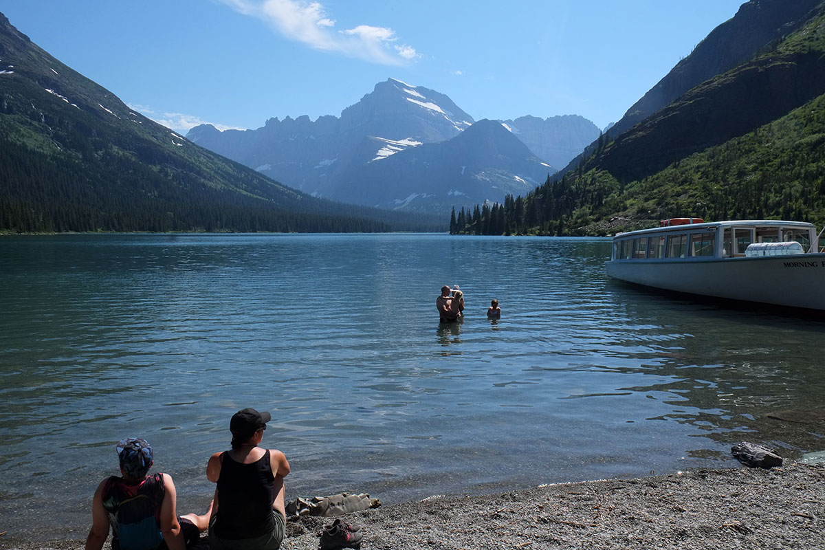
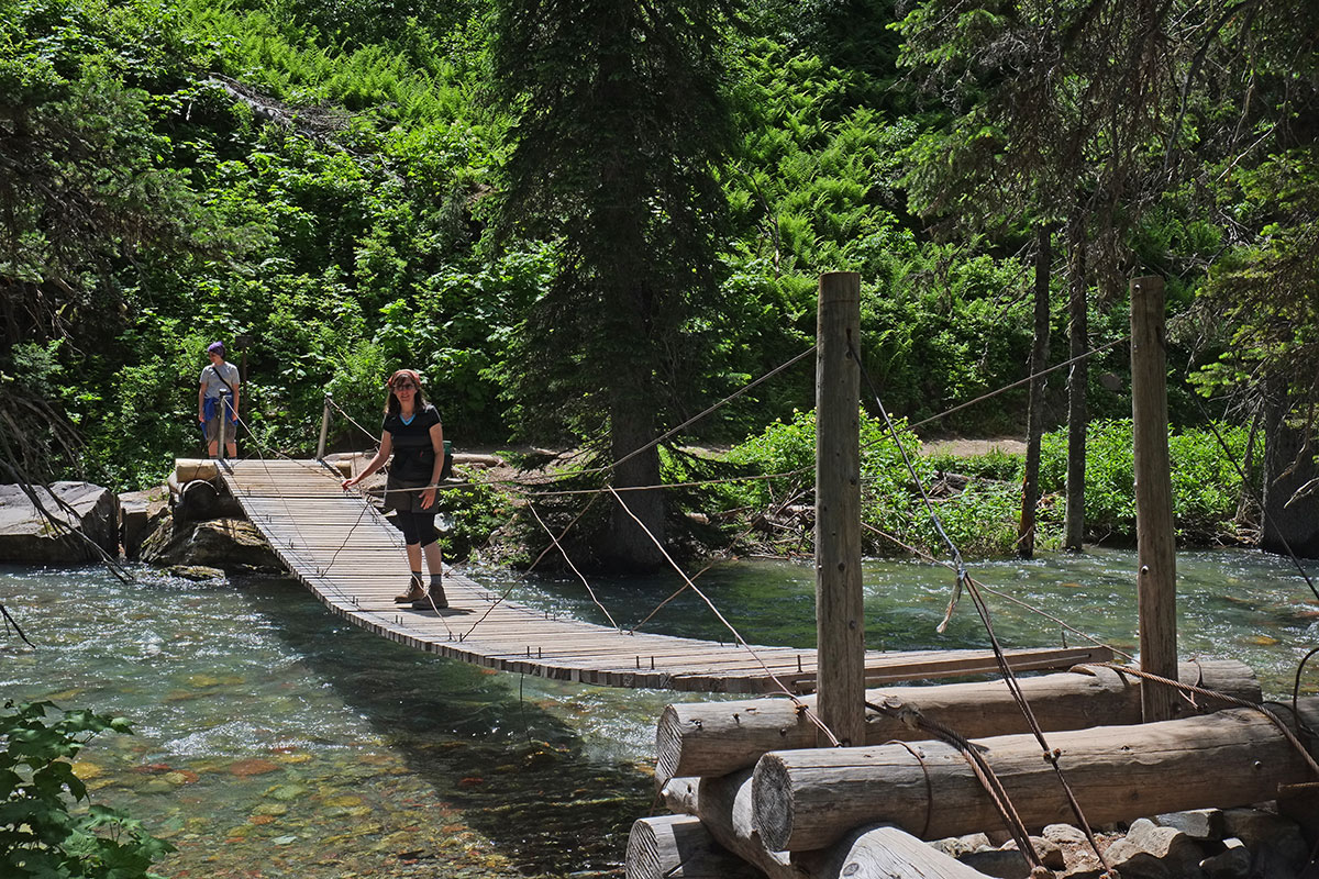
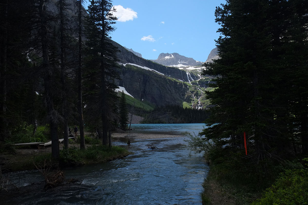
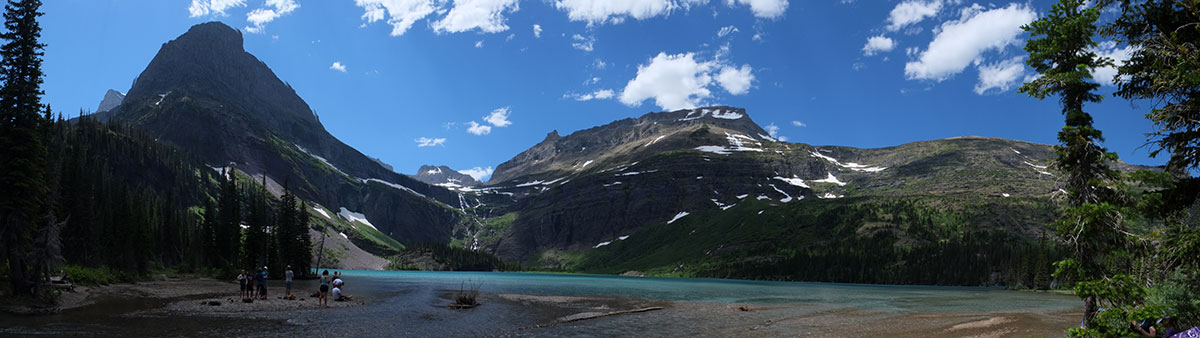
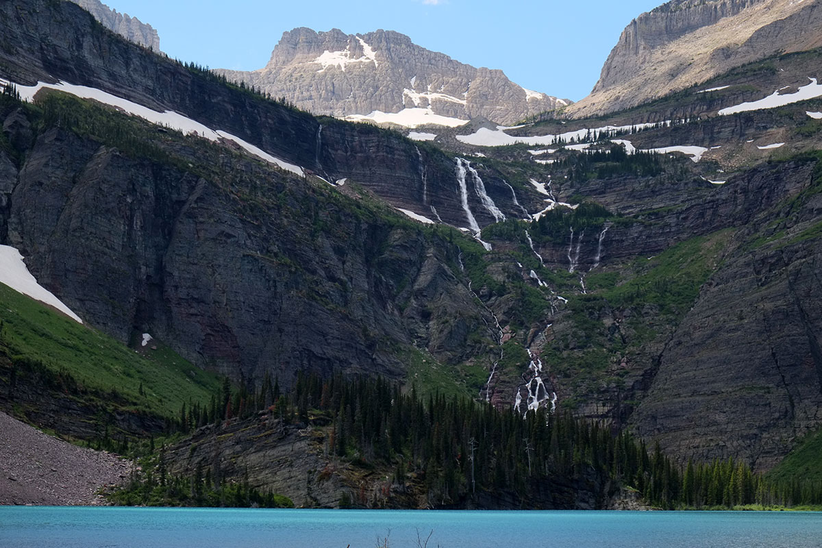
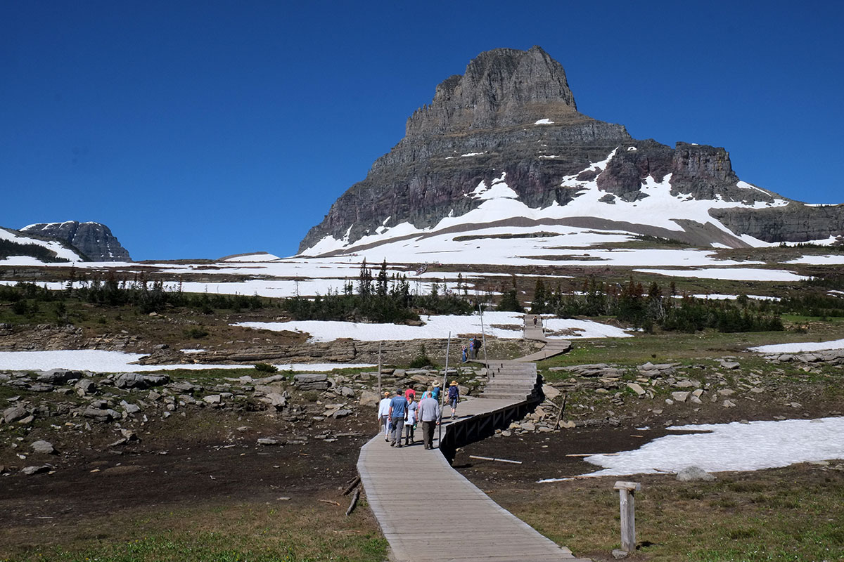
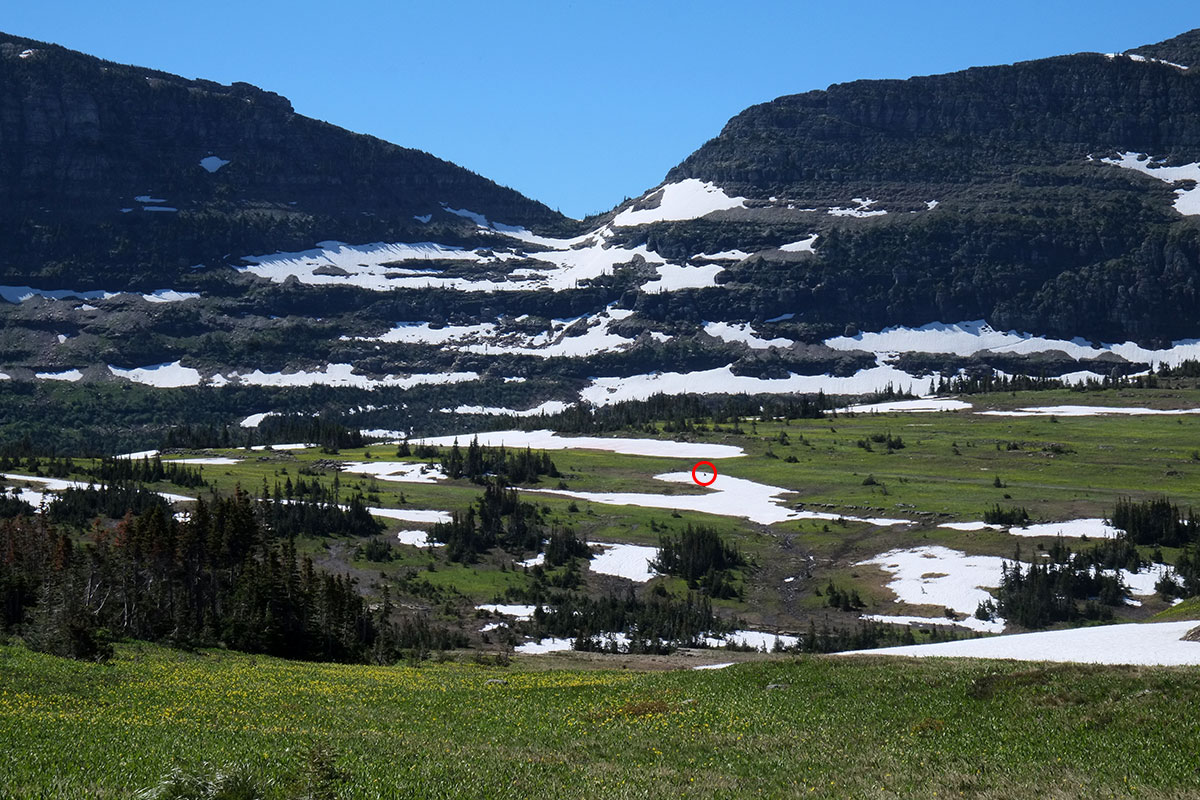
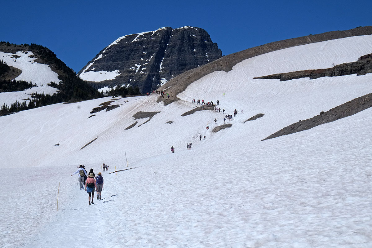
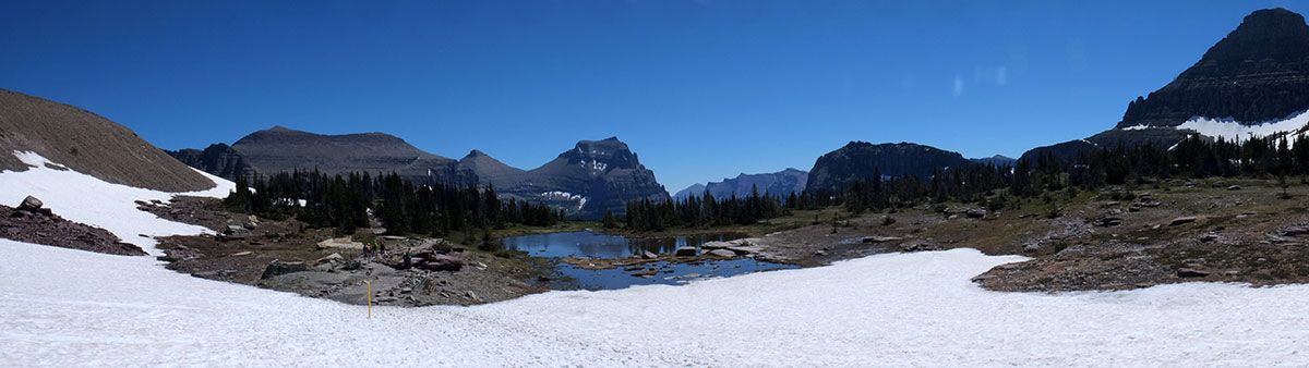
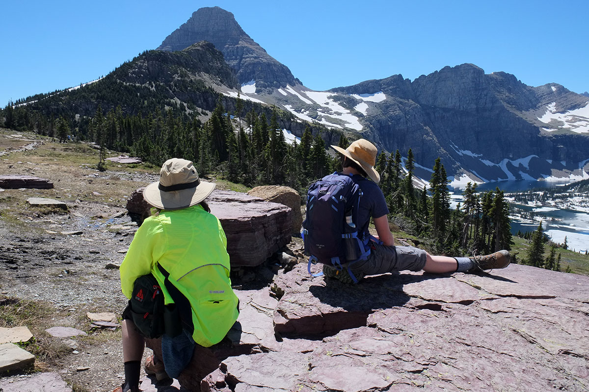
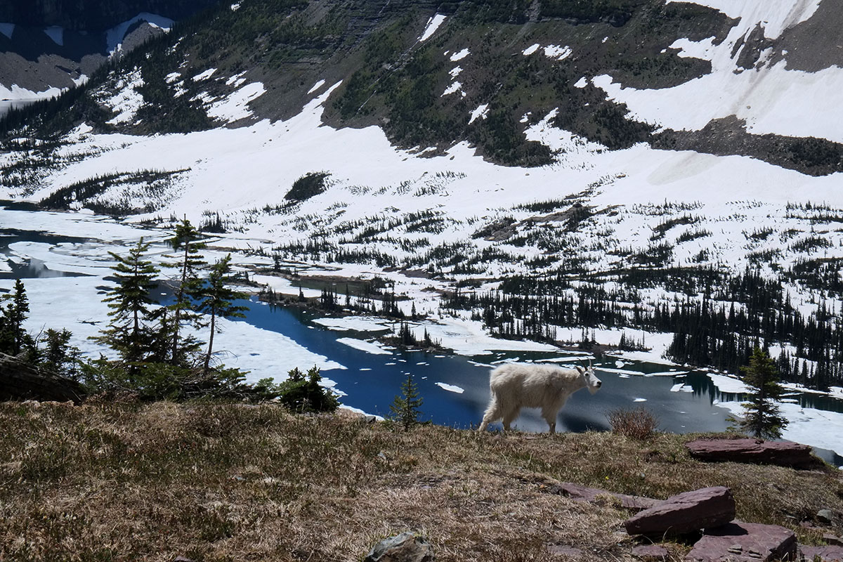
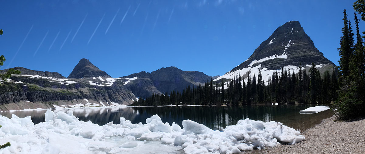
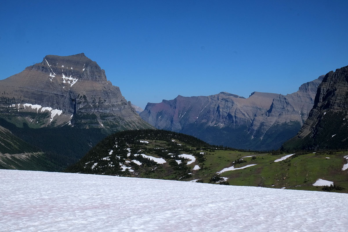
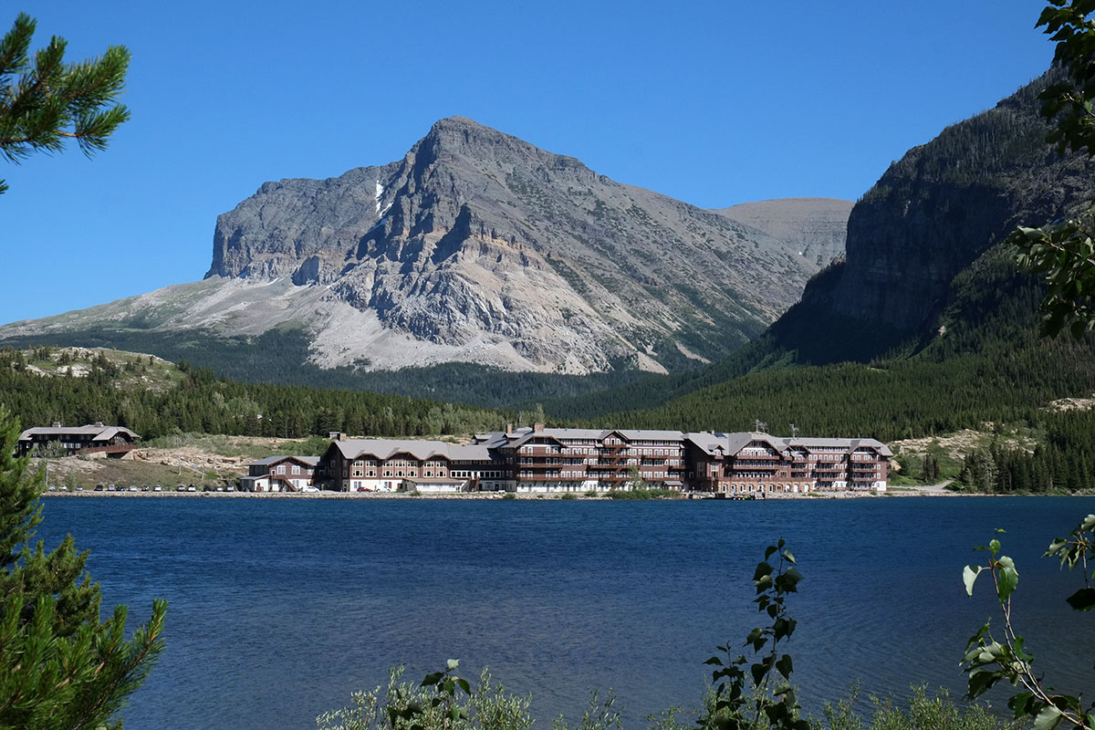
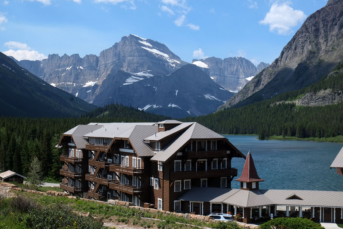
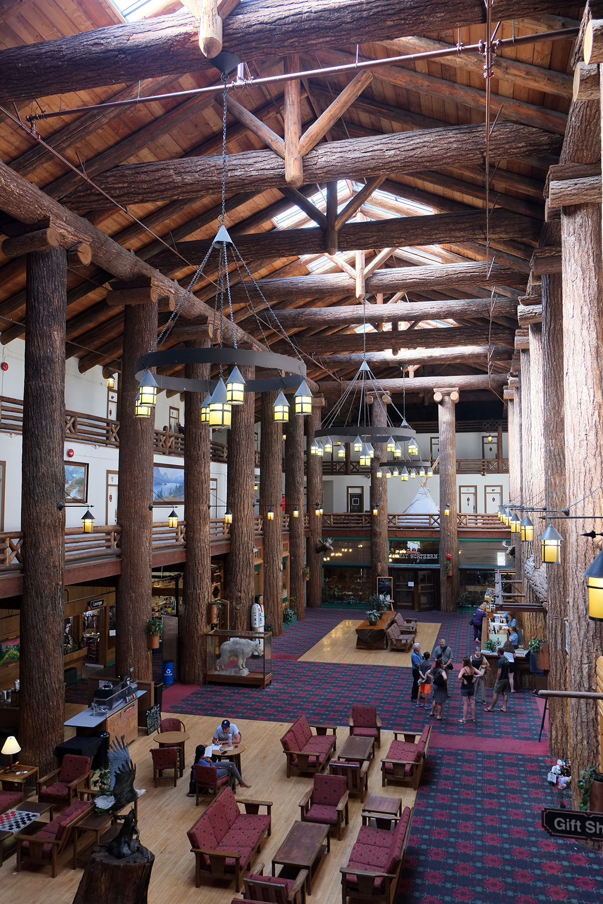
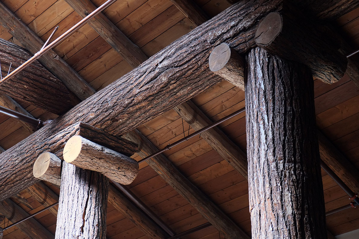
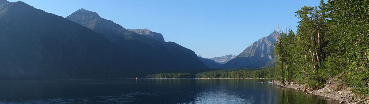
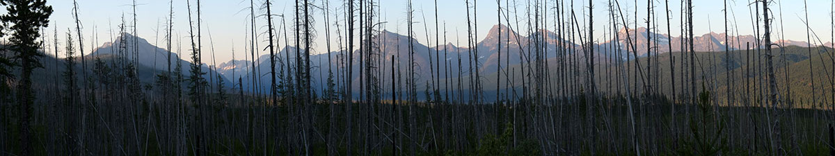
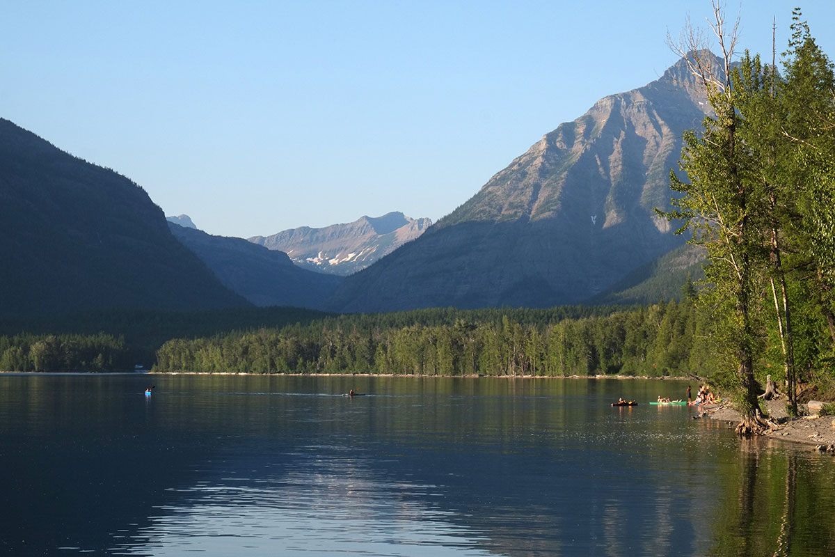
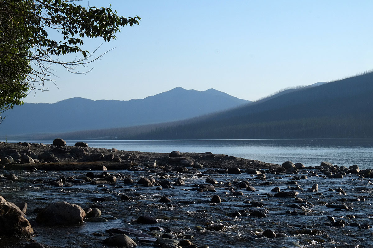
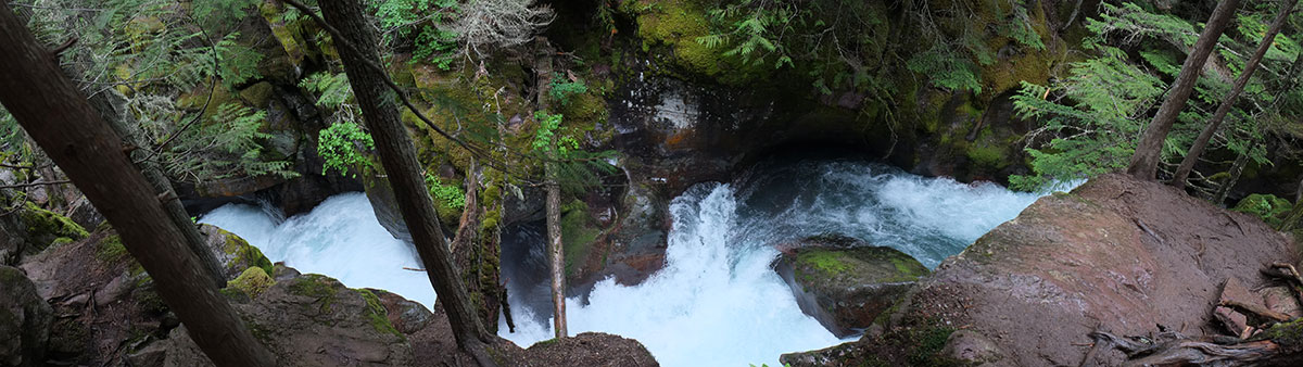
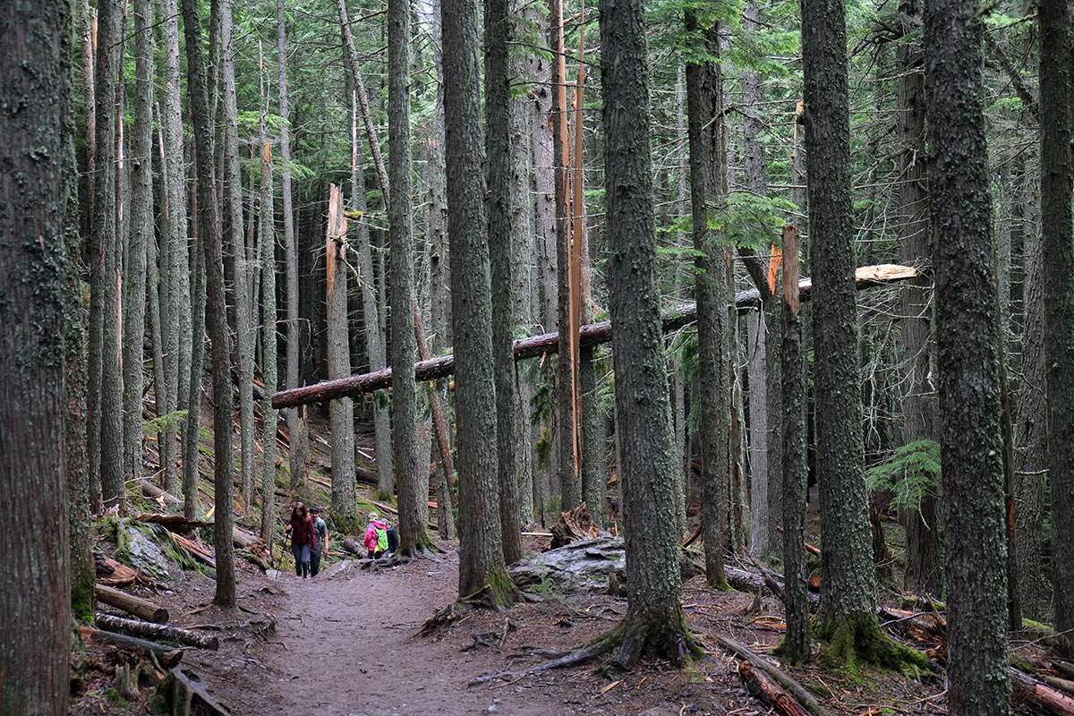
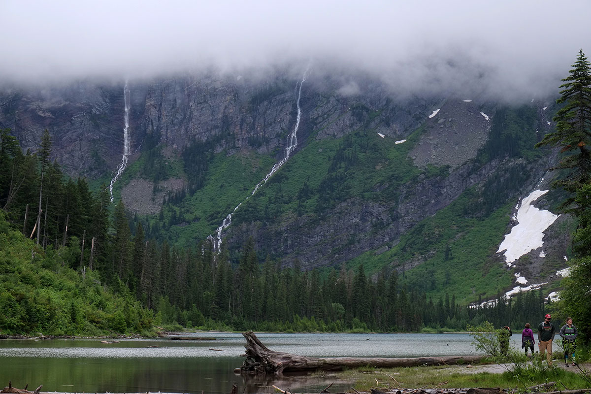
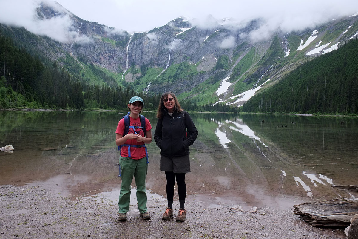
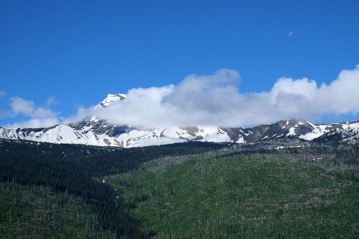
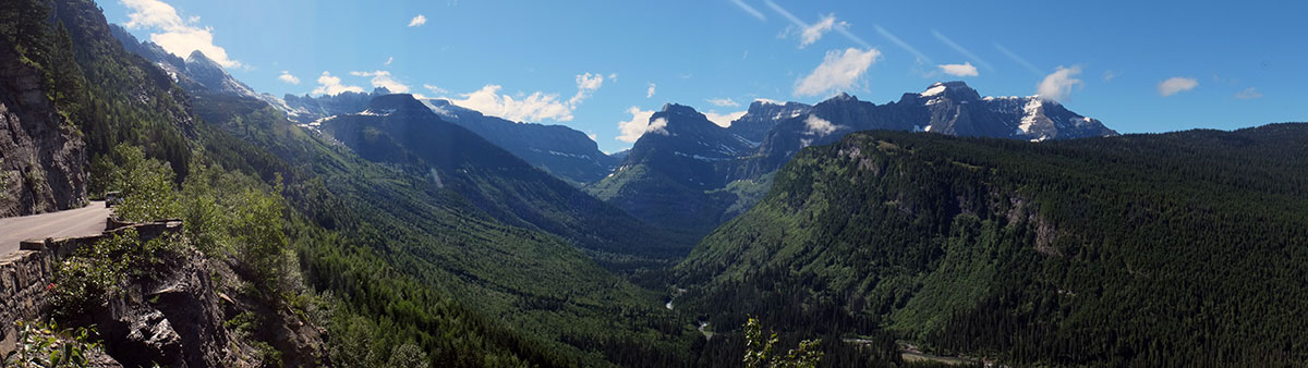
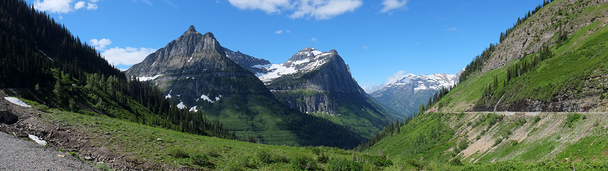
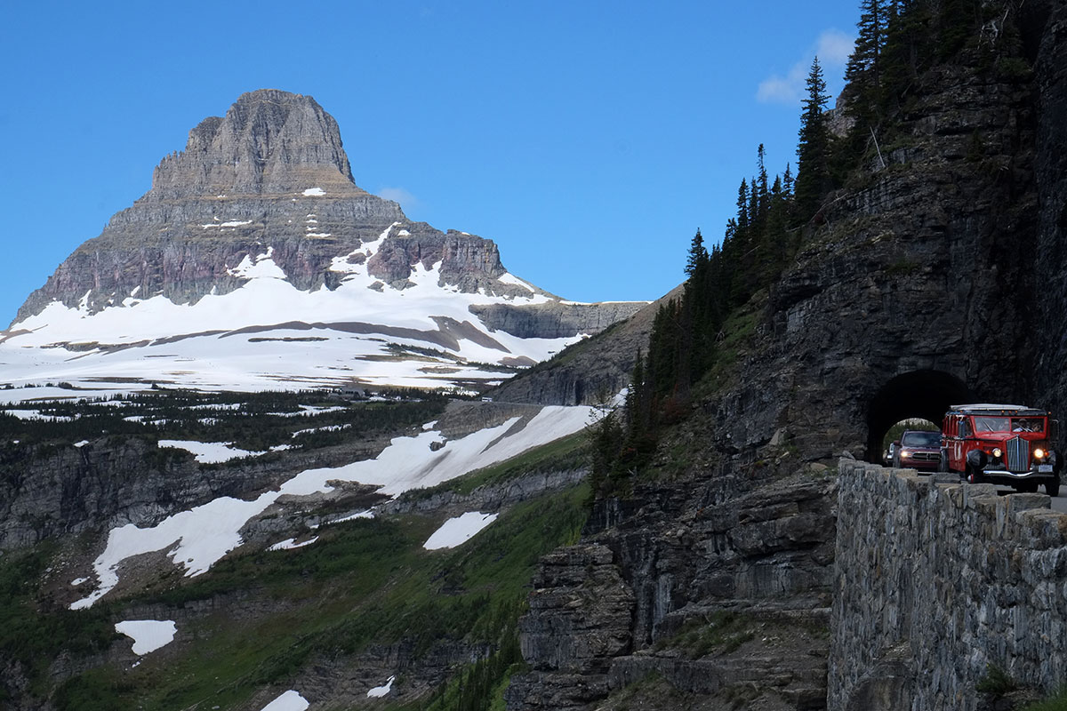
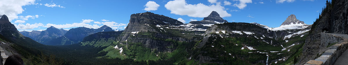
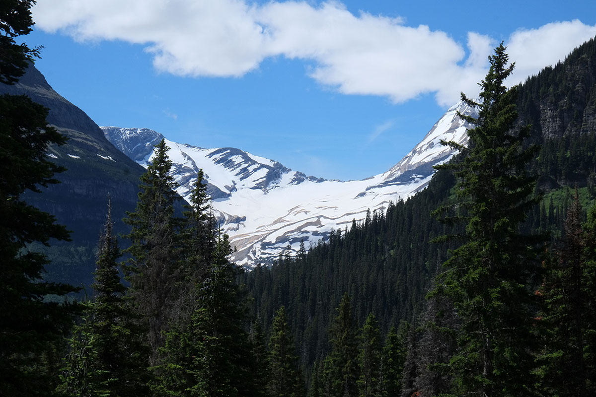
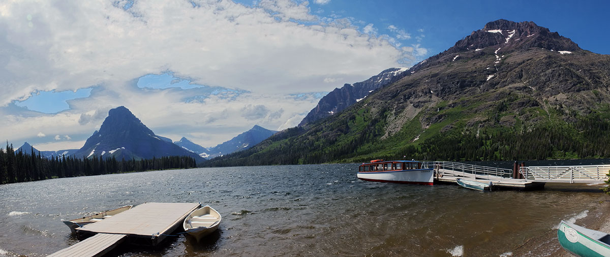
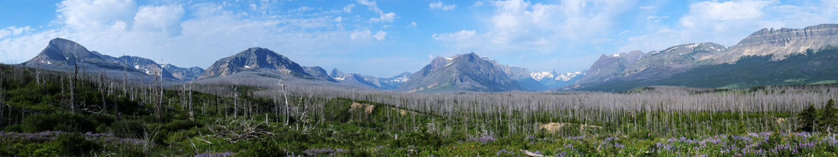
In 2018, we hiked through a three-year-old burn in Glacier National park, and were astonished at the renewal underway. But we’re not kidding ourselves about how quickly this area can snap back.  I’m not capable of saying anything useful about the future of the natural environment here, but as someone whose work revolves around housing, the extent of the damage and the difficulty of recovery are clear.  Our region was already suffering from a severe lack of housing, and adding a few thousand additional people strained resources further. Temporary housing has been secured for many, but the process of rebuilding (or even deciding whether rebuilding makes sense) has barely begun.  And with the 2021 fire season well underway (the Bootleg Fire is poised to become the largest fire in Oregon history), it seems that there will be no pause for recovery before the next round of disasters strikes.  

This potential doesn’t exist only out on the wildland/urban interface: in the center of Eugene, we are already beginning fire preparedness protocols, having seen how whole suburban neighborhoods have been wiped out in California cities in recent years.    For years I’ve been predicting that Oregon could expect millions of climate refugees, as many other parts of the country became uninhabitable; the past three years have changed my perspective, as it is increasingly clear that no region will be spared. 

One of the main reasons for the big trip that Greta and I undertook six years ago was Climate Change Farewell Tour – “I had realized that the world we live in will change dramatically in Greta’s lifetime, and I wanted her to have a good baseline understanding of what it was like for most of human experience.  With increasing temperatures, rising sea levels, and bigger storms, it’s hard to see how some of these places we’ve visited will still be inhabitable 50 years in the future.” As far as it went, my insight was pretty spot on. I just hadn’t realized that it would apply to our own place too, so soon.

The next adventure

Five years after heading out on our big trip, Greta is getting ready for her next great adventure. She was enrolled for freshman year at UW, majoring in environmental science, but as the pandemic progressed this spring, it became clear that college was either just not going to happen, or it was going to suck.  Maybe her online classes would be as good as in-person classes (well, we seriously doubted this), but that is such a small part of the experience of freshman year that she didn’t see the point.  So she began casting about for alternatives.  Working in Hendricks Park, she met a group of AmeriCorps volunteers, and thought that sounded like a possibility.  She applied, got in, and she’ll be heading off next month.  (One of her application essays explained how she had already been to most of the country, and that she’d like to go back and spend more time working in some of those places.)

She’ll be at the Aurora, Colorado AmeriCorps base in October, quarantining and training.  Then with her team of about ten young people, she’ll travel around the Southwest Region (Arizona, New Mexico, Texas, Arkansas, Oklahoma, Missouri, Kansas, Colorado, Wyoming), working on community-based projects.  They’ll stay in campgrounds, church basements, hostels, etc.  They’ll do their own cooking, and they’ll form their own pod during the pandemic.  As we talked about the risks, Greta observed that it’s probably safer than being on a college campus.

After we returned home four years ago, Greta had a great high school experience – singing in the choir, getting into more outdoor activities, interning in the local park, achieving a level of academic performance beyond my own, and being part of the robotics team for four years – as team co-captain her senior year.  It all came to a rather anticlimactic end spring term with the pandemic lock-down, as did everyone else’s year. 

Although I’d spent years fretting about her leaving home, and about how diminished our lives would be without her around, when we were suddenly confronted with a world on hold, I realized that even more than I might have wanted her to stay with us, I wanted her to live the life she’s meant to.  The three of us have been hanging around the house for the past six months, and Greta really needs to get away from her parents and get on with her life. She was primed for an intense college experience, but in keeping with how we evaluate everything in 2020, we all think this is the least-bad option.

About five and a half years ago, I was sitting in the kitchen while Greta unloaded the dishwasher.  I mentioned that I had been pretty fed up with things, and thought I needed a change (she had noticed).  I said I had decided to take a year off (she nodded), and I was going to hit the road for a year (she stared at me).  Then I told her I wanted her to come with me.  She didn’t say anything, just kept unloading the dishwasher as I floated some preliminary ideas on how I thought things might go.  Finally, she looked over at me and said, Dad, this is going to be an adventure – I want to have adventures!  I said, yes, but your first adventure has to be with your dad – this will be your starter adventure; after that, you’re on your own.

So now she’s ready to be on her own. While I have a parent’s normal anxieties about Greta heading off on her own, they’re not worries about her capabilities (they’re more worries about her being out there where heavily-armed militias are marching around without masks).  She’s smart, she’s sensible, she adapts to circumstances, and she’s great at dealing with groups of people.  I like to think that the prior year on the road gave her some of those qualities, and I expect that by the time she gets back she’ll be a fully-fledged grown-up.

I don’t know if she’ll post anything on this blog during the year – she tends more towards writing fan fic online than to social media of any type.  But I will post occasional updates on Facebook.  If you’re out there in the middle of the country where she’s heading, please make sure we have your contact information – I’d like to give Greta a list of safe houses where she could bail out of the boogaloo.  Or maybe she could just give you a call if she’s in the vicinity.  We think she’s going to have an amazing year, and she’ll probably make it to Arkansas and Oklahoma before I do.

The Oregon Coast – through pandemic and smoke

It’s been a long, difficult and challenging year, but we finally got around to dusting off the trailer for a trip to the Oregon coast. Our spring term at the university was all online during the pandemic, teaching large lecture classes and thesis studios (with up to 30 hours per week on Zoom).  After we revived from our post-spring term collapse, a lot of time this summer was taken up enabling summer living here – this was  our first summer in Eugene in 15 years, after selling the house we built on Whidbey Island last summer.  We built large cedar-framed screened panels and doors, outdoor furniture, caught up on a backlog of yard work, and established a plot at a community garden that fed us all summer.  The outdoor living allowed us to resume some socializing, with our ATTV (all-terrain television) supporting socially-distanced movie nights with friends.But as summer began to wane, we realized it was our first summer ever without being by the ocean.  The reported day-tripping crowds to the Oregon coast had kept us home during the pandemic, but as the forecast for the week after Labor Day was for temperatures reaching 100º for the third time this summer, we made some reservations at Oregon state parks, and took off.  Oregonians are not notably gregarious, and we figured we could stay in our own bubble if we were camping.

We plotted our route north from Eugene on Territorial and other minor roads, tight up against the Coastal Range on the west side of the Willamette Valley.  It was a beautiful drive on a sunny Labor Day, through farmland and small towns until Dallas, where we turned onto Route 22 through the mountains to the coast. Our destination was Cape Lookout, one of a series of rocky capes that project out into the Pacific – this one about 2 miles.  We stayed in a wonderful campground in the trees just behind the dunes, with a beautiful beach right there for walks along the Netarts Spit..This might be a good point to explain the repetitive elements and nomenclature of the Oregon Coast to those who haven’t been there.  There are a few basic classes of things:  cities & towns, rivers, capes, bays, beaches, spits, and rocks.  Each of these is named independently, usually without any reference to adjacent things in other classes, and in keeping with the general Oregon practice of having three different names for any given place, just to confuse things.  For example, if you are going to a popular destination north of Florence, you might say you were going to Heceta Head (cape, lighthouse and scenic viewpoint), or Cape Creek (river, bridge and cove), which constitute the substance of Devil’s Elbow State Park.  No matter what you called it, you would be at exactly the same place.  (And I honestly don’t know what the big rocks just offshore are named.)  To be fair, the bays and spits at the ends of rivers usually have the same name as the rivers, but it is never the same as the city that is situated at the mouth.  A state park in the same locale might allude to any one of these reference points, or something totally different.

What the Oregon Coast might lack in clarity, it makes up for in beauty and access.  Governor Oswald West got the legislature to declare the whole length of state beaches a public highway in 1913, and challenges to this were clarified by Tom McCall and the legislature in the Oregon Beach Bill of 1967, which established the state’s claim to all wet sand within 16 vertical feet of the low water line.  So while you may head to specific, named destinations, you can also just pull off the road wherever you want and walk on the beach.

While sitting outside that night, we suddenly felt a gust of hot wind, something we’d never before experienced on the Oregon coast.  We thought the first was a fluke, but then it was followed by another and another.  The wind picked up dramatically, with gusts up to 57 mph until 10:26, when the power went out and anemometer died.  We lay in the trailer listening to branches and debris bouncing off the roof, once again glad we weren’t in a tent.  In the morning I started Greta off on a solo hike from the beach to the beginning of the Cape Lookout trail, planning to drive to that trailhead and join her if I could (while favoring a bad knee and a sprained ankle).  She had a nice hike for a while through the woods,
with intermittent views back towards the Netarts Spitbut then she ran into so many downed tress that the path was obliterated.  We waited for her at the trailhead (annoying the rangers who had closed the whole area due to the windstorm), and eventually we drove back down the road, finding her hiking up, after bushwhacking off the trail.

Since hiking in the woods was off the agenda, we went back to the beach, where we saw what was following the wind:  a huge cloud of smoke moving in from the east.We knew there had been some fires east of Salem in the Cascades, but being out of cell and radio range, we had no idea that all of these fires had been supercharged by the unusual winds from across the Cascades the night before.  We enjoyed the blue sky, not knowing that it was the last one we would see for weeks.

We turned north to Tillamook, home of the famous dairy whose cheddar cheese we calculated we had eaten at least a half-ton of in the past 20 years.  Outside of the town is the Tillamook Air Museum, housed in the largest wooden building in the world, a former blimp hangar from WWII.The building is spectacular – an arched vault made up of wooden trusses, with a scale comparable to sports arenas.This building had a twin, but it burnt down in 1992;  they were using it to store hay.  But now they are probably more careful, and it contains a variety of military and civilian aircraft.
It’s a pretty eclectic collection, probably largely based on gifts.  What we really enjoyed beyond the aircraft was the random assortment of other items – tractors, cars, train engines, stored RVs, etc.  It reminded me of the Large Object Collection in Liverpool;  Liverpool had saved all this cool stuff, but at some point realized that they were never going to have the money to build a new museum, whereas they had lots of abandoned warehouses.  So they simply put everything in a series of buildings, with minimal attention paid to display and design – just let the objects speak for the themselves.  Tillamook does the same admirably.We emerged into air whose quality had degraded rapidly, and drove south on 101.  Familiar views took on a surreal quality. At Lincoln City the traffic was strangely bad, with the right lane often blocked as cars lined up at gas stations.  We later learned that a fire had ignited outside of town, and people were getting ready to evacuate if necessary.  But we continued on our oblivious way to the Beverly Beach campground, where they were clearing away the downed trees from the night before, and the sky took on what was to become a familiar, apocalyptic glow. The next day dawned even darker, and all the prominent viewpoints were blank.  We spent our time at the points that offered smaller scale, closer-up experiences, such as Otter Rock (also know as Devil’s Punchbowl.  Devil’s ____ is a favored naming convention on the coast). It was surreal, like being trapped in a photo album of 19th century tourist sepias.  Between the demands of social distancing, and the general eeriness of the day, we avoided the inhabited areas as much as possible, sticking to beaches and campgrounds.  Yaquina Head was devoid of other tourists, and we had it all to ourselves (along with the flies).On Wednesday afternoon we first heard of the Holiday Farm fire centered on the McKenzie valley just east of Eugene.  It had grown to over 200 square miles in the two days since it started on Monday evening.  We considered heading home immediately, but realized there was little we could really expect to do, that the heat and smoke would be worse in Eugene, and that we would either be homebound or evacuating in the near future, so we might as well stay one more night.  We walked on Agate Beach, ate clams in Waldport, and spent the night at the Beachside State Recreation area, where we slept 100 feet from the beach, and listened to the surf through the night.

The next day we found Eugene to be a smoky ghost town.  The air quality index was over 500, and no one was outdoors.  With fires sweeping the whole West Coast, there was nowhere near the number of firefighters that would be expected at such a huge fire – just around 200 for the first few days.  Up and down the Willamette Valley over 40,000 refugees from the mountains and small towns have fled into the cities, where a remarkable volunteer effort has sprung up, affording the evacuees (and often their animals) necessary supplies and  places to stay.  The winds have died down and shifted towards the west, rain is expected later in the week, and the immediate threat of the fires (over a million acres just in Oregon) spreading further into the Willamette Valley has abated.  People are staying inside, glued to the news and social media. weathering the latest of what has been an unrelenting string of disasters of all kinds this year.  We’re all saddened by the tremendous losses of our fellow Oregonians, and grateful for the heroic efforts of our firefighters.

As we reflect on our only camping trip of the year – and what may be the last camping trip we take as a family – it seems highly emblematic of 2020 in general – not at all what we expected or hoped it would be, but less bad than any other option.  We’re glad we caught the last days of what has been a beautiful summer, and we’re holding on to these memories to get us through what’s coming this fall.  Stay safe, everyone.

Tuesday

Wednesday

Sunday

Blog update

Hello blog followers!  It’s been a year since we posted anything, because Peregrine has only ventured out on one short drive around the neighborhood, and we’ve been preoccupied with other activities this summer, such as getting our summer house on Whidbey Island ready to put on the market. ( It sold in one day.)

Our lives continue apace.  The four years since we began our trip have flown by, and Greta is a senior in high school –  into outdoor activities and co-captaining her high school robotics team.  She may soon be coming to a university near you.

With the sale of our summer house, and the departure of the kid off to college in a year, we have more time to think about travelling, as it has been four years since we set out on the big trip, and I’m getting sort of itchy.   Linda and I are hoping to undertake a short Eastern Oregon trailer trip before classes start, but the weather has suddenly turned uncooperative.  Stay tuned.

But the point of this post is to alert you to a new formatting arrangement on the blog.  None of the normal ways of organizing the vast number of posts has struck me as being that useful, so I just set up another one.  On the menu at the top, there is now a link to “Thumbnail index of posts”, which takes you to a page where thumbnails of all the posts are in chronological order.  It is much better for browsing, and I may set it up as the landing page for the blog in the future.

BTW, my apologies for all the crappy ads that WordPress is apparently adding into blogs these days.  They seem to be the internet equivalent of medical informercials on Late Sunday night TV.  Cheers!

Roadside attractions

No road trip can be documented without its requisite amount of roadside attractions, kitsch, and oddities. Although it doesn’t rise to the level of South Dakota, the inland Northwest does have its share.

The first tipoff was the town of Wauconda.  Besides its obvious Black Panther references, the town was mainly interesting for its sole commercial enterprise, the Wauconda Café, which was defunct.  

Glacier did provide some opportunities for selfie documentation, but nothing on the order of Bryce, or Niagara Falls.

Our campground at Fish Creek mainly had Southerners with huge RVs, but there was some attractive retro glamping. 

We came across an interestingly accessorized car at Lake McDonald.  From the bumper stickers we could tell they were National Park aficionados, but their dashboard totems most reminded me of my grandparents’ dashboard, which had an assortment of crucifixes, BVMs, and action figures of the saints.  This dash seemed more attuned to the secularized (perhaps pagan) tendencies of our pantheistic age. 

The rear window revealed these molded constructions., which we guessed were molded clay representations of iconic topographic features that were of special significance to the owners. It was lovely.

We couldn’t discern the cause of this remarkably twisted tree, but we think it might be used by one of our colleagues in a lecture to illustrate the concept of torque.

At a couple of points on our hikes, we came around a curve to encounter a rapt hiker, staring intently into the underbrush, and desperately signaling us to be quiet.  We thought that there must at least be a bear approaching, or a mountain lion, but no, this is what we saw:

We thought, Where the hell do you live, buddy, Brooklyn?  Most of suburban America is under assault from ravaging deer hordes, and you have somehow missed it?  I went for a short walk in Coupeville the other morning, and counted 27 deer, right in town.

One thing that has changed since our major explorations in National Parks two years ago is the whole political context, and the rise of the Alt-National Park Service.  That gave us an interesting lens through which to view this new sign, erected in 2017 outside the Many Glacier Hotel.  Bravo.

We stopped for lunch at the Izaak Walton Inn in Essex, and saw these excellent annexes to the inn – cabooses that had been converted to guest cabins, mainly used by cross-country skiers. 

On our way to West Glacier, we had passed this “Ten Commandments Park”, which seemed to follow the Stations of the Cross format, but with the Ten Commandments, and on billboards.  Greta was adamant that we had to return to examine it in more detail, as being a secular Eugenean, she doesn’t get to see religious zealotry too often.  Her willingness to explore the venue stopped short of wanting to engage the proprietors in conversation, especially after she spotted the “Make Jesus Legal Again” bumperstickers.

We had been without a cell phone signal for over a week, as T-Mobile doesn’t seem to bother with areas below a certain population density.  But as we pulled in to the Ten Commandments Park, Linda’s phone erupted with a cacophony of pings and beeps, as the flood of pent-up texts and emails was released all at once.  But as we drove away from the Park, all the bars disappeared.  It was a miracle, she said. 

Driving through Plains, Idaho, we came across a whole street with these regularly spaced garbage cans, each enclosed in what we assumed were cages to keep them from blowing away in the winter.  We especially liked the plaque on each one, pointing out that it had been built by Mr. Friesz’s Shop Class. 

Pullman had an okay downtown, where we were desperately looking for a place to have a god meal on Linda’s birthday, as we had just left Montana, where chicken is regarded as a vegetable (not an original joke).  After checking the options on Yelp, we came to this place – a church:

which had a quite good bar in its basement!  The weekend before Mardi Gras in New Orleans, we had seen an Episcopal church dispensing drinks from its basement church hall, but this is the first time I’ve ever seen a church with an actual bar.  Who knew that Pullman would be on the cutting edge of such a cool trend?

We spent a little time looking for food in the Palouse – very small towns without many options – and in Colfax we came across Eddy’s Chinese American.  Despite Tom’s assurance that it was quite good (later independently confirmed by Jug when we returned to Coupeville), its Yelp rating of one star gave us pause.  Both Tom and Jug told us that there used to be another Chinese restaurant in Colfax – Pete’s.

The Palouse may be limited n the culinary area, but it has many options for big machinery.  This is the kind of thing we frequently saw driving down the street. 

While not technically a roadside attraction, I knew that there were other aspects to the Palouse that would please my family, besides the remarkable scenery.  Tom’s barn was full of kitties who, being working farm cats in training, rather than pets, had no idea what to do with a jiggling string. By the second day Greta had initiated them into this new mode of entertainment, and I assume that now they are constantly pestering Tom to pull out that ball of yarn.

By far the greatest roadside attraction we came across was the Codger Pole, in Colfax.  It is the tallest chainsaw sculpture in the world (so they say, and I believe them), and it commemorates two important moments in the town’s history. 

In 1938, Colfax was trounced by St. John in a football game, which they hoped to some day avenge. (You can read the details in the sign below.)

Their chance finally came in 1988, when the game was replayed by the surviving players, fifty years after the original game.  The sign doesn’t mention who won this time, but the occasion was of such note that it had to be immortalized.

Sometimes you come across things in small town America that just make you want to live there.

Architecture in the Palouse

In this week’s edition of our normal finding-the-architecture-in-the-landscape, we turn to the architecture in the Palouse.  As I mentioned, the farms are so big that the buildings are few and far between.  Tom showed us a photographer’s map of the Palouse, which actually mapped all the picturesque barns, grain elevators (and even lone trees) for the region, as potential focal points for landscape photographs.  However, whatever the architecture may lack in number, it makes up for in size.  As in other agricultural areas we’ve visited before (such as southern Idaho, or southern Utah), grain elevators are the dominant type.

The town of St. John has a grain elevator that looks not so much like a building as it does a whole city of grain elevators.  In fact, the parallel holds true even at a deeper, structural level:  the elevators were built at different times and by different companies.  Just as in a city, the form is a reflection of the historical process of growth and change over time.

The metal siding develops an interesting character over time.

In Oakesdale, we came across JC Barron’s flour mill, which is apparently being slowly restored. 

Outside the town of Palouse:

In Ewan, on the way to Rock Lake:

In Endicott, where a concrete and a framed elevator coexist.

There are a few built edifices that are not elevators.  Near Pine City, we came across this corral for hay bales.  Our friend Jug tried to explain its function to us, but I’m still not sure I buy it.  It may have to do with moving and storing hay bales, but it seems entirely too elaborate for that.  I think they just wanted to do something that had that machine-in-the-garden look. 

We meandered down to Pullman, and got to see the WSU campus.  This is the only picture I could grab.  As Greta and I discovered three years ago, it is almost impossible to park anywhere within miles of big university campuses.  All parking lots are designated for those with stickers, and the traffic is usually so heavy that you can’t even stop.  So we did a driving tour of the campus (not too bad), and then drove downtown, where visitors could be accommodated.

The architectural highlight of the trip was the Round Barn in Ewan.  It was just superb, and clearly is being well-maintained, with a recently replaced shake roof. 

The owner graciously allowed us to go inside, and we climbed a rickety ladder to the hayloft, where we found this:

It should be known as the Pantheon of the Palouse. 

As always, the strongest impressions came from seeing the contrast between the landscape and the built environment, whether from the top of Steptoe Butte,

or one of those picturesque barns that had been mapped (this one on the road between Endicott and St. John). 

Wind turbines are starting to edge out the elevators as the big things in the landscape. 

And sometimes the effect comes from rhythm rather than form. 

Once in a while, it is not even a building, but the simplest manifestation of human intention that leaves a strong trace upon the land. 

The Palouse

After a week in Glacier, we opted for a change in scenery before heading back to Whidbey Island.  The Palouse is an area about which we had long heard from our Coupeville friend Jug Bernhardt, who grew up on his family’s farm there, and I thought Linda would especially enjoy some quiet pastoral beauty after the rugged alpine sublimity of Glacier.  The landscape couldn’t be more different from the Rockies, but in many ways it is equally beautiful.

Occupying the southeast corner of Washington, the Palouse has one dominant landscape type: rolling hills. But rolling hills on acid.  It is the landscape a five-year-old would draw if you asked for a picture of farmland (but minus the cows).  If you think of any rolling farmland with which you’re familiar, and then compress the horizontal scale by a factor of five, that’s the Palouse. 

As you drive through the landscape, you are enclosed by the topography.  I don’t know why, but the national grid of townships and straight roads was not imposed here, even though it wasn’t heavily settled until the 1870s. Roads curve in and out of the hills, and you are always at the bottom of a trough, with the horizon a half mile away. 

The color palette is also primal and surreal, limited to five tones at this time of year: tan fields of wheat, green fields of alfalfa or other secondary crops, blue sky, white clouds, and black shadows moving across the land. 

It is strangely devoid of people, or much evidence of their presence.  In our era of gigantic agribusiness, a wheat farm in the Palouse has to be around 2000 acres (over three square miles) to be economically viable, so there are few farmsteads to interrupt the landscape.  It feels like a wilderness of wheat, rather than the pastoral ideal of people and nature in a finely-grained net of inhabitation. 

The built elements you do see are seldom quaint farmhouses or curving fences (there is very little livestock, so fences are almost nonexistent), but the large, shiny, cubic geometries of grain elevators.  The contrast between the curvilinear landforms and the rigidly orthogonal elevators is the best illustration I’ve seen of Marc Treib’s ideas in “Traces Upon the Land”, and I’ll certainly be using these photos in my lectures next year. 

A couple of buttes poke up out of the hills, so we drove to the top of Steptoe Butte to see the big picture.  It looked no less weird from there than it did from below. 

We did spot some attempts to make straight lines, but they were foiled by the irregularities of the hills.

The big view confirmed our perception that the built world occupied a small fraction of the land. 

When I expressed some interest in the Palouse a couple of years ago, Jug put me in touch with his boyhood friend Tom Schierman, who lives on land his family has farmed for a few generations outside of St. John.  Tom is an extraordinary photographer, who always has his camera with him as he goes about his normal day, and his photos on Facebook convinced us to visit the area.

Tom and his son James host campers on the back meadow on their property (listed on Airbnb as Schierman Springs).  They have only one party camp there at a time, whether it is one small family such as ours, or a large group.  So we (in the small trailer pictured below) had this secluded field to ourselves, with only the owls and coyotes interrupting the quiet (quite a difference from the campgrounds at Glacier, where we were surrounded by RVs from the South with generators and many children). 

In a dry landscape, the Schiermans have made use of the springs on the property – building a pond, and cultivating a wider range of plants.  Tom has been planting trees and shaping this landscape for decades, until it feels like an oasis in the high, open, wheat desert of the surroundings.  There is an interconnectedness among the buildings, gardens, ponds, fields, paths, woods, orchards and clearings,

that contrasts strongly with the simpler abstract environment that lies outside. 

In an essay on the world as chronicled and evaluated by Baedeker, Roland Barthes remarked on how the only landscape type deemed worthy of notice by the 19th century tourist guidebooks was the precipitously steep;  flat landscapes were somehow never beautiful enough.  But somehow after a week in the most astonishing alpine scenery on this continent, we found a few days in the Palouse to be equally engaging.

Alpine lakes

Early on in our big trip three years ago, we learned how both Greta and I relate to landscapes:  she gets bored with stopping intermittently while driving to look at the scenery or big views.  She has to be moving – hiking, biking or rowing – and then she can appreciate the surroundings.  On the other hand, I look for constantly shifting views and a variety of spatial experiences: both unrelieved short views (like hiking in the woods), or unrelieved long views (like hiking the rim of the Grand Canyon), bore me.  So satisfying these two criteria became our modus operandi for the rest of the trip, and the character of the hikes often determined how much we liked a place.  Then on this trip, we added one more variable, with Linda’s preferences: she will often focus on the small scale – plants and flowers – that Greta and I barely register.  Luckily for us, there were hikes in Glacier that were spectacular in all these different ways simultaneously, and we all agreed that these were some of the most beautiful places we’d ever seen.

The first was along St. Mary Lake, starting from Sun Point, where there had been a chalet, which fell into disrepair and was eventually demolished. The view from this spot looked west towards Logan Pass, and I can imagine sitting on a porch at that chalet, looking at the light change on this view (while sipping a Huckleberry Smash).

We hiked along the north side of the Lake, which had been swept by the Reynolds Burn in 2015.  As the climate changes and droughts intensify, Glacier has been hit by a series of big fires in recent years; we had in fact planned our trip for early July, knowing that much of the area has been engulfed in forest fire smoke in mid-to late summer in recent years.

But our reaction to the burn areas was not what we expected – they didn’t seem devastated, and we didn’t spend the day bemoaning the loss of habitat and natural beauty.  It was astounding to see how much new growth had appeared in just three years.  The scorched trees were surrounded by undergrowth, and new trees were already springing up. 

It had a strange beauty, in the contrast between the scorched trees and the abundant, bright green growth.  (As we always said to Greta when she was confronted with death or destruction as a small child – it’s the Circle of Life).  The landscape resonated with meaning, and I wondered if this was the same appeal that we architects find in what’s been called Ruin Porn – those stunning photos of major buildings from the not-so-distant past, falling into decay.

We came across information from the Park Service which emphasized to visitors how different familiar trails would now be after forest fires.  Just three years ago, this hike would have been almost completely in the shade, only emerging at a few points to access longer views.  Now the sun shone everywhere, and the mountains were always visible in the background. 

There are series of waterfalls feeding into St. Mary Lake, most of which are accessible on shorter hikes off the Going-to-the-Sun Road.  Here Greta has been applying her newly-learned rock-climbing skills to scramble up the Baring Falls (and to make her mother nervous).

St. Mary Falls was pretty crowded, and we began to understand the demographic of summer visitors to Glacier.  On our trip three years ago, we learned that when you’re camping in the South in the winter, you’re surrounded by retired Northerners.  This time we found that when you’re camping in the North in the summer, you’re surrounded by extended families of Southerners (and some Midwesterners).  In the Fish Creek campground, there were many multiple-RV encampments of connected households, who had travelled in convoys from their hot, humid homes.  They all seemed to have at least four kids, and the womenfolk tended to domestic tasks, while the guys messed with their RVs and giant pickups, and the kids rode their bikes in circles and ran amuck with sticks. Then they would all organize themselves, and head off on a short group hike to a noted destination. 

The crowds thinned out dramatically at Virginia Falls – the Southerners wearing flip-flops and dragging little kids along looked at the rocky climb and turned back to their vehicles. But for those less-encumbered, it was well-worth the climb.

On the return hike, we noticed a change in the view.  Hiking west, all of the trees we saw were scorched black.  Now as we headed back east, they were all silver. We realized that the fire has swept up the valley from east to west, so the east-facing sides of the trees had been scorched, and the west sides had been protected.  The fire must have burned off all available fuel quickly enough that most trees were not consumed, but left standing in this strange, two-toned manner.


When I briefly visited Glacier 22 years ago, during a one-week cross-country drive with my brother, I had stood at this point behind the Many Glacier Hotel, thinking it was the most perfect alpine view I’d ever seen (I described it to Greta as reminiscent of a Palladian villa, with its symmetry and hierarchy of flanking elements), and wanting to hike up one of those valleys which flanked the ridge of Mt. Grinnell in the center.  I finally got my chance, as we hiked around the south side of Swiftcurrent Lake, and then up the valley on the left, past Josephine Lake and arriving at Grinnell Lake. 

But before starting this hike, we stopped along Lake Sherburne, to see the huge meadows of wildflowers.  Even I, who has what we have come to term FPD (floral perception disorder) noticed these, and Linda was in heaven. 

Swiftcurrent Lake is circled by an easy trail, on which we kept our eyes open, as we had seen two moose there a few days before, and passing hikers told us of spotting bears. 

At the head of the lake there is short stream which connects it to the higher Josephine Lake.

Both lakes have excursion boats – if you don’t want to do the longer hike, you can take the boat to the head of Swiftcurrent, hike half a mile to Josephine, where you can catch this boat, which takes you to the head of Josephine, and closer to Grinnell. 

The water was much warmer in the lake than in the streams which drained the glacier fields directly. We did some wading, and wished we’d brought bathing suits. 

The hike from Josephine to Grinnell is through the woods and longer, and has some interesting aspects, such as this bridge, and a nice side climb to another waterfall. 

The path opens up, and Grinnell Lake comes in to view. 

It’s an amazing spot, with rugged peaks on every side, and a very cold stream to ford.

The waterfalls across the lake drain the Grinnell Glacier above.  It was hard to believe this place was real – it looked more like a CGI landscape from a movie about Shangri-La. 

Overall, it was about an 8 mile hike, with 800 feet of elevation gain.  Minimal effort, for a series of spots and views that are extraordinary.


Our final alpine lake hike was from the Logan Pass visitors’ center to Hidden Lake.  We took a shuttle bus to the top, which is much easier to do from the east side than the west. The hike starts at 6646 feet, and climbs another 600 feet, before dropping 900 feet to the lake.  It is incredibly busy – lots of visitors get to the pass and decide they can do the first section to an overlook, so the wetter areas have boardwalks to accommodate the crowds. 

We’d been heating stories all week about bear sightings (including someone who said that a grizzly cub snuck up behind him and nuzzled his side), but we hadn’t seen any at all. Finally, we spotted a grizzly sitting on the snow a few miles away (circled below).  Linda thought that was the right distance from which to view a grizzly. 

The path then climbed through a snowfield (which was definitely a slushfield by the time we returned), and where we were able to once again marvel at how tourists will just take off on a hike that seems reasonable, no matter how unprepared they are for it.  We saw many people in tee shirts, gym shorts and flip-flops (and no other gear) heading across the snow, dragging tiny children, some wearing tutus and carrying stuffed animals.  I actually had some initial problems with the altitude, having just taken a bus up the 3000 foot elevation change on the road, but I acclimated after about half an hour.  But we saw many people much older and in worse shape than us, who seemed undaunted.

This recalled an observation Greta and I had made while climbing through a cliff dwelling at Mesa Verde – you can probably complete a somewhat demanding excursion if you are old, or out of shape, or ill-prepared, but if two of those three conditions apply to you, you might be in trouble.  But we’ve found that with little oversight from rangers or officials, people seem to make reasonable decisions about their capabilities.  The one exception we came across was a young family that was about to head onto the pretty demanding hike to Avalanche Lake with three kids under seven, and no lunch (the shuttle from the west side was really busy, and they’d arrived at the trailhead later than expected).  We gave them our energy bars, and when we ran into them at the end of the day, they said they never would have made it otherwise. 

We arrived at this saddle 600 feet above the pass,

and hiked past the overlook to this view of Hidden Lake below.  If you look at the bottom of that notch to the right, you can also see the end of Lake McDonald, 4000 feet below.

The big panorama is breathtaking, but there were other attractions.  We took a break and watched a marmot (between Linda and Greta) licking a big rock. There were many other marmots around, a few different species of chipmunks,

and lots of mountain goats, who seemed quite used to the crowds, and who were willing to pose photogenically in the foreground. 

We left the crowds behind for more slush-climbing and scree fields,

and arrived at this spot by the lake for lunch.  We cooled our waterbottles in the snow, and watched the reflections in the lake while chatting with some other hikers. 

They pointed out that at the mouth of the lake, there was an osprey catching fish, while two rainbow trout were somewhere in the middle of their extended spawning activity.  The female (on the left), was swimming in place in the current, and every few minutes would writhe around, digging a trench in the gravel for her eggs.  The male was waiting to fertilize them, but would shoot off every minute or so, to chase off other males who were trying to horn in on the action.  I’m pretty much a city guy, and I couldn’t believe we were seeing this – it struck me as entirely too much like a staged nature video for it to be real. 

The reflections on the still lake were dazzling. 

We climbed back up to the saddle, and crossed over to the east side again, where the mishaps of the late-day crowds were intensifying as the melting snow got slipperier and slipperier. 

As I’ve mentioned, most of the day hikes in Glacier were either too easy, or a bit beyond our capabilities (that might change if we were there for more than a week).  But these three hikes had everything we were looking for – awesome views of the mountains, beautiful blue lakes, constantly shifting perspectives, a level of exertion that was enough to guarantee we’d sleep well, and the small-scale attractions of plants and wildlife.  At some point on each of these hikes I’d pause, and remark that this was the most beautiful place I’d ever seen.  `

Glacial architecture

As Greta has repeatedly learned to her dismay, we can always find architecture to look at, even out in the wilderness.  This was true at the Grand Canyon, where Mary Coulter’s superb buildings for the Santa Fe Railroad took up most of my attention, or at the sublime Old Faithful Inn, which resembles Piranesi in logs.  Linda and I even got married at Timberline Lodge, as we considered it the best building in Oregon.  So it came as no surprise that we found many buildings to appreciate at Glacier, while Greta often sat in the car (unless there was a meal  involved.)

As at the Grand Canyon, all the lodges and hotels at Glacier were built by the railroad, used to house the tourists who travelled there by rail.  They are all quite similar in style, with a more definite mimicking of a regional style – Swiss chalet alpine – than most other National Park lodges.East Glacier

Many Glacier

The exteriors are rather straightforward – large wooden boxes housing many guest rooms – and they don’t reveal anything of the large atrium spaces within.  Most of the interest from the exterior comes from their setting – such as here at Many Glacier – where the large lodges act as tiny scale buildings, almost follies, in the landscape.Many Glacier

Many Glacier

As demand increased, new wings of rooms were added, in the same boxy, solid style.  No modern architecture allowed.

The East Glacier Hotel (which is technically outside the park), was where most guests were housed after getting off the train.  This still holds true, and we heard bellhops discussing how 28 parties were expected momentarily when the train pulled in.  The main hall is spectacular, and must have made it clear to the new arrivals that they were now Out West.

All of the effort was put into the central atrium lobbies for the buildings, which are variants on log peristyle halls, in the classic Ionic style with log volutes. East Glacier

East Glacier

While the halls were internally focussed, there are always side aislesLake McDonald

or sunrooms which are oriented out towards the views.Many Glacier

I had visited the Many Glacier Hotel 22 years ago, when it had been in a depressing state of neglect, worn out, and with insensitive interventions.  So it was gratifying to see that it had recently been completely renovated. 

The most spectacular detail is this fireplace, which is hung from the roof structure, and open all around. 

There is a mechanism which allows the telescoping flue to be lowered.  My guess is that since it is notoriously difficult to control the draft even with even two-sided fireplaces, this adjustment makes it possible to fine-tune the airflow, or even act as a snuffer when the wind kicks up. 

The Lake McDonald Lodge is the smallest and most intimate of them all.  The atrium is only two stories, and feels on the scale of a large living room. 

Linda observed how attention had been paid to the lighting in all of them, with eclectic, Japanese-influenced lanterns that were typical for the time. 

Even with the large, south-facing clerestory window above the fireplace, this atrium was dark compared to the others;  we wondered whether the large skylights at many Glacier and East Glacier had been added during renovation, and whether this degree of darkness was more in line with the original design.

The dining rooms were elegant, serving variants on the same high-end menu.  (Since our modus operandi when trailer camping involves going out for good meals, then living off the leftovers for another day, we ate dinner at a couple of them).  The Lake McDonald Lodge has a view of the Lake.

At Many Glacier, the renovated dining room is tall and beautiful, with light streaming in from west-facing clerestories.  However, this direct light must have been too much for the diners, and a pergola-like shading device runs along the western side of the room.  We couldn’t tell if this was original or not – the timbers were huge, but it seems like an unusual solution for 100 years ago. 

The roof trusses are exquisite, with the tension members articulated as thin steel rods, while the compression members are logs. 

This question about the pergola highlights one problem we had – the lack of available information on the architecture.  Even when we found a book that was purportedly about the lodges, it was really a social history, and had very little documentation of the buildings themselves.

The lodges were not the only original buildings at Glacier.  The Granite Park and Sperry Chalets were built of stone and wood at high elevations, providing comfortable lodging for hikers.  Sadly, they have both been burned in recent forest fires, and the Park Service is considering what to  do with them.

The adherence to a historicist, rustic style in National Parks came to an end in the 1960s, and modern architecture was introduced.  This may not be as visible at other parks, as they have often been built-out in the earlier style, but at Glacier there are a few fine examples.  The Logan Pass visitors’ center has substantial framing members that provide much of the expression,

and big rooves to shed the snow,

while extensive glazing allows for views out to the landscape. 

The St. Mary visitors’ center is even newer, with asymmetrical shapes, driven by roof forms which deal with the wind and sun. 

So while the natural environment at Glacier was sometimes overwhelming, the lodge architecture provided a way to touch base with civilization and its emanations.  Especially important to three people trying to live together in 85 square feet.

Lake McDonald and Going-to-the-Sun Road

Glacier Park can best be visualized as a node in the Rockies, where the Livingston Range and the Lewis Range come together.  There are four deep valleys which cut into these ranges – Lake McDonald from the west, Two Medicine from the southeast, Saint Mary Lake and Many Glacier from the east – and where most of the national park facilities and development are located. The astonishing bit of engineering that connects Lake McDonald and St. Mary across the middle is the Going-to-the-Sun Road, which climbs 3500 feet from Lake McDonald to Logan Pass, the literal highpoint of the experience for most visitors.

We learned in advance that large vehicles and trailers aren’t allowed on this road, so we decided to split our time between four nights on the west side at the Fish Creek campground, and four nights on the east side, at the St. Mary campground. You can drive your own car on this road, although it is almost impossible to find parking at any of the popular trailheads.  A shuttle service began a few years ago, similar to those in place at the Grand Canyon and Zion, and you can take this from either the west or east sides.

The west side of Glacier is the more peaceful, less rugged part.  The ten-mile-long lake is surrounded by wooded mountains, some of which have burned in recent years. 

The higher elevations to the east are glimpsed through the gap where McDonald Creek and Going-to the-Sun Road climb up to the Continental Divide.

Hanging out by the lake is quiet and serene – the light is beautiful, and the colors of the water and the mountains change throughout the day.

The west side doesn’t have the spectacular alpine scenery, breathtaking climbs, and higher-altitude views of the east side.  And being 1500 feet lower and on the west side of the ridge, it is the wetter, more temperate, more heavily forested part.  (Whereas the east side is usually colder, dryer, and much windier.)  We also found that the dayhikes were mostly of two types – very short and flat (under 2 miles and 500 feet elevation change), or pretty long and steep (over 8 miles and 2000 feet).  Given our general out-of-shapeness, Linda’s complete inexperience with mountain climbing, and our prior incidents with altitude sickness in the Southwest, we were looking for moderate dayhikes, which were hard to find. By the end of the trip, we had done every hike with which we felt comfortable.

The one moderate hike on the west side was to Avalanche Lake.  It was a cool and damp day (so it felt like home), and we ascended along a creek, which had made some spectacular cuts through the rock.

There were lots of trees down in the forest, and a ranger informed us that there had been a big avalanche a few years ago on the opposite slope; when the snow hit the bottom of the slope, all the air pockets blew out and created a 100 mph wind up the slope, which had blown these trees uphill.

When we reached the lake, there was this view of waterfalls running down out of the sky, as if the clouds were being drained.

After a while the overcast lifted, and we could see that the mountains did indeed have peaks.

The weather turned sunny and warm, and we decided to drive up the Going-to-the-Sun Road.  It climbs the slopes in a series of moderate traverses, with only one hairpin-switchback.  There’s a huge drop below you on one side, and a sheer cliff above you on the other.  Pullouts allow you to stop and gawk at the awesome scenery.

Back when Glacier first opened (in 1910), most visitors arrived by train, as the roadway system developed, they were ferried around by these “Jammer” cars, which have removable tops so you can enjoy the scenery above.  These historic vehicles were all recently renovated, and are still used by those who don’t want to drive themselves.

On the right you can see the Weeping Wall, where a rock face is always disgorging groundwater onto the road. 

We crossed Logan Pass at 6646 feet, but weren’t able to stop, as the parking lot is always full by 8:00 am.  Descending down the east side, we could look back towards the pass and Clements Mountain,

and then see the sweeping panorama above the St. Mary valley. 

The Jackson Glacier overlook affords a good view of one of the remaining high altitude glaciers. 

Overall, it is one of the most amazing drives in the country.  The views are spectacular in every direction, and although the parking lots are almost always full, there are enough pullouts where one can stop for a while.  But the roadway is very narrow, and somewhat scary;  Linda moved to the middle seat in the truck, as she really didn’t enjoy sitting out there on the edge.

To move the trailer from west to east we had circle around the south side of the park, but due to road construction and more unexpected vehicle restrictions on Route 49, we had to drive all the way east to Browning, which is the center of the Blackfeet reservation (and their bison reserve). 

Overall, this added up to 140 miles and took most of the day, but it did allow us to have a superb lunch at the Izaak Walton Inn in Essex (to which we were tipped off by some fellow visitors who heard us discussing how there wouldn’t be any good food out there in Montana), an afternoon hike at Two Medicine (which used to be an important node of tourist activity when almost all visitors arrived by train at this point),

and a glimpse of life on the reservation (we hadn’t been on a reservation in two years, after a lot of time spent with the Navajo, Hopi and others in the Southwest).

We finally arrived at St. Mary, the jumping-off site for the east side of Glacier.