Category Archives: landscape

The North Coast

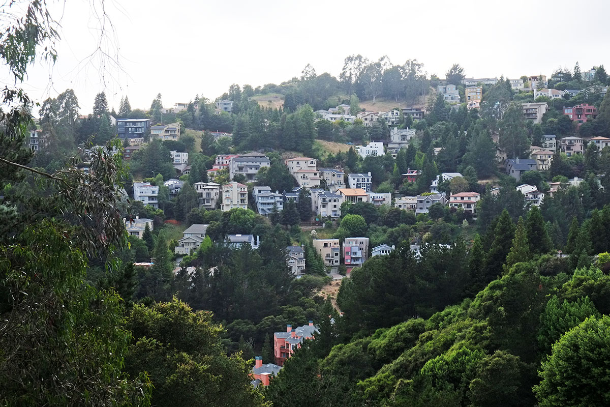
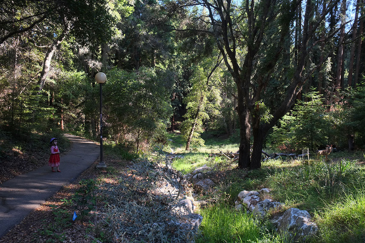
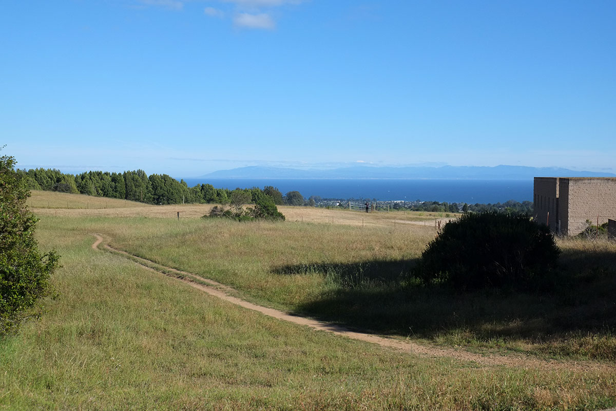
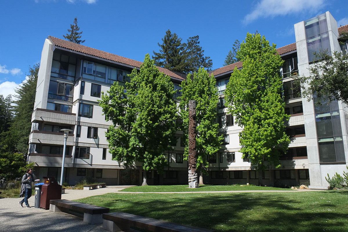
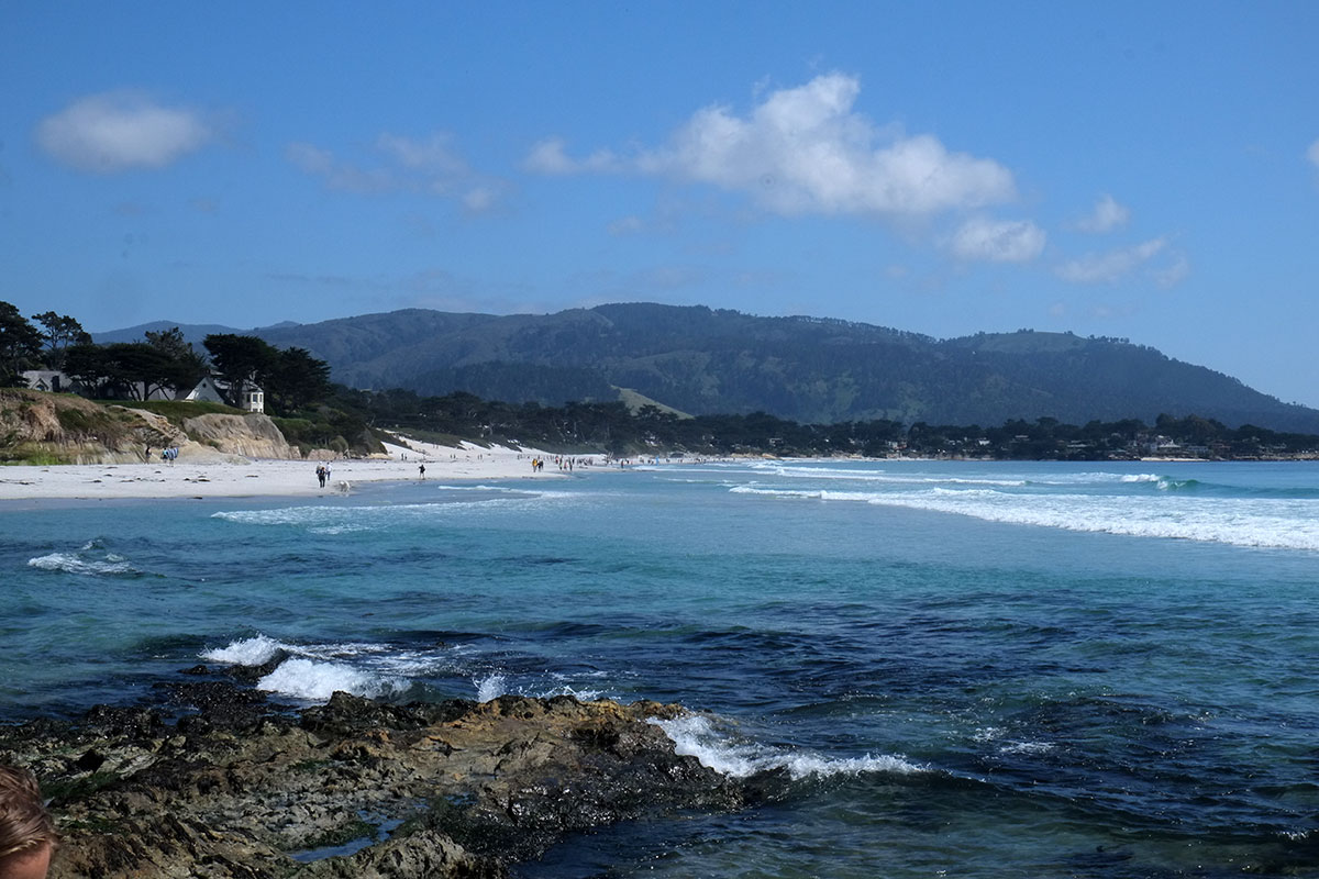
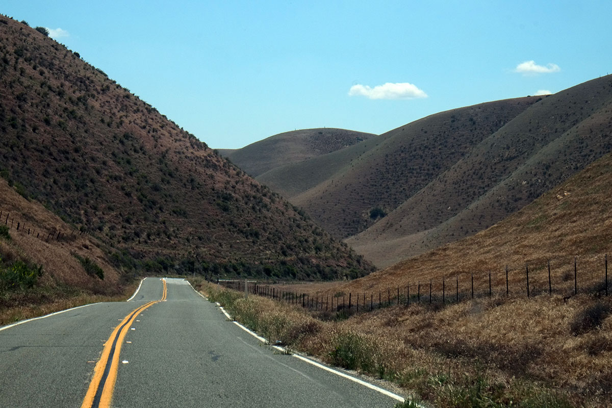
The last days of our trip were spent on the California North Coast. We’d hoped to cruise through Sacramento and up into the Sierras, but given the lingering snow in May and the impossibility of a campground in Yosemite, we were forced to once again drive up the coast – which may be our favorite landscape in the world. Before we reached the Bay Area we had covered a bit of the coast we’d never actually done before – the 40 miles or so from Santa Cruz to San Gregorio, from where we took 84 through La Honda and in to Palo Alto. This is a breathtaking stretch, with gentle river valleys coming out to the coast – which reminded us of the Olympic Peninsula – and some big headlands. It is astounding how few people there are here, right over the mountains from the Bay Area.dscf0963

dscf0968

A week later we began our final leg, crossing the Golden Gate and following Highway 1. The variety of landscapes on this section is unlike other parts of the coast. In Big Sur you are always on the side of the mountains, looking down into the ocean, and it is unrelievedly spectacular. But here the highway weaves in and out, with beautiful farmland near Pt. Reyes Station,115-north-coast002dscf1703

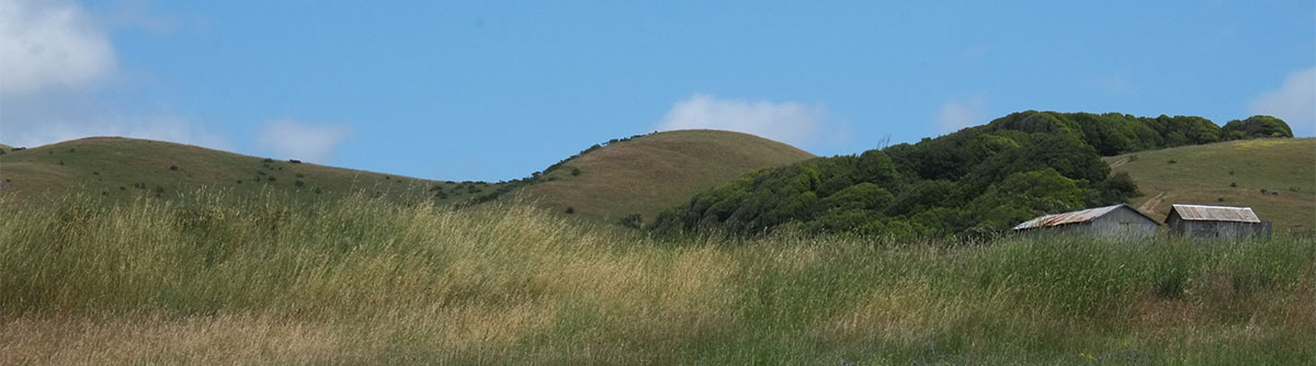
just before you run along Tomales Bay, which is essentially a fjord, with the ocean hidden just over the hills to the west.dscf1707

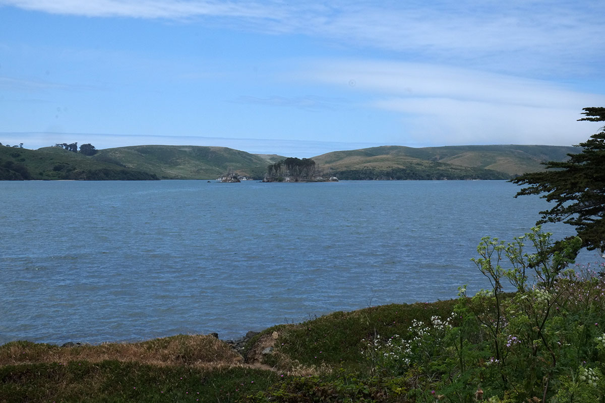
At the north end of the bay we cut inland again, driving along Keyes Creek,115-north-coast003dscf1711

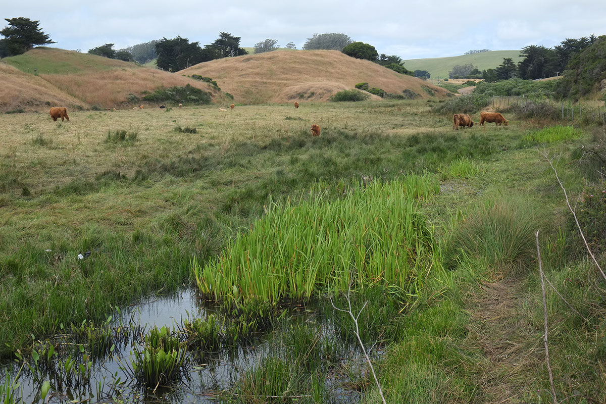
where you can see how the California Coastal Commission regulations require that even the cattle must be picturesque.dscf1714

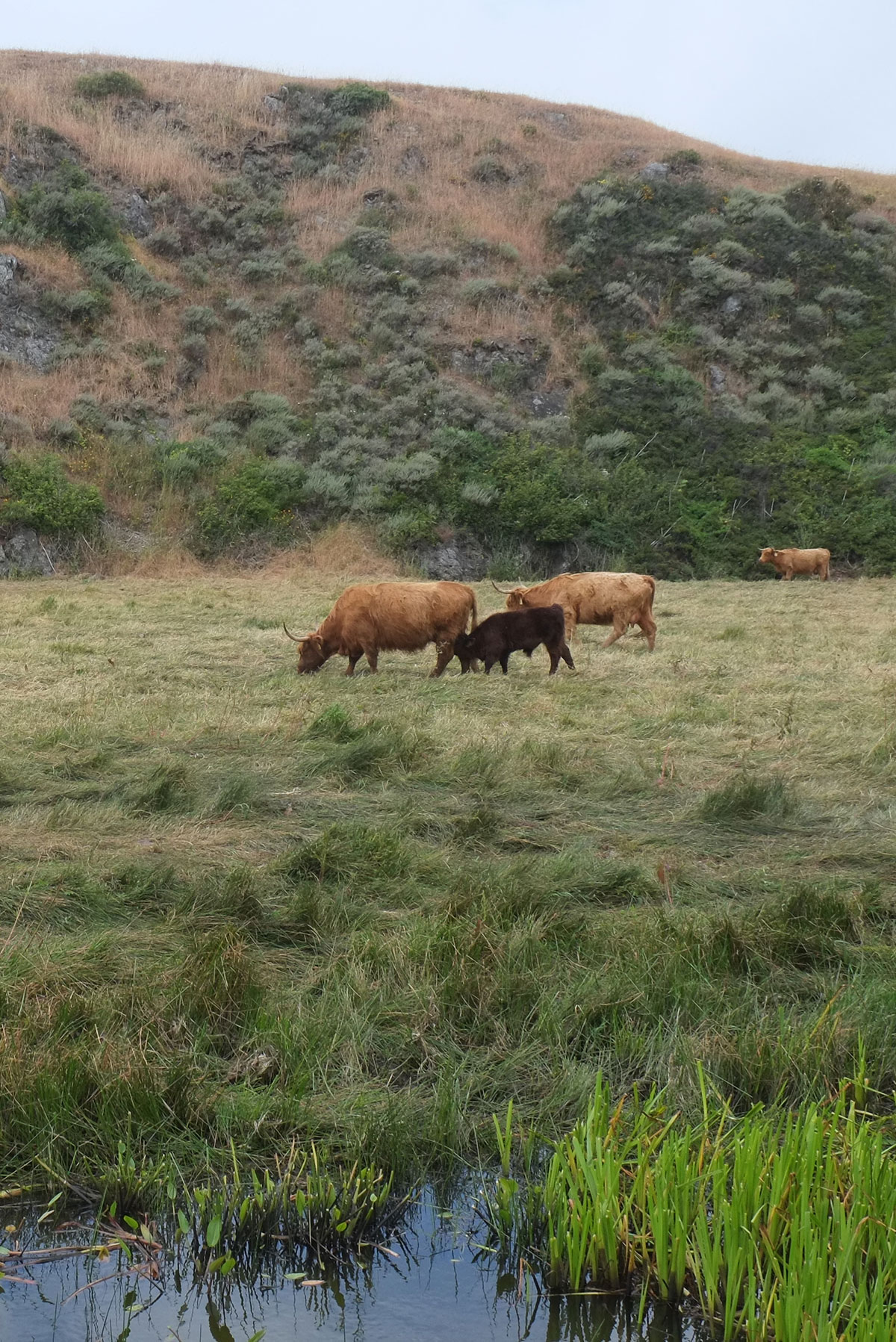
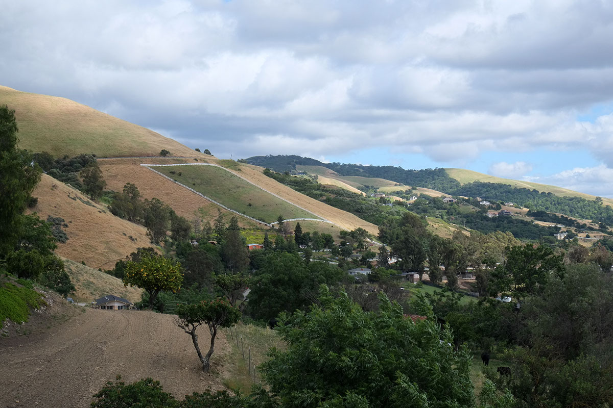
On this inland jog we entered Sonoma County, and then back to the sea, where a wider plain appears between the mountains and the ocean.dscf1716

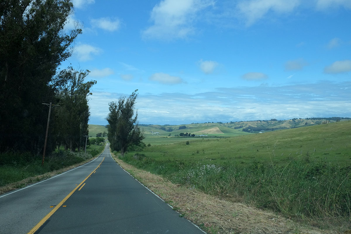
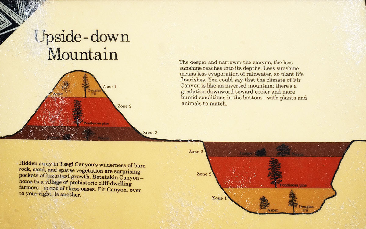
All of this variation – farmland, fjord, estuary, coastal plain, ocean – occurs within one hour of driving. We were overwhelmed with the density of beauty, how every minute there was some new and different prospect. It was similar to the experiences we had in some parts of the Southwest – Zion, Canyon de Chelly – but with more water.

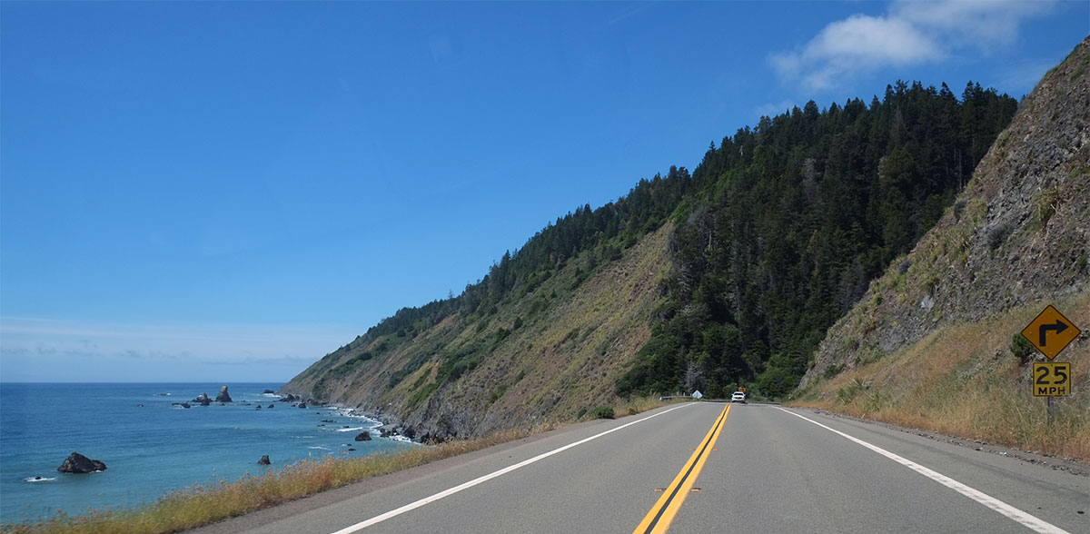
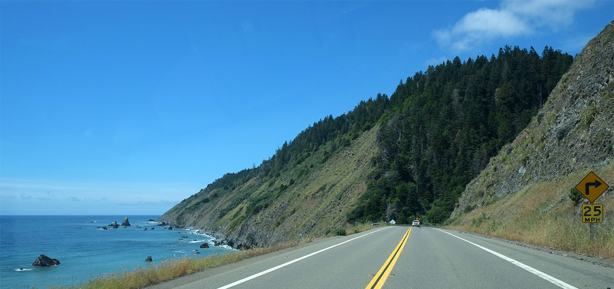
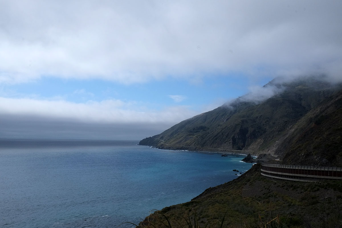
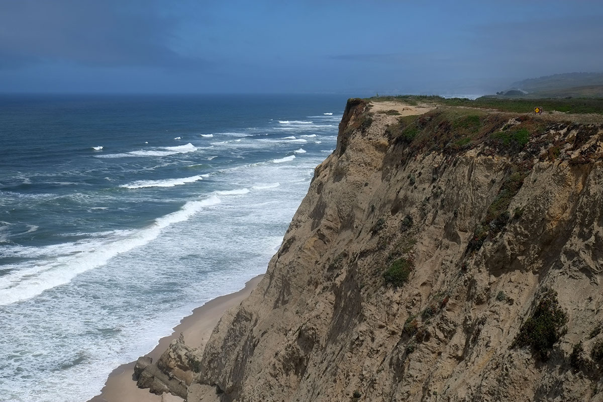
We entered the part of the drive that does more cliff-hugging, and I stopped taking photos – too many sharp switchbacks with steep elevation changes for someone driving a truck with a trailer to ever have enough warning to contemplate pulling over onto a tiny gravel shoulder – but the scenery continued to amaze us. We had driven this stretch six years ago, and we wondered why we didn’t have a stronger memory of it – perhaps that had been on an overcast day, when the stupendously elemental qualities of ocean, sun, sky and cliff were just not as vivid. The Sonoma coast was one of the most arresting landscapes we saw on this whole trip.

We drove past Sea Ranch, the famous Halprin/MLTW/etc. resort development, but didn’t stop. I’ve learned from prior trips that visiting Sea Ranch without an in or connection is a frustrating experience, as you really can’t see the buildings and views you want. Perhaps we’ll catch it on the next trip, renting a place to stay..

At the end of the day we made it to Mendocino, the 19th-century New England whaling village perched on a bluff sticking out into the ocean. It can be a little too quaint and precious (and expensive), and as Isadore once said, Mendocino seems to be the Spanish word for gift shop. But every time I’ve been here I’ve been blown away, for many reasons. There are very few places in this country that have a setting anything like this – a headland with steep cliffs on three sides,115-north-coast005dscf1754

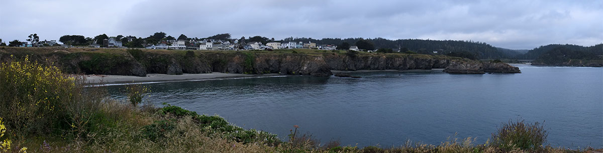
where the view down every street ends in the ocean.dscf1729

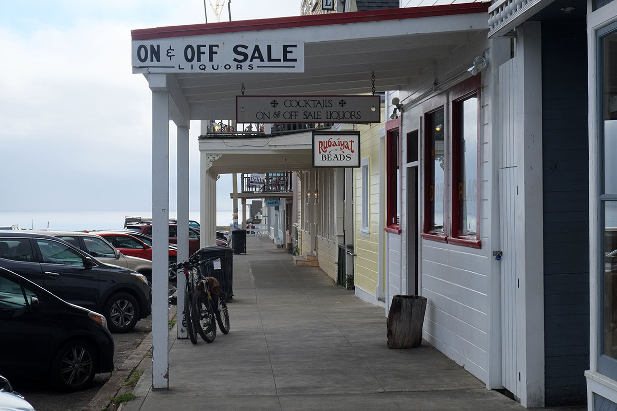
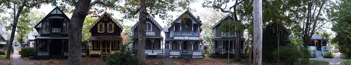
Some of the houses have been spiffed up pretty extensively, such as this one, which was used as the stand-in for Maine in the Murder She Wrote TV series,dscf1788

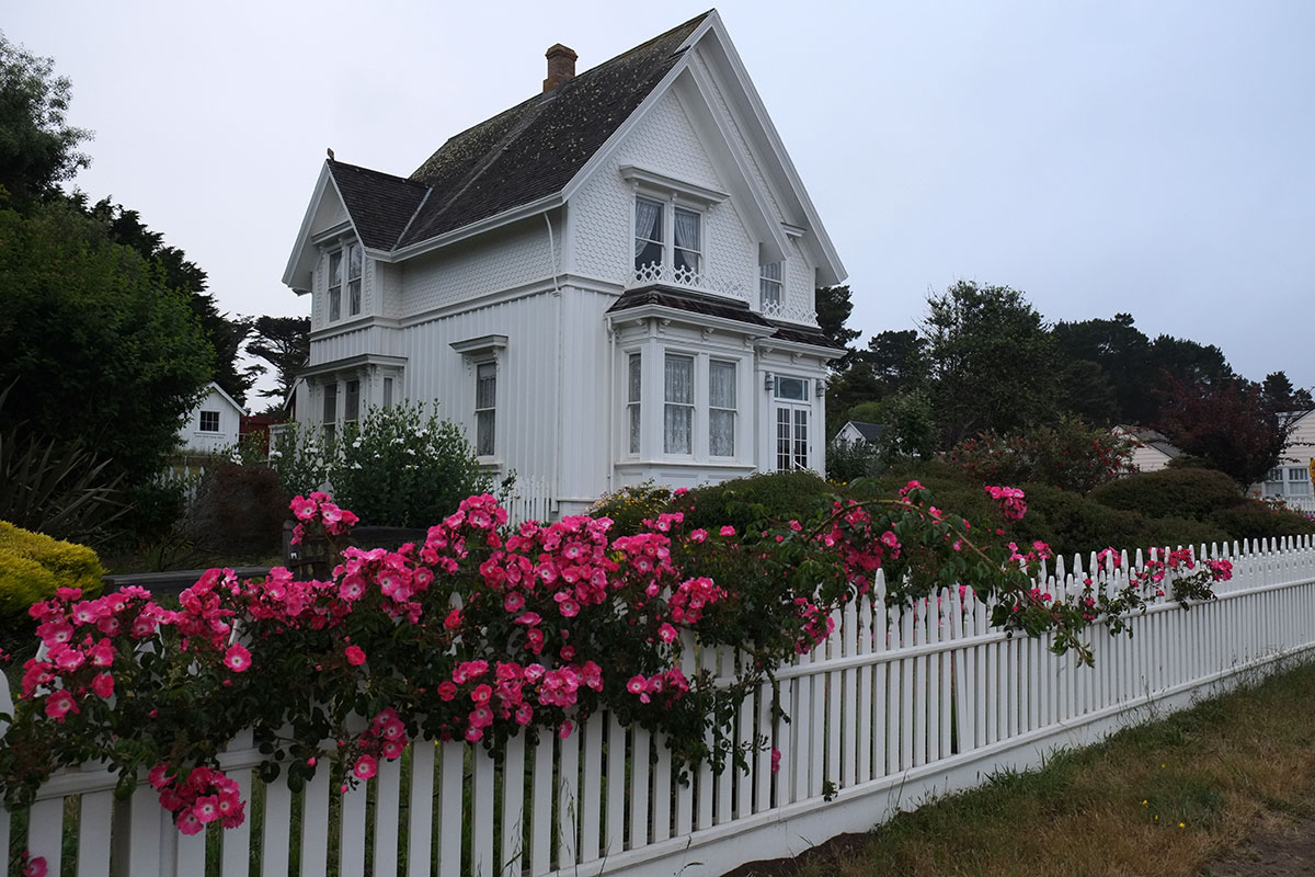
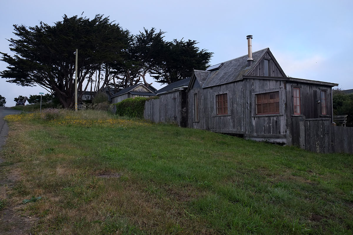
but much of the town retains its vernacular character, with old houses and water towers.dscf1721

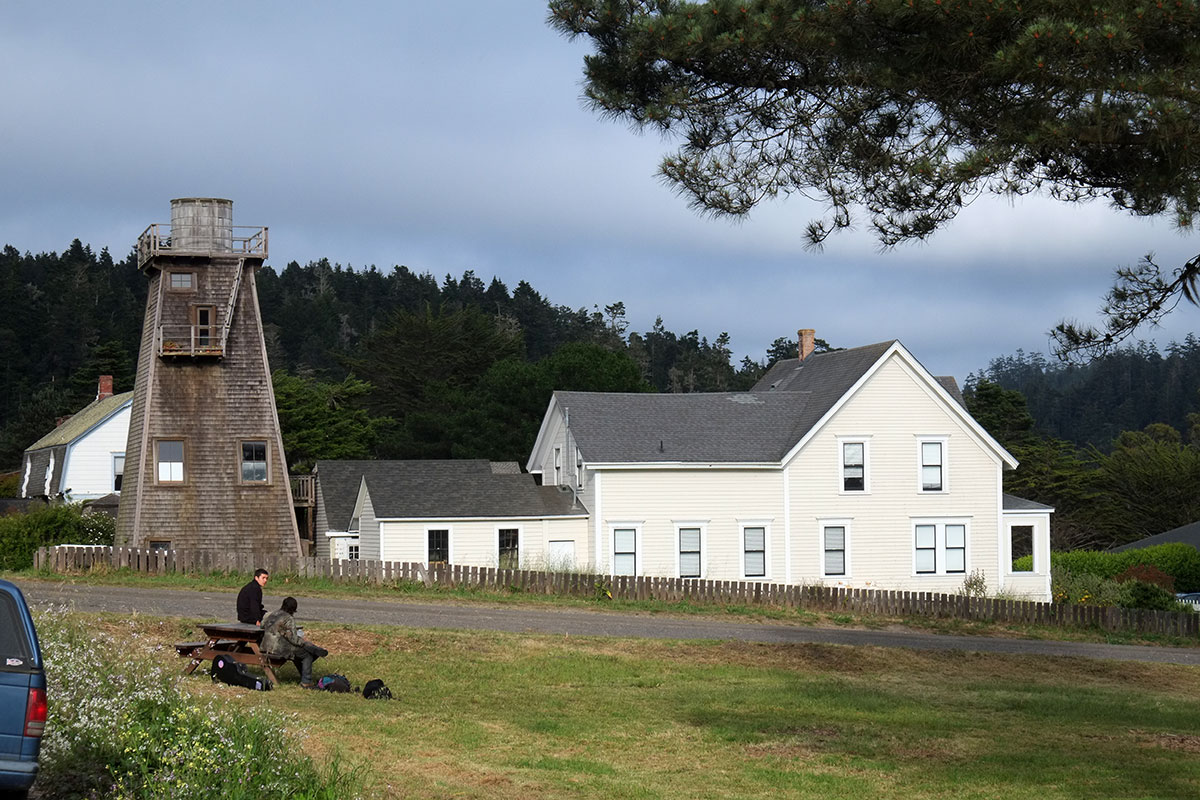
There is a range of styles, from the simple cottages to the more elaborate Queen Anne, Italianate, etc.dscf1768

dscf1761

dscf1723

dscf1772

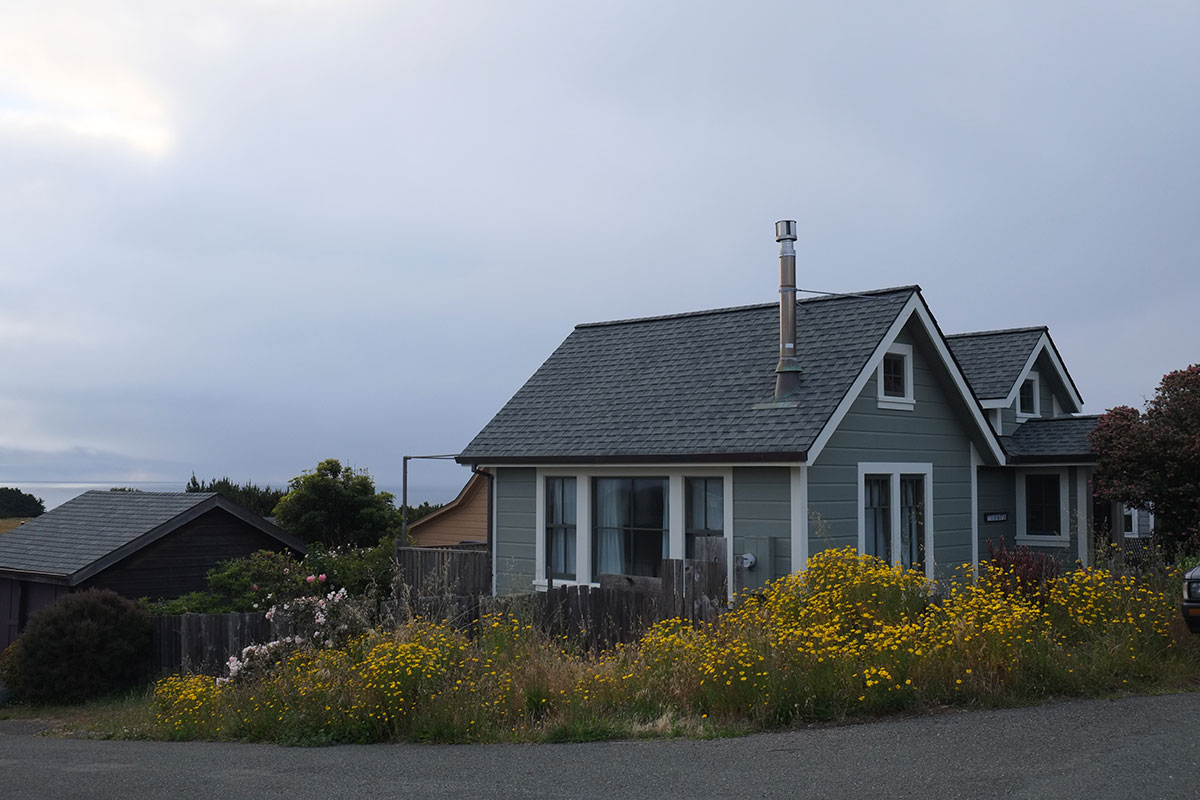
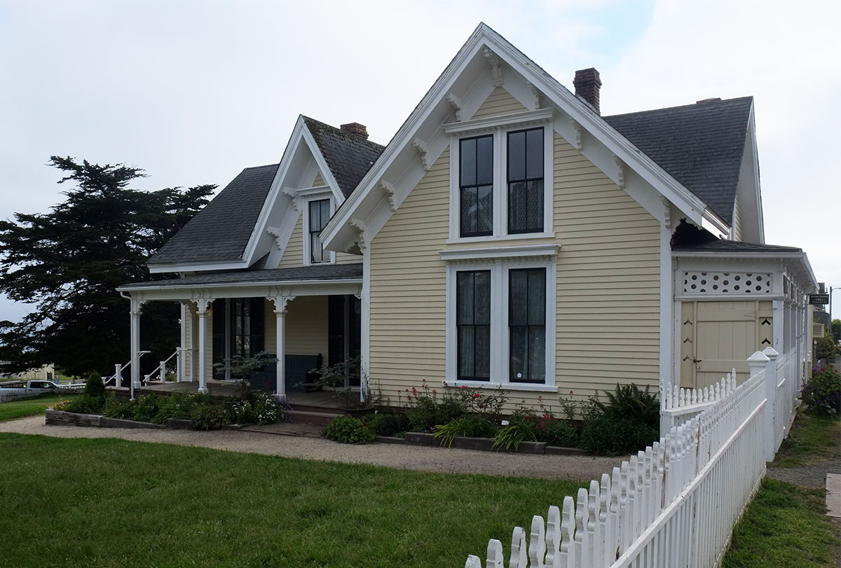
I think I spent a night sleeping in this house over 20 years ago, when it was owned by the family of one of our students. I was awakened the next morning by the sound of sea lions barking at the base of the cliff.dscf1732

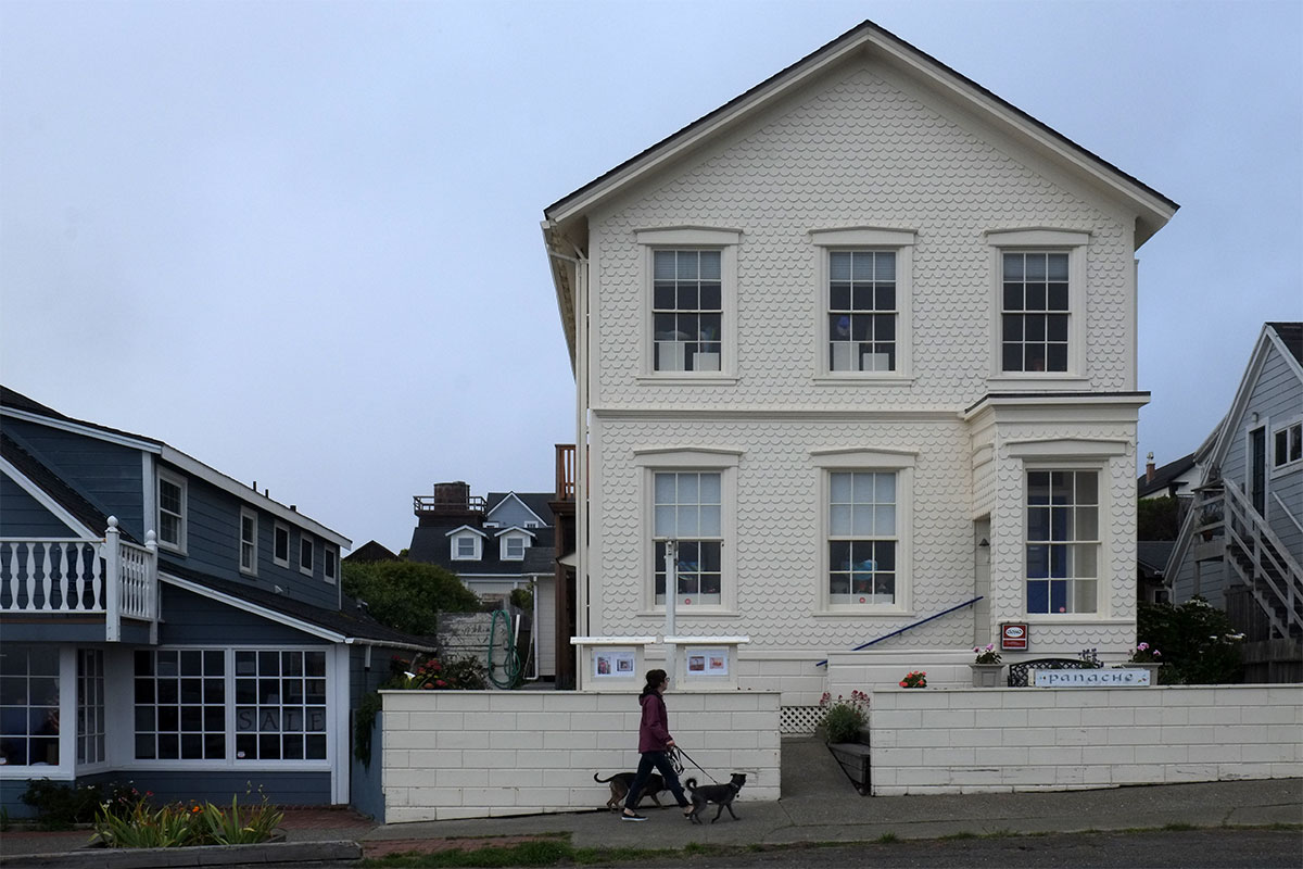
About half of the headland is preserved open space, with walks through fields of wildflowers to the ocean views.dscf1764

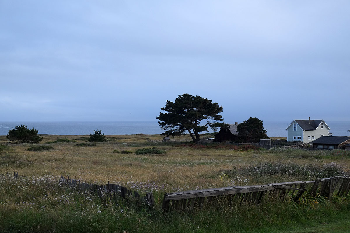
Greta and I walked out onto the bluff trail, where we saw the first weasel we had ever seen in the wild, and which was too fast to be photographed.dscf1740

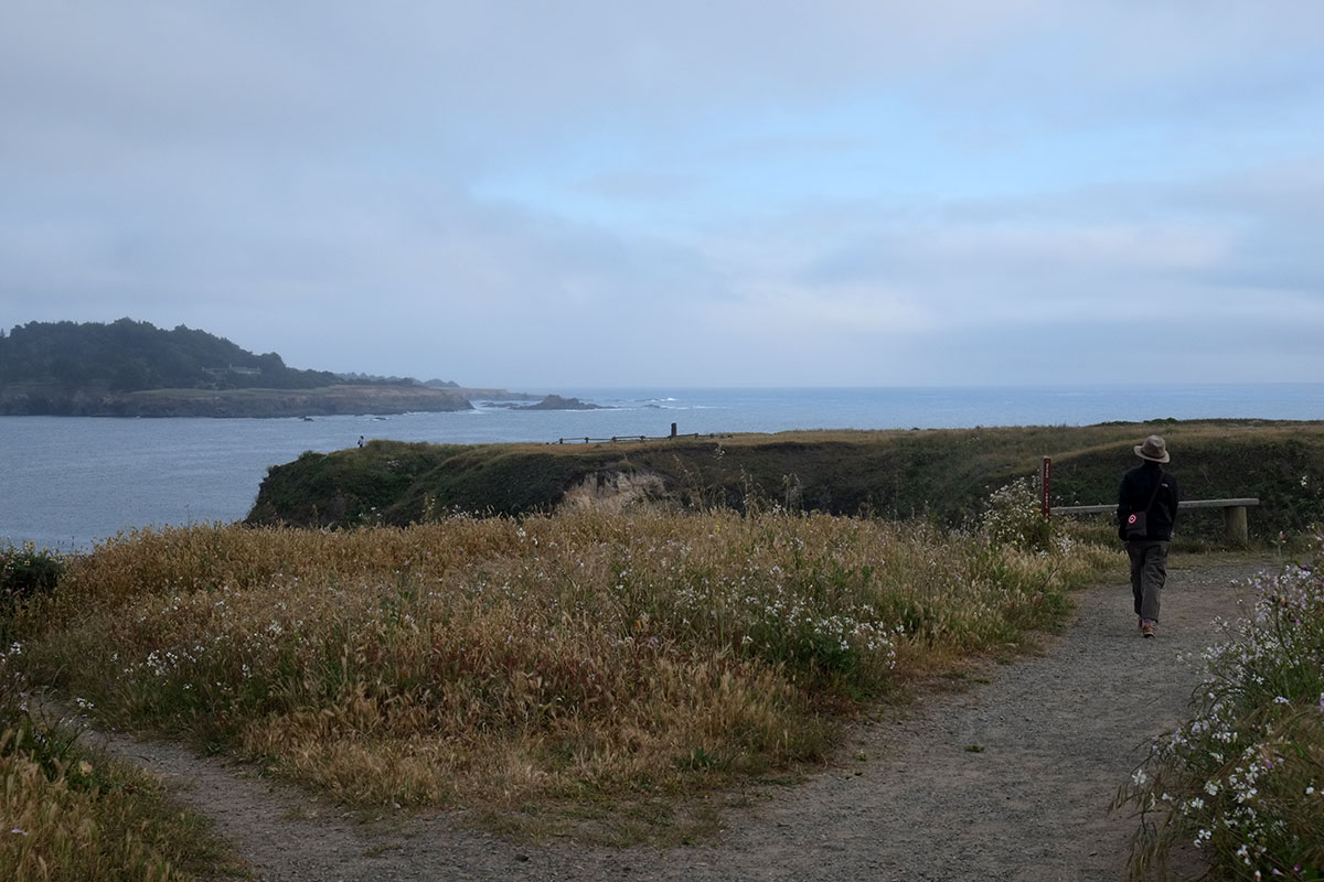
Then there is the light, which changes rapidly and dramatically, as clouds break and fog rolls in. We have been there on sunny days and rainy days, and it is notable how your impression of such a small, simple place can also change so drastically.dscf1719

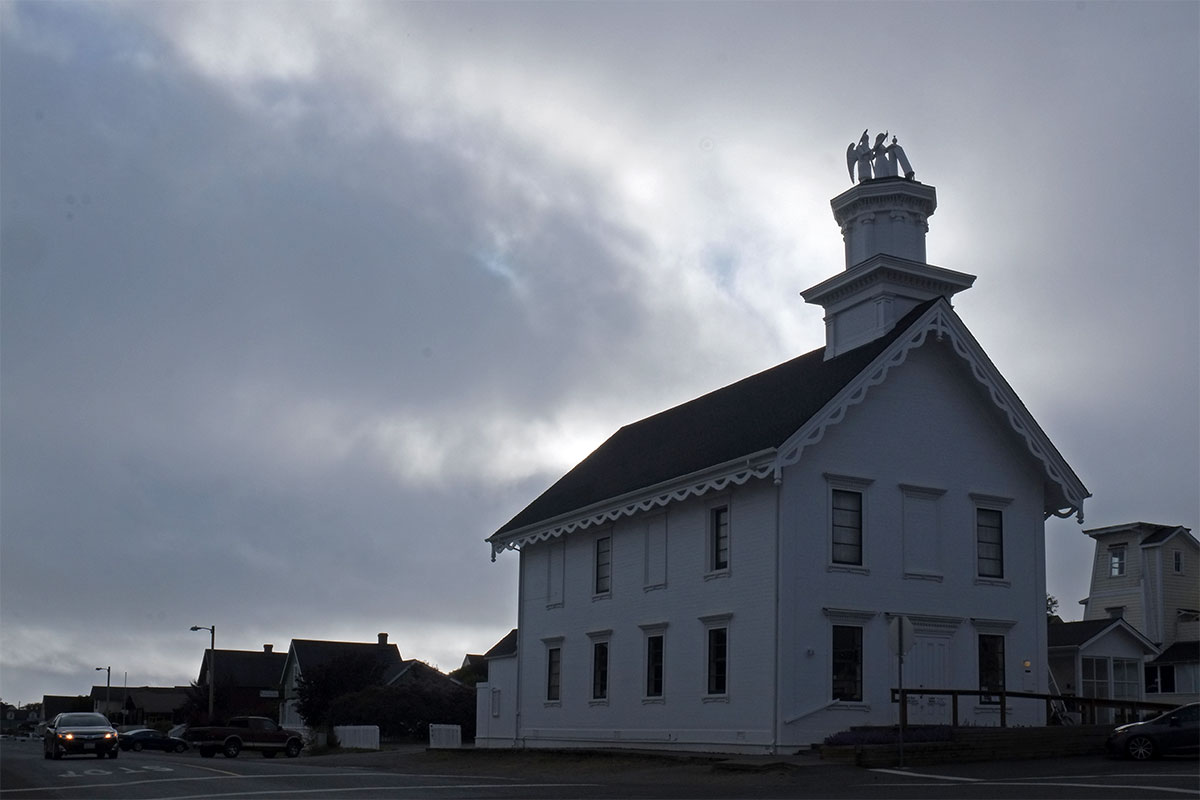
Mendocino was like many historic towns we visited on the East Coast, where it is obvious that the seeming simplicity and casual quality is maintained by unrelenting diligence and at great expense. But I can’t help being bowled over by these places, even if they represent Disneyfication by the Upper Classes. There are so few corners of this country that have not been overwhelmed by the crap of the past 60 years, that I’m completely able to suspend disbelief, and just enjoy the care and art that has gone into the creation of this environment. My appreciation for Mendocino is probably heightened by our experience in the past decade in the town of Coupeville, on Whidbey Island, which has both a historical building stock and amazing landscape that rival Mendocino’s. However, over the years Coupeville has made some astoundingly bad decisions about zoning and development, which have rendered much of the town indistinguishable from any other postwar suburb. Mendocino happens to be situated in a region that attracted a wealthy and sophisticated populace, which seems to be the solution nationwide for preserving this type of coastal town with any degree of integrity.115-north-coast006dscf1775

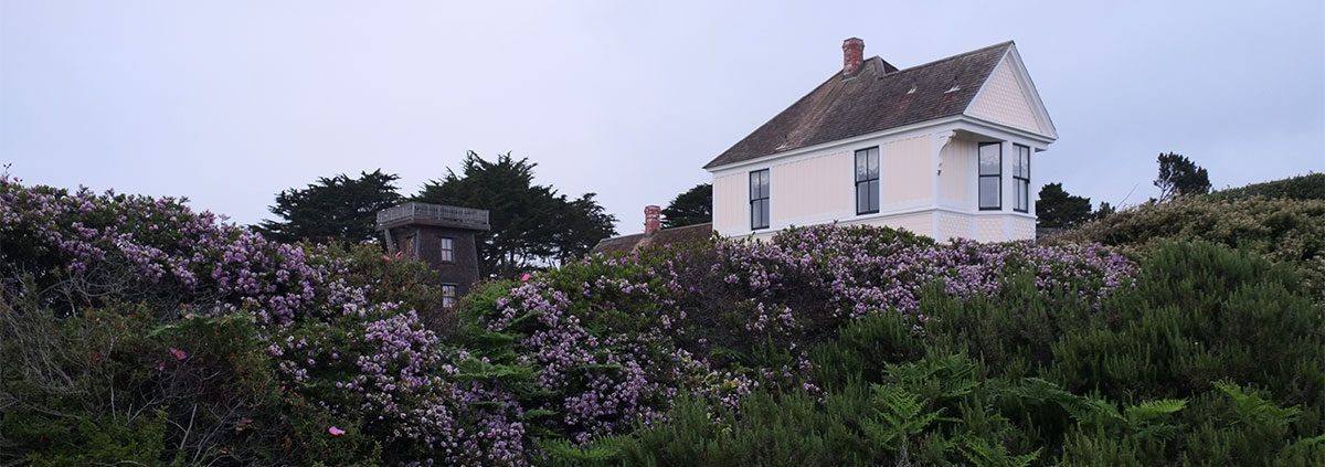
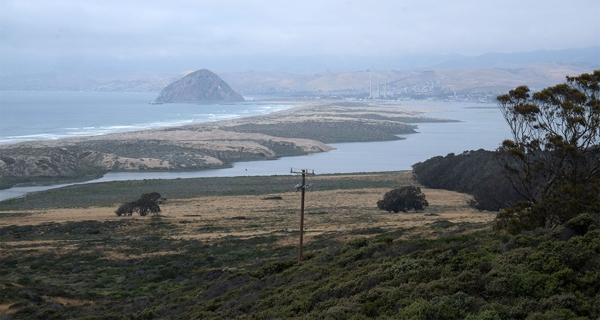
North of Mendocino we stayed in Ft. Bragg, a more normal small city which had a fishing and lumber-based economy. It could adopt the informal motto of Astoria – We Ain’t Quaint – but some of the remnants of that period are remarkable. There is the Glass Beach, which Greta has blogged about,dscf1816

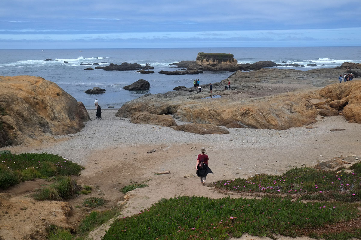
the views of the coastline,115-north-coast008dscf1817

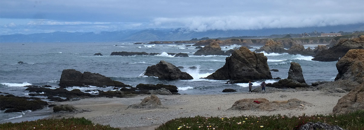
and the fabulous Pudding Creek Trestle, where a railroad spur ran right along the ocean.115-north-coast010dscf1826

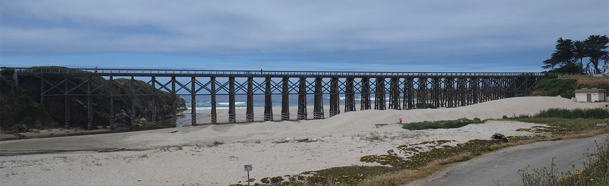
A day out from Oregon, we were feeling the loom of home, and while the landscape felt increasingly familiar, there were still signs that California is different. In the town of Inglenook we came across this allee of trees, but they were eucalyptus, not the firs or madrones which would have been normal for us.115-north-coast011dscf1831

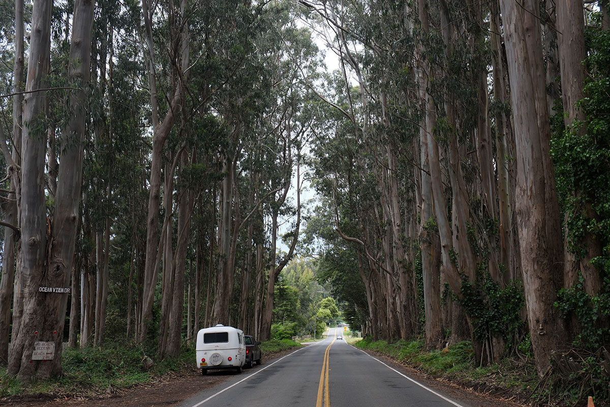
The highway continued this weaving in and out of farmland, forests, hills and coastal plain. The jogs in the road when we came to a creek were always amusing. We’d be driving along with a panoramic view of the ocean, then there would be a sharp right turn,dscf1834

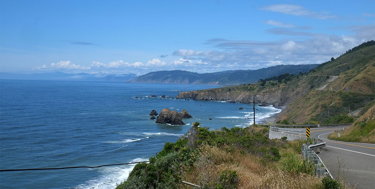
and we’d be heading up the creek into the hills.dscf1835

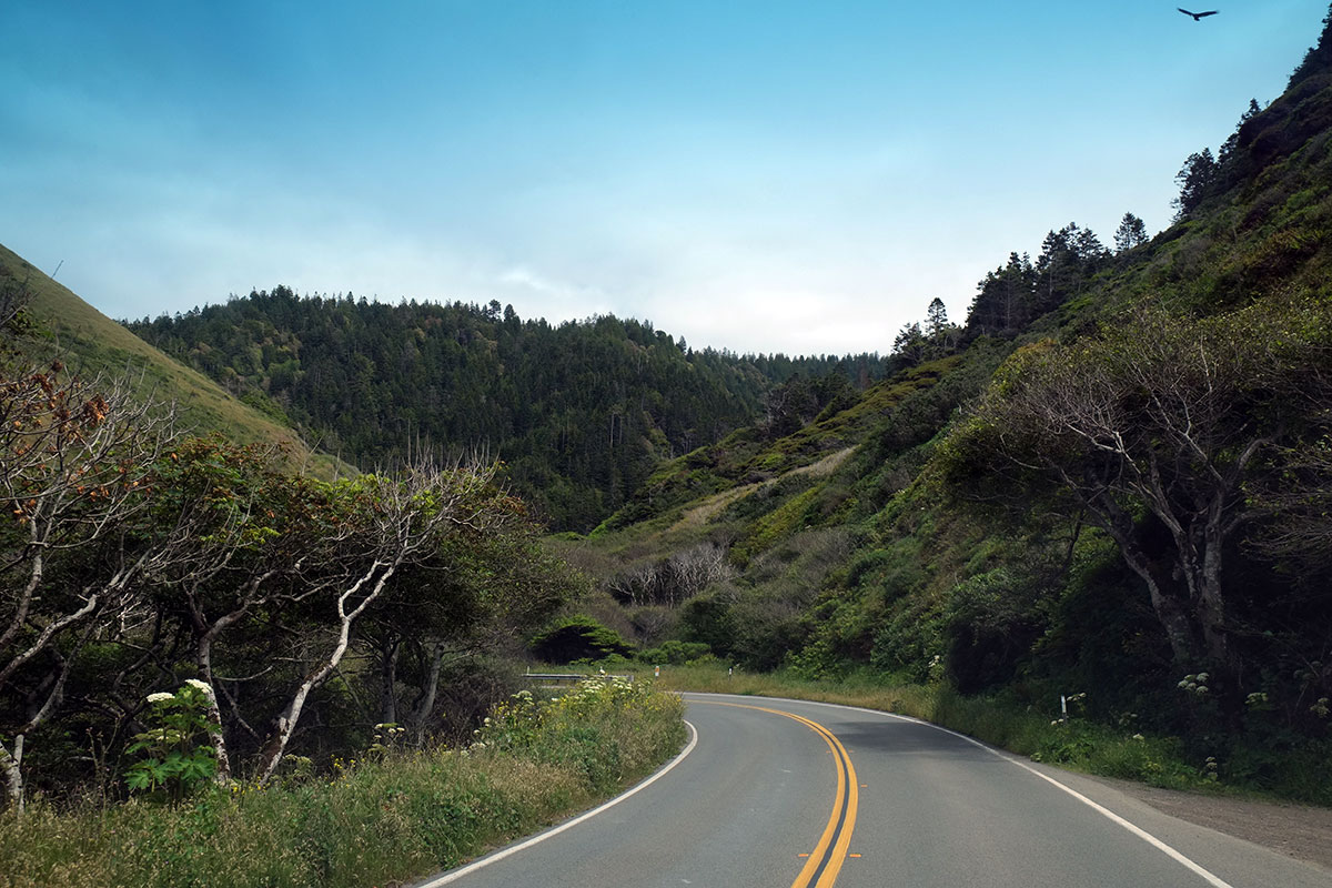
A hairpin turn at the head of the creek, and we’d head back out to the ocean view. This shift in perspective repeated often, and each cycle took just a minute or two.dscf1836

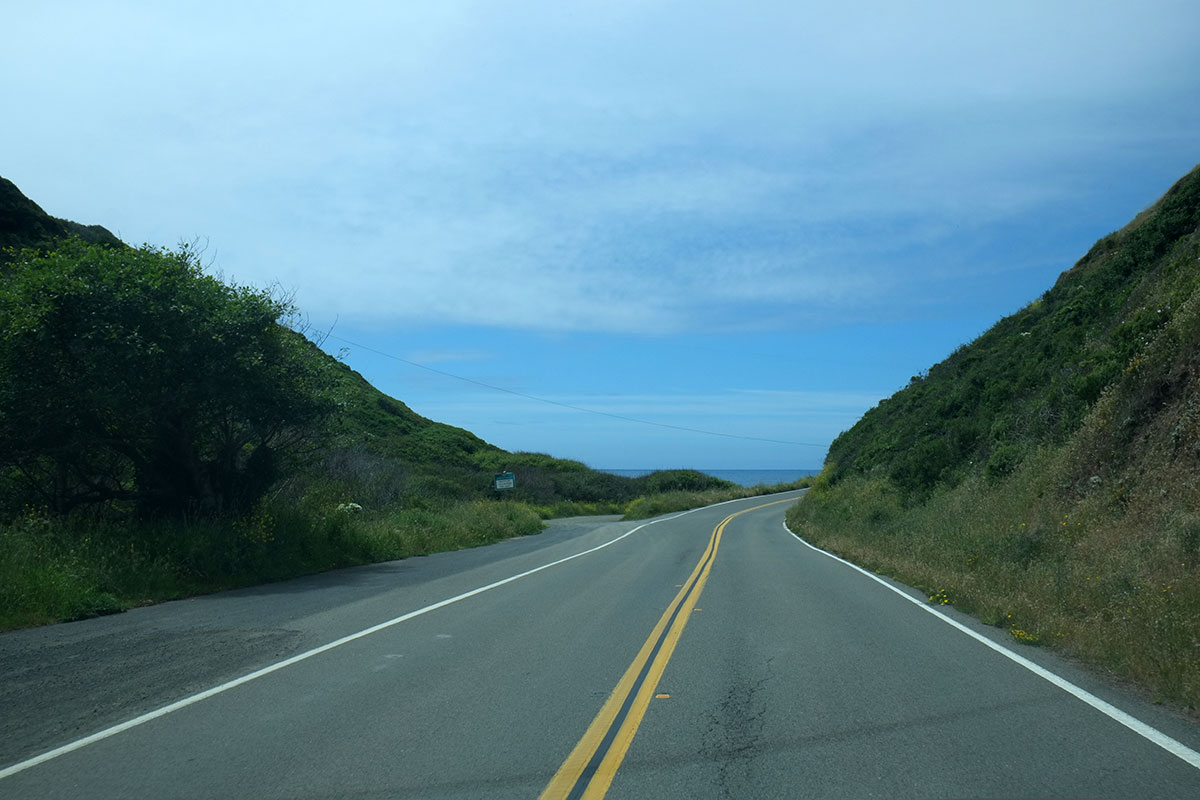
Finally, Highway 1 leaves the Pacific for good at Hardy. The Lost Coast, 100 miles of fairly inaccessible coastline, lay between us and Eureka. We followed the last 15 miles of Highway 1, which after many trips I’m convinced is the twistiest highway in the country. The trees closed in around us, and our weeks in the sunny Promised Land of California came to an end.dscf1837

The East Bay

On most trips to northern California we spend our urban-wandering time in San Francisco itself, which always offers a combination of seeing cool new things and visiting old favorite neighborhoods and places. But in the last weeks of our trip, we realized that we had no real ambition to tackle the big city in our usual manner. As Jonathan Franzen had just written in an article in the New Yorker, about a trip to Antarctica: “As in the Magic Mountain, the early days of the expedition were long and memorable, the later ones more of an accelerating blur.”

Just as we did in a few other places on this trip (such as New York), we shortchanged familiar places to which we could return fairly easily, and focussed on less accessible places to which we’d probably not return for a while. So we spent a few days in the city for specific reasons – seeing friends and a couple of museums, but no wandering up Russian Hill or cable car rides. But as we planned our last days before returning to Eugene, we decided we should stockpile a few more urban experiences. Incredibly, I realized that I probably hadn’t been to Oakland or Berkeley in 20 years, and so we headed off to the East Bay with Dan as our guide one Sunday morning.

Oakland was a shock. I remember heading to meetings at the DOE offices in downtown Oakland in the mid-80s, and all of us wondering why they had been stuck in the backwater of Oakland. In the mid-90s I spent time looking at housing and neighborhoods there, but the downtown still seemed deserted and bereft. Now, it is bustling, even on a weekend. Like many other good cities which had a late 20th century period of disinvestment and decline, there wasn’t much economic impetus to destroy the older buildings (once the mania of urban renewal had passed), and so the great old stock remains, ready for renovation and reuse in the urban revival of the 21st century.dscf1578

dscf1574

We saw evidence that at least part of this renaissance came from people and hipsters getting pushed out of San Francisco by the expense:dscf1568

I recognize my complete ignorance of the forces at play here – in a city where issues of gentrification and displacement are especially acute – and I apologize to my many friends in the area who could say more insightful things about what is going on. (One of the joys of blogging about a place like Biloxi is that no one else I know has ever been there, and so no one argues with me.) But just from the perspective of the built fabric, it was a pleasure to see a fine old city on the rebound, and a city which feels more like a normal mid-sized American city, in contrast to the sometimes precious and overly-touristed parts of San Francisco.

We moved on to Berkeley, which doesn’t seem to have physically changed much at all. I had forgotten that it too is a real city, not just a big college town, with a thriving commercial center as well as beautiful residential areas,dscf1586

and some strange remnants of bygone eras.dscf1611

dscf1617

Greta’s favorite part of the city (besides the beignets at Angeline’s) was the Daiso store, a Japanese discount store (which Dan couldn’t believe we were wasting time on) where she acquired a pile of good notebooks (at $1.50 per), and lots of excellent and cheap plastic trinkets. We have since learned that these stores also exist in Seattle, so we’re planning our next trip there.

On the edge of the campus is the new home of BAMPFA, the Berkeley Art Museum and Pacific Film Archives, a renovation/addition to the 1930s printing plant, by Diller Scofidio Renfro. It is tres hip, but after seeing their art building at Stamford, we were fatigued with swoopy, gestural, probably dysfunctional buildings, so we skipped it.dscf1591

We wandered around the campus for a while, which I found less engaging than I had in the past. Probably because it was overcast and a Sunday, it all seemed rather drab and dead. In some ways the buildings reminded us of UT Austin – there was less uniformity in building style, but not much change in scale or materials – at some point they must have mandated that all new buildings should be of light masonry or concrete.dscf1595

The campus planning was too much to comprehend in a short visit – the original plans, by Olmsted and John Galen Howard, were later compromised by the typical slew of terrible 60s buildings, but recent campus planning has been sensitively done. But I was dragging a tired kid around, and I sensed she was nearing her limit on architecture for the year.  dscf1597

We had a true Berkeley moment in the student union, where a Filipino student association event was going on. The bathrooms around the corner had these temporary signs posted, which confused the hell out of everyone who read them. People hesitated, then picked a door, in a post-heteronormative version of The Lady or the Tiger. Men who walked into one room mainly full of women immediately backed out and went into the next room. Women who walked into a room to find men standing at urinals exited quickly, and many of them were so nonplussed that they gave up on going to the bathroom altogether.dscf1600

We went by Maybeck’s great Christian Science Church, but didn’t time it right to go inside.114-east-bay-002dscf1621

dscf1637

However, we made it into Julia Morgan’s Berkeley Women’s City Club, a not very big building which still manages to be grand.dscf1653

114-east-bay-003dscf1644

We took advantage of having Dan as our guide, and drove up the winding streets into the hills, seeing both intimate lanes and panoramic views.114-east-bay-004dscf1664

We wound past the fabulous Claremont Hotel,114-east-bay-005dscf1678

and drove through the area rebuilt after the 1991 firestorm, which destroyed almost 3000 houses and killed 25 people. It has not been rebuilt with any great architectural style, and beyond the human suffering, it’s sad that everything is now so uniform.dscf1687

On a different day we had driven with Dan to one of his favorite places, the Lick Observatory on top of Mt. Hamilton, built in the 1880s east of San Jose. There are a few giant telescopes here from different eras,113-san-jose003dscf1390

and we were able to see the original refracting telescope, the largest in the world when it was erected.113-san-jose002dscf1381

The drive itself was spectacular, with a narrow road crossing many ridges and ascending on switchbacks.113-san-jose004dscf1410

This knocking around in East Bay focussed us on the character of the region, rather than just on San Francisco. The interface between suburbia and open space in the Bay Area has always seemed extraordinary to me. You can be in a quite dense city or suburb, and within minutes you’re out in the landscape; this applies equally on the Peninsula, East Bay, and Marin County. I remember looking down on the region flying out one night – a huge, dark empty space in the middle (the Bay), surrounded on all sides by brightly lit cities, which abruptly come to end, surrounded by another dark zone (the hills and mountains).img_6321

The physical geography is interesting enough, but when you add in that there are four really different, big cities on the Bay, plus many diverse smaller ones, you realize that there isn’t another metropolitan area remotely like it anywhere else in the country; there’s a density of different and interesting places here that is unmatched.

Most American cities and regions feel finite to me – with a little time, you can pretty much get to see all there is. While there are many metro regions which are so big that you probably will never literally get to see all of them, you just don’t want to – they’re big, but there’s not much variety (Phoenix, Atlanta, Houston, etc.) Then there are the smaller, interesting places that are comprehensible (Portland, Pittsburgh, Albuquerque, etc.). New York always felt infinite to me – I knew that no matter how long I lived there, I could never truly say that I knew all of it. The Bay Area is another one of those. The diversity of the landscape, the cities, the people, the food – it’s complex and beautiful, and it’s obvious why everyone wants to live here, despite its obvious shortcomings of insane traffic and high cost. Samuel Johnson’s quote about London applies to the Bay Area too.

The Stanford campus

IMG_3176

The Stanford campus is an outlier, seen by many to more resemble an Ivy League university than one on the West Coast. Part of it is institutional – Stanford is one of the few big, rich, elite, private, research universities that is not in the east, and part of it is the design – with a campus design by FL Olmsted, and the original quadrangle and buildings by Shepley, Rutan and Coolidge (the permutation in which their name existed then), the successor firm to HH Richardson’s practice.

Olmsted’s plan is truly wonderful – a clear hierarchical system of axes, malls, quads, and open spaces, which organizes the placement of buildings. It is a very big and spread-out campus, and the effect of the initial vision as the university grew from a relatively small core out to its current extent is evident. Although there are places where this system was not rigorously followed in the postwar boom era, and places where the preponderance of cars undermines the character of the campus, it is easy to imagine how much worse the campus would be if there had not been this underlying order, and instead the campus plan was typical of postwar, car-oriented, curving, formless planning (cf. Solomon’s analysis of Magic Marker bubbles).

Despite this brilliant planning, in prior visits I’ve always found the Stanford campus to be a pretty uninteresting place. I couldn’t understand why it didn’t impress me more (Olmsted! Shepley Bullfinch Romanesque!), and now I think I’ve arrived at an answer – almost all of the buildings on campus are deeply mediocre. The campus plan put them in the right places, and they form these fairly consistent building walls which enclose the open spaces, but the buildings themselves vary from banal to embarrassing. It’s hard to understand how they acquired such consistently bad buildings, given the obvious amounts of money and effort put into each.

There is an underlying similarity to the mediocrity, which certainly came from building development standards, which limited building height, and specified common vocabulary elements and strategies which had to be used, such as symmetry, hipped tile roofs, and punched windows in masonry walls (or solid walls which appeared to be masonry), that derived from the original core complex of the campus. But then each new building manages to be bad in its own, special way. There is the tame Brutalist building, which valiantly tries to hide its tile roof with a glazed, hipped porch at the perimeter.DSCF1068

There is the one by Bob Stern that plays the game of the smooth skin emerging from the rusticated base (which mimics the original buildings); but it makes too big a deal out of the arched entry, and tacks on an unnecessary apse on the end, looking a lot like a bank building along a highway in Tampa.DSCF1070

There is the modernist cliché pastiche building, by Pei’s office, where they have given up on making a coherent design, and have opted for a series of aedicular elements, breaking the façade into distinctly articulated pieces resembling a streetscape (but tied together by a feeble cornice element). Each piece is ill-proportioned, boring, flat and static, but then they attempt to punctuate the whole by inserting an overblown glass shard staircase, which appears to never be used.DSCF1075

There is the hyper structurally-expressive Brutalist example, with its massive concrete frames superintending a hierarchy of secondary elements and curtain wall sections bounded by bays, a massive heavy building floating above a dematerialized base, in imitation of a Japanese temple on steroids (if Japanese temples had parking garages beneath them).DSCF1080

At the end of the axis is a fairly restrained building, a rather flat evocation of a precast Renaissance palazzo, but with a badly-proportioned and under-detailed central archway that looks like a remodel carried out under the auspices of il Duce.DSCF1082

I thought this was the best of the lot – a strong, taut skin with a thoughtful rhythm of big punched openings, with the vestigial roof form articulated in steel and floating above the mass. (Note that this façade faces onto a depressed service road.)DSCF1081

But when you come around to the front side facing the pedestrian axis, they couldn’t restrain themselves, and just crapped it up with a clip-on arcade topped by a pergola, with the now-visible tiled roof looking silly floating above, vainly trying to disguise the daylighting monitors poking up behind.   It reminded me of a five-year-old who doesn’t know when to finish a drawing and keeps adding more and more until it is ruined.DSCF1087

It gets even worse with the addition of a squat octagonal pavilion (I bet they were thinking of the Florentine baptistery), tenuously connected to the rest of the building, with flat arches on the verandahs at the top, trying to make them look “special”.DSCF1076

The clip-on arcade is a just-the facts space, that looks like no one ever got around to designing it. It reminded me of similarly-scaled corridors in high-end shopping malls, and I expected a Nordstrom at the end of the axis.DSCF1085

Compare it to the arcade from the original complex, in which all the four surfaces have a simple yet contrasting character – the smooth floor, the rusticated wall, the dark beamed ceiling, and the arcade with its degree of texture varying from rusticated arches of smooth columns, all of this held together by the pattern of light and shadow.DSCF1092

The new arcade has none of this richness, and a closer look at the materials and detailing highlights their lame reference to the original. They did notice that the original had wooden beams holding up the ceiling, so they imitate this with a dark, linear metal snap-in ceiling. Rather than closely spaced joists which give a rhythm to the space, there is a very wide and shallow (probably fake) beam cover made of the same metal, occurring only at the columns, never establishing any kind of rhythm. The arcade wall itself is dreadful, with the arches jammed up against the ceiling, so that the top of the already-flat arch is just lopped off. It is obvious that the stonework is less than an inch thick, and the overly-elaborate joints articulation shows that it was considered only in elevation, as a two-dimensional surface pattern, rather than with any consideration of it as a three-dimensional, sculptural element, as seen in the original. I was taught that when you’re designing an arch (yes, they used to teach those things back in the 80s), always look at the proportions of the spandrels (the wall spaces between the arches), not just at the arches – advice which might have helped here.DSCF1086


When I looked at this central mall as a whole, it reminded me of Washington DC, another place where brilliant site planning is undermined by mediocre buildings designed to comply with an overly rigid and simplistic set of guidelines and standards. When the demands of the program probably require building out to the maximum volume allowed by the standards, you end up with buildings that are almost identical in height and footprint, and the architects must jump through hoops to differentiate their work within this restrictive shape and limited vocabulary. I think that in any large ensemble there should be a balance between the common order and the individuality of pieces, but at Stanford the parameters have killed any meaningful differentiation among the parts.

Away from the center of campus, things apparently can loosen up a bit, and there are some okay buildings. I really like the stark geometry of this building by Antoine Predock, which does treat the arches and punched openings as elemental slices through a seemingly thick wall. There is a strong, asymmetrical balance to the whole, with some pieces (such as the side elevation of the “arcade”) creating a local rhythm. It reminded me of how when classical architecture gets too fussy, eventually someone such as Ledoux comes along and reasserts the underlying geometric basis of the system. And the playing with the expression of the vault is very subtle, showing a complexity of spatial imagination that is just not apparent in the other buildings.IMG_3246

Some of the more recent buildings seem to acknowledge the new role Stanford plays in our culture, as the incubator for the tech geniuses who will move a few miles down the peninsula after graduation and join the Silicon Valley elite. This building by Forster and Partners looks like it might have been a rejected design option for the new Apple headquarters, so they just put it here to get the students acclimated to their anticipated milieu.IMG_3252

I’ve spoken with some people who are shocked by my opinion of the Stanford campus, as they see it as such a beautiful place, but after some discussion, they sometimes concede that the quality of the later buildings doesn’t match that of the original complex. I’d like to now compound my heresy by saying that I don’t think the original buildings are all that good either.   The places where the building forms reinforce the big axial moves of the campus plan are superb, creating dramatic vistas and long perspectives that emphasize the immensity and simplicity of the vision. The big arch framing this view is powerful, and the two pavilions enclosing the space while framing the further view are perfectly scaled and proportioned. It is scenography, done very well.IMG_3180

The gate pavilions on the cross axis assert their identity as objects beyond their functions of framing views. (Although the palm trees do give it a bit of a cheesy Hollywood studio / Mar-a-Lago ambience.)DSCF1089

But the main court itself is a bore. Walking in the arcade is extremely pleasing, yet viewed from the court, the arcade is just too relentless, an unvarying wall enclosing a very big space which has some random planting beds scattered around to relieve the monotony. Even where special events occur, such as the big church on axis, the arcade is barely inflected to acknowledge them, and the essential flatness of the enclosure wall continues. The space is really overscaled, and the architecture is too minimal and uniform to stand up to it.DSCF1095

Even the individual elements in the system do not help. This may be mainly my irrational taste, but after decades of considering these buildings, I’ve concluded that this is about the ugliest color of stone I’ve ever seen, a sort of sick-dog mustardy khaki. After months in the Southwest, where the variety of stone textures and colors was an endless source of surprise and delight, I can’t understand how you could find such an ugly stone, and then use so much of it.IMG_3185

The rustication is also overdone and boring. It looks like many bad 19th-century armories and other military facilities, which wanted to project that sense of martial strength. It gives a three-dimensionality of about one inch in depth to the material, which stands in contrast to the overwhelming flatness, planarity and lack of three-dimensional spatial exploration at the larger scale.

The comparison to Richardson to inevitable, and I can’t help wondering what this might have been like if he hadn’t died so young. These were clearly his followers, and they had learned the elements of the Richardsonian Romanesque, but they were only able to apply that vocabulary in a rote and perfunctory manner. There is one uniform system of parts and vocabulary, but that limited vocabulary is not being used to say anything very interesting. Compare this arcade corner, with its weak rounding-off and embarrassingly conventionally stylized decorative panel of wreaths and cartouche signs,IMG_3170

with Richardson’s mind-boggling stair at the New York State Capitol. The light and shadow are astounding, but more relevant here is the sense of three-dimensional play, the plasticity of the stone work, the recognition of stone as a material to be understood and shaped almost sculpturally, rather than a material that happens to be used to build an automatic and endlessly extruded space-enclosing system.24b. Richardson05636. Richardson14337. Richardson023DSCF2329

The argument might be that the arcade exists mainly as a system to enclose that court, and it should be a simpler, background element, as befits its role as just a wall. But look at the jail at the Allegheny County Courthouse, which has a literal wall running around it, and where Richardson somehow was able to play the continuity of the wall off the legibility of the individual pieces that interact with it.

The basic problem is that Shepley et al were not Richardson, which is not really their fault. (Were they the employees who were responsible for contact documents and administration? This may be one of the first cases where an architecture firm had enough institutional solidity to continue on as an enterprise, after its founding genius has died.)

Strangely, there is a big difference between their take on this Richardsonian approach, and what all the other Richardson imitators did. I once thought of writing a book called Not by Richardson, which was to be a catalogue of all the Romanesque buildings around the country which the locals always tell you are by Richardson, but aren’t. What most of those faux-Richardson buildings have in common is that they’re overly exuberant, with too many colors, textures, forms and details all jammed together, without the incredible restraint and balance that Richardson had. But at Stanford, we see the opposite – the elements of the Richardsonian vocabulary, used in a timid and limited manner. It’s robotic Richardson, with a primitive algorithm.

By far the best part of it are the smaller-scale elements. The pattern of simple openings making a sort of stone screen wall is beautiful. It’s a detail Richardson used often, and it is used here very well.DSCF1093

Or where the arcade becomes a pergola between two courts, and the landscape can be glimpsed though the arches. It reminds me of the little enclosed court at the rear of Trinity Church.IMG_3202

Or the narrow courts and passages formed by the elements of this system. They seem in scale with this intimate space, whereas the same architectural elements are overwhelmed by the scale of the main court. And just as the big moves in the architecture are best when they reinforce the big moves in the landscape, so the smaller scale architectural moves are best when they work with the small moves in the landscape. The architecture is just too boring to stand on its own. If the core of the campus had a clearer, systematic hierarchy of open spaces that drove the architectural design, it might have been more satisfying than what was built, where the landscape comes in two scales (very big and pretty small), while the architecture is always just at one scale.DSCF1091

It strikes me that the seed of the mediocrity of Stanford’s buildings was planted here, in the original core of the campus. The reliance upon architectural rules and uniformity was established, along with the subservience of individual pieces to the whole, and a distrust of any individual design expression or a big vision. We’ve learned that cities work better when there is contrast and juxtaposition among many buildings of different eras and styles. It is on a campus such as Stanford’s where we can see the effect of too much control and regularity, with the excessive integration leading to repetition and boredom.

Kresge College / UC Santa Cruz

DSCF0842

How does one design a major university from scratch? The University of California system dealt with this question in the 1960s, as it expanded its number of campuses. The Santa Cruz campus is an interesting example, as it shows the influence of a few different strains of American campus design. The first American colleges were located in cities and towns, roughly following the urban European approach, but in America the campuses and towns usually grew simultaneously. In the 19th century, the model changed, partly reflecting the agrarian American distrust of the city, and benefitting from the land-grant system which provided support for state universities. The huge growth in universities after WWII reinforced this isolated campus approach, and most campuses reflected the same development pattern that was seen in suburbia – isolated buildings set in an open landscape, with much room set aside for cars. (This campus model was then adopted in the design of office, and even industrial “parks”.)  One aspect they all had in common was seeing the landscape as a fairly neutral, “natural” background for the buildings, and seldom designing the outdoor space as a bounded space; even the earlier campus planning strategies of quadrangles and malls were largely abandoned as being too formal.

The Santa Cruz campus reflects this trend – the site was a vast undeveloped area of forest and ranchland, up in the hills above Santa Cruz, but miles from the city center. The master plan reflects what was considered best practice planning then – separate clusters of development, linked by ring roads, with some accommodation for pedestrian movement among the clusters in the center. It was an overwhelmingly decentralized (or maybe multi-centralized) approach, one which responded to the anti-urban “environmentalism” of the day, and one which supposedly reflected the state government’s concerns about student revolts: student demonstrations would never be able to achieve a critical mass, as gatherings could be isolated in the different clusters by security forces. Dan Solomon has written about this development pattern (which he somewhat facetiously blames on Magic Markers) – he says that planners stopped drawing blocks and streets and just drew bubbles.

As we drove around the campus, this was indeed the feeling. We followed road signs and directions to the various clusters – it was impossible to intuitively grasp any spatial order, more like driving in the rural countryside than in a settled area. It reminded me of Columbia, Maryland, the new town built in the 1960s by the Rouse corporation, where you drive through the woods on curving roads, directed to the named residential clusters by signage, which are otherwise invisible in the woods as you pass. However, some of the pedestrian connections through the center of campus are quite amazing – you are often in a redwood forest, and ravines are bridged so that you are walking up in the tree canopy.DSCF0898

The campus does show the best side of cluster development, in its intention to preserve special natural open space by focussing higher densities in specific locations, rather than spreading density uniformly across the whole site.DSCF0899

Some of the buildings from the period are quite fine. This is the main library, designed by John Carl Warnecke and later remodeled by BOORA. A classic Brutalist institution set in the landscape, but with the simplicity and clarity that typified the best work of the era.DSCF0911

DSCF0903

109. Santa Cruz004DSCF0908

Jolie and Albert explained how as ideas on campus design have changed, recent projects have adapted. There is more of an academic center emerging, countering the initial scattering of buildings in the woods. It is also literally beginning to emerge, out of the woods and onto the meadow which has views over Santa Cruz out to Monterey Bay. This ecotone is magnificent, a spot in the landscape which captures what is unique in the spectacular California coastal landscape.DSCF0913

So I was perplexed by one of the more recent signature projects, a music complex by Antoine Predock. We had spent much of a day looking at some wonderful Predock buildings in Albuquerque, and he strikes me as one of the best regionalist modernist architects (similar to Erickson in the Northwest), able to integrate the universal imperatives of the modern movement with the peculiar qualities and demands of strong local context. The Predock buildings work beautifully in the desert, and I just couldn’t figure out how one had gotten to Santa Cruz. The open spaces were rather stark, preserving grand vistas, but not doing much for the humans huddled in the shade.DSCF0920

Rather than making a building in the landscape, Predock did one of his normal moves of making a building that is landscape, and you walk over and across and around the pieces. I glanced down into this oasis canyon. Was this his reference to Tsegi? Where were the horses?DSCF0918

Then looming ahead of us was the mesa. I know that concert halls want to be blank boxes, but I just couldn’t see how this had anything to do with this site. I think this points out the problem as the campus tries to move away from the models of the 60s – they recognize the need for a center, an actual build-up of density at the core of the campus, but they’re still stuck in the 60s paradigm of the building as object, not creating the important public spaces between buildings. This is especially surprising, as right on their own campus they have one of the best precedents around which could show them how to proceed.DSCF0921

While the Santa Cruz campus took the mid-century, decentralized-in-nature, American campus approach to a new extreme, it then also circled back to the older, English university system of residential colleges, which had been adapted in the early 20th century by some American universities, such as Harvard and Yale. The college broke down the overall scale of the large university to a smaller unit, which would have its own identity, reinforced by its own physical location. A student supposedly isn’t just an individual floating around in a huge, impersonal institution, but has an affiliation with an intermediate-sized entity, which allows them to become part of a identifiable community. Each of the residential pods at Santa Cruz becomes its own village, in this case set out in the wilderness, versus the dense urban locations of its predecessors.

Charles Moore was at the peak of his renown in 1970, having designed many brilliant buildings in California as part of MLTW, and having taught at most of the distinguished design schools in the country, including his stint as dean at Yale. The design for Kresge college works within the campus concepts of open landscape and residential colleges, but then he brought in yet another precedent from the past – treating the college as a small piece of dense urban fabric, rather than as a collection of individual buildings in the landscape. The other residential colleges, designed by other architects, do often try to establish a spatial identity to reinforce the institutional one, using a hierarchy of courtyards, irregular quadrangles and common open spaces, as well as a consistent formal vocabulary for the buildings. But overall, they do look much like other college dorm districts from the era.DSCF0834

Kresge College is totally different. From the exterior, it presents as a walled village – the buildings form an assemblage for the enclosure of the residents within. To enter, you must walk along the perimeter to one of the gates. Architecturally it also reinforces this idea of being a village or town, rather than one large building – the various forms are juxtaposed, and even collide – it intentionally avoids the uniformity that you expect when seeing one large complex deigned by a single architect, even though the vocabulary is consistent.DSCF0841

The boundaries and gates are emphasized, simply but powerfully. The wall plane is interrupted by a few large openings, through which you can glimpse the dense interior. Color plays an important role – on the exterior, there are often darker hues which allow the complex to recede into the forest. On the inside, white walls prevail, almost as in a Greek village. Though large trees have been preserved within the new townscape, it is clear that by crossing the threshold you have entered the domain of human settlement, protected from the dangers of the wild.DSCF0844

Your view is shaped by the frame of the gate and the tree, and you are presented with a forced perspective up the pedestrian street. As you proceed,DSCF0843

the view opens up, and you are greeted by an entry plaza. These two views set up the pattern for the rest of the complex – there are streets, and there are plazas – spaces through which you move bounded by linear buildings, and places where you are encouraged to gather. The architecture around the plazas is more imageable, with certain forms reading as iconic buildings, even as they maintain their role as part of the streetwall defining the plaza.DSCF0846

The architecture along the streets is more uniform, mainly rows of housing. Here again, there is a harkening back to older types – rather than the typical dorm type of rooms along corridors, there are suites and maisonette (rowhouse) units which are entered either off a porch zone, or from gallery circulation. The street becomes the hallway for the housing, and the buildings open to it, rather than being internally oriented. This also provides a pattern for the housing which is now sometimes seen in higher-density exurban housing – one side of the unit is oriented to the shared, public entry side, while the other faces out into the larger world. In this case, that larger world is the forest, which paradoxically, is quieter, darker and more private than the street side.DSCF0863

We were lucky to come across a large gathering on a Saturday afternoon, in this case, a university-wide gay pride event being held in one of the plazas. The containment within the space certainly contributed to the vitality of the festival, making it feel more intense than if it had been held in a large field somewhere else on campus. Jolie was interested to see this, as one of the current issues with the college is that the public spaces are not generally very lively (which I would guess is due to the students spending all their time indoors with the blinds drawn, surfing the internet).DSCF0859

The architecture is straightforward, yet expressive of its nature. The construction is simple and cheap – lightweight wood frame, covered with stucco, and accented with color. The repetitive, modular housing doesn’t try to be anything it isn’t (such as trying to manufacture a picturesque cuteness, or agglomerating the pieces into some grandiose statement), and the simple rhythm of the units established a sense of order along the streets.DSCF0888

At the end of the linear buildings, the section becomes the façade, and a little bit of playing with planes and colors makes a vivid elevation, where the inside- and outside-the-village vocabularies are integrated.109. Santa Cruz003DSCF0869

These regular types set the stage for the special effects, the iconic buildings where their special function is emphasized by non-typical designs. This is the view up the street, where the vista is terminated by the library. The forms are simple, the symmetry is not rigid, yet by the location, perspective, hierarchy of tumbling forms, use of color, solid and void, light and shadow, the library is established as an important, unique building, one which stands out from the background buildings. Moore has clearly been paying attention to the Rationalists such as Rossi and Krier, whose analysis of historical urban fabric emphasized this distinction between the private and the public in constituting the city. He also catches a certain moment in architectural history, where the forms of modernism are being inflected towards what became known as postmodernism. Without the self-conscious copying of historical forms, which postmodernism quickly devolved to, the lessons of history are being incorporated here, with the design of individual buildings supporting the overall urban design intent.109. Santa Cruz002DSCF0867

Inside, the building is defined by walls as relatively scale-less, abstract planes, crashing into each other to define spaces between, with relatively little structural expressiveness, but again with reference to iconic building elements, such as windows being cut into planes.DSCF0883

This building also emphasizes one of my favorite aspects of Moore’s design approach at this point. Lightweight wood frame is a remarkably flexible system. We tend to build in straight lines and repetitive dimensions with it, because that is simpler and cheaper, but we don’t have to. Here we can see Moore having fun within the parameters (not going to great lengths and expense to flout them) of the system, creating unexpected spaces and elements in an abstract spatial composition, which doesn’t mimic any historical or even conventional precedents. He is limited only by his spatial imagination, and the wood frame system gives him a wide degree of freedom.

Fifty years later, we find ourselves in a period where many architects feel the need for unrestricted and nontraditional spatial expression, but they achieve by very different means. Here is Gehry’s museum in Biloxi, which I think is achieving not dissimilar effects to Moore’s library (although on a grander scale):DSCF1285

Gehry’s building is made up of colliding brick and steel forms on the exterior, and seems to have an independently-framed interior of studs and gypsum board within that shell. This building probably cost ten times as much as Moore’s on a per square foot basis, and I’m not sure that the difference in cost is that noticeable in the final result. Many of today’s starchitects demand huge budgets to accomplish their visions (the late Zaha Hadid springs to mind), and much of that budget goes into cutting-edge technologires that let materials be twisted into forms that don’t come naturally to them. It is just very satisfying to see Charles Moore achieving his vision with some 2x6s and plywood sheathing.

Kresge College is almost fifty years old, and Jolie Kerns has the job of managing its renovation. It’s an interesting, yet daunting proposition, from many perspectives. An old woodframe building with stucco sheathing is definitely going to have issues with water and rot. The building was built under energy codes that are nothing like our current ones, and how could the envelope, including the windows, be brought up to code while maintaining any of the architectural character? College students now are pretty different form those in the 60s, much more used to more personal privacy, space and amenities, and more focussed on their online lives, rather than a collective existence in the analogue world. What are features of this college that can be preserved, and which will have to be adapted to modern life. The library also presents what might be the most difficult challenge: accessibility.DSCF0881

Here is a building whose whole premise is a series of levels and platforms and quirky little spaces. Can any of this character be preserved while making it accessible? If it can’t, it’s hard to see how in a strapped university system, spending the money to renovate it would be justifiable, or even legal. The university has hired Jeanne Gang’s office to come up with a master plan for the renovation of the college; Jolie was going off the next day to show her around the campus. I think that their approach will be a good fit; I recently saw her office’s proposal for a major remodel of the Baltimore aquarium, and it appeared to be a very good blending of new ideas and approaches (architectural, functional and environmental) with a recognition of the quality and importance of the existing buildings. I hope the same approach can work here. Kresge College is a really important and beautiful complex, and it illustrates a critical moment in our recent architectural history. It also has many lessons for our current world, as we still confront the problem of making humane places which draw from our traditions, within a largely placeless and soulless modern context.

The Promised Land

108. Carmel002DSCF0779

After two months in the desert, it was hard to believe that this scene was real.

California is the mythic landscape of America. Before we are even conscious of it as a real place, its landscapes and views and cities are implanted in our brains through movies and television. It has been such a magical place in our mass culture for so long, and through so many different versions, that it’s sometimes hard to remember it is actual.

The first time I travelled to California was on the road trip with Norman and Dan after college. We drove down the Oregon coast and through Humboldt County (which is really Baja Oregon), then cut inland on 101 around the Lost Coast. At the first opportunity we got onto Highway 1, threaded our way through the coastal range (on what I can now reconfirm is indeed the twistiest highway in America), and returned to the Pacific Ocean, emerging from the hills and woods at this point:DSCF1837

I thought I was home. It was the most beautiful landscape I’d ever seen, even better than the imagery in the movies. Research in landscape preference has shown that for almost all people, no matter where they’re from, the two favorite landscape elements are water and savannah. Oregon had its awesome cliffs, but this landscape was more deeply appealing, a landscape where humans could imagine themselves dwelling, similar to the canyon oases in the desert. (Vancouver had a similar reaction to the landscape around Pt. Townsend on the Olympic Peninsula – the wild landscape seemed to embody the pastoral ideal, and was more welcoming than the alpine terrors of Desolation Sound.)

In later years, California maintained this magical aspect for me. I’d fly in from wintry New York on a business trip, and be met by friends in shirtsleeves who offered the options of wandering around San Francisco or driving up Mt. Tamalpais. When I moved to Oregon, suddenly California was just a day’s drive away, and I had some time to explore more of the vast landscape. Six years ago, Linda and Greta and I had spent two weeks of spring break driving around northern California, which was the best trip of my life, and the first time the then eight-year-old really got into travelling.

This landscape would be the penultimate destination on our trip this year – we had driven east until we ran into the Atlantic on Cape Cod, then south until we got to the Gulf of Mexico in southern Florida, then we were going to drive west until we hit the Pacific, at which point we’d turn north for home.

But first we had to get there. We didn’t finish our southwestern wanderings as we had originally anticipated, at Las Vegas – as we circled back and around, avoiding the wintry April weather on the Colorado Plateau, we’d ended up at Mesa Verde, 1000 miles from the Pacific. And while all our previous entries into California had been from an airport or from the north, this one meant driving across a succession of deserts almost all the way – a very different trajectory from which to approach California, but one that was probably closer to that of most historical visitors and migrants.

We plotted several routes, and had hoped to spend a little time in Death Valley, but the weather was already too hot in May, and with its proximity to the population centers of California, campgrounds had been booked solid way in advance. We also realized we had had enough desert for a while – we’d save Death Valley for a winter trip in a later year, when the ultimate desert experience could be better appreciated by soggy Oregonians. We tried to plot out an itinerary that would lead us by Sequoia and Yosemite, but the late winter conditions in the Sierras made that iffy, and the campground situation at Yosemite was even more ridiculous; our play-it-by-ear approach to this trip doesn’t mesh well with how most Americans plot out their vacations. So we chose a reasonably direct route west, one that would allow us to revisit some spots Greta had loved – the campground at Lake Powell with its jackrabbits, Oscar’s restaurant outside Zion – as well as some inevitable locations that are on no one’s bucket list, such as Bakersfield.

Things went well until we left Lake Mead to head into the Mojave Desert. We stopped for a bite in Primm, Nevada, which is really just a couple of casinos and an outlet mall located on the California border, a place so horrifying and soul-deadening that it makes you regret every decision you’ve made in your life that caused you to end up there.DSCF0589

Glad to be leaving this tawdry corner of Nevada, we slapped in the appropriate Joni Mitchell CD as we crossed the border, and entered the 36th state of our trip. We were in California, one of our favorite places, and there were giant solar collector farms on the side of the highway, harbingers of the progressive region where we belonged!

But once across the border, a different aspect of California emerged. We encountered the worst traffic jam of the whole trip, 100 miles of bumper-to-bumper driving across the Mojave, until Barstow, where the Angelenos turned south to go home. (When we eventually reached San Luis Obispo, Brian paled when he heard that we’d tried to drive west from Las Vegas on a Sunday afternoon.) We continued towards Bakersfield on Route 58, in a semi-industrialized desert landscape (mines and air bases) that rivaled the west Texas area around Pecos for Most Unpleasant Landscape of the trip. Then twelve miles west of Boron, we blew a tire on the truck (doubtless caused by the residual minimalist art juju from seeing Double Negative the day before). I changed the tire only to discover that the spare was too low on air to use, so we spent a couple of hours making phone calls, finally convincing some guys from a tire store to drive out and pump it up for us. We limped into Bakersfield quite late.

The next morning, I stepped out of the trailer right next to a rotting orange on the ground. I was surprised to see this garbage in what had seemed to be a rather well-groomed campground. Then as I walked to the bathroom, I spotted more oranges lying around. I looked up, and realized the campground was in an orange grove. In the dark we had crossed out of the Mojave and into the Central Valley, one of the places where human intention has had the most extreme effect upon the environment, turning an arid valley into the major food-producing region of the country. We knew that this was an artificial creation, and the Central Valley was on our checklist for the Climate Change Farewell Tour, as in the next century it will most likely be radically transformed by aquifer salinization, mega-drought and climate change. But at that moment, after two months in the arid Southwest, the orange grove looked pretty good.

We drove under I-5, and realized we’d hit the bail-out point – for the first time in eight months, if we wanted to head home, it was just one long day’s drive away.  We spent the morning driving through the agricultural area, vast orchards of almond trees, and some of the strangest buildings we’d seen. DSCF0600

The highway climbed out of the valley, passing through a low-level petro-landscape (another part of California we lose sight of). The only other vehicles we passed were white pickups driven by guys working for oil or utility companies.DSCF0602

Finally, in the distance we could see hills covered with grasslands,DSCF0603

and even some trees.DSCF0611

After the jagged slickrock canyons of the Southwest, this valley of gentle hills with grazing cattle was surreal – it looked like an illustration in a children’s book. Coming out of the desert, even this semi-arid landscape felt lush, a place where you could let down your guard and not worry that the environment had it in for you personally. We wondered about the feelings of the migrants coming into California this way, the Dust Bowl refugees spotting the first sign of the coast that lay ahead.DSCF0612

We crossed the hills into San Luis Obispo, and the next day Brian and Karen drove us to the Pacific. At Montaña de Oro State Park, we reached the ocean,105. San Luis Obispo002DSCF0622

and explored on a beach covered with small rocks which had had holes bored in them by piddocks , and which Greta realized would make excellent necklaces.DSCF0627

At Morro Bay, our first glimpse of the misty, overcast coast. It seemed so familiar to us, and we realized that coming home is a series of recognitions. We are so used to airplanes – where we travel great distances and pop out into a different world – that we think of returning as something that happens all at once. But when you travel great distances on land at a slower speed, there are incremental changes in the environment, each of which triggers a reaction, filling in pieces of the picture that you eventually recognize as home. Even though we were still 1100 miles from Eugene, this was the first place in eight months that fell within the outer circle of home, the first place that we felt was ours.105. San Luis Obispo003DSCF0632

After a few days we headed north, to the elephant seal beach at San Simeon. Sea mammals, another familiar piece – although there were a lot more of them and they were all much bigger than we are used to in the Northwest.106. Coast050DSCF0651

106. Coast051DSCF0654

Big Sur, on an overcast day, had a different quality than we’d experienced on previous trips, but still astounding. After the washboard dirt roads of the Southwest, seeing such a smooth asphalt highway built in such impossible terrain was incredible; this must be a very rich place, we thought. We had just spent so much time in spectacular southwestern desert landscapes that we had a heightened awareness of both the contrasts and similarities – the landforms, the scale, the water, the sky, the vegetation, the humidity, the road itself. We wondered what the Hopi teenager we had met would make of this.106. Coast052DSCF0655

And at the end of Big Sur, the beach at Carmel. With the absence of cliffs, we were able to recognize this place as the antithesis of the southwestern desert in every way. Our acclimatization for the past week had been gradual, but here it hit us with full force. This was the promised land at the end of the road. Greta and I just sat and stared, not quite able to process the reality, beauty and meaning of such a place. Rob Peña and I used to talk about whether you could ever feel truly at home in a landscape that was completely unlike that where you had grown up, whether certain landscapes were imprinted on your brain. As he had grown up in Los Alamos, he feels at home in the Southwest in a way we never can. Greta and I had loved the desert, but it could only ever be as a visitor – it would never feel like home to us. Although I had grown up in the Northeast, there were enough common elements here – ocean, sky, beach, trees – that it felt familiar, and for Greta it was even closer to her ideal (although perhaps a bit too sunny).DSCF0769

We luxuriated in this benign environment, where the local wildlife isn’t something that can kill you, but instead is happy to pose for a photo. There’s a reason why California is the fabled land of America, why it was irresistible to so many people in the past century; we were almost giddy with its attractiveness. We wondered why, if this place actually exists, people live in places like Phoenix instead of here. And then we looked around Carmel and said, Oh yeah, you can’t afford to live here.108. Carmel003DSCF0802

Double Negative

The natural world and the ancient human world dominated our experience of the Southwest. The desert is almost empty of people, and those places where people have clustered – such as Phoenix and Las Vegas – were places we wanted to leave as quickly as possible, to head back into the vast spaces, silence and beauty of the desert. My friends Pam and Chuck once remarked, after their first trip through Oregon, that they were struck by the contrast between the incredible grandeur of the landscape, and the utter crap that had been built in it everywhere. I think this is true of the West as a whole, but Greta and I were more aware of it in the Southwest, as long residence in the Northwest had accustomed us to both its astounding landscapes and its crappy built environment. In the Southwest we were awed by the alien landscape, and able to see the tawdriness of the built landscape with new eyes.

At a simplistic level, it appeared that everything natural was beautiful (or at least impressive), and everything we built was terrible. But the remains of the older civilizations countered this – they had the beauty of vernacular buildings, being of the local materials and responsive to the demands of the environment. They showed how humans could inhabit a place without destroying it, and by reconciling human needs with natural conditions, create a place that was even more meaningful to us than the natural world alone. Obviously there were recent human interventions that took care to work with this local context (Arcosanti and some buildings in Tucson came to mind from our recent travels), but we wondered about seeing places where recent human action actually enhanced our understanding of the world, as the primal qualities of cliff dwellings did.

This brought us to the artwork in the region – perhaps conscious interventions devoid of pragmatic considerations would show that people could comprehend the essential qualities of this place, and contribute to that understanding. Our first experience of this had been in Marfa, with Donald Judd’s work. Some of the work at the Chinati Foundation seemed disconnected from the place – object sculptures that could be understood on their own, that had just come to rest in that location. Other works seemed related to the built environment there – such as Judd’s aluminum boxes in the big artillery buildings, or Flavin’s installations in the series of barracks buildings. But other works connected directly to the landscape – most notably Judd’s 15 large concrete sculptures, out in the desert, creating an axis that terminated in a mountain.

After learning about the celestial alignments at Chaco, James Turrell’s Roden Crater came to mind, where he has been manipulating a volcanic mountain for decades, creating passages and rooms whose location and alignment enhance the experience of celestial and environmental events. But Turrell is still at work on Roden Crater, and it’s not open to the public. Then I realized that when we left Las Vegas, heading northeast towards Zion, Michael Heizer’s Double Negative would be only 20 miles or so off our route. I had always liked his sculpture at the IBM building in New York, and Double Negative struck me as the most spatially and topographically interesting of all the earth art from the 70s.

103. Double Negative050DSCF0527

We put it on our itinerary, and one morning we rolled out of our Lake Mead campground, headed back to the desert to see big art and huge landscapes, and immediately got a flat tire on our trailer. This derailed our plans for half the day – changing the flat, and then driving into Vegas to find a tire store to buy a couple of spares. At one point, Greta looked over at me and observed that our one previous blowout on the trip had occurred in Alpine, Texas, as we were hurrying to Marfa for a tour of Donald Judd’s downtown compound. She wondered if there were some necessary connection between going to see conceptual art and blowing out tires. We discussed causation versus correlation, but it did seem weird that both times we had headed off to see art in the West, we had been thwarted. I regretted the lost opportunity, but it was just too late in the day to begin a long detour on desert dirt roads, and we headed off to Utah.

A month later, as we wound our way back west after two storm-caused changes of plans and directions, I realized one of our possible routes led back through Zion and Las Vegas, and we could attempt the Double Negative trip once more (and stop again at Oscar’s in Springdale, for lunch, which secured Greta’s buy-in). So north of Lake Mead we turned off the highway, headed down the Moapa Valley to Overton. Double Negative is hard to find – six miles out of town on a badly-marked road which winds through sparse residential settlement. We got to the end of the pavement, looked ahead at the rough dirt road and the steep slope onto Mormon Mesa, and left the trailer behind. The road was fine until we got to the route up the wall of the mesa, which we could see would be impassable if it were raining. But the clouds looked far off, so we drove up and across the mesa. We arrived at the cattle guard and turn-off for the last leg, and after 50 feet we turned the truck around, as the road was just too rough for a two-wheel drive pickup with normal tires. As we assessed the gathering clouds and assembled our gear for a hike, we heard the whine of motorcycles behind us. Images from all the bad biker movies I had ever seen came back to me, as they approached us in this isolated location, five miles out from civilization in the desert. It turned out to be three teenagers riding their dirt bikes out for an afternoon in the adjacent Virgin River Canyon, and as this probably-Mormon biker gang circled past us, we wondered if they would ply us with brochures and try to convert us.

DSCF0526

We hiked the last mile or two, looking across the mesa to the distant mountains. It was an incredible, big landscape, seen from a mesa in the middle of a basin that was about 40 miles across. To the east the mesa dropped abruptly down to the Virgin River (the same river which runs through Zion), and there are a few short canyons which cut west into the mesa from this edge. Double Negative is at the head of one of these canyons. It comprises two sloping trenches, running north-south, aligned across the head of the canyon.DSCF0528

At the north and south ends, the trenches meet grade at the mesa top. The trenches slope down into the ground, until the side walls are 50-feet high. Walking along the side of a trench, you see it as a void, not perceiving just how deep it is. It could be relatively shallow, as here, or it could be a mile down, as at the Snake River Canyon – there is no way to tell until you walk right up to the edge.103. Double Negative051DSCF0543

As you walk down the slope to the flat bottom, your view is narrowed to just the perspective at the end of the slot, where you look across a flat area where the floor of the canyon has climbed up to that level, and across that, to the mouth of the opposite trench. The feeling of descent was much like what we had experienced at other canyons – you start on the rim, in the wide open spaces of the desert, but as soon as you go down past the rim, everything changes. You are in a bounded space – sometimes a mile across, sometimes 30 feet, as here.DSCF0545

The walls looked much like those of other canyons, with strata of sandstone and other rock types (just a little more regular).DSCF0562

I looked back at Greta, who wasn’t that interested in climbing down, as she thought the trench looked like prime snake territory. Outlined against the sky, the amount of erosion and collapse that had happened in the past 45 years was apparent. This trench is an artificial construction (or destruction), but then the natural forces take over. Boulders that were embedded in the ground are loosened and fall. The crisp edges of the cut become more irregular.DSCF0547

It is a man-made canyon, distinguished from natural canyons by its geometry (the meaningful contrast discussed by Marc Treib in his “Traces upon the Land” essay) but as the piece ages, this contrast will become less and less clear. Perhaps thousands of years in the future, archaeologists will discover these two aligned trenches, realize that they had been intentionally created, and ponder what their purpose might have been.

You emerge from the trench, turn 90 degrees, and are confronted by this view. The little canyon being traversed aligns with a prominent bend in the Virgin River, and with the highest peak in the mountains to the east. It is clear that this axis was critical in setting the location of the piece (why this particular canyon?), and the piece frames and emphasizes the view along the axis in a way that is invisible from the top of the mesa – the piece essentially establishes the axis, selecting this one perspective from the infinite number available from the mesa top.DSCF0553

The space in the middle between the two trench openings is an important place, and it clearly has attracted prior visitors, building their ritual fires.DSCF0551

Turning back towards the trench, the opening presents a powerful image for something so small.DSCF0555

It reminded me of the Santa Elena Canyon opening out to the desert in Big Bend, but there the canyon walls are 1500 feet high – how can a 50-foot high opening have a similar effect?DSCF5833

It may be due to the scalelessness of the desert – with the lack of markers of humans or trees, it is the form and not the size that we focus upon. As soon as you insert a person, the illusion is revealed.P1090542

Heading back up the trench the experience was even more dramatic, as the view through the gap was filled with sky and not with ground.103. Double Negative053DSCF0563

Back on the mesa top, the panoramic view reiterated the scale comparison. Double Negative is huge by the standards of art – 1500 feet long, 50 deep, 30 wide. But compared to anything else in this landscape, it is tiny. Trying to locate it in the aerial photos in Google Earth took a long time – two narrow shadows in alignment, in the middle of hundreds of square miles of desert.

Before we visited, I had appreciated the conceptual clarity of Double Negative. But like all good art, there was more to the piece than just the idea behind it. It is on the border between sculpture and landscape architecture, as the movement through it is essential to the experience. It engages and orders the larger landscape in a way I had never heard explained before. It engaged issues of scale and form, organic versus geometric, natural and built. At the time it was made, it pushed against the boundary of What Is Art – but that boundary has moved so far now that that the issue seems moot. The underlying ideas were strong, but the interaction of these ideas with the physical context was more powerful than I expected.

After this intellectual and aesthetic experience down in the trenches, I looked up to notice that the clouds that were looming earlier had gathered and headed our way, moving to the northeast against the wind. We hustled through this primal scene back to the truck, with lightning strikes getting closer and closer.DSCF0574

At the edge of the mesa we spotted our trailer out on the road,DSCF0579

drove back down the dirt road and headed south, crossing flash floods from the storm along the way.DSCF0584

The next day we left our Lake Mead campground again, and drove out into the Mojave Desert, where we blew out a tire on the truck.

Cliff dwellings

Dwelling – home – place: the cliff dwellings of the ancient Southwestern peoples strongly evoke these associations in most contemporary observers. How is it that the ruins of a civilization from 700 years ago resonate so intensely with us now, when our lives and our world in no way resemble theirs? The initial hook for me at Chaco was the plan – how the architectural order visible in that plan was riveting. But cliff dwellings appeal to normal people – not just architects – and this appeal comes from the image, not from the plan.

The first cliff dwelling I ever saw was Montezuma’s Castle (about an hour north of Phoenix), twenty years ago. It is the picture-perfect cliff dwelling, the small enclave for a few families, tucked into a small arch in a canyon wall. Different buildings have differently-colored masonry, so it is easy to imagine them as individual houses, rather than one large complex. Montezuma’s Castle is the dollhouse version of a cliff dwelling, the one a small child might draw.DSCF6944

The cliff dwelling itself is intriguing, and the surrounding environment is gorgeous. You are traveling in the high fringes of the Sonoran Desert, and you then descend into a narrow canyon of the Green River. The desert is replaced by an oasis – a lush riverbottom of grasslands and shrubs, with cottonwoods lining the river.IMG_6203

It is cool and green, sheltered from the sun and wind – it feels like a tended garden more than a natural environment. I think this is much of the appeal of cliff dwellings – humans belong here. While we may appreciate the stark beauty of the desert – mainly because we know we can escape it back to our civilized comforts at a moment’s notice – we know at a visceral level that it is not a place for us, that we couldn’t last a day there unsheltered. The desert inspires awe, a word which in its original usage was understood to include a dose of terror. The canyon evokes a sense of relief, shelter from the heat, a “place” in the trackless wastes of the desert, where humans can abide.

It is physical shelter due to the change in microclimate, but also psychic shelter due to the sense of enclosure. The horizon out on the desert can be a hundred miles away – here the canyon is just a few hundred yards wide, putting a boundary around the inhabitation that sets it off from the infinite spaces above.

You can also see the harmony between the natural world and the built world. The cliff dwelling is the accent which marks our fitting into this environment. JB Jackson defined landscape as the sum of the natural environment plus the built environment, and nowhere is this more archetypally visible than here. Humans haven’t dominated the place – they have recognized the qualities of the natural world which will nurture them, and have built a small dwelling which enhances their viability functionally. It has been done so perfectly that it is apparent to all on a deeply intuitive level. Tourists stand quietly, marveling at the ruins above them.DSCF6946

We returned there one winter when Greta was three years old, and she was fascinated by it, wandering along the river path and gazing up at the ruin. This year, as we approached Montezuma’s Castle again, I asked Greta whether she remembered it. She said she did, vaguely. But as we entered the canyon, specific spots triggered strong memories for her. The path paralleling the river by the cottonwoods, the opening in the woods approaching the cliff, the view of the houses themselves – they all came back to her as they appeared. This place had been so different from anything she’d seen in her short life that these vivid impressions had been filed away, ready to emerge when seen again. A little, primal human responding to the primal, archetypal elements

At Navajo National Monument we saw the remains of Betatakin from across the canyon. We weren’t allowed to enter the canyon, but even looking at it from above, the importance of the canyon microclimate was apparent.DSCF8099

As usual, the Park Service had an excellent sign explaining this – showing how the climate zones in a canyon were inverted from those seen on a mountainside, with the cooler weather, alpine vegetation at the bottom.DSCF8087Navajo-NM001

The village itself was tiny, tucked beneath the large arch across the canyon, exposed to the warming spring sun.DSCF8097

I started to wonder why we call these places cliff dwellings – canyon dwellings might be more accurate. They were never located on mountain cliffs looking across the desert, always in canyon walls.

The cliff-dwelling civilization followed the era that was centered at Chaco Canyon. A variety of reasons have been proposed for the change – the climate becoming more severe, with persistent drought requiring dispersal to locations with more reliable water supplies; attacks from other tribes leading to building more defensible villages; a breakdown in the social order, etc. No one knows the main reason, and some archaeologists think it is most likely a combination of many of these reasons.

The primacy of the canyon location became even more clear at Tsegi (Canyon de Chelly), where the Antelope House is located at the foot of a cliff, but on the canyon floor, not in a recess. We wondered about its risk of being flooded, but if the buildings have been there for hundreds of years, they must have called that one right.95. Tsegi176DSCF8691

Just as no one has the definitive reason as to why people left Chaco-era settlements, no one knows exactly why these villages were built in canyon cliffs. They have many advantages – shelter from the high summer sun while being exposed to the warming winter sun, easily defensible from attackers, always located with a good water source, where groundwater seeped out from cracks in the cliffs, overlooking a canyon bottom where crops could be grown, or slightly below the canyon rim, giving access to farmland above. Again, probably a combination of these reasons.

Access was Important – often from below as here at Mummy Cave at Tsegi. The “tower” form is apparent, although it is not known whether the tower function was critical, or whether it was just a vertical stack of rooms.DSCF8706MummyCave004

White Cliff House at Tsegi shows both ways the village on the canyon floor could be built – either in a arch above, or directly on the floor. There are a lot of these bottom-access villages at Tsegi – perhaps that meant that the canyon as a whole was defensible, and they didn’t have to rely on the inaccessibility of individual clusters.95. Tsegi185DSCF8814

(Tsegi was one of the most extraordinary places we visited – for many reasons beyond the cliff dwellings – so I will put up a post just about it.)

There are no cliff dwellings at the Grand Canyon – perhaps because it was just too big and deep to furnish the necessary microclimate that came with a smaller canyon. But there were ancient people there, dwelling in pit houses near the top of the rim. The Tusayan Museum has artifacts from this era thousands of years ago, including fetish animals made from reeds and willow twigs. They were simple and powerful, and again we northwesterners were astonished to see unrotted plant material that old.DSCF8611

We finally arrived at Mesa Verde, which was the center of the post-Chaco civilization. I knew some vague things about Mesa Verde before visiting, but I was unprepared for its extent. Within the Park boundaries, there are 4500 archaeological sites – cliff dwellings, pit-house villages, farms, and great houses which resemble those left behind at Chaco. It is only 100 miles from Chaco, but it is located in a very different environment, a series of branching canyons on a ridge of the Rocky Mountains, versus the desert plain at Chaco.

The most-visited ruin is Spruce Tree House, misnamed after the large trees which grew in front of and sheltered it, which were actually Douglas Firs (obvious to northwesterners). The pit house settlements at Mesa Verde were on the canyon rim, and the cliff villages are right below the rim, and accessed from above. Normally one can hike through this village, but a large piece of stone detached from the arch a little while ago, and so we couldn’t go in.DSCF0353SpruceTree002

The Square Tower House.102. Mesa Verde047DSCF0457

The nearby Cliff Place is the largest of the villages. You can see the pattern of plazas and paths, square rooms (probably private or used for storage, as at Chaco), and the round rooms, which are now thought to be shared, living and working rooms, rather than just used as ceremonial kivas. There are square and round towers.102. Mesa Verde044DSCF0371

102. Mesa Verde043DSCF0360

The most surprising experience was coming to this viewpoint and realizing how many cliff dwellings could be seen from one point – I have put yellow circles below the clusters, both above and below the rim.DSCF0462FireNew002m

This area comprises the Fire House and New Fire House to the left, with several other village in sight on the far canyon wall. Some of these are accessed from the rim, but the ones to the left also connect to the canyon floor, where it climbs higher.

Montezuma’s Castle is a relatively isolated village – certainly in communication with other villages, but alone in its own canyon. Mesa Verde is clearly an organized metropolitan area, with a system of villages and dwellings located at appropriate sites, all within close proximity. The Sun Temple is marked by the yellow dot just below the rim – it is a Chaco-style great house, and probably served as the center for all the villages in the area.

I began to wonder if the transition from Chaco to Mesa Verde might reflect some of the same processes that were seen in Europe in the Dark Ages. Did the environmental, social and political forces at the time make large, centralized settlements unsustainable, and so a smaller, decentralized village-based system sprang up? Or, closer to home, as some archaeologists have speculated that Chaco was the ancient version of Las Vegas, I wondered if Mesa Verde represents ancient sprawl?

The most amazing thing at Mesa Verde is the chance to actually climb through a cliff dwelling. Unfortunately, three of the accessible villages only open after Memorial Day, but we were able to visit the Balcony House. We were part of a large group of tourists led by a ranger. When you buy your tickets, they are very explicit about the obstacles that you will encounter – after walking down metal stairs attached to the canyon wall for five stories, you hike along a path and approach a 32-foot tall ladder up to the village (marked in yellow on the right side of the photo below). When exiting the village, you have to climb through a 12-foot long tunnel/chamber, which at its tightest point is 18 inches wide and 27 inches high. Then you climb another ladder, up to footholds cut into the cliff, with a chain to hold onto and a steel fence to keep you from falling to your death (marked in yellow on the left side of the photo below). Given my claustrophobia and Greta’s fear of heights we carefully considered it, and decided we just couldn’t pass it up. When we joined out group, we thought that if we were worried, these people should have thought about it a lot more -there were quite a few typical American tourists, overweight and out of shape and very casually dressed (rock climbing in sandals?), and we wondered if some of them would actually be able to fit through the tunnel.DSCF0449BalconyHouse074p

This is the first ladder, leading to the village:DSCF0385BalconyHouse012

We got past that fine, surrounded by people who were determinedly not looking down. Next was the narrow, defensible entryway.DSCF0387BalconyHouse014

Which led to the first of two plazas – surrounded by buildings under the overhang on three sides, and open to the canyon to the east.102. Mesa Verde045DSCF0397

DSCF0393BalconyHouse020

It was incredible to be standing there, knowing that 1000 years ago the residents had been right there, going about their business of grinding meal, cleaning animal carcasses, living normal lives. In the second courtyard, there is a large beam cantilevered out from a building – it is thought that this was used for hanging carcasses to dry, away from vermin (and res dogs).DSCF0429BalconyHouse056

The group is standing beside one of the round rooms in the plaza – entered from above, probably better heated due to its shape and location, and perhaps used for daily activities.DSCF0399BalconyHouse026

The view from the second plaza – across Soda Canyon. We don’t know if the Ancestral Puebloans appreciated views, but the modern Americans certainly did. Beyond the beauty, this picture points out another of the reasons we find cliff dwellings so meaningful – refuge and prospect. These factors probably come from a time in our evolution when they were critical to our survival – the knowledge that you were in a safe, protected spot, and able to see things coming from a ways off – either things you might eat, or things that might attack you. We may not have quite the same primal requirement for these conditions, but modern humans tend to really like places with these qualities. We wondered whether the Park Service might initiate some Air Bnb opportunities in their cliff dwellings.DSCF0412BalconyHouse039

The way out: it wasn’t a tunnel so much as a small chamber, with narrow deep doorways at each end. Here is 100-pound Greta squeezing through, and when I followed her I had to twist my torso to fit my shoulders through. We had made sure we were near the front of the line, as I had no desire to be in the middle when some large people got stuck ahead and behind me. Everyone made it through, but it was quite a while before some of them emerged.DSCF0440BalconyHouse066

This is looking down at the final ladder and the hewn footholds in the cliff. This was the most terrifying part for many people, and the camaraderie exhibited, as people in distress were exhorted and cheered on, was very commendable. We didn’t leave anyone behind.DSCF0445BalconyHouse071

The Southwest had many highlights for us – the landscapes and National Parks, the ancient ruins, some of the towns, the pueblos – and one of the best parts has been acquiring a rudimentary understanding on how all of this fits together. It is wholly different from where we have ever lived – climatically, culturally, historically – and by seeing these cliff dwellings within their environmental and historical context, it all started to make sense. 20 years ago I had visited the Hopi reservation, seeing villages that were, unimaginably, 700 years old. But now, seeing how humans have lived here through different eras even further in the past, the more recent settlements and cultures make more sense. There is an astounding, unbroken chain of people moving from somewhere else to construct the Chaco culture, then on to the cliff dwelling era, and then on to the pueblos, which remain into our time.

More Pueblos

DSCF0290The Hopi Pueblo is extremely isolated – in the middle of the Navajo reservation in northeast Arizona – but most of the other pueblo villages are more accessible, clustered near the Rio Grande valley in northeastern New Mexico. Since this area also contains the population center of New Mexico – from Albuquerque through Santa Fe to Taos – these pueblos attract many more tourists, and they have clearly learned how to manage this tourist influx to their benefit – providing income for the tribe, while minimizing the intrusion upon their way of life.

Acoma Pueblo is about 60 miles west of Albuquerque, and their village on top of a mesa, “Sky City” (they clearly hired a branding consultant before the other pueblos) has many similarities to the Hopi mesa villages – masonry and adobe houses tightly clustered around plazas, with a very defensible location hundreds of feet above the valley floor. There has been this ongoing dispute between Acoma and Walpi, as to which is the oldest existing settlement in the US, or the oldest continuously-inhabited, etc. The different clans own the houses in Acoma, just as in Walpi, but Acoma seems to have a more organized approach to actually living there. All the members of the tribe have more modern houses in the valley, but they sign up to be in residence on the mesa top for a year or so, living without running water or modern utilities.

98.Acoma018DSCF9655

As you enter the Acoma reservation, you first spot this mesa ahead, a striking and isolated element in the horizontal landscape. We were told that the Acoma people first considered this as the site for their village, but that two people were struck by lightning after climbing the mesa, and this was not taken as a good sign.DSCF9488

To visit Acoma you head to the Sky City Cultural Center, a new building at the foot of the mesa, which has a museum, meeting center, café and gift shop. The architecture is based upon the traditional Puebloan forms, with a series of boxy volumes that contrast in size and color. It is at a much bigger scale than the adobe buildings, and reminded me of some of the recent National Park buildings which work in the local vernacular, in a much more thoughtful way than you see in commercial buildings ineptly imitating the style.DSCF9672

You must visit the village as part of a tour group, and take a bus ride up the road to the top.98.Acoma019DSCF9652

However, visitors are allowed to walk back down the ancient pathway at the end of the tour if they wish. It is easy to see how defensible this route is, and also how tiresome it would be to carry everything up.98.Acoma020DSCF9643

The houses are set around medium-sized plazas, and most are in very good shape, with a combination of older building fabric and newer elements, such as windows.DSCF9633

There was a lot of construction going on while we were there, and in a very organized manner. It is clear that there is much greater concern for the historical integrity of the new building than at Walpi, and this might be directly due to the huge numbers of tourists who visit here. The tourists are probably much more interested in seeing authentic-looking buildings (rather than ones with obvious Simpson Strong-Tie connectors), and the tourist income can pay for those careful renovations.98.Acoma022DSCF9542

Narrow streets run between the plazas in the village. The Hopi mesas are pretty narrow, and small villages are very near each other, whereas Acoma is one, much bigger settlement (Sky City, not Sky Village).98.Acoma021DSCF9532

The traditional ovens were everywhere on the edge of the village.DSCF9528

Acoma is noted for its multi-story construction. This is the back side of the biggest building, facing onto a street, while the other side faces a plaza, and is stepped back with roof-top terraces.DSCF9575

The mesa is a big solid rock, so excavating kivas into the ground would have been difficult. So here they are built of masonry above ground, but still entered in the traditional way through the roof. These ladders are a recent reconstruction – when the native religion was being actively suppressed by the Spanish and the Americans, the big ceremonial ladders were a tip-off to the authorities, as well as a visible symbol. So the residents used less conspicuous ladders that could be hidden, and posted a lookout.98.Acoma023DSCF9600

Most of the buildings show the wear of time,DSCF9544

but there are some new buildings. They are clearly based upon the same premises as the old style, but are not pretending to be ancient. Acoma felt more like a European village, where you can sometimes see this blending of old and new in a vernacular tradition.DSCF9534

The Catholic church, San Esteban del Rey from 1640, is by a large plaza and cemetery on one side of the mesa. While we were told the church is not used for any religious services, our guide was clear that we couldn’t take photos of the church interior, or of the cemetery, and implied that most of the current tribe members shunned the Church in favor of their traditional beliefs. When she was pressed by a tourist for some more detail on this, she just said, We don’t talk about that. It seemed to me that there was a big difference between Hopi and Acoma here – they didn’t want to discuss their beliefs, but they were generally unconcerned about photographs in the village, whereas with the Hopi it was the opposite. (The Hopi talk about their legends to a certain degree, but obviously there are many secret parts they’re not mentioning.)DSCF9621

The questions of the tourists strongly reflected the preoccupations of modern Americans – sex and money. Acoma Pueblo is matrilineal, so the tourists were very interested in how that affected marriage conventions, divorce, and especially, disposition of property after a divorce. What struck me as strange was that all of these questions about Acoma society could be answered by reading a book, whereas the one aspect of their culture that required a visit to comprehend was the nature of their physical settlement. Yet I didn’t hear one question about the village or its buildings, which reinforced my feeling that Americans are generally completely oblivious to the meaning of the built environment around them, focussing more upon the more abstract organizational and relationship issues. Americans don’t really care about the house as a physical artifact, they just want to understand what it’s worth and who gets it after the divorce.

One of the larger plazas was remarkable in that it had a tree, the first one we had seen on any mesa top. It was the urbanized version of all the garden valleys in the desert we had been seeing, the organic surrounded by mineral. It is adjacent to a small pool, which acts as a cistern.DSCF9612


Santa Clara Pueblo is located on the Rio Grande River, between Santa Fe and Taos, in what might be called the Pueblo Belt – many different, distinct reservations are adjacent here. We were attracted to this pueblo by their renowned, abstract black-on-black pottery, and we stumbled upon a small gallery run by a potter of about my age, who showed us his and a few others’ work. He took the time to explain how their firing process worked, which was amazing in the contrast between simple and rather ad hoc facilities they used and the incredible sophistication of the final products. They don’t have large, permanent kilns, but rather build a small one every time out of rocks and metal sheets, achieving the black finish not though a glaze, but by packing the kiln shut with dirt at the right time, so the fire is dampened and the pots are smoked. They then burnish the pots with a stick to get the shiny surface. It must have taken generations to get that process right, a process that must be learned by every new potter. The approach relies upon a complex series of steps that must be guided by experience and judgement, rather than complicated tools or equipment. We leaned a lot, and once again we found that buying some art (in this case a couple of extraordinary small pots for Linda) gave us a great excuse to spend time talking to some wonderful people.

The pueblo is not set on a mesa or hill, but right alongside the river. The buildings were adobe rather than stone, but still had the characteristic masonry forms, organized around plazas.DSCF0094

Being in a river valley there was much more use of organic material in the built environment,DSCF0102

and there was a relatively lush landscape everywhere. There was a newer part of town immediately adjacent to the old village, with schools, administrative buildings and detached houses. Some of the older houses were in disrepair and boarded up, but others had been recently rebuilt. Santa Clara doesn’t get the tourist throngs of Acoma, as it more resembles a normal western town, and isn’t the anomaly of a Sky City. But its location right on the Albuquerque-Taos axis makes it much easier for the residents to participate in the larger economy off the reservation, and so rather than the large-scale and highly-coordinated renovations we saw at Acoma, the work we saw here was at the level of the individual house, probably based on what one family was able to accomplish.DSCF0108

Finally we visited Taos Pueblo, a UNESCO World Heritage site located north of the city of Taos, which is the Mecca of pueblos for architects. It is mainly known for the large building on the north side of the village, a multi-story complex which antedates our own multi-family condos by at least 600 years. Architects tend to respond to the simple cubic forms – the irregular but similar volumes based upon the construction system with bearing walls and the span of small trees.DSCF0185

Everywhere I’ve travelled in the past 35 years, I’ve noticed a bias inherent in how architects and historians think about and document important places: there is always an emphasis upon the building as an object, but a relative disregard for the importance of the setting, whether urban or natural. The north building at Taos is truly remarkable, an incredible pile of abstract forms that gets at the primal idea of dwelling in the same way as do the cliff dwellings, but the natural setting is no less incredible.

When we first arrived at Taos, I couldn’t believe the backdrop of the mountains.100. Taos035DSCF0032

In the Northwest we’re used to seeing big mountains from in town, but those mountains are usually 50 miles away from the cities, which are set on the water. In all the cities in northeastern New Mexico, the cities are right at the base of the mountains, and their visual presence dominates the place. This is even stronger at Taos Pueblo, and not just due to proximity. These mountains were the traditional preserve of the Pueblo, containing their sacred Blue Lake, but they ended up being part of the National Forest system. The Taos Indians fought a protracted legal battle to get them back, which they eventually won in 1970. So the overwhelming beauty of the city of Taos has really been preserved by the Pueblo, which has kept the mountains free of development (or logging).

When we see the mountains behind the pueblo, it is not merely the visual background/foreground relationship which gives it power. It is knowing that there is a deep cultural connection between the natural world and the built world, that the pueblo was built where it was to have that relationship to the mountains.100. Taos037DSCF0173

This relationship is then strengthened by the stream that comes from the mountains, and runs through the center of the pueblo. There are obviously great practical benefits to having a stream in the middle of your village, but once again, the power derives more from the symbolic relationship than the pragmatics. The mountain – the stream – the people: the primal aspect of dwelling in a specific place on earth couldn’t be made any stronger.DSCF0199

As with any great work of art, analysis can’t begin to capture the multiple layers of meaning implicit in the work itself. You can dissect the pieces to try to explicitly understand what is going on, but you just experience it more directly. Taos Pueblo is simply one of the most beautiful places built by humans I’ve ever seen, and we wandered around happily for hours, soaking up every aspect and detail.

Across the steam is the southern side of the village, which is not a monolithic wall, but a more typical pueblo arrangement of low houses around small streets and plazas.DSCF0242

The smaller-scale elements of day-to-day life are apparent – doorsteps, ovens, raised platforms used to keep carcasses and animal hides away from vermin and dogs.DSCF0209

There is a church near the stream too, which seems to be more active and integrated into the life of the village than at Acoma.DSCF0172

However, this is a newer church, built in 1850. The first church was destroyed in the Pueblo Revolt of 1680, and the remains of the second can be seen below, standing in the middle of the cemetery. Taos was the center of a revolt resisting the transfer of power of when the territory was ceded to the US in 1847. The governor was killed, and the rebels retreated to this church, which was destroyed in a bombardment, killing all those within. The ruins now stand as a simple memorial.DSCF0298

The kivas and traditional ceremonial spaces are located towards the edge of the village, on both the north and south sides. Taos gets a lot of visitors, and they are explicit about which areas are off limits.DSCF0225

I haven’t seen many places in this country where there is such a complete or beautiful expression of people inhabiting a place, with their complex culture and history being made visible, accomplished with an abstract, built formalism that clearly says that residents are claiming this place,100. Taos038DSCF0262

DSCF0289

DSCF0259

while also integrating so seamlessly into the natural world.DSCF0201

Taos was right up there with the places we most wanted to visit on this trip, but the experience of seeing it was so much better than we anticipated. And seeing several pueblos led to a much better understanding of them all – before visiting we mainly could see the similarities among them, but now it is apparent how they are all clear and vivid places, something you have to directly experience to understand.

Taos

100. Taos035DSCF0032

The urbanized corner of northeastern New Mexico (the part of New Mexico that has three actual cities) affords a pretty wide range of urban experience, given how small the cities are. Earlier in our trip, we’d gotten pretty blasé about medium-sized cities American cities – they started looking more like examples of a standard type, rather than really distinct places (JB Jackson’s essay on “The Stranger’s Path” comes to mind again). The major independent variable seemed to be the ratio of pre-war size to current size, with the cities that were bigger in the past often having a historic core that gave them some character, whereas the cities dominated by post-war growth all just looked alike. The New Mexico cities have all kept their pre-war cores, and they maintain a strong identity despite the more recent sprawl. Most interestingly, they are all really different from each other. Albuquerque is the relatively big, diverse city. Santa Fe is the boutique city of government, arts and wealthy visitors. Taos is the funkier town up in the mountains, which has its overlay of tourism and artiness, but in a less rarified way than Santa Fe. It also has the outdoor-activity jumping-off place feel to it, but at a lower level than places like Moab and Jackson. And with the Taos Pueblo just north of town, the native culture is more noticeable than in the bigger cities.

100. Taos034DSCF0040

Each of these cities sits right where the high desert meets a mountain range, but in Taos the contrast is stronger and the connection to the mountains feels more immediate. Taos Mountain, at the end of the Sangre de Christo Mountains, dominates the views in the area, including the downtown. After a couple of months in the dry and usually hot Southwest, Taos felt different to us – a high-elevation city in the Rockies, near the desert, rather than a desert city from which you can see the mountains. It might have been the altitude, or the fact that it was cold and snowing, in May.

The downtown architecture is similar to that in Santa Fe, with a mixture of adobe and faux-dobe. The atmosphere is probably regulated as closely as in Santa Fe, but without the overlay of serious wealth, it doesn’t feel as precious.DSCF0014

The historic plaza is surrounded by shops selling Indian crafts, outdoor equipment and a nice hotel. On a cold Sunday afternoon, it was deserted. We assume that in the summer, it and the surrounding shopping streets would be full of tourists.DSCF0034

DSCF9970

Moving away from the commercial core into the residential areas, there are some beautiful places, with adobe houses set in a landscape with trees and grass, something we found really appealing at this point.DSCF0020

Once again the simple vocabulary of the Puebloan style allows for variety of expression within the few rules, the elevations respond to interior needs, and the casual arrangement of the whole is held together by the discipline of the style.DSCF0004

There were older houses where the plasticity of the material was exploited – I became very fond of lumpy, curvy architecture with little attached blobs. Making these forms out of adobe and stucco makes a lot more sense than going to the extreme lengths current high-style architecture does, with its torturing of steel frames and metal panels into curvilinear forms which are only obtainable through the application of advanced computer modeling technology, computer-controlled fabrication, and tons of money. Here, there was probably a rough sketch from the architect, and a couple of good masons.DSCF9981

DSCF9991

From everywhere in town, there were these intermittent views out to the landscape, such as here across a pasture to the smaller mountains to the south.DSCF0001

And then there were the random building agglomerations which made us feel that we were back in Eugene, but with stucco.DSCF0306

That feeling continued into the art world. Santa Fe had lots of outdoor art, all of which tried to seem very serious, even when it was pretentious and bad. Taos had more of the funky sculptor-puts-things-in-front-yard aspect to it, and the contrast between the sublime and the ridiculous again made us feel at home.DSCF0048

At Rancho de Taos, just south of the city proper, we saw the mission church made famous by Georgia O’Keefe.DSCF0059

Even 100 years after this was discovered by O’Keefe and other modernists, and even after knowing what to expect from seeing their representations, the church is riveting in its stark, geometric forms. The simple shapes, the play of light and shadows over the surfaces – it’s obvious why it was a revelation and inspiration to them. The clarity present here, due to the demands of the material and the vision of the artisans who knew how to use that material, stands in contrast to the self-conscious striving for technical difficulty and obscure meaning in the current milieu. Our appreciation of this architecture may sometimes be overly naïve and romantic, but seeing this church in person reinforced how powerful simple and clear forms can be.DSCF0052

100. Taos036DSCF0069

Taos is in an incredible landscape, so we spent a couple of days exploring outside the city. We took the much-recommended “high road” back south towards Santa Fe, which was a combination of broad perspectives over the high country of mountains and ranchland,DSCF0075

and small towns that at first glance were completely casual and untouched by the larger regional culture, but if you looked more closely you could always find a few artists’ studios mixed in.DSCF0078

Santuario de Chimayo is an old mission church, which is reputed to have holy soil with curative powers. We read some disclaimers from the Church on how the soil doesn’t have any power beyond its ability to focus believers’ faith in God’s power to heal, and so only indirectly leads to miraculous recoveries, etc. But everywhere we looked there was lots of evidence of a strange, fantastic mysticism,DSCF0089

with shrines that showed the devotions of Hispanic pilgrims,DSCF0086

and even those originally from Viet Nam, now living in this very different world.DSCF0085

Greta was nonplussed by all of this. Even I, who went to Catholic school for 12 years and was quite used to little old ladies lighting devotional candles at Our Lady of Sorrows, found this strangely alien and fetishistic, having more in common with the traditional practices we’d been coming across at the pueblos than with doctrinaire Catholicism. We’d been hearing about the syncretism in Southwestern religious beliefs, but this was the evidence we’d seen that this was a living system, not just a curious bit of history. Greta is a child of the Enlightenment and lives in the secular atmosphere of one of the most irreligious states; most of what she knows about Christianity has come from watching Monty Python’s Life of Brian, and she had no idea what this was all about. Like many teenagers these days, she reads a lot of fantasy, but coming face-to-face with actual, iconic expressions of non-rational religious faith (that weren’t in a folk art museum), was completely outside of her prior experience. But we both really liked this painting of the Mission which was in the lobby; probably we’re both more comfortable with magical realism than mystical religion.DSCF0087

While the high road to Taos is relentlessly beautiful mountain terrain, we found the “low road” to be equally beautiful. It goes through the more densely populated corridor along the Rio Grande, and provides access to many pueblos (and casinos). When the main highway and the river diverge, we turned off onto a dirt road along the river, the lower reaches of which were peaceful and calm, with a range of good camping opportunities.DSCF0136

DSCF0138

Eventually the road climbed up the western canyon wall, and we hiked into the canyon on an escarpment, leading to this view. We then realized that this was the second time we’d hiked into a deep canyon on the Rio Grande – the first was two months earlier, in Big Bend, way downstream.DSCF0144

The road climbs up to the desert plain above, until it reaches this bridge which spans the Rio Grande, and we then took the highway which led back into Taos.DSCF0157

Taos was our gateway back into high mountain country. We hadn’t seen what we westerners would call real mountains since Big Bend a couple of months before, and we hadn’t been in the Rockies since leaving Yellowstone in September. When we left we drove north and west towards Mesa Verde, and truly appreciated the landscape of mountains, conifers and snow.DSCF0310

DSCF0313

We crossed a mountain pass at 10,000 feet, and went through small towns and ranchland nestled in the foothills, an amazingly different environment from the one in which we’d spent the past few months. We would soon head back through the desert on our way west, but for a few days we were back in the more familiar and comparatively lush world of precipitation, vegetation, and snow-capped mountains.DSCF0316

Chaco Canyon, and the seduction of the plan

96. Chaco003DSCF9175

The compulsion to visit a place:  what triggers it?  Travel is often arduous, time-consuming and expensive, yet we feel ourselves irresistibly drawn to certain places, no matter the difficulties.  For many, it’s an image of the place: sunlight glinting on the peaks of the Himalayas, the clear blue water of the Caribbean, or the Vermeer painting (that you need to see larger than a postcard).  For others, it’s the map – that intriguing road over the ridge and down into the plain with the city in the distance.  Or perhaps the food:  you’ve had a taste of a cuisine, but know you’ll never understand it until you head to the source.  Or a movie: set in Paris is the 30s, or New York in the 40s.  It could be the history – Jesus lived there, or Napoleon, or your ancestors.  The music – where the legacy of Mozart or Louis Armstrong continues.  A cultural event:  running with the bulls, or Mardi Gras.  Or the stories – the England of Austen or the San Francisco of Hammett.

For architects, sometimes it is the plan.  it may seem strange to others, but the beauty and the order of a place is sometimes revealed in a plan, in a way that is different from a view.  A view shows you only a glimpse from one point, in one direction;  a plan shows the underlying logic and design of the whole.  Architects spend years of their lives studying plans, and we get pretty good at understanding the spatial reality of a building from looking at a two-dimensional plan view, something that you will never really see, even if you visit the place.   We can fall in love with the concept for the place through the plan, and then need to go there, to see how the experience grows out of that concept.

There are plans that everyone recognizes.  Versailles.  St.Peter’s.  The Darwin D. Martin House.  Chartres.  Then we all develop our personal obsessions;  I had the plans of Jørn Utzon’s Fredensborg and Kingo housing project hanging on my walls for a decade before getting to see them in person.  We had already hit a few plan-obsession destinations on this trip – mainly the Kahn buildings – but there was one more critical site waiting on the Colorado Plateau:  Chaco Canyon.

pueblo_bonito_plan

The plan to which I’m referring is the floor plan of Pueblo Bonito, the largest of the great houses at Chaco.  Before I knew anything about the the history of this place, I found this plan completely fascinating.  There’s the repetition of the small quadrilateral rooms which form a field for everything else, the irregular perimeter, the two almost symmetrical plazas, and the irregular distribution of round rooms.  The non-geometric qualities of this plan might have driven earlier architects nuts, but there’s a way in which the balance between order and random, regularity and exception, figure and ground, resonates with the way we see the world in the 21st-century.

If Chaco were not so compelling, we might not have bothered to go.  It is in the middle of nowhere – 400 miles from Phoenix, 200 from Albuquerque.  It’s 100 miles from Gallup, which is already in the middle of nowhere.  And then there’s the road in – 20 miles of the worst dirt road I’ve ever seen, much of of it washboard, on which we had to drive about 3 mph.  We had just heard from someone we met at Canyon de Chelly that when she drove in the week before, much of it was mud where the road crossed flash flood zones, and people had abandoned their trailers in the middle of the road.  96. Chaco002DSCF8895We were lucky it was dry when we arrived, but it still did some damage to our trailer – loosened every screw, broke the door off the refrigerator, and caused what is referred to in our family as the Nutella Incident.

The recompense for all this effort was getting to a place that is only visited by people who are engaged enough to make the trip.  There were no monster Rvs in sight, no services or food available – a pristine place where the quiet and darkness of the night sky were amazing.  It must be the only national park which has prehistoric stone houses right in the campground. DSCF9027

There is a lot of confusion in the general culture about the inhabitants and history of Chaco Canyon, or as it is technically now known, Chaco Culture National Historical Park.  The name emphasizes a critical aspect if its history:  Chaco was not one settlement area, it was the center for a culture that spread hundreds of miles out across the ancient Southwest.  This culture peaked in the era from the 800s to the 1100s, at which point Chaco went into decline, and other areas became more prominent.  The ruins at Chaco are the oldest and most important remnants of this ancient civilization, our Machu Picchu or Chichen Itza.

The canyon itself is rather wide and only a couple of hundred feet deep.  As a geographical feature, it is not as notable as such spectacular canyons as Zion or Canyon de Chelly, and it doesn’t seem to possess as many natural features that would single it out as being a great location for concentrated human settlement as they do.  We’re not sure what it meant in the culture a thousand years ago – there is no written record.  But the archaeological evidence at Chaco is clear that it was the center – hundreds of thousands of artifacts were found (most of which are now stored at museums in New York, Washington, etc.) that show the power and wealth concentrated here – cloaks made from the feathers of parrots, sea shells from the Pacific, human remains interred on beds of thousands of pieces of turquoise, rooms where exotic birds from Central America were raised.

What can be seen at Chaco now are the ruins of over a dozen “great houses” and smaller buildings.  The largest is Pueblo Bonito, which had over 600 rooms on four levels.   DSCF9061PuebloBonito103The function of great houses is not completely clear.  They could have been the residences of the most important people – not many people actually lived in them relative to their size;  they weren’t apartment houses. Each one might have been associated with a certain clan.   They might have been religious cultural or commercial buildings.  One of the theories about Chaco is that it was the ancient version of Las Vegas – the big city in the desert, to which people from other places travelled to congregate, have fun and spend money.

What is know in amazing detail is the physical history.  To someone who lives in the Northwest, the strangest thing about the desert is that wood doesn’t rot.  The beams in these ruins are original, and they are mostly over 1000 years old.  DSCF9202

The science of dendrochronology has now compiled such a complete database of the past millennia that the precise dating of any piece of wood is possible by looking at the sequence of growth rings.  They can tell to the year when a tree was cut down.  They also know where these trees came from, and it wasn’t from around Chaco – hundreds of thousands of trees were cut down in the mountains over fifty miles away and carried to Chaco (they didn’t have horses).  DSCF9180

While most of the ancient floor and roof construction has been destroyed over the past thousand years, some has not.  The ceiling construction in the this room is original.  DSCF9082PuebloBonito124

The masonry has been dated with precision too, with five different techniques identified, corresponding to different eras.  Here at the Chetro Ketl great house you can see how the openings in a colonnade from one era were filled in later with a different technique.  DSCF9098

Greta and I are both skeptical about overly-definite conclusions about the past drawn from scant archaeological findings;  David Macaulay’s Motel of the Mysteries is one of our touchstones.    So we were pleased to find that recent archaeology has become more careful about this.  The best example is how the understanding of the prominent round rooms in Southwestern architecture has evolved.  They are commonly called kivas, as that is the Hopi name for their own round, ceremonial rooms, which are obviously descended from earlier rooms in places such as Chaco.   96. Chaco006DSCF9101But that association of form with use was inappropriately applied to prehistoric structures – we don’t really know that all these rooms were ceremonial.  So now they are generally called “round rooms”, and while some, such as the one shown here at Chetro Ketl might be considered ceremonial due to their size and location, smaller ones embedded in the fabric of the building might have functioned simply as gathering rooms, or easily-heated rooms where people would congregate.  (I tend towards the theory is that it may have had a lot to do with the difficulties in roofing larger rectangular rooms in wood.)  DSCF9206

The largest round room is Casa Rinconada, essentially a big room with a few surrounding support spaces.  DSCF9218CasaRinconada002

Visitors are given great freedom to wander around the buildings in Chaco – entry is not allowed to various buildings or sequences of rooms, but there are many spaces which are completely open. We took a few excellent guided tours, and then returned to the same houses on our own, to spend time in and photograph the parts that most interested us.  DSCF9073

DSCF8927PuebloBonito002

DSCF8985PuebloBonito055

DSCF9129ChetroKetl034

96. Chaco005DSCF9078

Beyond the ruins, the experience of camping at Chaco is worth the trip alone.  It is astoundingly isolated and quiet, and the few other people around were remarkably inconspicuous.  Our campground was one of the most primitive and beautiful of our trip,DSCF9030

and it was extraordinary to sit there in the evening, looking across the canyon to Fajada Butte (seemingly a very important ritual site, based upon evidence of building and astronomical alignments), realizing that we were seeing essentially the same landscape as the original residents 1000 years before, sitting outside their house fifty yards away.  DSCF9034

Chaco is where we began to understand the complicated. but not so mysterious, fate of this civilization.  We used to call these people the Anasazi, but that term fell out of favor a while back, as it was a Navajo word, meaning roughly, alien ancestors.  As the Navajo got here fairly recently, why should their word be used?  It is now well-known that the People Formerly Know as Anasazi are in fact the ancestors of the Hopi, Zuni, and other modern Puebloan tribes.  We can’t use the word Hisatsinom, which is the preferred Hopi term, as there are other distinct language groups among the descendants, and no one word bridges these languages.  So Ancestral Puebloan is indeed the most accurate and respectful way to name them.

The mystery of why they left Chaco is still there, but there are many clues.  A drought probably contributed, and as this location became less viable, the centers of this civilization moved on to the later cliff dwellings, which had environmental as well as defensive advantages.  At a certain point, those cliff dwellings were abandoned too, and the modern Puebloan villages, such as the Hopi village of Walpi on First Mesa, were founded about 800 years ago.  When the Hopi have been asked to explain what happened in the past, they generally say, you know, it was just time to move on.

How did my fascination with the plan play out?  We learned that we could hike up the canyon wall to see Pueblo Alto, a great house located on the canyon rim.  From that trail, we would be able to look down upon Pueblo Bonito.  We started up what is actually one of the ancient pathways into the canyon, with narrow passages and stairs, some of them hewn out of the rock by the residents.  There was a view of Kin Kletso:96. Chaco00796. Chaco191DSCF9160

and then the path narrowed considerably, to a slot in the cliff, one which could easily be guarded against enemies.  DSCF9158

Shortly beyond where this photo was taken, Greta yelled “Snake!” and jumped back.  We watched the snake for a while, which was not moving very much, weaving back and forth at the narrowest part of the passage.  P1090240

After watching it for a few minutes, we couldn’t tell what species it was, and Greta, our family naturalist, noted that there were indeed poisonous snakes in the region that were not rattlesnakes.  (We showed this photo to a ranger the next day, who said it was probably a bull snake, not moving much because it was still cold.)  I halfheartedly ventured that we might chimney-climb above the snake, supporting ourselves on the rock faces above, but Greta was having none of it, so we turned back.

We took this as an omen.  Apparently many Hopi do not like to visit Chaco, feeling that there are   good reasons that their ancestors left, and that there is some bad juju there.  We felt that if you are venturing on an ancient path, made narrow and defensible by its builders to protect the settlement below, and if at the narrowest point a strangely-behaving snake plants itself in your way, you should pay attention.

I didn’t get the plan-view from above of Pueblo Bonito, so I don’t know if it would have caused a personal architectural epiphany.  Maybe I wasn’t ready to have it, so the guardian snake intervened.  But as I had been wandering around Chaco, the importance of the plan receded in my mind.  I have found that preconceptions about places often turn out to be inaccurate, or at least misleading, when the place is actually visited.  The experience of moving through a complex, three-dimensional place encompasses so much more information than can ever be adequately represented in two dimensions that this is necessarily so.  My earliest fascination with Chaco was with the pattern of the plan, and now I can add to that the very different experience of moving through those spaces that were inhabited one thousand years ago.  I went to Chaco with a limited understanding of  the underlying, abstract complexity of the physical structure; I left with a much deeper (but still rudimentary) understanding of the complexity of the history and culture that had produced the place.  Perhaps I can return when I have a better understanding of how that process of production happened.