Category Archives: landscape

Tsegi (Canyon de Chelly)

95. Tsegi177DSCF8709
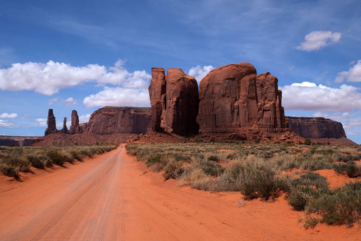
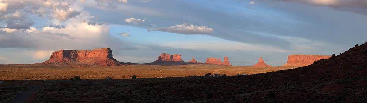
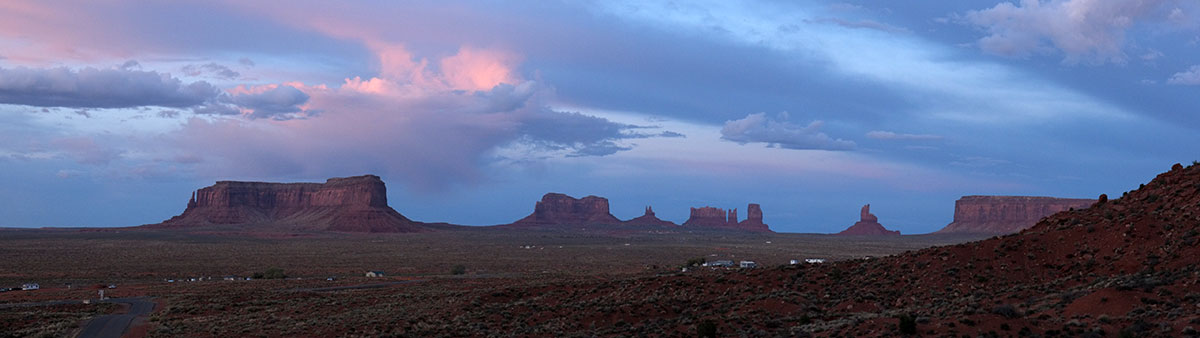
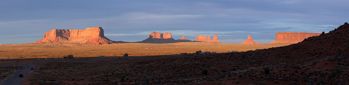
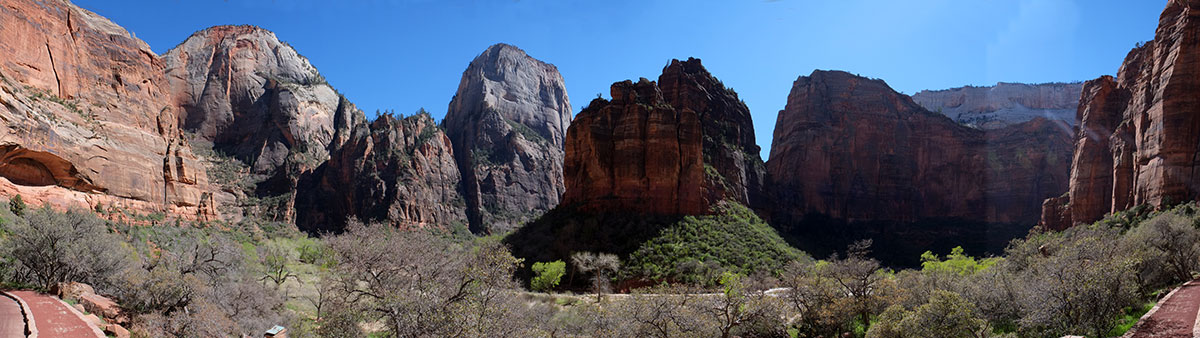
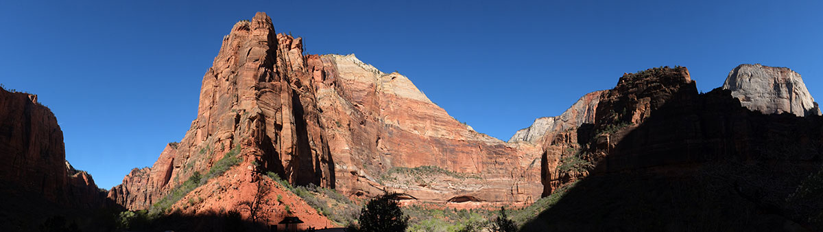
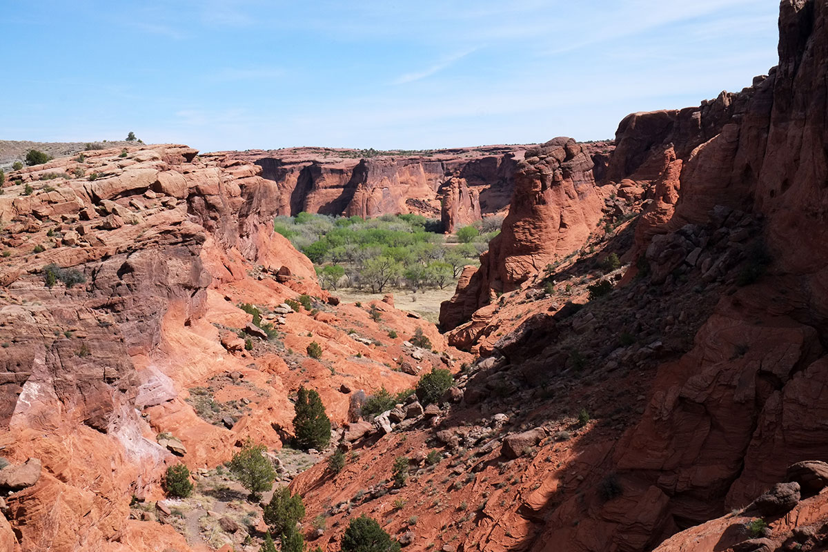
The garden in the desert – the defined place that is lush and life-sustaining in the middle of infinite, awesome emptiness. We came across these intermittently in our travels in the Southwest, and in each one we felt a sense of shelter, relief, of coming back to a world that nourished humans. Santa Elena Canyon, Montezuma’s Castle, Zion Canyon – they each had their extraordinary scenic appeal, but the experience of them is more than just visual, and is heightened by the contrast with the world outside their confines. Tsegi (Canyon de Chelly) may be the most enticing of them all. It has the grand vistas of the others, but it also feels the most inviting – a green world at the bottom of a 20-mile long canyon, not just a small interruption in the desert.

We dropped our trailer in the Cottonwood campground, (run by the Navajo parks service, complete with res dogs), and drove up the north rim to the Antelope House overlook (which actually is looks down into Canyon del Muerto, one of the two large canyons in the National Monument.) We looked down from on top of the sheer red rock cliffs to where they crash into a green meadow below – a continuous carpet of grass and shrubs, not just some straggly desert survivors. Then we heard a faint rumbling sound and saw movement – a herd of horses galloping down a dirt track, and turning into a field below us.95. Tsegi175DSCF8679

After the visually inanimate desert, where wildlife is sparse and well-hidden from our view, this scene was incredibly affecting, primal, almost Edenic – beautiful animals running through a green landscape. A high-pitched, whining sound arose, and then we saw the source – two Navajo cowboys on motorbikes herding the horses – so not completely Edenic.

This is the one oasis canyon where you don’t have to imagine people living there – people actually do live here, and have for 5000 years. First there were small groups, then the Ancestral Puebloans arrived over 1000 years ago and built cliff dwellings. After they moved on to the modern pueblos, the Hopi would still return here for summer hunting and farming. Finally, the Navajo arrived a few hundred years ago, and have lived here ever since.

An etymological digression, which travel in the Southwest seems to frequently require: I had always wondered how this place came to be called Canyon de Chelly (pronounced “shay”) – a strange not-Spanish, not-French hybrid. It turns out that it is simply a corruption of the Navajo word Tsegi, (pronounced Tsay-yi), which roughly means canyon. So Canyon de Chelly means Canyon of Canyon, which is really quite a stupid translation when you think about it. Since we now live in an age where we increasingly recognize the original native names for places (such as Denali), and sometimes officially change the names back, I’d like to move Tsegi to the top of that list.

Tsegi is a centrally important place to the Navajo – I’ve seen it referred to as the heart of the nation. It is a US National Monument, but it is jointly administered by the National Park Service and the Navajo nation. Most of the land is private, and it is all under Navajo jurisdiction; we weren’t sitting around the campfire at night drinking bourbon while on the res.

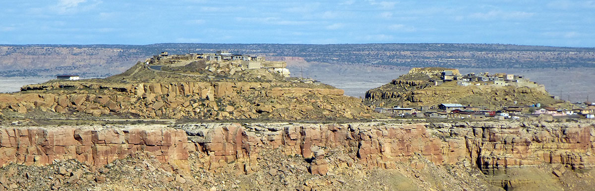
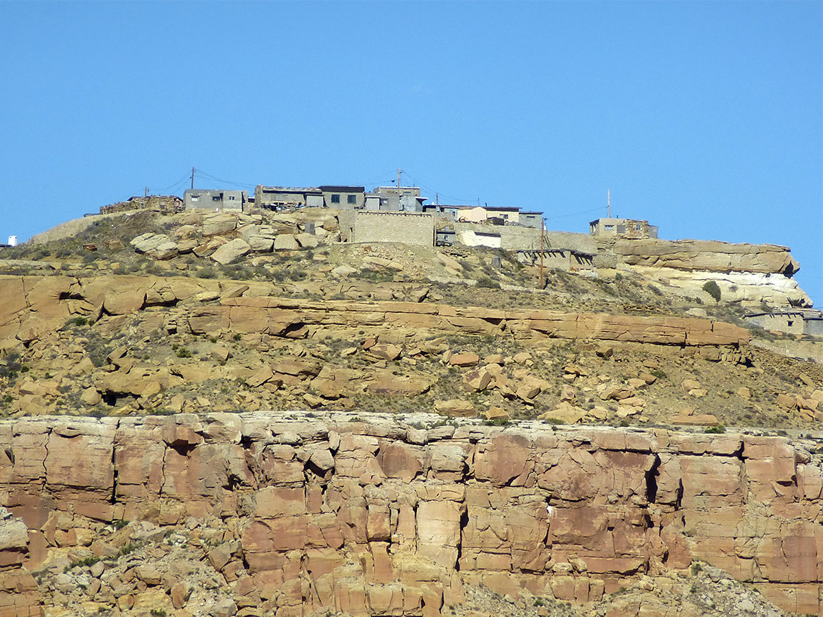
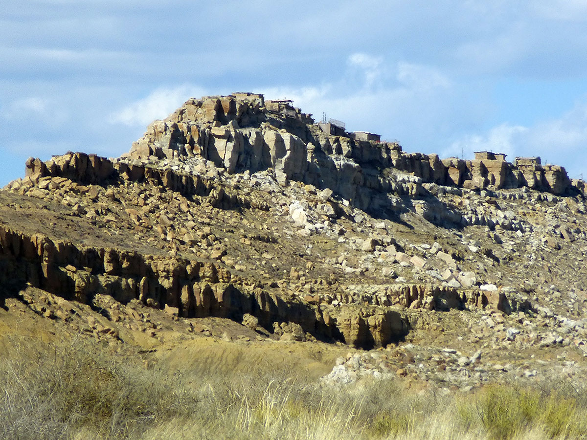
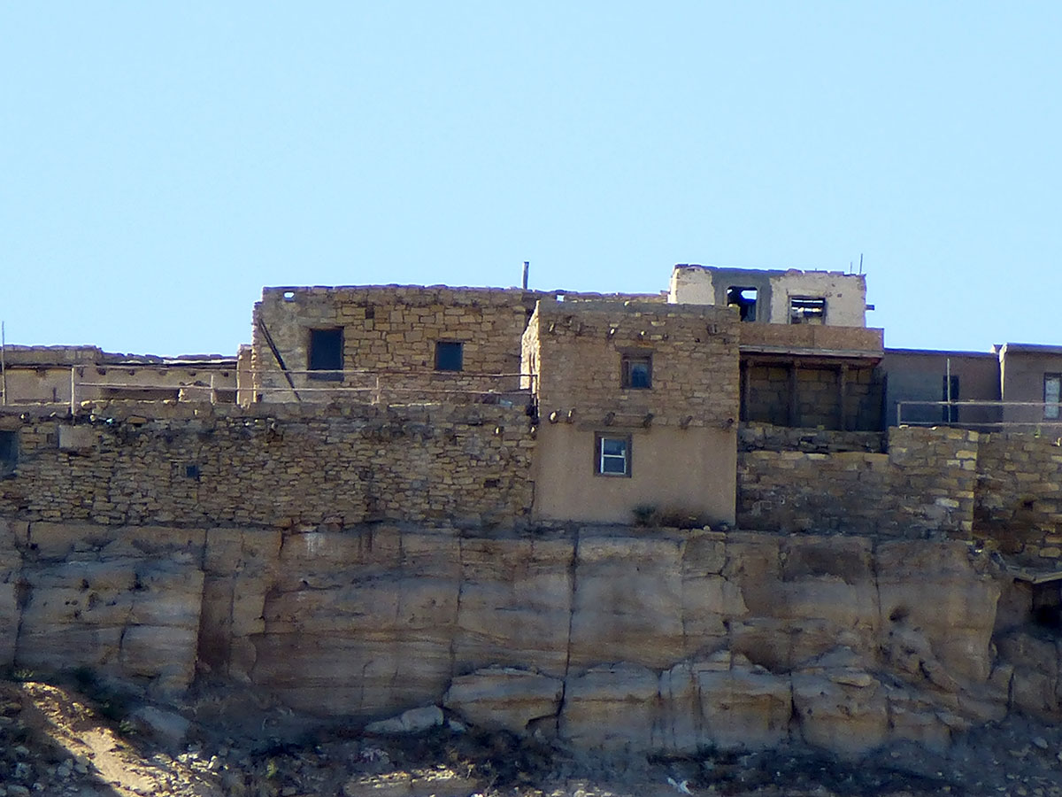
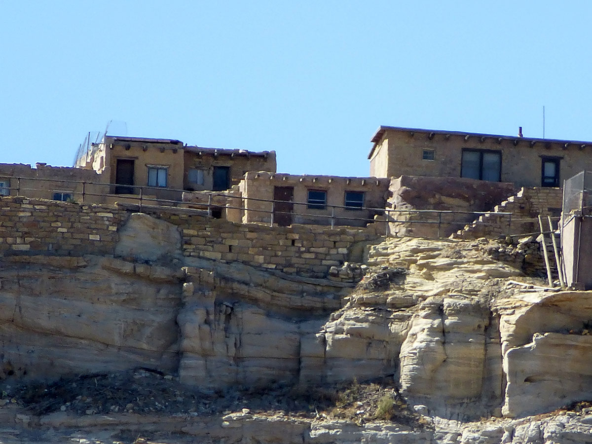
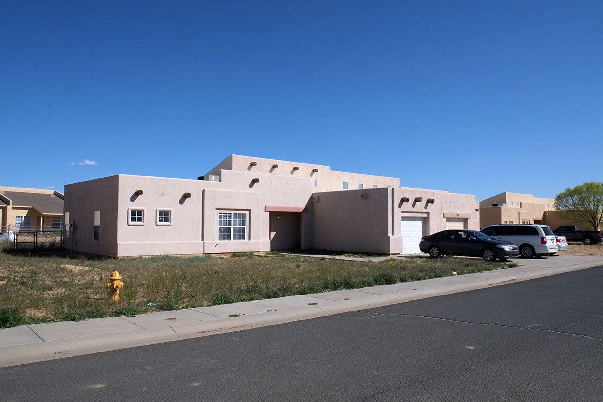
You can see the difference in preferred settlement patterns between the Puebloans and the Navajo quite clearly, even in this confined canyon. The Hopi and other Puebloans (descendants of cliff-dwellers) live in dense villages, clustering together in one spot in the desert. The Navajo prefer open country, and don’t seem to appreciate towns – their cities all seem to be recent service centers, places where the 150,000 members of their nation can get supplies and intersect with the modern world of bureaucracy. They take the normal nature/built-world Manichaeism typical of the Southwest to the nth degree – Navajo empty-nesters and millennials are not flocking to walkable neighborhoods. Everywhere we went in this vast reservation, this was the typical dwelling – a cluster of small buildings, surrounded by range land, where they raise their herds of sheep:DSCF8626

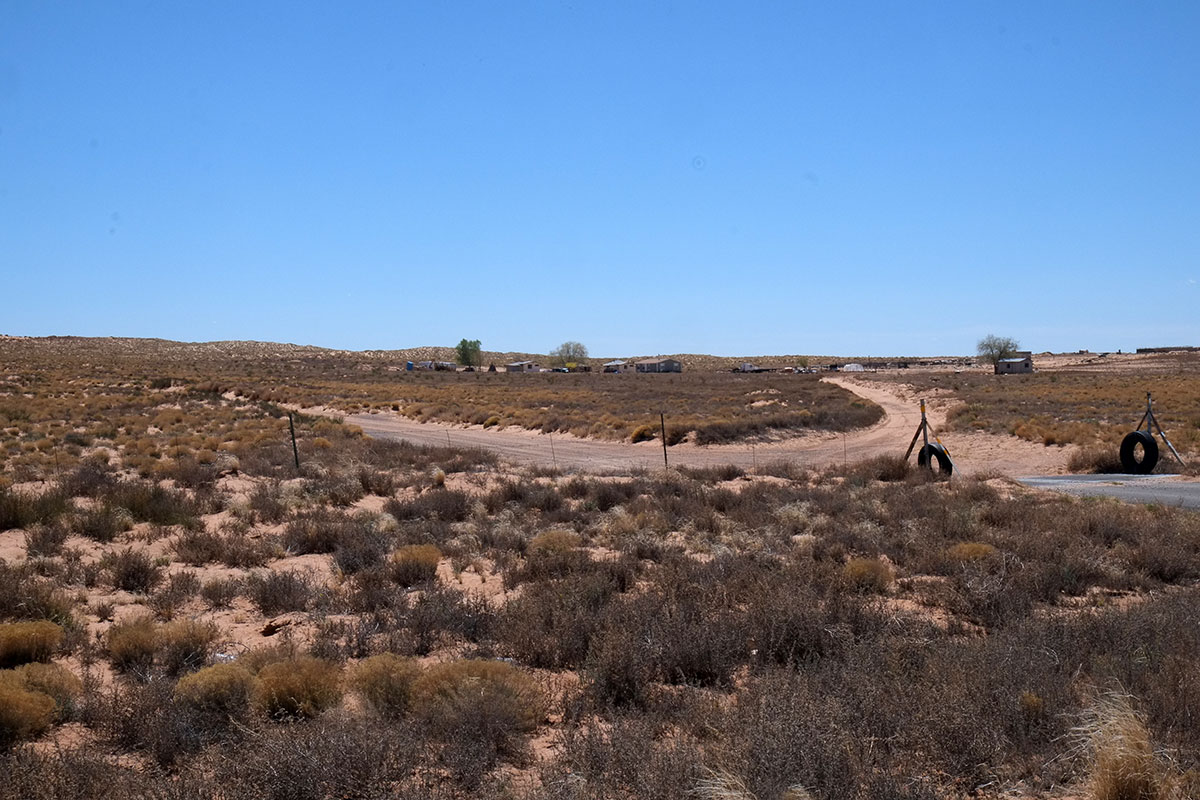
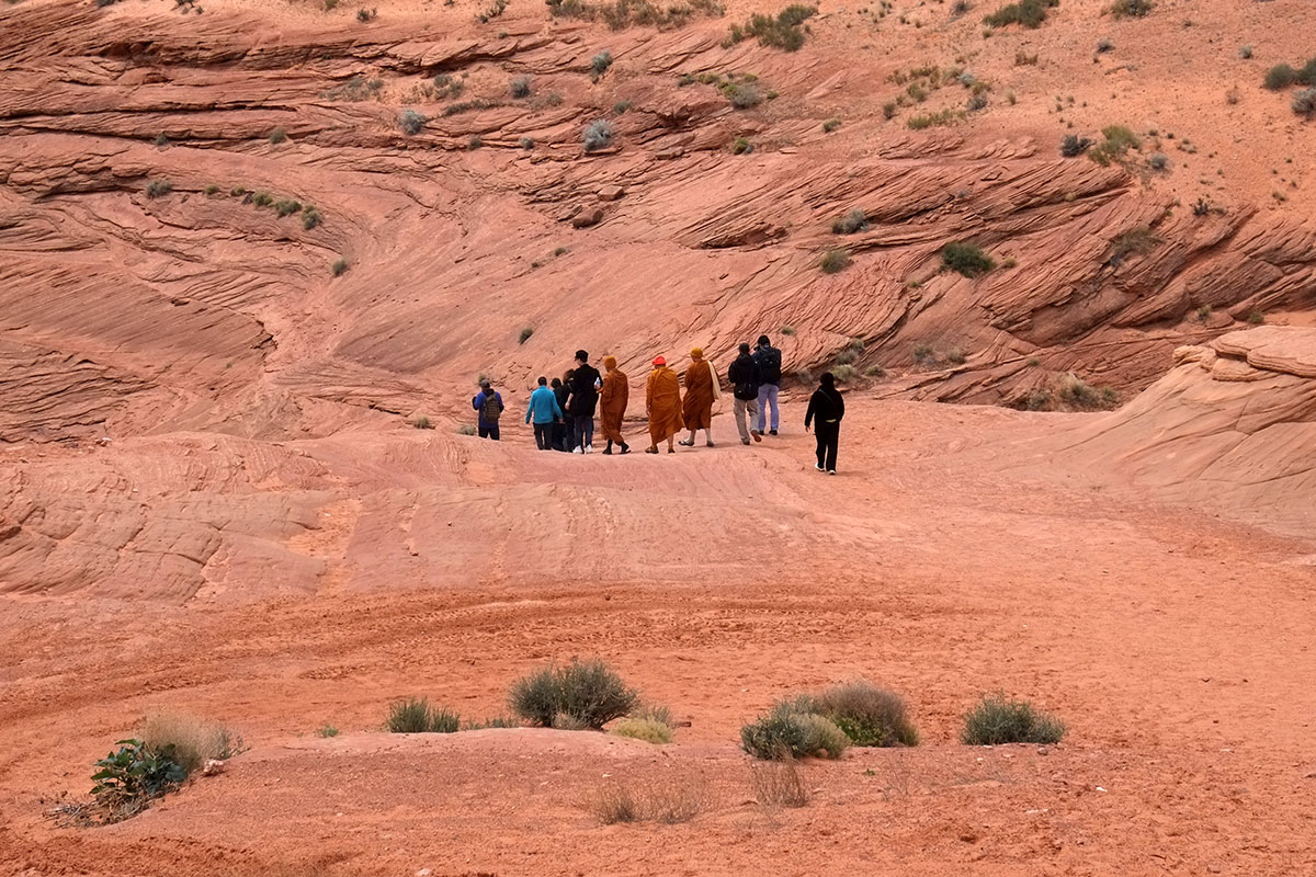
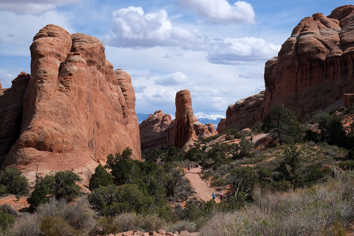
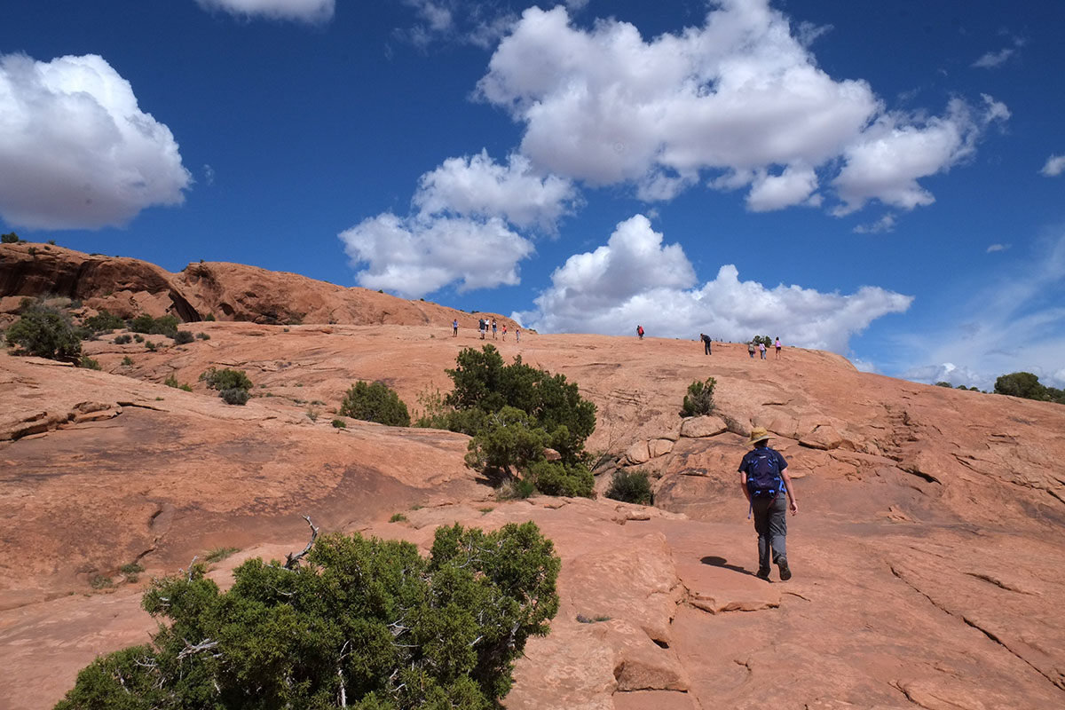
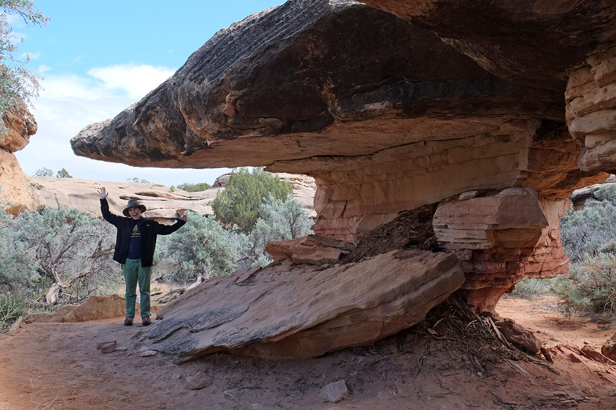
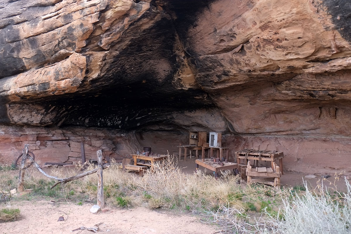
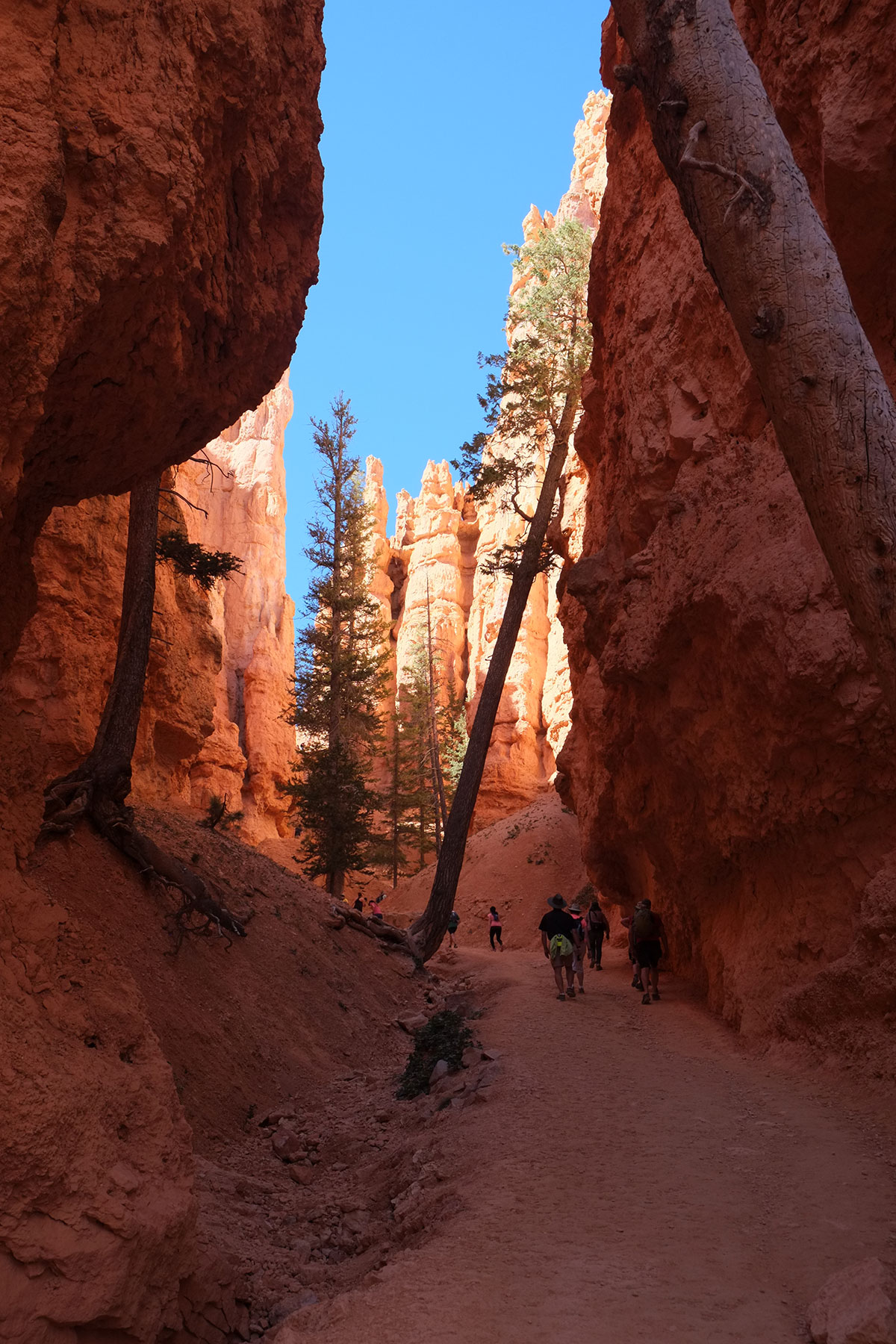
Even within the confines of Tsegi, this is the normal pattern – individual farms and ranches spread up the lengths of the two main canyons, connected by dirt roads, which sometimes are coincident with the streams that run through them. Since the land is private, tourists are not allowed to wander at will. There are drives along the north and south rims that give access to major overlooks. If you want to visit the bottom of the canyon, you must hire a Navajo guide, who will take you through either in a jeep or on horseback. There is one point where you can hike to the bottom of the canyon from the rim, which might be the most fascinating hike we did on this whole trip.

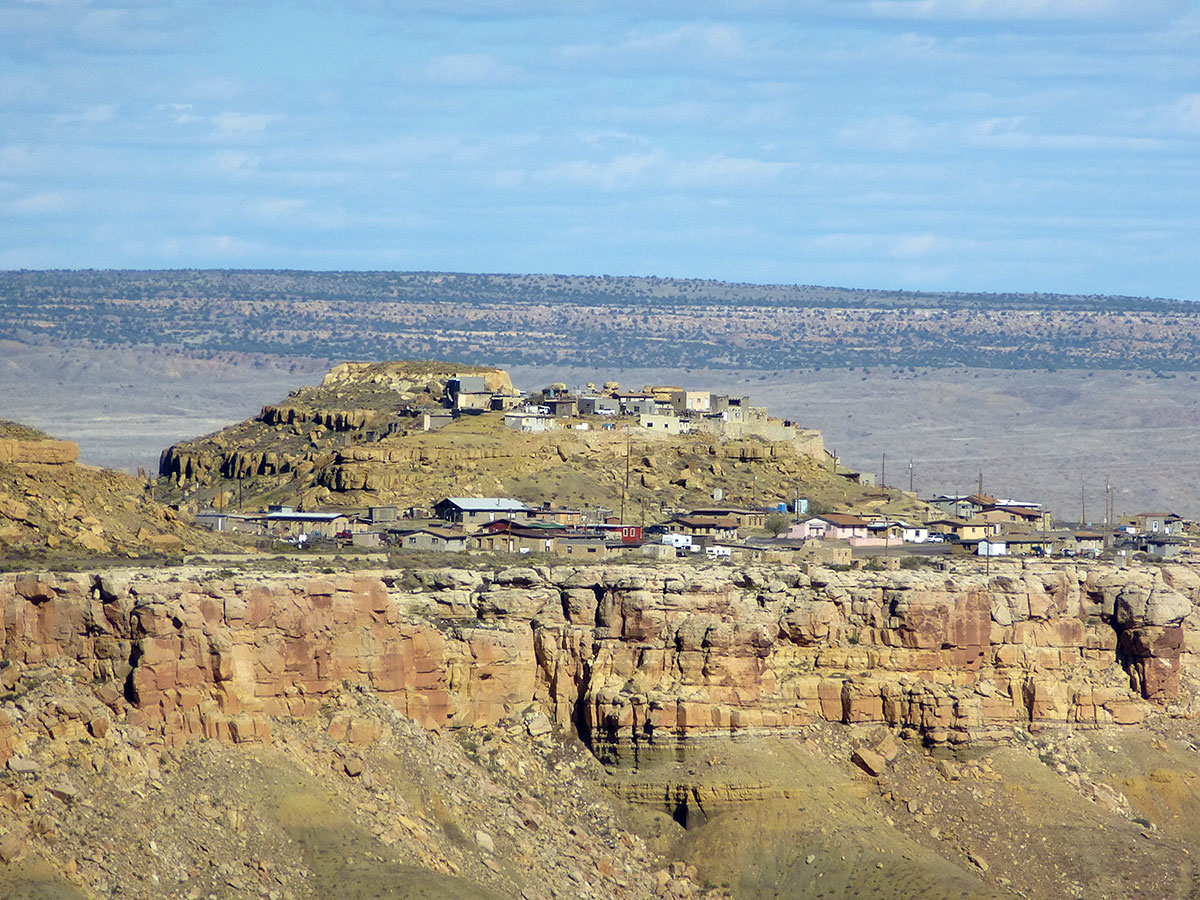
At Antelope House overlook, we watched the herd of horses until they were out of sight, then we turned to Antelope House itself, a cliff dwelling on the canyon floor, below the cliff.95. Tsegi176DSCF8691

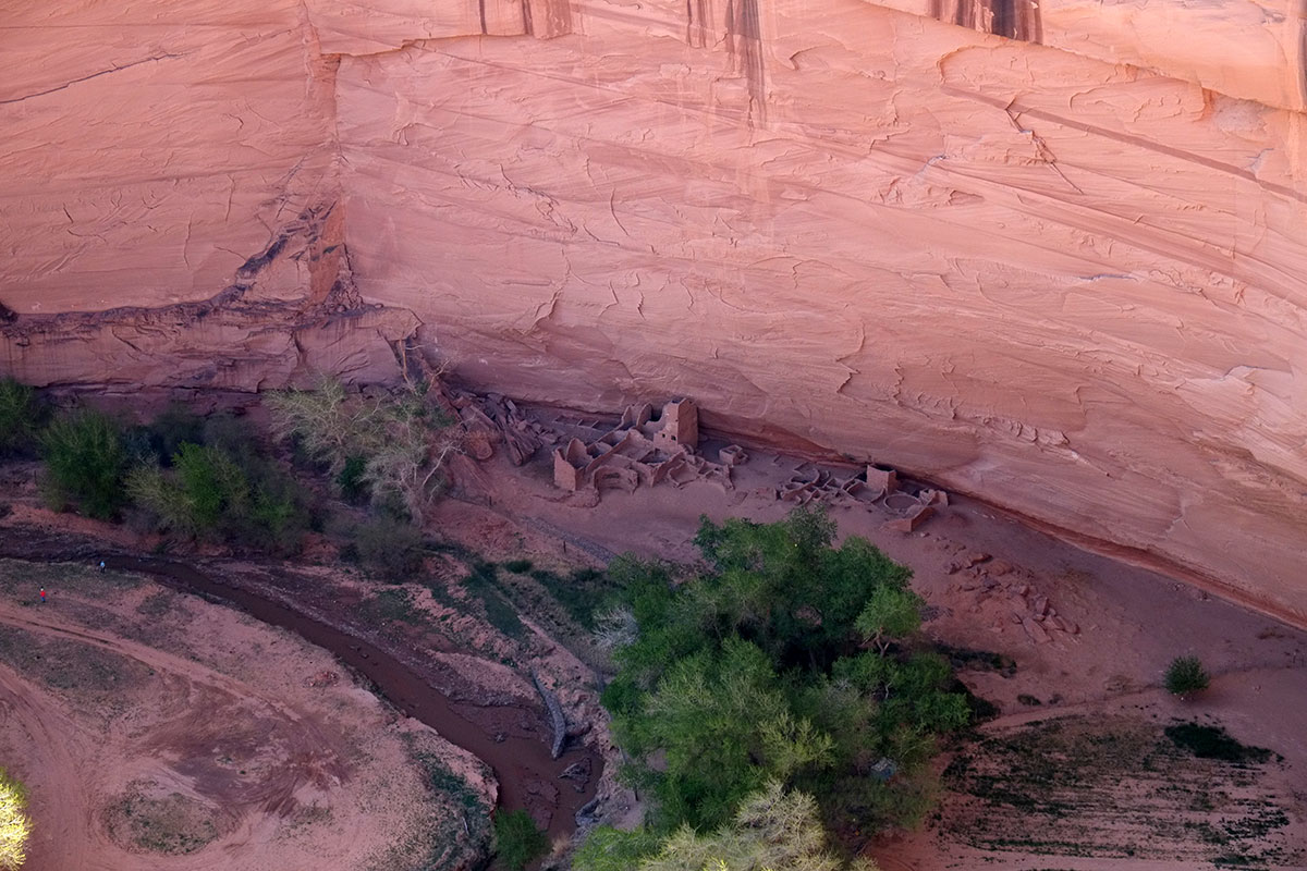
No one would be coming down that cliff (to the right in the picture below) and since the only way in is at the mouth of the canyon, 5 miles away, an integrated defense of the whole canyon might have made sense, rather than counting upon the inaccessibility of each individual cliff village.DSCF8693Antelope-House003

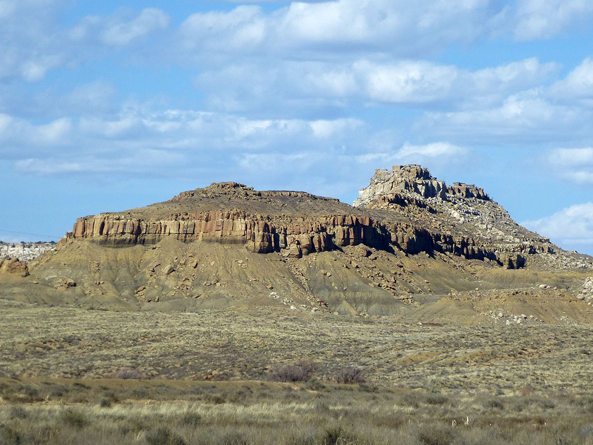
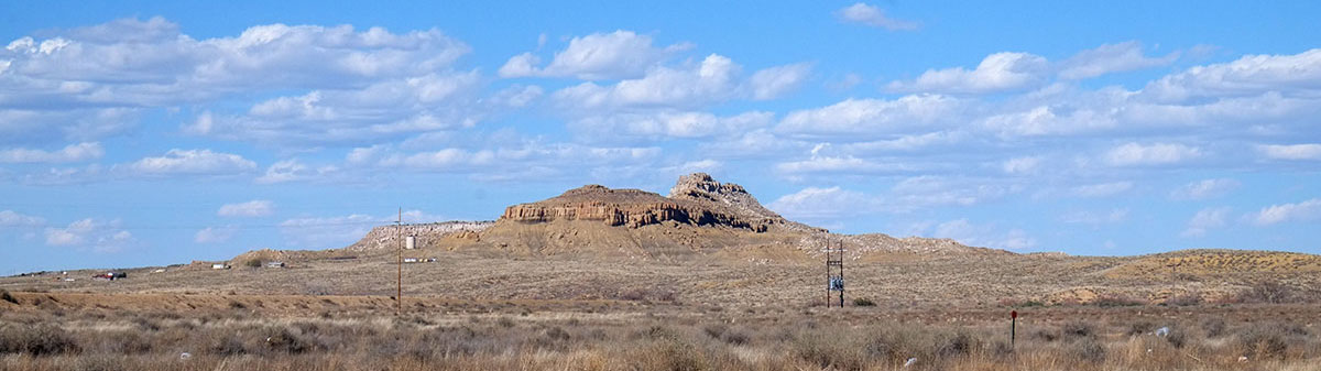
It is an extraordinary spot, where Black Rock Canyon splits off from Canyon del Muerto. The escarpment in the middle below is Navajo Fortress, a well-hidden and completely defensible spot to which the Navajo warriors could retreat in their wars with the Spanish and Americans. _DSCF8685NavajoFortress001

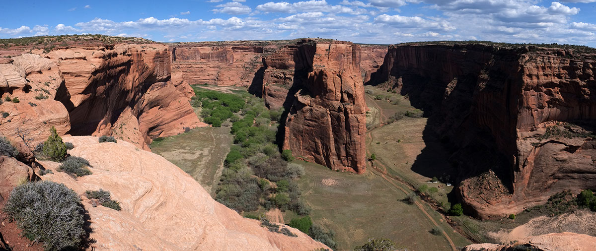
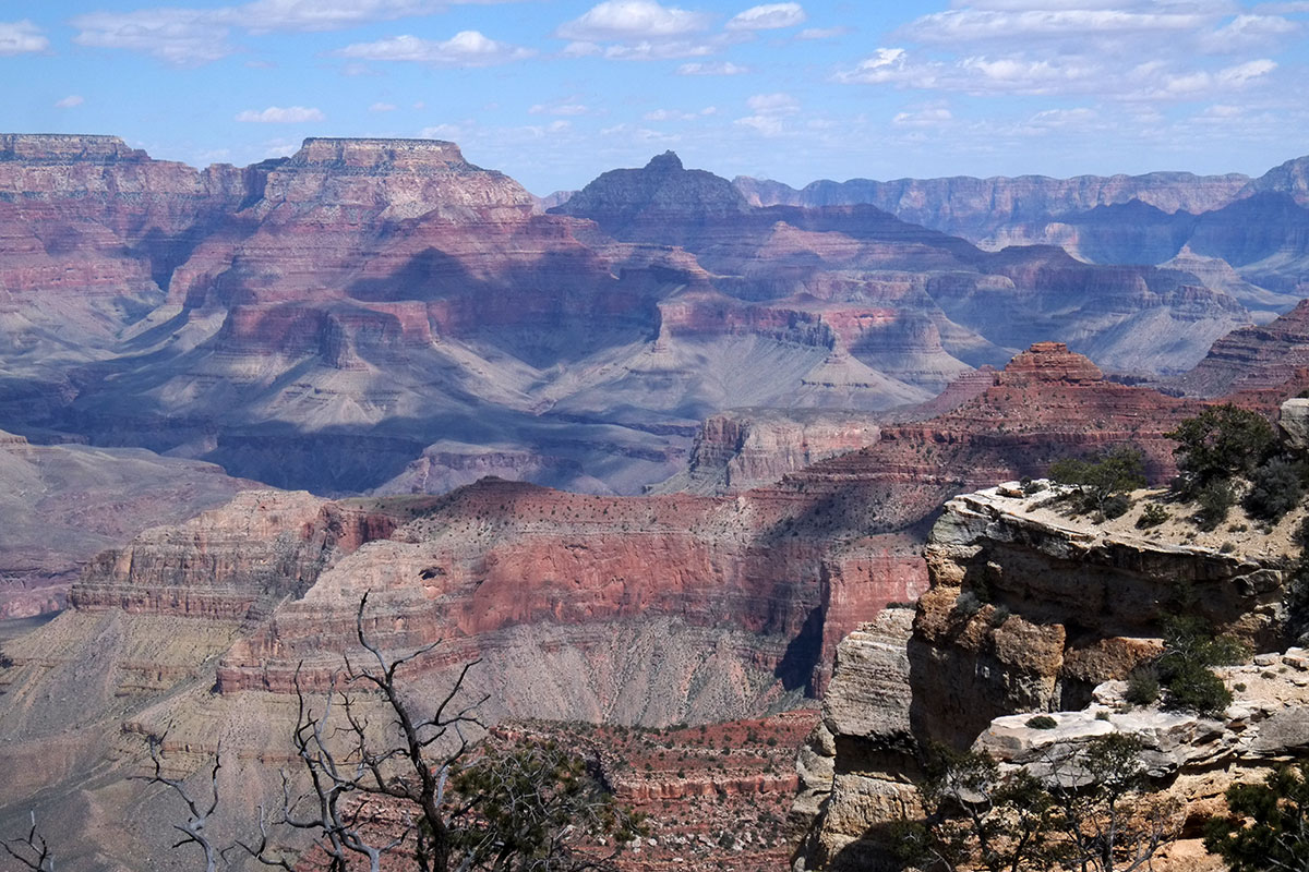
On the south rim drive, looking into Canyon de Chelly, we caught a glimpse of riders on the road / streambed.95. Tsegi178DSCF8714

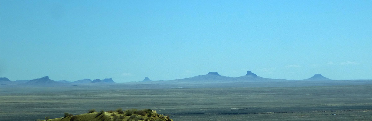
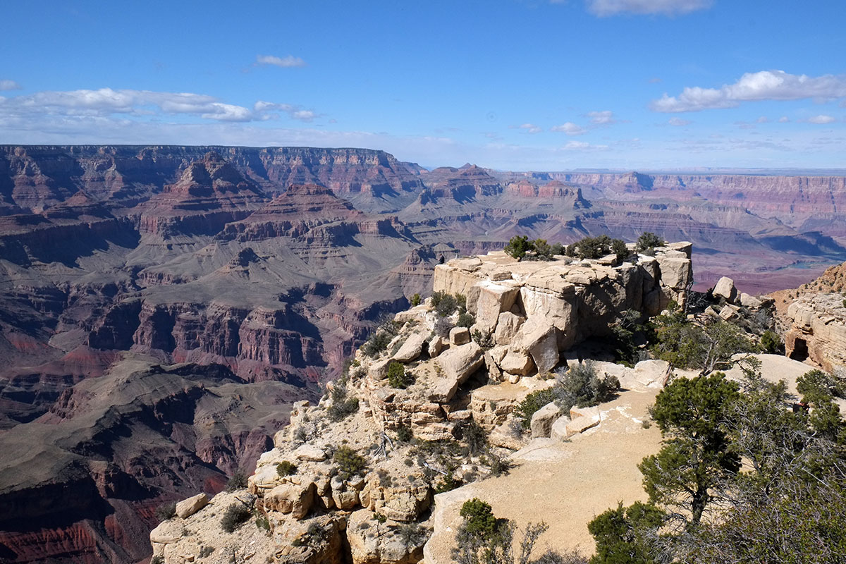
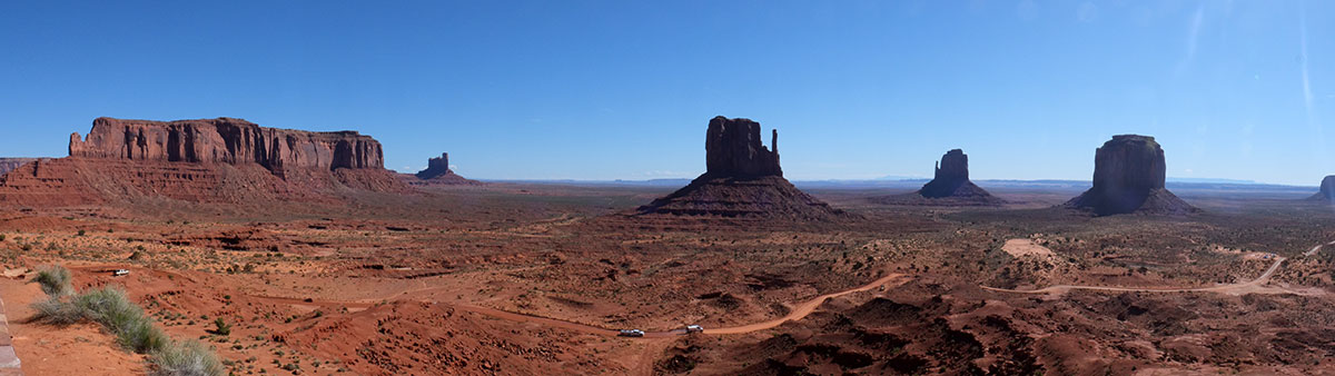
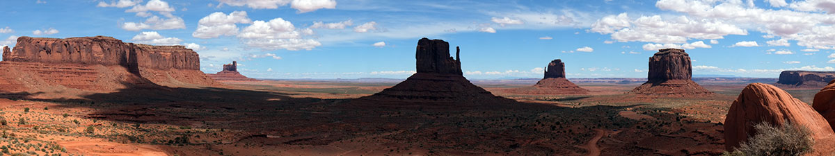
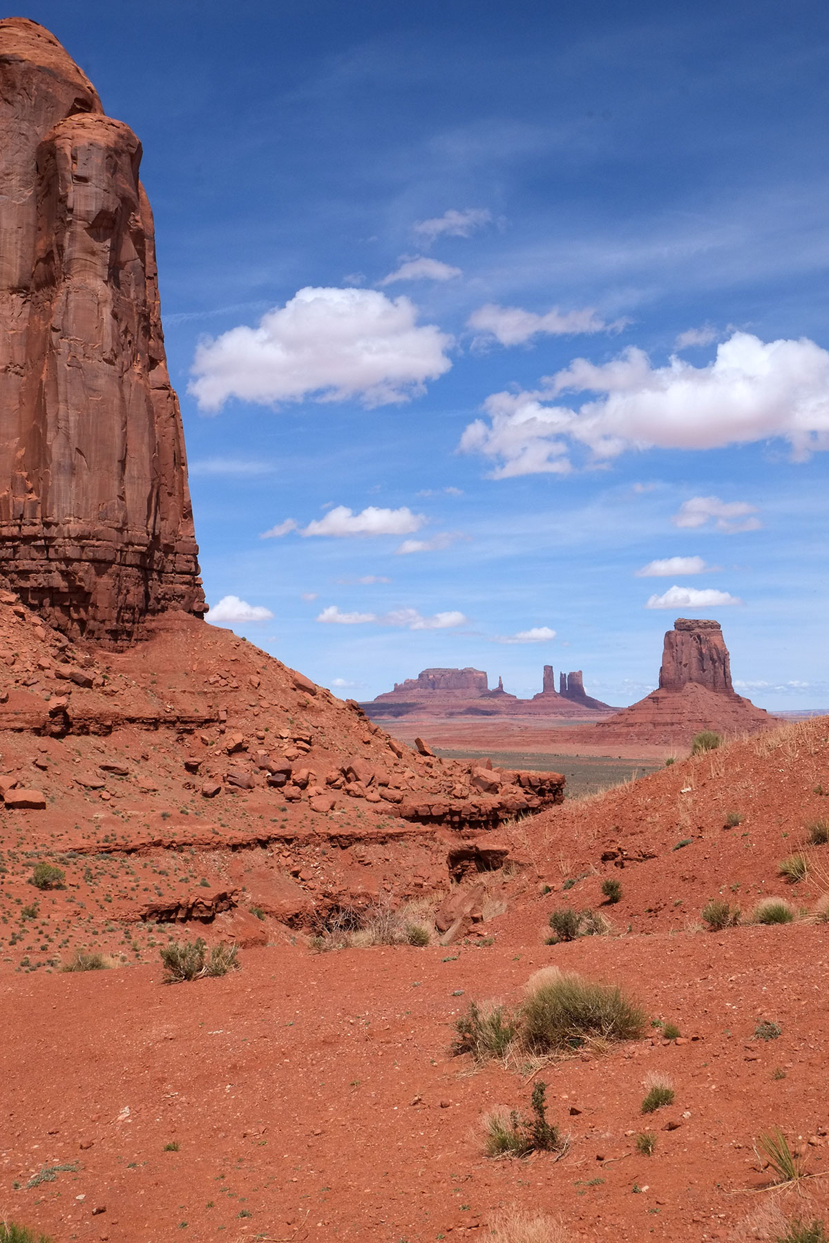
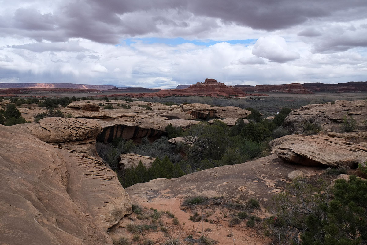
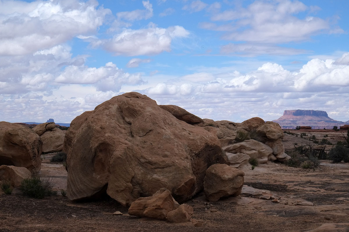
The Tsegi overlook affords a big-picture view of the canyon.95. Tsegi190DSCF8883

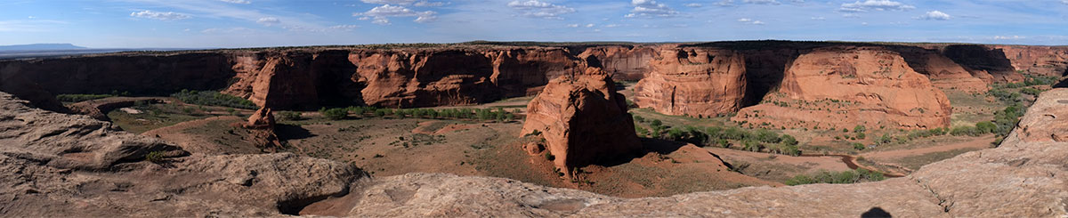
The end of the drive is at Spider Rock, an 800-foot butte which is the home of a legendary spider, used in tales to frighten Navajo children. The Chuska Mountains are visible in the distance.95. Tsegi179DSCF8744

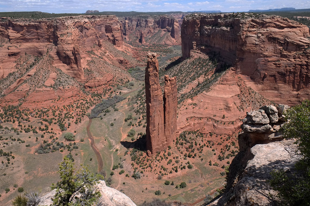
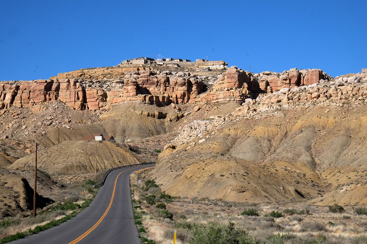
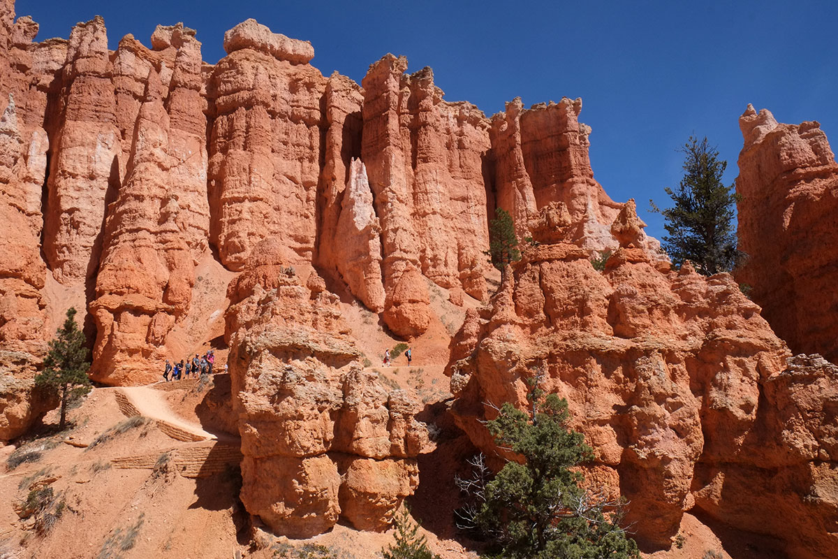
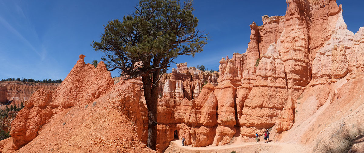
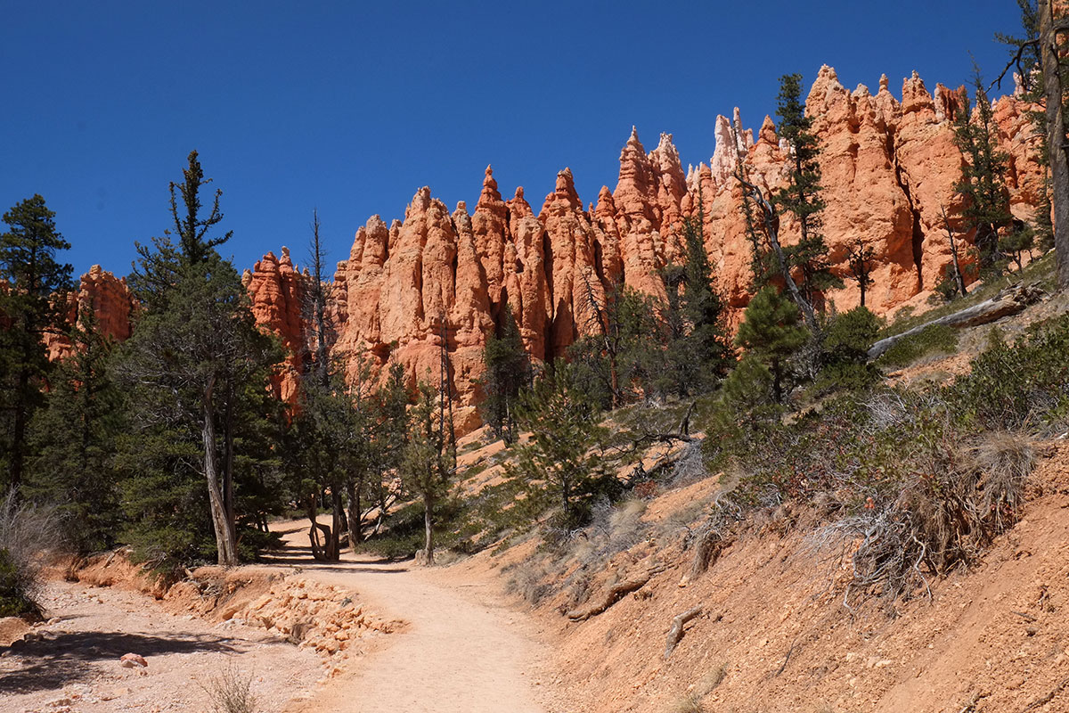
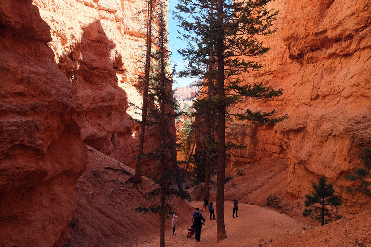
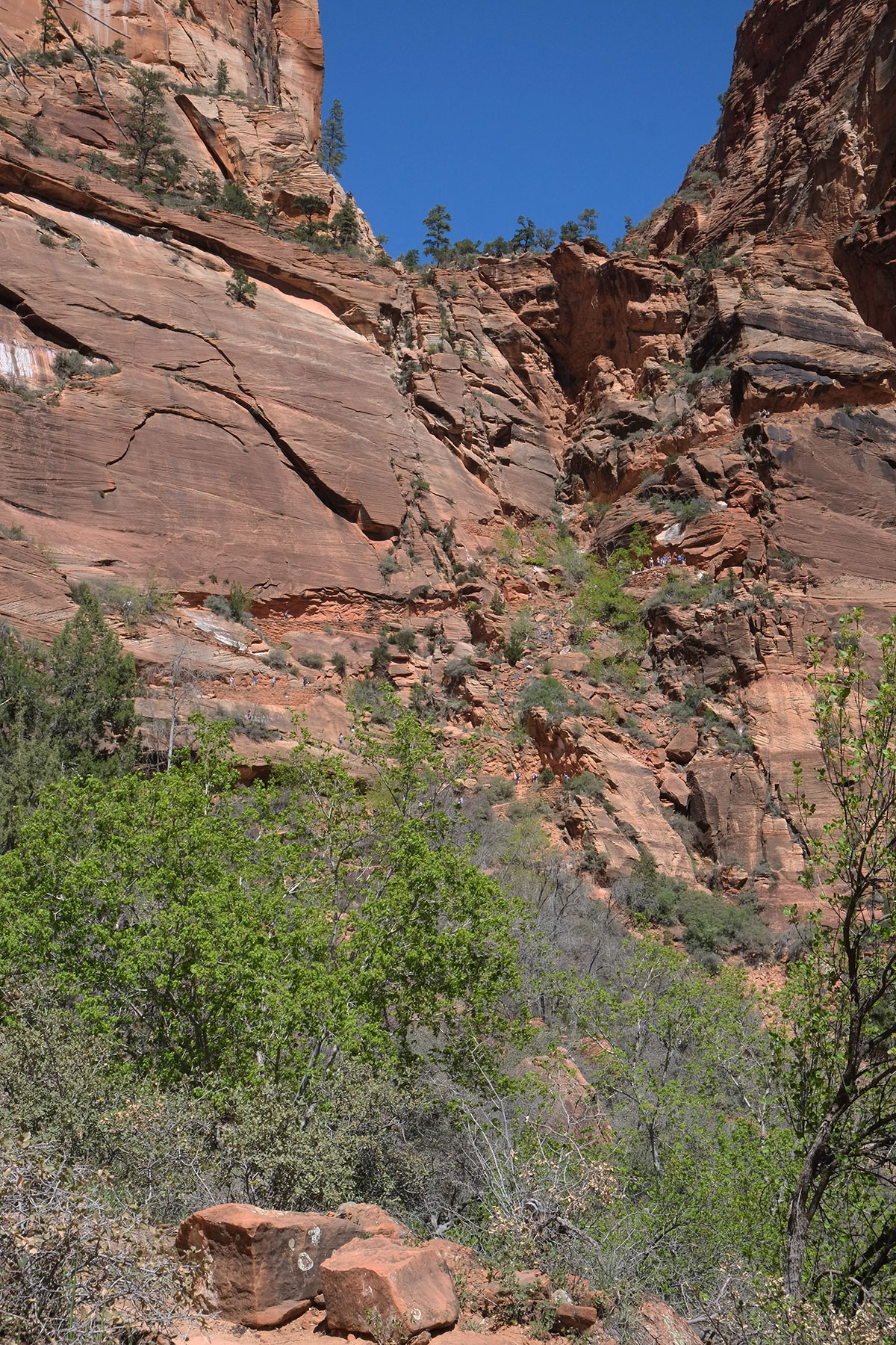
We stopped at other points, with equally cool vistas of canyons or other cliff dwellings. But as always with us, the best way to see and understand the place was to do what hiking we could. So we headed for the one trail down, which leads to the White House cliff dwelling. The path winds its way down the cliff, with switchbacks and a couple of tunnels.DSCF8755WhiteHouseTrail002

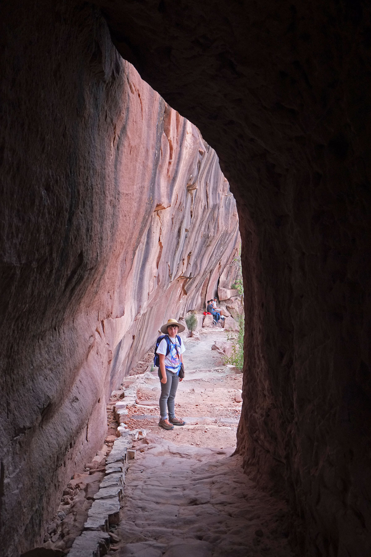
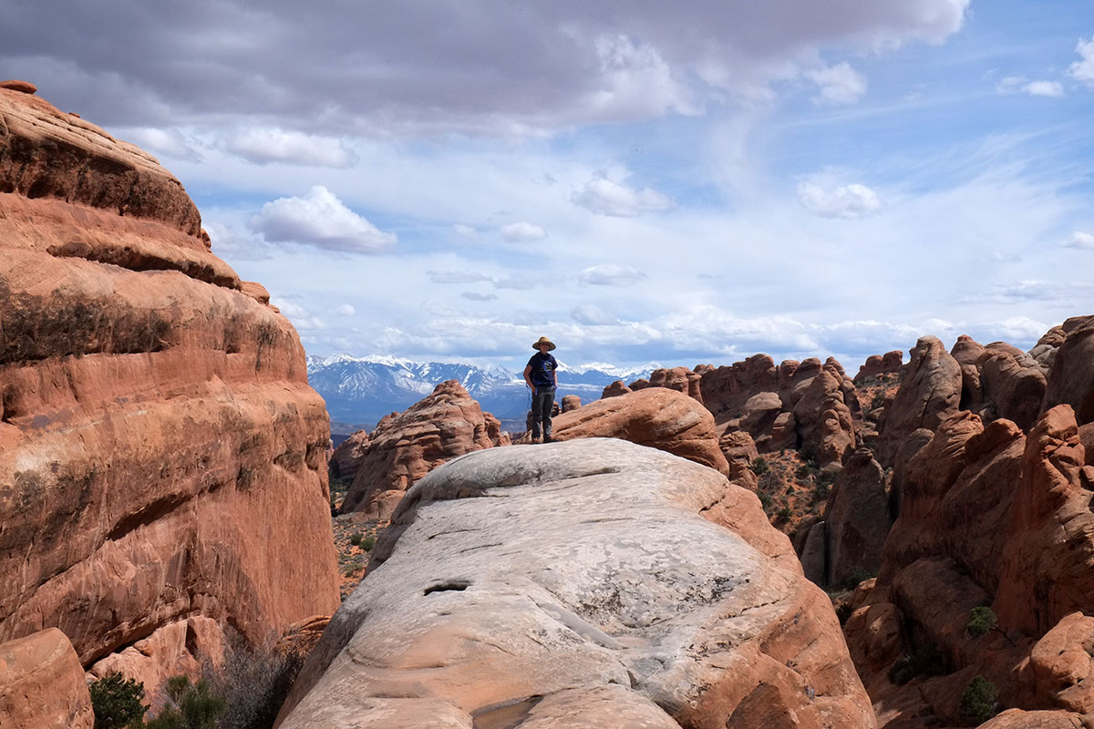
Your perspective always changes (literally) as soon as you’re below the rim – you’re below the horizon, rather than above – in a space enclosed by the canyon walls, not just looking down into it.DSCF8767WhiteHouseTrail012

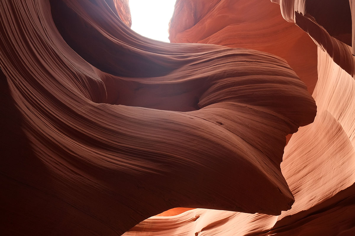
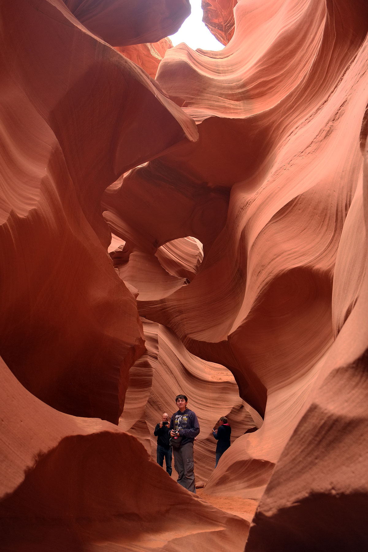
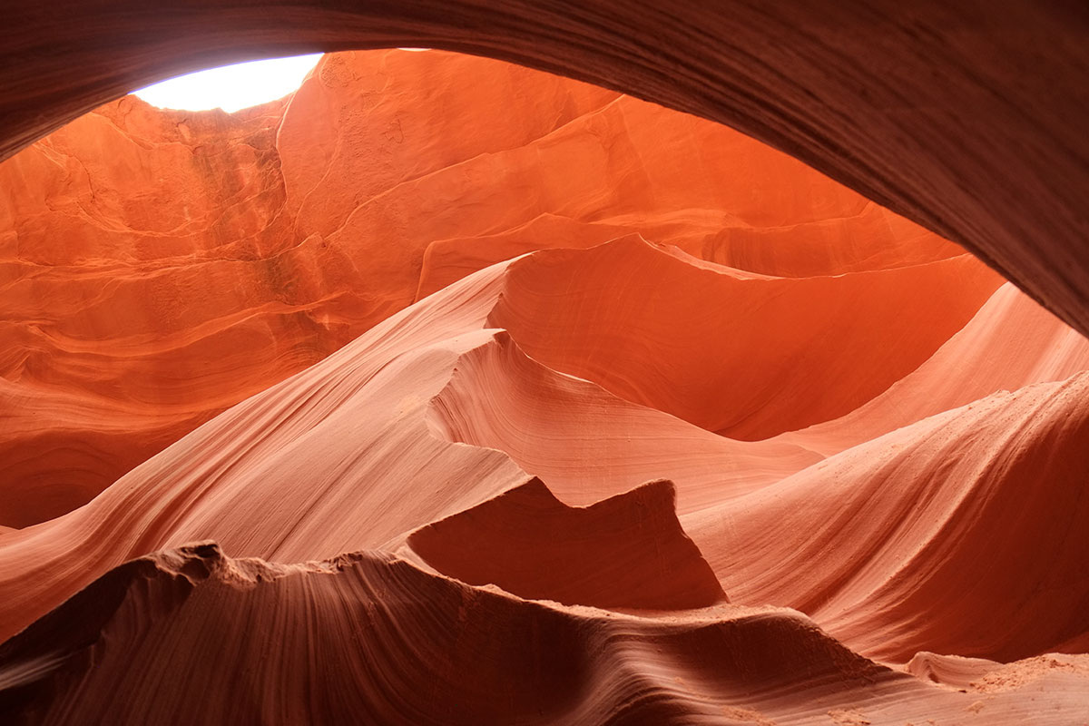
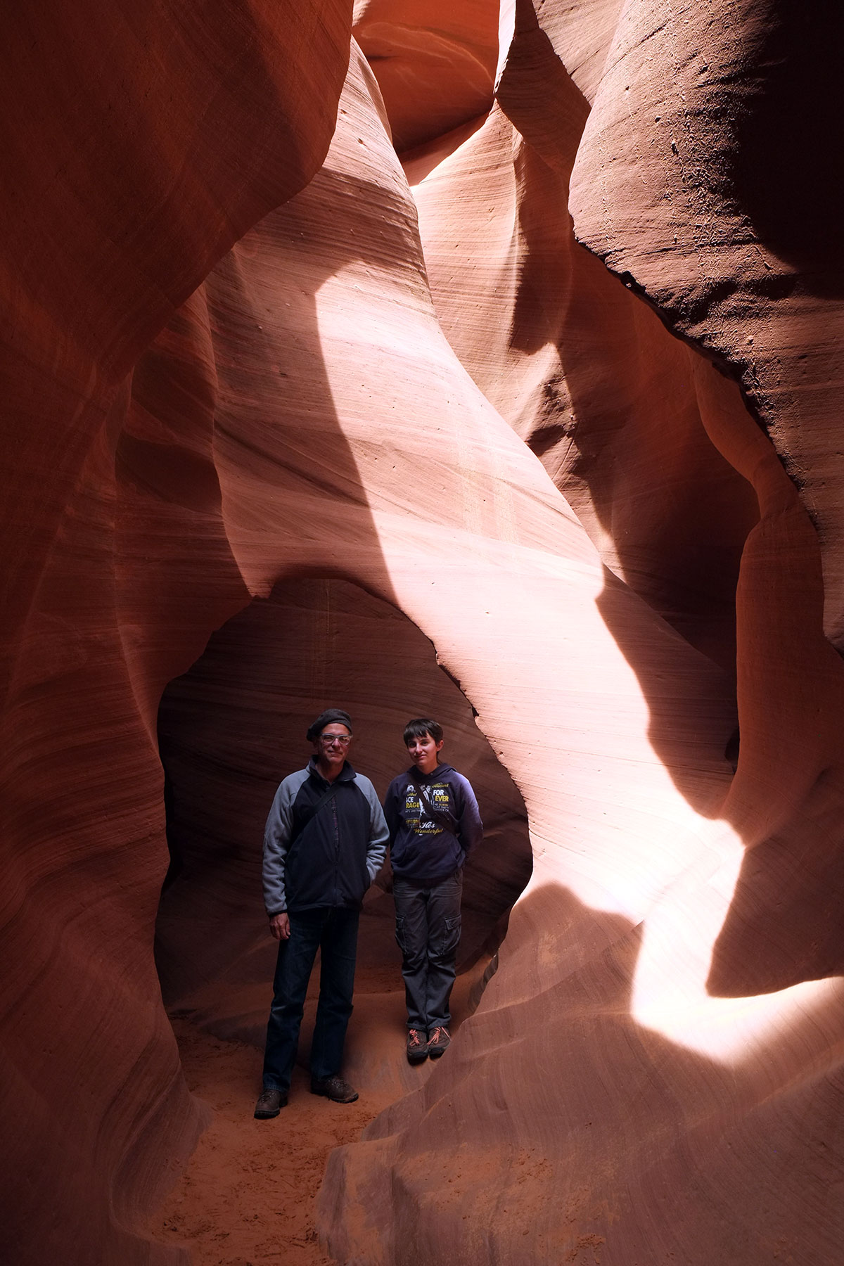
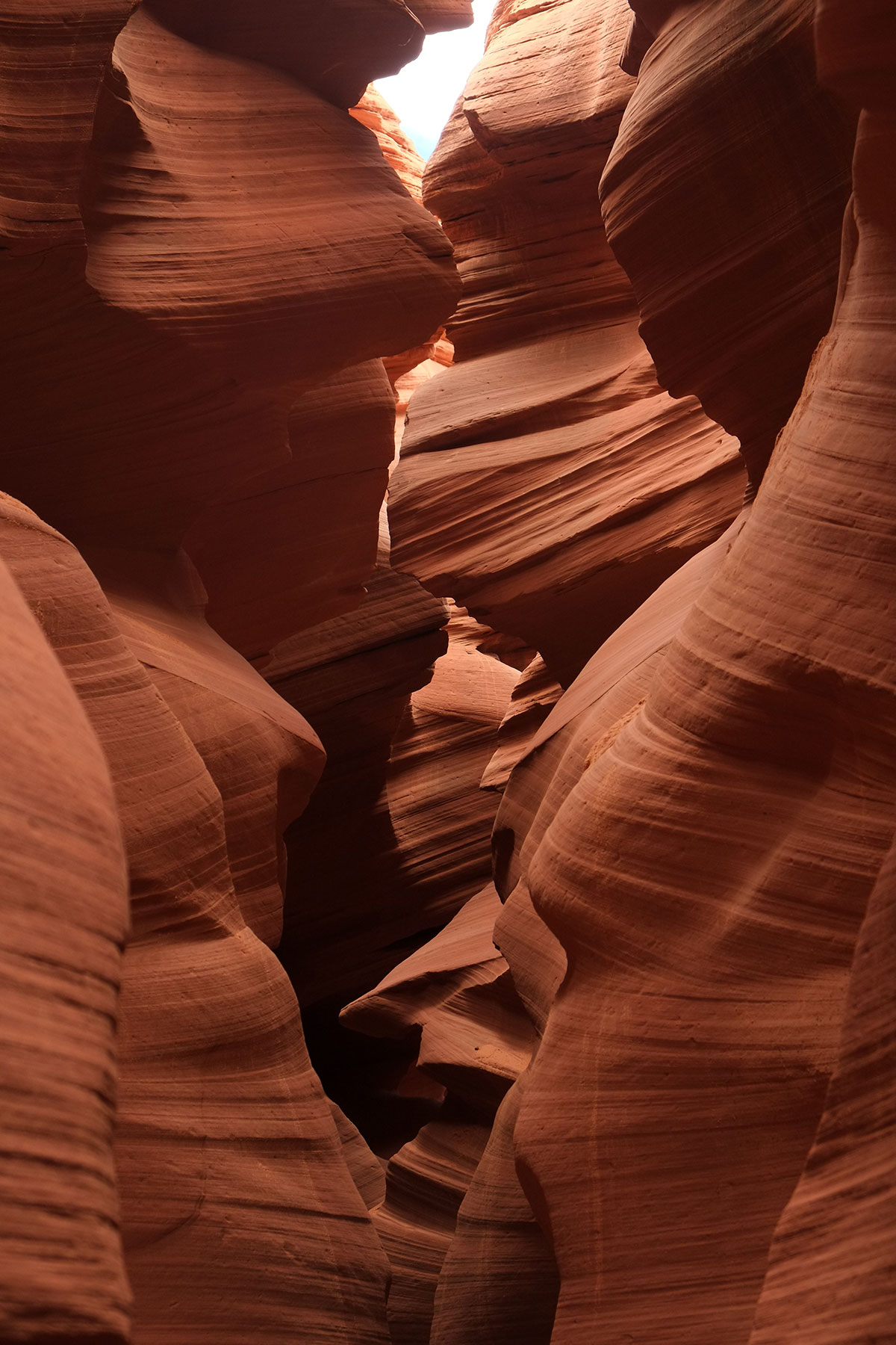
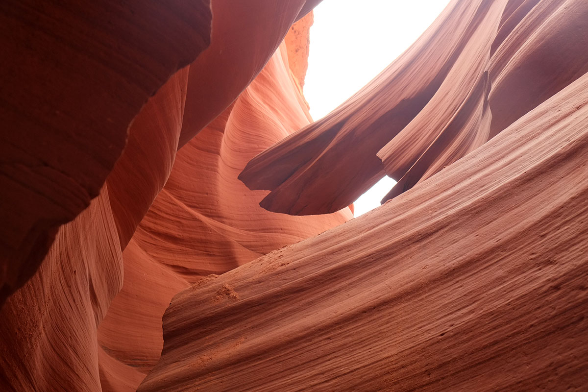
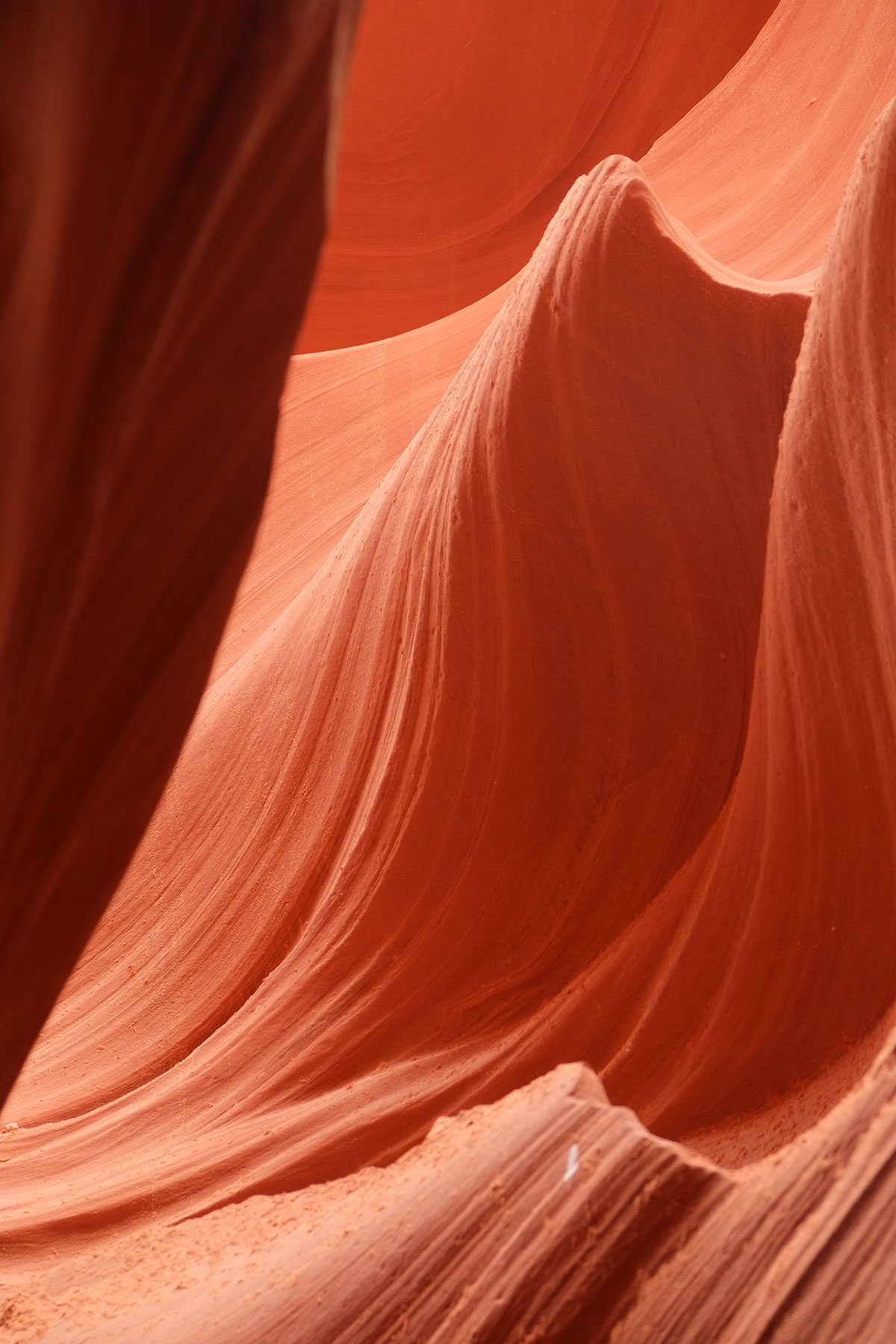
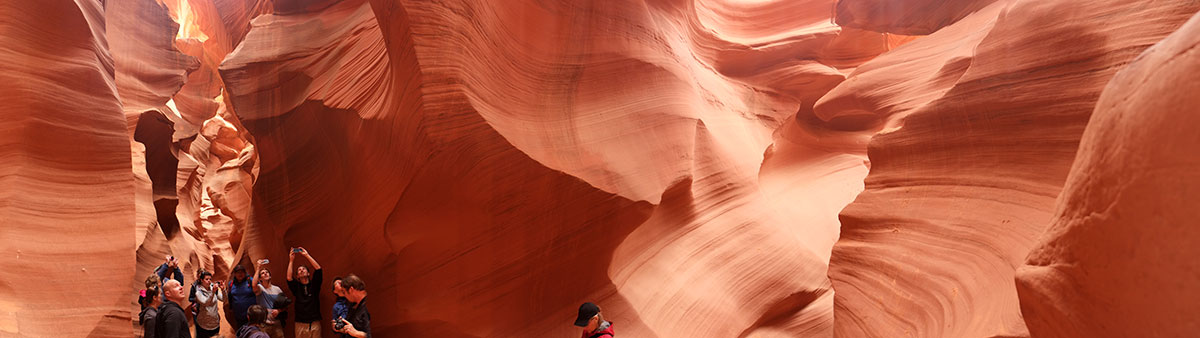
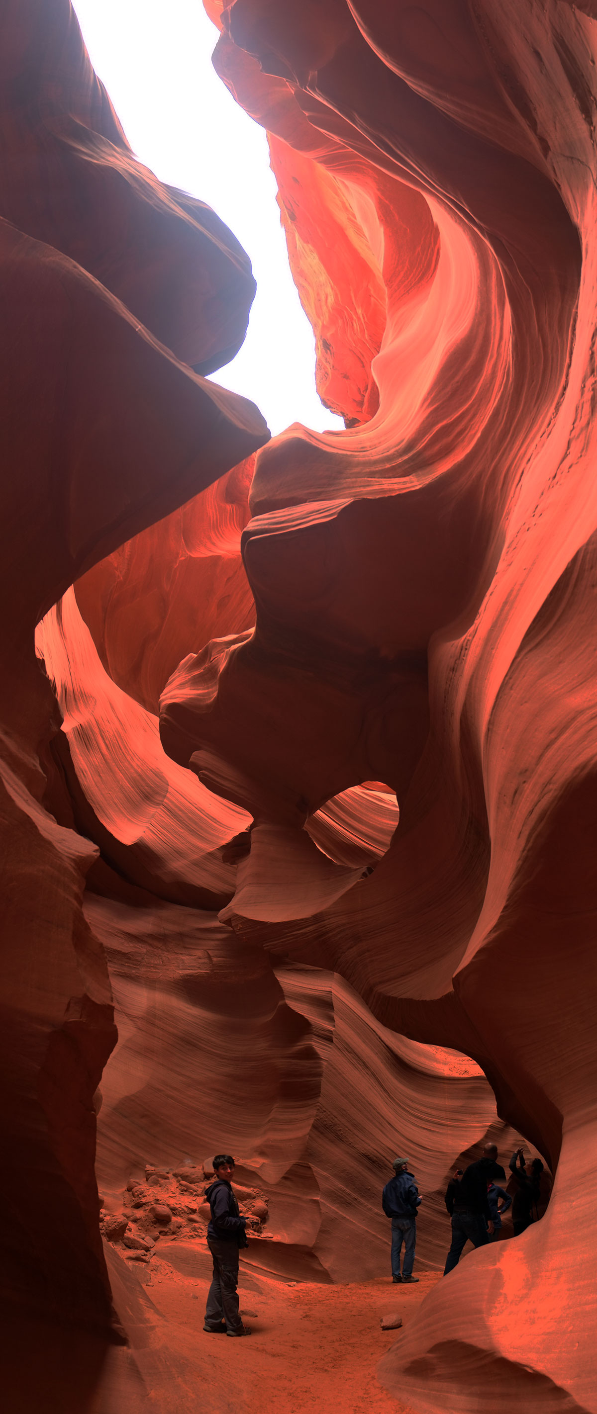
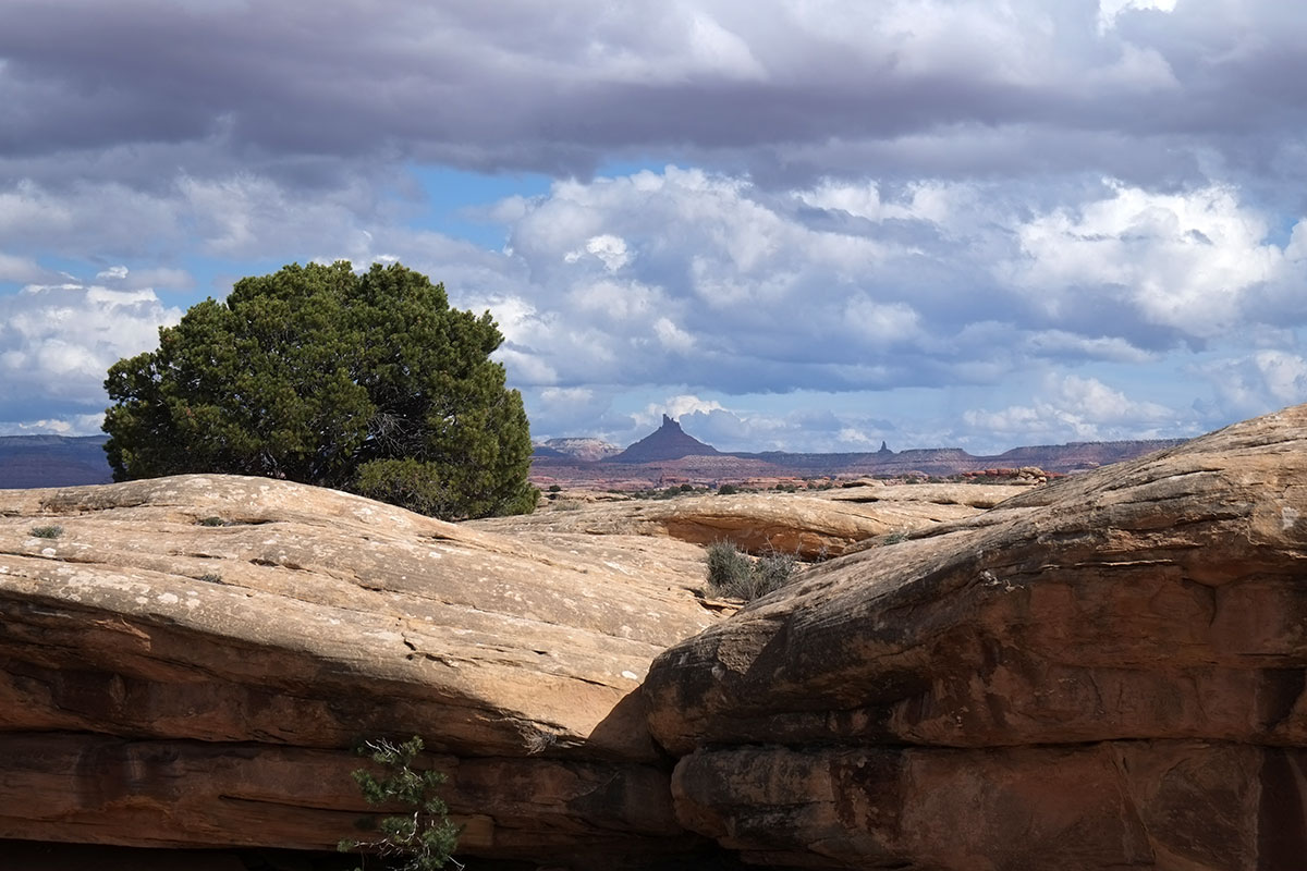
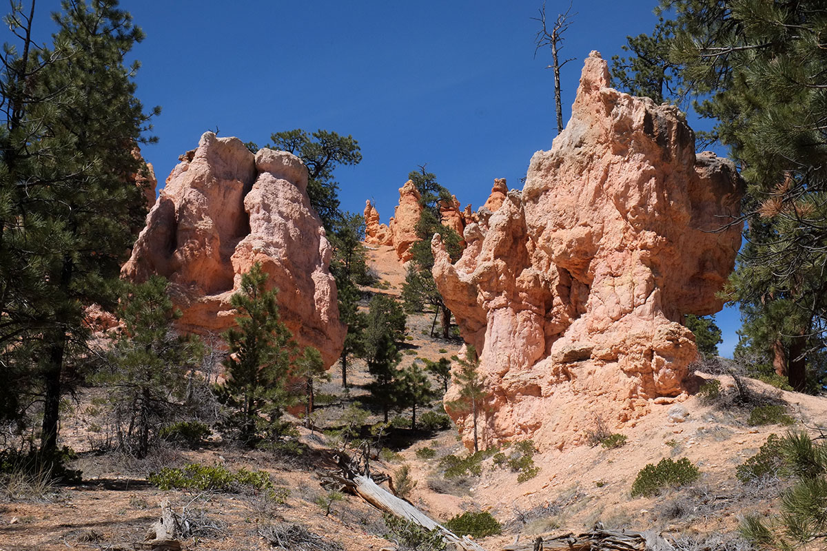
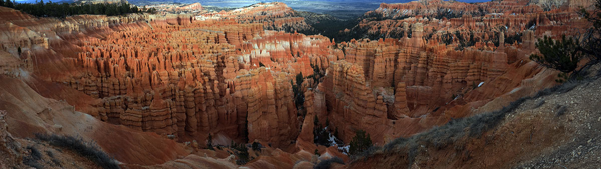
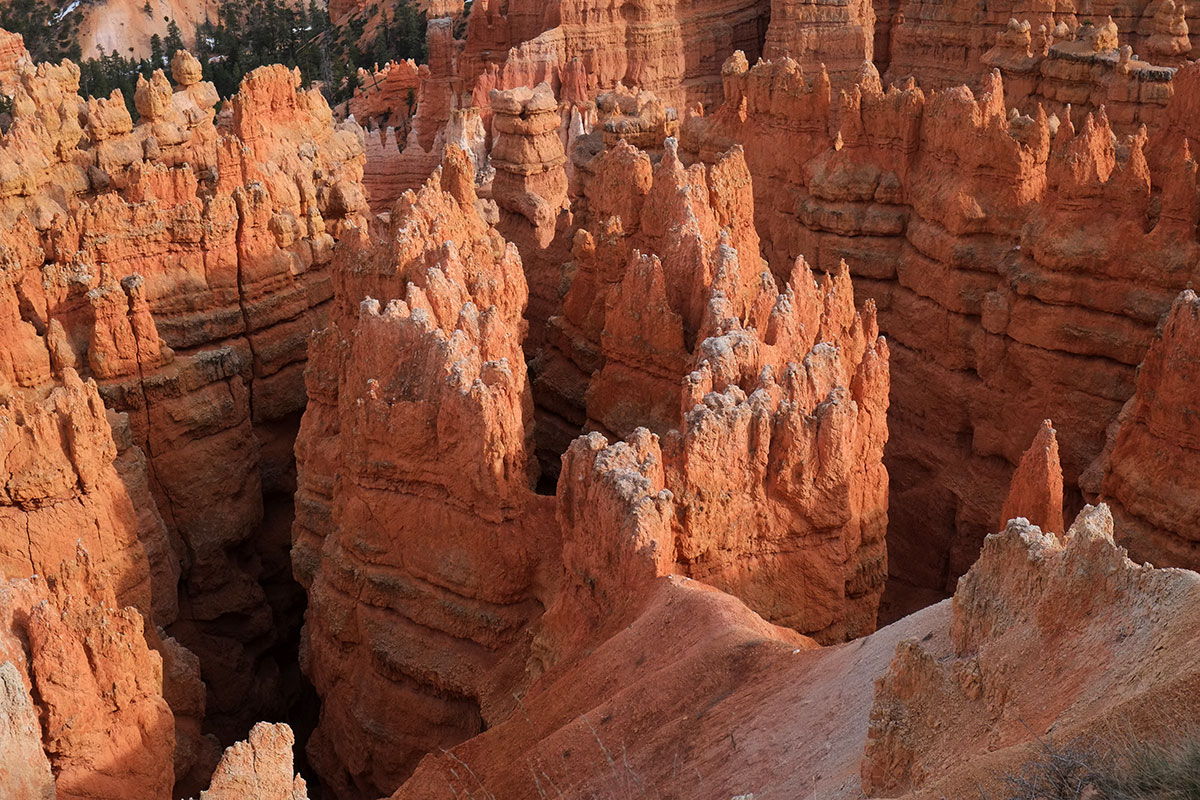
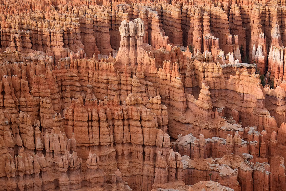
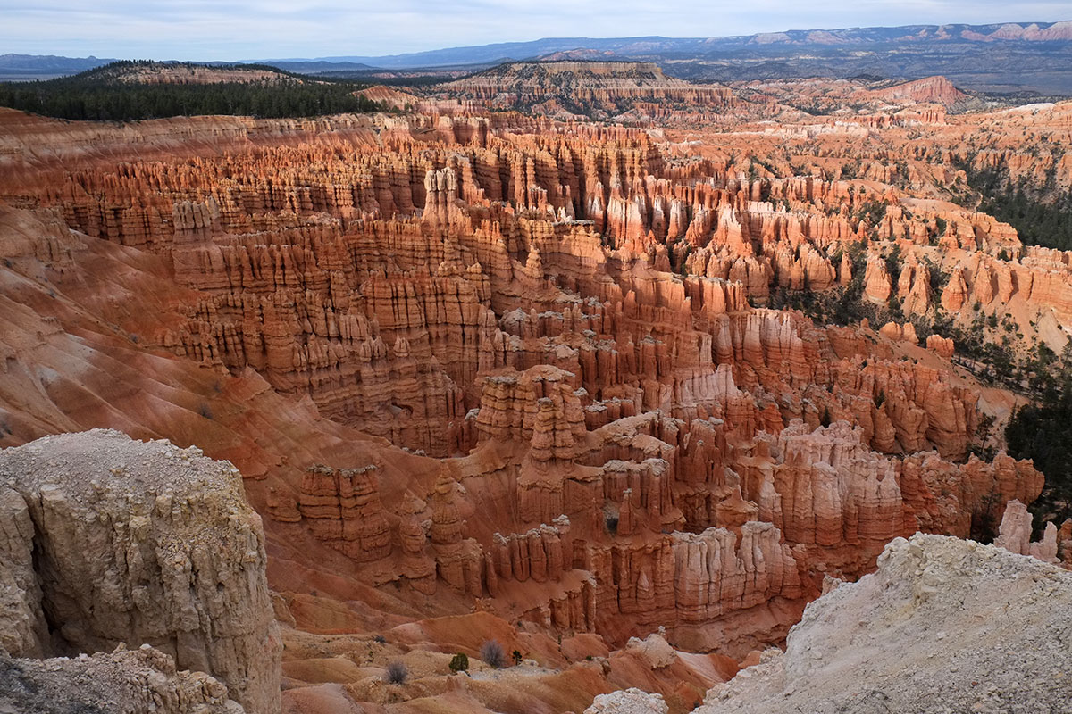
There were the big views out into the landscape, and closer views of astoundingly textured rock walls. With our fundamental lack of interest in the details of geology, we could only float hypotheses. Perhaps this formation is somewhat similar to Antelope Canyon, just not as smooth?95. Tsegi189DSCF8864

And as elsewhere at Tsegi, there is the astounding contrast between the red rock walls, and the river course with the cottonwoods putting out new leaves.95. Tsegi181DSCF8770

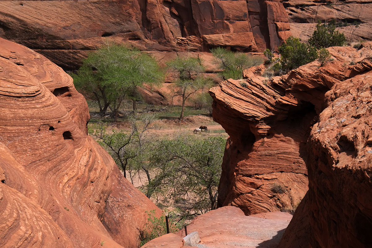
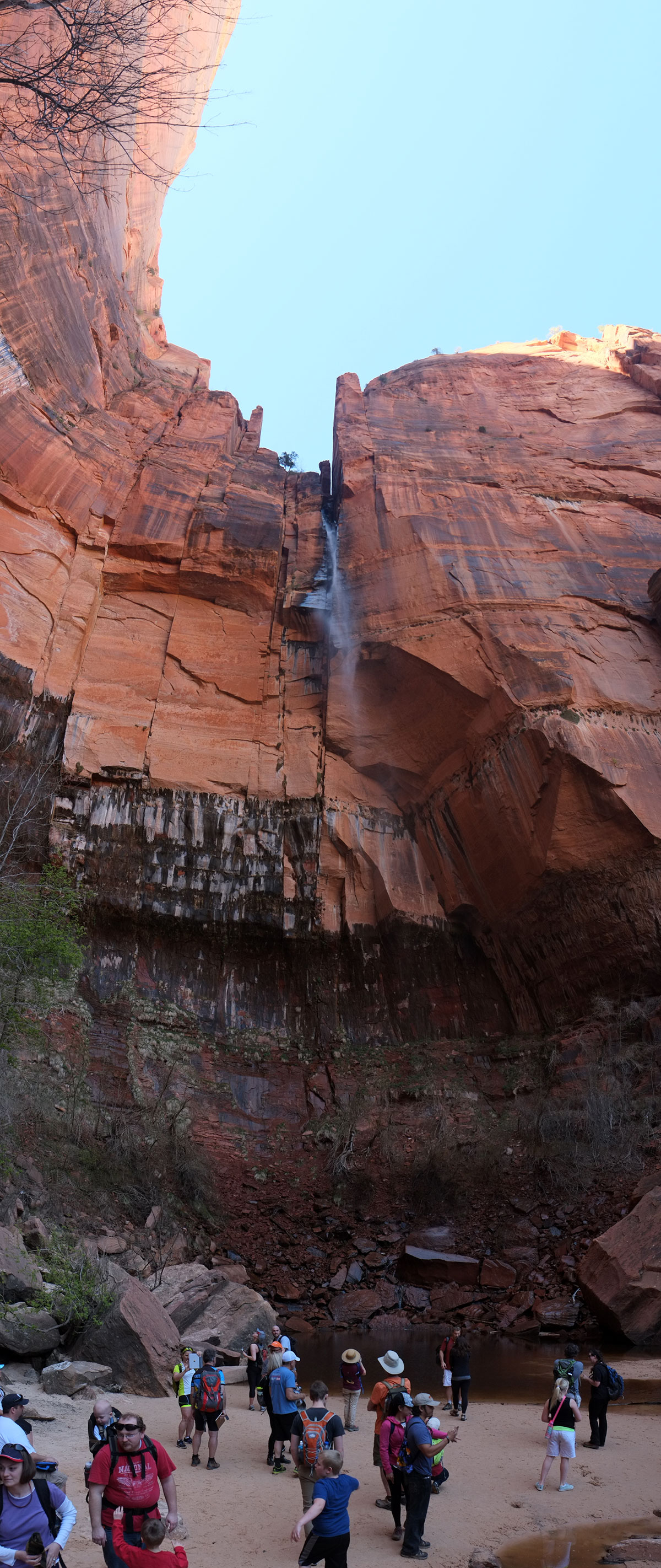
The view through the last tunnel was astounding. It reminded me of the entrance to Prospect Park from Grand Army Plaza, where there is a view through a tunnel under the roadway to the slope beyond, with one tree in the foreground. Did the Navajo hire Olmsted to place that tree here? (He probably would have moved it off-axis.)95. Tsegi183DSCF8779

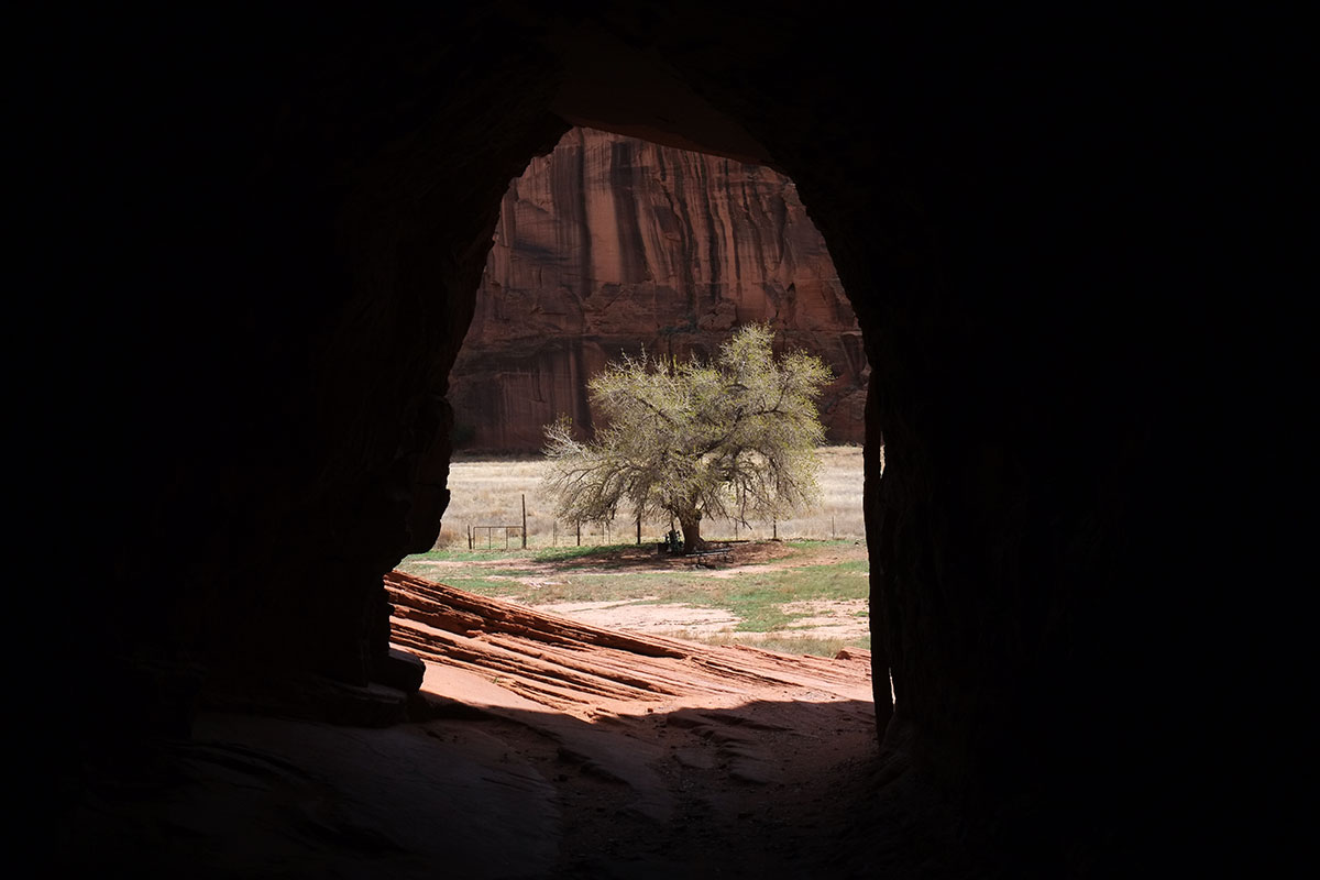
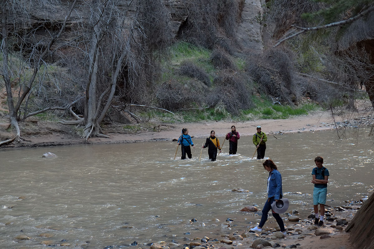
On reaching the bottom, the trail runs along the river, with the horses as the perfect scale figures in the landscape. This is what makes Tsegi different from all other places in the Southwest – the pastoral. Whereas most of the Southwest is beautiful for its awe-some qualities – the sense that untamed nature dwarfs us and our puny human sensibilities, and a few places are appealing because we think humans could actually survive here for more than a day – Tsegi is an inhabited landscape. We can see evidence of human habitation through time and into the present, and we have the stark contrast between the horses calmly grazing against the sheer cliff behind.DSCF8789WhiteHouseTrail031

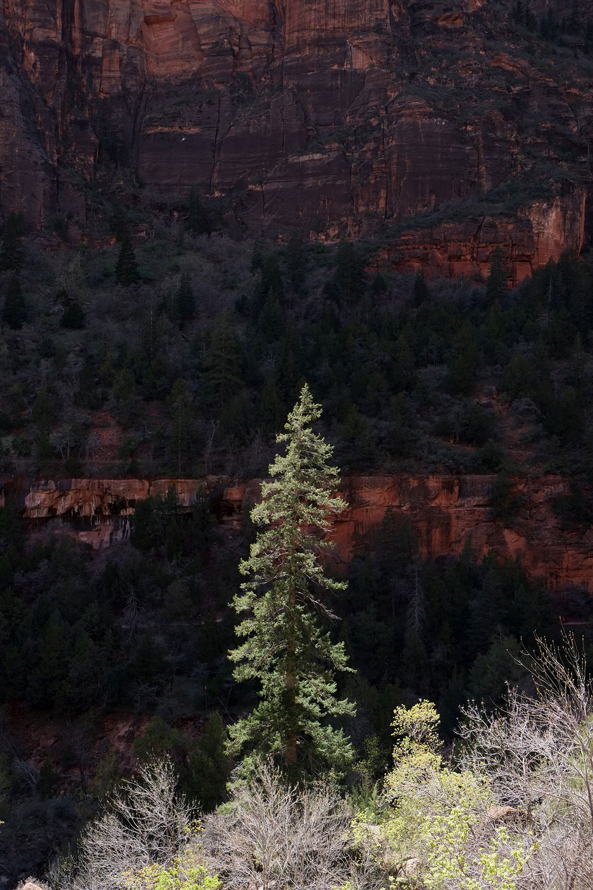
This contrast between the hard, barren cliffs and the life in the canyon plays out with the vegetation too. We were there in April as the bright-green leaves of the cottonwoods popped out. Living in the Northwest, cottonwoods are just one of the many trees we know, and we notice them mainly when they cover the bikepath along the Willamette with their seed pods; after a spring in the Southwest, I will never take them for granted again.95. Tsegi188DSCF8853

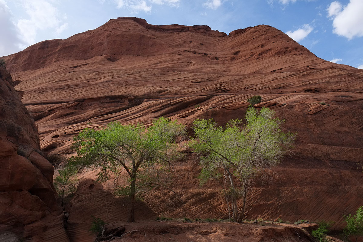
The trail arrives at the White House cliff dwelling – somewhat hidden behind the second cottonwood from the right.DSCF8794WhiteHouseTrail035

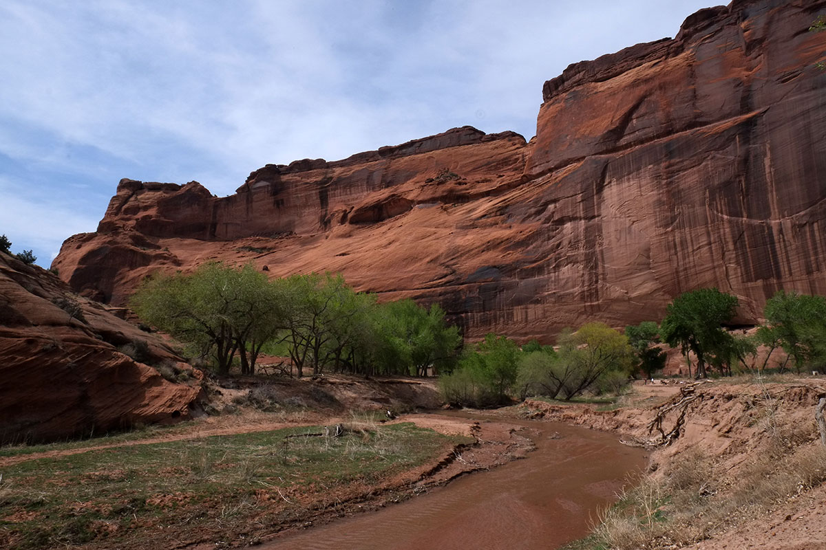
By this point we had seen several cliff dwellings and thought we comprehended them – not in the sense of completely understanding their history or context, but in the way in which they resonate with us modern humans – the way that they so perfectly embody the idea of dwelling: some primal neural pathway fires and we instantly and deeply feel the rightness of people living in these places, understanding them as our ancestors, across centuries of wild development. But seeing White House brings this to another level. The inhuman immensity, the outward sweep of the cliff above, poised over the tiniest marker of inhabitation. The recognition that within this astounding and hostile natural world, humans somehow made a place for themselves in a way that was not just about survival, but seems to embody the deep meaning of our place in that world.95. Tsegi185DSCF8814

We just sat and stared for quite a while, then wandered around the area, looking back at the White House from different perspectives. It was like seeing any great work of art – there is the instantaneous apprehension of its impact, but then you have to slowly consider it, let the levels of meaning sink in. It is a restful and quiet place – a couple of Navajos selling crafts, a jeep arriving with a family of tourists, a small herd of horses wandering by – but mostly there is the contemplation of the village, the cliffs, the river, the trees, the birds (and snakes). You just come face to face here with the history of the human species, making a place for themselves in this often harsh, yet beautiful world.DSCF8820WhiteHouseTrail059

Hopi Pueblo

MishongnoviP1090059

We live in a new country, with few places where the evidence of the distant past can be seen; when there are traces, they are seldom older than a couple of hundred years. The vast majority of our surroundings are quite new, and we live modern lives within that familiar context. So when Americans travel abroad, we often aim to see older places, cities and landscapes where traces of earlier eras survive. In first world locations, such as Europe, there is the strange contrast between the remnants of older cultures and normal modern life, not that different from ours. But sometimes we can experience not just the physical remains, but ways of life that are remnants of an older culture – perhaps in the food, customs, festivals, or folkways.

If we want similar experiences in our own country, the only place to go is the desert Southwest. The ruins of the ancient civilization there are the only widespread, significant remains of a pre-modern, non-European culture we have. But these ruins have been empty for over 700 years – the original inhabitants moved on – their descendants are no longer there. If we want to see the living, cultural descendants of this civilization, we can visit the pueblos.

As we wandered around the Southwest for seven weeks, we traced the migrations of the ancient native peoples through space and time. Our path wasn’t direct – we skipped around and circled back a few times to avoid winter weather in April. But their path was not very direct either, as they moved and their habitations evolved, partly driven by changes in the climate. There were early traces of inhabitation in pit dwellings, which then coalesced in the great center at Chaco Canyon. Chaco was abandoned, and the residents shifted into cliff dwellings, scattered over a wide area, but likely centered at Mesa Verde. The cliff dwellings were slowly abandoned too, and these ancient people moved south to the 21 different Pueblos, where they remain to this day.

Twenty years ago I had visited the Hopi Pueblo and been astonished. I remember standing on the edge of the cliff on First Mesa, looking across the desert to the San Francisco Mountains in a snowstorm and thinking, am I really in the United States in the 20th century? It was the most alien place I’d ever been, one where the history, culture, environment and language had nothing to do with the ones in which I lived, and it seemed bizarre that these people and I were now part of the same country; thinking of the US as an empire rather than a nation began to make a lot more sense. One of the major goals of this trip has been introducing Greta to very different ways of life, and life in a pueblo struck me as one of the most extreme outliers we could experience.

The Hopi reservation centers on the three mesas, (more accurately well-defined escarpments from one higher table land), completely surrounded by the Navajo reservation. The original villages were built on these mesas over 700 years ago, and have evolved over time – buildings come and go, and whole villages have disappeared too. The buildings are masonry, usually made from the local stone; when you look at one of the mesas from a distance, it is often hard to see where the native stone ends and the buildings begin, as here at First Mesa,

94. Hopi166P1090101


unless you zoom in closer.WalpiP1090085

There is strong sense of the buildings being of the earth. Local stone, adobe, and trees for roof framing (which had to be transported long distances).

The Hopi have not allowed visitors to take photos in their villages since around 1907. As early visitors often came to witness ceremonies and dances, the intrusive taking of pictures disrupted the rituals, and the Hopi wisely banned them altogether. (In fact, they banned all recording – including sketching and note-taking.) While residents of all historic venues have to put up with tourists poking around, it was probably extremely annoying here, as the Hopi themselves were the subjects of the photos as well as their surroundings.   So while I was somewhat frustrated by the photography ban (couldn’t they just let serious architecture professors take photos?) I respected their decision, and was frankly amazed that they had figured this out so long ago. So all the photos I have from the Hopi reservation were taken from long distances, well outside the villages from the highways below. However, the Hopi aren’t worried about earlier documentation (you can buy books of older photographs which show the villages quite well), or rigorous contemporary research (there is a project at the University of Redlands which is building three-dimensional digital models of the villages, including historic reconstructions).

We first visited Shongopavi on Second Mesa, driving through the newer areas on the outskirts of the village and walking in to the historic center. The houses are tightly clustered, one or two stories, sharing common walls. They surround small plazas, which are the sites of dances and ceremonies. The buildings are loosely rectilinear, but there is no rigidity to their location – there may be a more or less regular street wall line, but buildings set back various amounts. There are irregular passageways and alleys, and you simply find your way through the connections.

As soon as we arrived we were checked out by a few calm reservation dogs, who lost interest and wandered off. As we walked through one plaza, a young man named Benedict left his house and welcomed us to his village, explaining a bit about their life, and how he was working with youngsters to get them farming in a traditional manner. Eventually he asked if we’d like to buy some art, showing us some beautiful colored drawings he’d done of Hopi legends and spirits (kachinas). This established the pattern we’d find at all the other villages – many of the Hopi are artists, and make a living by selling drawings, and especially kachina carvings, to the tourists who come by. Greta and I are not really souvenir collectors (except for rocks and shells), but this was different; the work was really beautiful, and it also gave us an opportunity to talk to the artists themselves, who explained the meaning of their work and the processes they used. We met Robert on the other side of the plaza, a man of about my age who was watching one of his grandchildren. We were invited into his house, then we walked over to another house where he had more carvings stored. We ended up buying a lot of art on the Hopi reservation (and the other pueblos we visited), always from the artists themselves.

Talking to Robert was also our introduction to how the Hopi seem to feel about historic preservation. His house was a one-room masonry house, probably a couple of hundred years old, but it actually belonged to his wife’s family – the Hopi are matrilineal. Robert belonged to a different clan, and had moved there from another village on Second Mesa when they married. Robert remarked that his wife, as head of the clan, thought they should have a bigger, newer house, and she hoped to tear this house down and build the new one. We noticed that some of the nearby houses were newer, and often built of concrete block. I asked him how they felt about this, and he was unconcerned – it appeared that the physical house didn’t matter that much to them, but the location on the plaza did – that had been in the clan for a long time.

94. Hopi172P1090061

We headed over to the other Second mesa villages, Sipaulovi and Mishongnovi. All of the mesa tops can now be reached by roads built in the late 20th century.94. Hopi171DSCF8634

Again we wandered around quietly, trying to not intrude too much on people’s lives, although we did run into the only somewhat threatening res dog of the whole trip. As we passed a cluster of little kids, one small girl spotted the two palefaces in their big sunscreen hats, and excitedly called out, Hi cowboys! As we headed up towards the end of one small street, a woman came out of her house and told us we shouldn’t go that way, which was again something we encountered a few times. There are important ritual areas near the villages (especially some cemeteries) which should be avoided and certainly never photographed), but they don’t make a big deal out of it – no signs or barriers. They just politely but firmly say you can’t go there.94. Spipaulovi169P1090109

We also had a nice conversation with a high school boy who was weeding the plaza in front of his house in the photo above. He asked where we were from, and then asked what Oregon was like. I told him that we lived on top of a hill about the same height as his mesa from which we too could see mountains in the distance, but that our house was also surrounded by 100-foot-tall trees. He just stared at us in amazement. We then finished off the afternoon in a conversation with three guys who were probably high, and who had spotted us while driving by in their muscle car. They offered to show us around for $20, but I said we had already walked through the villages and were heading back to the motel. One pointed out that they could take us to forbidden places, such as the cemetery by the Corn Rock, and we could even take photos. I said we had been told that was explicitly forbidden, but he said it would be okay if we were with them. Eventually we negotiated a deal whereby they would leave us alone for $10, which seemed like a fair price for admission to their village.

The next morning we went to Old Oraibi on Third Mesa, where a much more respectable woman offered to guide us around, explaining the locations of the kivas, ovens, houses, etc. She pointed out the old mission church below the village (seen to the left in this photo) which had been burnt out in one of the not-infrequent revolts of the Puebloan people against the Spanish. Throughout the trip we became aware of the complex relationship between Puebloan people and the Catholic Church. It ran the gamut from devout Catholicism, to complete disavowal and a return to traditional practices, but many people seemed to fall somewhere in the middle, partaking in the traditional Hopi rituals while still attending the church.OraibiDSCF8640

In Oraibi we were also able to buy a Hopi staple, parched corn, from the aunt of our guide. Kernels are heated in a pot packed with sand, and the corn expands, but not nearly to the extent of our popcorn. It was somehow more satisfying and tastier than popcorn, and is taken along by the Hopi as a snack when they are heading out into the fields to work. When we mentioned this later on First Mesa, our guide was surprised to hear someone was selling this, and thought she might have to head over herself to track it down.

Walpi, at the end of First Mesa (about six miles from Second Mesa), is the oldest of the Hopi villages. We drove up a precipitous road to the top, then passed through the villages of Hano and Sichomovi. (Hano is inhabited by Tewa people, who have lived next to the Hopi for 600 years, but still speak their own language.) You must have a guide on First Mesa, so we met her at a small parking area before the narrow ridge into Walpi; if you pulled your truck a little too far forward you’d plunge a few hundred feet off a cliif on one side of the mesa, and if you backed up a little too far, you’d go off the cliff on the other side.94.-Walpi165DSCF8666

The site is extraordinary – First Mesa is like a ship in the desert, and Walpi is the bridge deck at the top.94. Hopi167P1090094

You can see 60 miles southwest to the San Francisco Mountains, or to the buttes in the southeast where the Hopi catch eagles for their feathers.P1090056

Beyond the narrow entry ridge, Walpi itself is just two streets wide, with one main spine of buildings up the middle, and a few other houses located on the east and west edges, along with the kivas and plazas. Around a half-dozen houses share each of the plaza areas.94. Hopi170P1090073

No one now lives in Walpi full time; when I was there twenty years ago I met an old woman who must have been one of the last residents. The different clans own the individual houses, and they congregate there for important festivals and occasions. There were two young artists we spoke to, who were using what I believe to be the Fire and Coyote clan house as their studio, to the left in the picture below. It was a narrow room, with windows looking across the plaza and desert to the east, and windows in the opposite wall looking out to the sunset in the west. It was a mixture of very old masonry and newer renovations, and they had plans on how they were going to fix it up further, some of which had to do with the pleasures of sitting outside on the west side barbecuing in the evening.WalpiP1090075

The nearby Snake clan house had been damaged by fire when a propane stove was installed incorrectly, and it was being rebuilt. I was surprised to see that a porch section, where the floor joists had probably been four-inch diameter trees was now being constructed with badly-sawn 2x6s and Simpson joist hangers. The same lack of interest in historic methods and materials we had seen in Shongopavi held true at this even older location, perhaps the oldest continuously inhabited village in the country. I couldn’t figure it out – many of the Hopi are fine artists, creating carvings, pottery, paintings and prints, but this widespread focus on artistic production didn’t extend to architecture. It may be due to poverty – selling art to tourists brings income, whereas restoring a house accurately would just cost more money. At Ebey’s Landing on Whidbey Island, many of the historic buildings are on active farms, where the owners can’t afford to restore or even maintain them in an appropriate way, so a fund has been established to provide grants for preservation work. Perhaps an arrangement like that could work here – gifts and ticket sales to tourists might generate enough capital.

This contrast between the incredible physical location, and the lack of economic opportunity in that remote location was evident throughout the reservation. Many buildings were in an extreme state of disrepair, and selling artwork and handcrafts was clearly a major source of income for many residents. Many of the younger Hopi we spoke to had spent years off the reservation – working jobs in Phoenix or Albuquerque, or in the military. The problems of rural areas in America are magnified here – by a more severe climate, extreme isolation, and limited employment opportunities.DSCF8660

There are signs of growth and development – a new school, a medical complex, plans for a new commercial center down the road from First Mesa. But all of this redevelopment is down below the mesas – the population in the traditional villages continues to decline. There are real disadvantages to living on top of a mesa – lack of running water and other creature comforts, lack of privacy, small cold houses. The newer housing down below is fairly standard for detached American houses, although somewhat inflected towards a more traditional Hopi style. The development pattern is typically western American too – large lots with small houses surrounded by many vehicles. The traditional day-to-day life in a small village has mostly disappeared, revived only for festivals and special occasions. But even if they are living in new buildings below, the Hopi are maintaining their traditional life in many ways, in the landscape where they’ve lived for 700 years. Just staying on the reservation is in itself a huge commitment, not succumbing to the attractions of modern life in a big city. Perhaps this move down from the mesas is just the latest stage of the Puebloan people responding to changes in the environment – from Chaco to cliff dwellings to the mesas, and now into suburbia.

CulturalCenterDSCF8647

We stayed in the motel at the Hopi Cultural Center for three nights – there’s no camping on the reservation, and the nearest spot off the res was 70 miles away. It was another opportunity to talk to the Hopi, as the place wasn’t just full of tourists, and conversations with local residents in the lobby late at night (where the wifi was strong) were really informative. The Hopi have a devotion to their separate culture, which gets defined in many ways, large and even small: Arizona doesn’t observe daylight savings time, while the Navajo do, but the Hopi, wholly contained within the Navajo reservation, don’t. We started to pick up on the cultural distinctions which we outsiders don’t often hear about. They live between two very different worlds, and while maintaining their own society, still seem very open to the outside world.

The Hopi we met were all remarkably friendly and welcoming, willing to explain aspects of their culture to us, maybe because it was April and they hadn’t gotten tired of tourists yet. But the more we learned of the culture, the more clear it became that we would never really be able to understand anything about it in a deep way. I’ve been rereading Reyner Banham’s America Deserta recently, and at one point he observes that native culture is essentially foreign and completely incomprehensible to him – there is no way he could ever comprehend what is going on. I think this is true – the natives have to understand enough about the American mass culture to survive within it, but I can’t imagine being able to understand this culture without being part of it. The paradox is that this is the one place in the US where we can go to see a non-European physical environment, inhabited by the current members of that culture, but there is still no way that we can truly experience it except as foreign tourists. But even being able to witness it from the outside was very satisfying.

There was one cultural event which we only learned about at the last minute, and unfortunately had to miss. Sitting in the lobby before we left I spoke with one of several young Jamaican guys I’d seen around the night before. He turned out to be a member of a reggae band that was going to perform the next night at the events center on the reservation. I later spoke to the young woman at the front desk about this, and she said, yeah, the Hopi really like reggae. There would be two bands at this concert, and there would be a traditional Hopi dance in the intermission in between. I mentioned how I’d seen these guys the night before and how I could tell they were from somewhere else. She looked at me quizzically, and I said, I thought that maybe they were Navajo. She cracked up and said, no, couldn’t be, the Navajo just like heavy metal.

The Grand Canyon (it’s all about the architecture)

93B.Grand Canyon02293.Grand Canyon137DSCF8425

The Grand Canyon is the Champion of One-Liner National Parks:  It’s the biggest canyon you can imagine, and it’s the biggest single thing you will see in any National Park (oceans don’t count).  When you first see it, you can’t really comprehend how big it is, until you spot some scale element at the bottom, such as a cabin, or a group of hikers.  (I’ve always thought they should build a replica of the Empire State Building in it.)   For the average visitor, this is why it is also the most boring National Park.

The Grand Canyon raises exactly the same tourist problem that became clear to us at Canyonlands. There are two distinct modes for visiting:  either you do the easy tourist daytrip, or else you commit to a multiple-day backcountry trip.  We would have loved to take a rafting trip through the Grand Canyon, but we realized that would have to be planned years in advance, and that was not our modus operandi this year.  We really didn’t want to commit to hiking down to the bottom, since our earlier altitude-related incidents made us leary of a 5000-foot climb back up with decreasing oxygen levels.  So we were stuck in the South Rim tourist world, which was not so bad since it was April and not the high tourist season of summer.

We decided to hike as much as we could, instead of driving or taking the shuttle bus along the rim, but even though it was beautiful, it got pretty boring.  The problem is the scale of the place related to the observer.  In Antelope Canyon, you walk ten yards and the view changes completely.  In Zion Canyon, you walk a mile and the view transforms slowly but appreciably, constantly revealing new aspects.  At the Grand Canyon, you walk two miles along the rim and nothing changes at all.  It’s like looking out the window of a space ship.  This explains the density of tourist-oriented alternative activities (such as shopping and eating) at the Grand Canyon, to give people something to do after they’ve looked at the view for half an hour.

I’ve been taking landscape photographs for almost fifty years, and the main thing I’ve learned is that the most overwhelming, giant landscapes make the worst photos.  Your eye is different from a camera, and the experience of seeing the Grand Canyon is very different from looking at photos of it.  But going to see it was on the checklist:  we knew that Greta had to see it, but we didn’t have to spend much time there.  Check.  Here is another picture to prove we were there.  DSCF8568

We had reserved a campground spot for a couple of nights, so how were we going to fill the time?  We fell back on our old standards of taking photos of tourists taking selfies, and looking at architecture.  Luckily, the Grand Canyon has some of the best and most important National Park rustic architecture that exists.  Mary Colter was the head architect for the Fred Harvey Company, the concessionaire for the Santa Fe RR and the Grand Canyon.  She designed the buildings on the South Rim from 1908 through 1937, and her work helped to set the style of “Parkitecture” that is seen throughout the system.

Her first commission was the Hopi House, which is a shop that sells authentic native craftwork.  It was also built by Hopi craftsmen – the quality of the masonry is exquisite.DSCF8472

Colter didn’t just make conventional buildings that imitated motifs of historic Puebloan edifices or cliff dwellings – she actually incorporated traditional construction techniques.  But in the best way of complementing the historic structures, she also didn’t slavishly copy them.  Rather, she studied the formal language which underlay them, and produced her own innovative designs using that language.DSCF8513

Her smaller buildings were destinations on the rim drive for tourists – places where they could rest and have refreshments. The Lookout is perched on the rim itself, growing out of the cliff in a way similar to that of the Hopi mesa villages.  (The interior is a gift shop at this point, which obscures the quality of both the spaces and the finishes.)  DSCF8454

93B.Grand Canyon03293.Grand Canyon147DSCF8530

The Hermit’s Rest is at the west end of the Rim Drive.  The plan and its volumetric expression are incredible: a lower porch zone, a higher wide & shallow nave, and a huge apse / inglenook. The spatial invention is amazing – taking traditional elements as a jumping-off point for explorations in space, structure, light and materials.

93B.Grand Canyon04093.Grand Canyon155DSCF8585

DSCF8578

The outside is not very visible nor emphasized – it’s mostly just the skin surrounding the interior volumes – but if you climb up the rise behind you can see the fun she had with the chimney.DSCF8574

93B.Grand Canyon04293.Grand Canyon157DSCF8600

The Bright Angel Lodge is straightforward in its use of structure, and (once again) amazingly detailed stonework.  DSCF8469

DSCF8449

I have never seen stones of this size used in a fireplace.  DSCF8519

The cabin area of the Lodge uses a kit-of-parts of a few cabin types, articulated in a a few different material types, combined in a site plan with small entry spaces and carefully-considered landscaping.   I had stayed in one of these small cabins over 20 years ago, in January, and still remember the pleasure of seeing the snow-clad Canyon in the moonlight, before heading across the icy walkways into my cozy cabin with a fireplace.  Taking a closer look at the architecture this year I was even more impressed. DSCF8557

DSCF8563

The most spectacular of Colter’s buildings is the Watchtower, at the east end of the South Rim.  The form refers to an element sometimes seen in cliff dwellings, though there the towers are always part of an ensemble tucked beneath the cliff.  Colter had the audacity to put this right on the edge, where it affords tremendous views and becomes that small scale element needed to understand the size of the canyon, without being obtrusive.  DSCF8403

The texture, craftsmanship, balance between rhythm and disruption, evocation of ruins without being too coy.  93B.Grand Canyon02193.Grand Canyon136DSCF8617

DSCF8388

The tower has a series of viewing levels, all decorated by native craftsmen.  93B.Grand Canyon01993.Grand Canyon134DSCF8389

There is a large round room adjacent to the tower base, which plays with kiva-like elements.  The use of wood framing actually shows how pre-historic rooms would have been roofed.  DSCF8619

DSCF8620

Just as seeing a broad range of Donald Judd’s sculpture in one place leads to a deeper understanding of it than seeing one isolated piece in a museum every once in a while, seeing this collection of Mary Colter’s astounding talent in one location allows you to appreciate the themes, subtleties, variations and development throughout her career.  She was lucky to have the opportunity to work on one of the most astounding sites in the world, and we’re lucky that she was one of the few architects around who probably wouldn’t have screwed it up.  For me, there is just the right balance of being respectful of the site and local vernacular traditions with a tremendous personal vision and design integrity.  For Greta, it was just the latest example that no matter where we went, I’d find some architecture to look at.

Antelope Canyon

92. Antelope Canyon01092. Antelope Canyon00592. Antelope Canyon010DSCF8289

Most of the people we’ve met on this trip have asked Greta which place has been her favorite.  She always had a hard time answering that – how do you pick one favorite place?  That changed in the middle of April, when we descended into Antelope Canyon.

It is absolutely the most surreal place we have visited.  It makes Bryce Canyon look normal.  It is a very narrow slot canyon, eroded by Antelope Creek (which empties into what is now Lake Powell, where the Colorado River has been dammed by the Glen Canyon Dam), and also by the wind blowing through.  Many people don’t know about it, since it has only been open to the public for about 20 years.  It is part of the Navajo Nation park system, and you have to go on a guided tour, of either the upper or lower canyon.  When it was first opened, guides were not required, and a group of 11 hikers was killed by a flash flood.  Since then, guides with walkie-talkies lead tours, and know how to get you out if a flood appears.  They also have rope ladders positioned along the top, which can be thrown down in an emergency.

We followed a bunch of Buddhist monks into the canyon.  I took this as a good omen.  92. Antelope Canyon00192. Antelope Canyon00192. Antelope Canyon001DSCF8213

The canyon as seen from above.  92. Antelope Canyon013DSCF8321

While the upper canyon is easily accessible, the lower canyon requires climbing down stairs, some tight squeezes, and a little rock scrambling.  They are apparently comparable visually, but the greater difficulty in accessing the lower canyon keeps the crowds down.  92. Antelope Canyon002DSCF8215

92. Antelope Canyon007DSCF8281

92. Antelope Canyon006DSCF8278

92. Antelope Canyon005DSCF8267

At a certain point, you just stop taking pictures.  As Greta said about Monument Valley, it’s impossible to take a bad photo here, and having yet another perfect photo won’t make a difference.  92. Antelope Canyon01292. Antelope Canyon00792. Antelope Canyon012DSCF8311

One of the aspects that makes it such an astonishing place is that the experience changes with every step.  When you look at a big landscape element – such as the Grand Canyon or a mountain range – from a distance, it always looks pretty much the same, even if you travel a few miles.  Antelope Canyon is a landscape at the scale of architecture – as you walk through, your perspective is always changing, and new vistas appear, the light and shadows change dramatically, people in your group disappear around a bend.  The photographs might be beautiful, but can’t begin to capture the spatial experience of being surrounded by sculpted stone and moving through it.  92. Antelope Canyon003DSCF8241

92. Antelope Canyon00692. Antelope Canyon011DSCF8275

It occurred to me here that all the architects who go to extraordinary lengths to make graceful curvilinear buildings should just give up.  Stick to straight lines, humans are pretty good at those.  92. Antelope Canyon00992. Antelope Canyon00492. Antelope Canyon009DSCF8284

92. Antelope Canyon00892. Antelope Canyon00392. Antelope Canyon008DSCF8282

We passed by Antelope Canyon again on our way west, three weeks after our initial visit.  (It is outside Page, Arizona, by the Glen Canyon Dam, the only place for hundreds of miles where you can scoot between the Grand Canyon and Canyonlands.)  As we drove up to it, I asked Greta if she wanted to go into the canyon again.  She thought about it, and said no.  The first time you see it, it is completely astonishing, even if you’ve seen photos and think you know what to expect.  A second visit couldn’t possibly match up;  we’ve gotten pretty blasé about some things on this trip, and she didn’t want Antelope Canyon to fall into that category.  I think if we wait a few years, the immediacy of the experience will diminish, and then we’ll be ready to visit again.

Intercepting the Colorado

91.NE Arizona023DSCF8157

We spent six weeks knocking around the Southwest, which basically means six weeks in relationship to the Colorado River – approaching, skirting, crossing, paralleling, viewing from afar, photographing, contemplating.  The Colorado and its tributaries organize the landscape on the Colorado Plateau, but unless you take a raft or kayak trip down the river, you seldom see it, as the river runs through deep canyons, across fairly impassable deserts.  It touches civilization at three points – at Moab, at Page / Lake Powell, and at Lake Mead / Las Vegas.  You can also glimpse it intermittently from far above at the Grand Canyon.  So those of us who are road-travelling have a very different perception of the river than those who are able to make river trips. They see it as a wilderness phenomenon, whereas we only saw the river where civilization had the biggest impact possible on the Colorado – where it was dammed.

Colordado-River

Our first contact was at Hoover Dam, where the river was dammed in the 30s, to form Lake Mead, without which Las Vegas (and many other desert communities) could not exist.  I had always realized that without this water the desert could not be settled, but it had not occurred to me that the electricity generated by the dam was the other half of the equation.  The photo below shows the relationship between the dam and the Black Canyon which it crosses.  The most notable new feature is the white ring seen above Lake Mead:  this marks the 150 foot drop in the level of the lake since 1983, due to the continual and increasing droughts in the Southwest.83. Hoover dam092DSCF7026

We toured the interior of the dam, seeing the turbine room and the tail races.  83. Hoover dam089DSCF6971

83. Hoover dam088DSCF6968

Hoover Dam is also always packed with tourists – even on a weekday afternoon in March.  It is very close to Vegas, so when families there get bored with the surreal built environment of the casinos and hotels, they day trip to Hoover Dam.  (Note:  you have to wait on line for a long time – and pay a lot of money – to see these spaces, but they are not notably different from the turbine room that is easily seen at Bonneville Dam on the Columbia.)  Every morning we stayed at Lake Mead, we heard a flock of helicopters approaching, as the richer tourists would fly in from Vegas to see the dam from the air.

The outdoor electrical infrastructure at the dam is even more impressive.83. Hoover dam095DSCF7034

We were walking across the top of the dam around 5:00, when these golden doors opened, and a crowd of men with lunch boxes appeared.  This is the workers’ entry to the dam – certainly the grandest one I’ve ever seen.  83. Hoover dam090DSCF7012

The top of the dam has a two-lane roadway which used to be the main highway into Las Vegas from the southeast. But post-9/11 security concerns led to the construction of this new bridge, which carries the highway traffic.  One can still drive across the dam (and go through a security check) but only to reach the visitor parking lots on the Arizona side.  83. Hoover dam087DSCF6965

As you walk up onto the bridge, there is a lot of information about the building of the bridge, so much so that even bridge geeks like me and Greta ignored much of it.  But this jumped out at me:  never before has the work of the construction manager been glorified in a bronze plaque!  83. Hoover dam094DSCF7033

I can almost hear the arguments leading to this one – how the documentation about bridges is always about the structural engineering, and not about the management of complex processes.  It’s great that this is included, but at a certain level I still can’t believe it.

The 180° panoramic view from the bridge, showing the approach roads to the dam.83. Hoover dam091DSCF7022

We stayed at the Boulder campground on Lake Mead, where you can see the extent of the lake. After spending weeks in the desert, seeing this much water is surreal.  There is a bizarre contrast between the cliffs which were formed by the Colorado, but which have been dry desert stone for millennia, and this brand new, enormous body of water, which in the summer is covered with water skiers, jet skiers, pontoon party boats and houseboats.  As someone who has spent his life in rowboats and sailboats in salt water (and who can barely acknowledge motorboats as real boats), seeing big, ugly, unseaworthy boxes floating on this lake offends my maritime sensibility.  But then I look at these astoundingly beautiful cliffs and canyons and think, it would be a lot more fun to explore them while sitting on a boat drinking a beer than it would be to hike in across the hot, parching desert and climb down cliffs full of rattlesnakes and scorpions.83. Hoover dam096DSCF7048

This gets at the essential quality of all this development in the desert – its complete artificiality, perhaps the clearest example we have of the domination of nature by humans in the 20th century.  I am used to thinking of Las Vegas in this way, but it applies equally to Lake Mead.  On this trip we’ve tried to approach the experience of places in the most direct, historically-based way possible – always trying to get out of the car and walk whenever we can, seeing how the pieces of the puzzle of human inhabitation fit together, and how humans necessarily had to acknowledge and integrate with the natural elements in a location to survive.  But out here in the desert, this is just not possible.  If you know what you are doing, and you prepare and are really careful you can survive for a while camping in these areas.  But everything in the environment is essentially hostile to humans, as opposed to our home in the Northwest, which is a remarkably benign environment.  It struck us repeatedly what a rich and technologically advanced civilization we are a part of:  we take it for granted we can easily head out into an environment such as this, survive, find it enjoyable, and just leave whenever we want.  We felt this again while driving the impossible roadway of Highway 1 on the California coast, or seeing the bridge over the Pecos River in Texas, or the levees up the Mississippi.  Our engineering feats have been astounding, and have made almost all of our national landscape accessible to anyone who feels like going there.  It is only fairly recently that we have started to see the costs and limitations inherent in what we’ve engineered.

83. Hoover dam097DSCF7056

The contrasts in the imagery can be compelling, such as with the air-conditioned survival boxes lined up against the forbidding cliffs of the desert.  I realized that we stayed in this same campground in 1978, but the shoreline then was right at the edge of the campground.  With the 150-foot drop in water level, that shoreline is now 1/2 mile away.83. Hoover dam098DSCF7059

We entered the zone of influence of the Colorado again in Hanksville, Utah.  It was a 40 mile drive to a launching ramp on the Colorado above Glen Canyon, so we were treated to the strange site of large houseboats stored in the desert.  DSCF7687

The Colorado briefly touches civilization in Moab, 50 miles above the confluence where it is joined by the Green River.  These are major wild sections of both rivers, so Moab is an important jumping-off point for rafting trips through deep, inaccessible canyons.

Cutting southwest at this point, through the Navajo reservation and Monument Valley, we arrived at Page, Arizona, where the Glen Canyon Dam was built across the river to form Lake Powell.  Three weeks later we crossed through his area again, as it is really the only route between Canyonlands and the Grand Canyon.  The second time we passed by Four Corners, where we participated in all touristically-appropriate activities.  It is a place where the contrast between the natural world and the abstracted, human-made world is vividly apparent.  In an area with impassable wild rivers, cliffs and deserts, the boundaries between four states are arbitrary straight lines intersecting at one point.  We did appreciate the further irony that this intersection of four US states is actually in a  Navajo nation park, and you have to pay an entrance fee to visit it.  91.NE Arizona013DSCF0493

The Glen Canyon Dam was built 20 years after the Hoover Dam, and its water and power supported the great explosion of human settlement in the southwestern deserts.  There is again the pairing of the dam with a separate bridge, although here the bridge was part of the original plan.  91.NE Arizona020DSCF8119

91.NE Arizona021DSCF8125

91.NE Arizona019DSCF8117

The nearby town of Page began as the settlement for dam workers in the 1950s, and remnants of its origin can be seen in such wonderful places as:  91.NE Arizona025DSCF8199but it is otherwise largely devoid of charms.

The landscape here shows the same intense contrasts as at Lake Mead – a huge expanse of water surrounded by cliffs – and it provides the same recreational activities.  Both times we stayed here the light was spectacular – the landforms of the Southwest are magnificent, but they are equalled by the skyscape.91.NE Arizona028DSCF8349

91.NE Arizona029DSCF8360

Our campground at Wahweap was one of our favorites on the trip.  I liked the views, but Greta was mainly preoccupied by the many jackrabbits that had overrun the place.  91.NE Arizona026DSCF8209

Outside of Page is the Horseshoe Bend on the Colorado, a spectacular attraction for tourists, and one where, since it is on Navajo parkland and not National Park land, the safety precautions are nonexistent.  91.NE Arizona023DSCF8157

Greta was careful with her photo poses here, as were many other tourists.  91.NE Arizona022DSCF8145

We could never figure out why, but these Japanese cowboy bikers were very insistent that Greta pose with them.  We think maybe they liked her hat.  91.NE Arizona024DSCF8163

At no other point on our trip were the contrasting pleasures of the natural and built worlds more apparent than at these points where civilization intersected with the Colorado River.  We were deeply affected by our experiences in the pure landscapes of the southwestern deserts – the landforms, views and earlier human habitations were literally awesome, and our subjection to the (admittedly minor) physical effects of the environment – the heat, the sun, the dryness, the difficulty of movement – contributed to our visceral understanding of the meaning of the places;  we wouldn’t have understood them in the same way if we had simply hopped out of an air-conditioned car to see them.  But after a few weeks in the desert you come to one of these massive, artificial lakes in the desert, and you can’t believe how beautiful it is.  Even if you have theoretical problems with them and the  whole way of life they have made possible, your initial reaction is that of all humans when confronted with a large body of water, especially in the desert:  they are giant oases, and I even began to think that a houseboat trip would not be so bad.

But at these same points the unavoidable – and now obvious – consequences of our activities are made visible.  The Colorado River was dammed, which both collected the water and generated the electricity which made large-scale inhabitation of the desert possible in a way unprecedented in human history.  That type of settlement is now one of the prime causes of climate change, which is contributing to the ever-deepening droughts of the southwest, which have caused the water levels behind the dams to drop substantially in the past 30 years.  Last week there was a good  New York Times article on how the changing conditions in the Southwest have gotten to the point where the decommissioning of the Glen Canyon Dam is being considered, which would let the Lake Powell water flow unimpeded into Lake Mead, leading to one possibly full reservoir instead of two half-empty ones.  But as a ranger explained to us about the already exposed lake bottom at Lake Mead, the pre-existing desert ecosystem would not spontaneously regenerate on land that has been underwater for decades – an invasive landscape of tumbleweeds has already taken over there.

Already the demands of these desert settlements for water and power have outstripped the capacity the dams can provide, and other facilities, such as the Navajo Generating Station outside Page, have been built to accommodate them, putting out yet more carbon.  91.NE Arizona027DSCF8327

We have had this immediate experience of the paradoxes of history a few other times on this trip – visiting the slave quarters at Southern plantations, or seeing the causeways that reach the port of Fourchon in southern Louisiana.  In each place we were confronted with the visible evidence of huge societal undertakings where the seeds of their own destruction were inherent in their foundations.  These places in the desert have provided yet another poignant stop on our Climate Change Farewell Tour, and the sense of their strange beauty is only deepened by an understanding of their larger impact on our world.


Monument Valley

DSCF8038

The one-line description of Monument Valley is, Really Big Objects in the Desert.  You don’t feel the boundaries of the valley, and you seldom feel that you’re in a defined place.  Mainly you drive across an open plain, and these extraordinary, imageable, gigantic things are looming in the distance.  You can’t get close to many of them (as they are off the road), and getting closer doesn’t really change the experience anyway.  It’s like looking at a star, and then using a telescope – it’s the same thing, just a little bigger.

What you really notice here, even more than at other places in the Southwest, is the play of light and shadow across the landscape.  The distances are so great that it takes a long time for a shadow to move an appreciable distance.  The light and shadows are equal with the landforms in determining the view – the same view seen at two different times varies dramatically with the movement of a cloud.  DSCF8019

DSCF8056

Our experience of Monument Valley was the most mediated of any place we went in the desert.   It is most famous for its role in dozens of westerns, including the great ones of John Ford.  We stayed in a campground connected to the Goulding resort.  The Gouldings were a young couple who came to Monument Valley in the early 1920s and set up a trading post on the Navajo reservation.  This is the building they lived in, on the upper floor, DSCF8073

while the trading post occupied the ground floor.  DSCF8012

When the Depression deepened, many of the distributors they depended upon went out of business, and they and the Navajo were in bad shape.  They heard that Hollywood was looking for a locale for shooting westerns, so they traveled to LA and met with John Ford, showing him photos of Monument Valley.  He decided to shoot Stagecoach there, which was the beginning of decades of filming.  The actors and crew stayed at the Goulding’s inn, and many of the Navajo were employed as extras, especially in scenes which required serious horse riding.  The old part of the Goulding’s is now a museum, with lots of movie paraphernalia.  The storage building below was used as John Wayne’s quarters in She Wore a Yellow Ribbon.

DSCF8010

There is a small theater, and every night they show an old western.  We saw The Searchers and Stagecoach, and it was strange to see the same landscape elements appearing in scene after scene (even when the locations were supposed to be hundreds of miles away).  The experience raised some of the same questions that arise when you see a painting you’ve seen reproduced many times – can you actually see the Mona Lisa, or is your perception so warped by the prior exposure that any genuine experience is impossible?  At a certain level, this is the appeal of the place to visitors.  It is a deeply meaningful place for the Navajo, but for us outsiders, it exists as the locus of image-making.   The tourists we met were largely French and Japanese, who must have seen it in westerns and so came to this place.  I think that the lack of Chinese tourists was due to their isolation from the west during the peak years of the western.  I was surprised at the absence of Germans, as I know that the American West has long been a popular subject there.  (Perhaps it is because their connection to the West comes from a series of books, and not the movies?)

This aspect of our visit was reinforced by some other factors.  Monument Valley is a Navajo park, and the experience is quite different from the one you have in a National Park.  Highway 163 runs through the Valley, and you can see most of the iconic monuments just by driving through.  There is also a 20-mile dirt, loop road through narrower branches of the Valley.  But there are not many opportunities to get off these roads to go hiking.  There are many spots in the Valley that are sacred to the Navajo, and they are off-limits to visitors.  The few trails that do exist are not very appealing – your experience isn’t very different from what you have on the road.  For example, there is a trail that circles one of the big buttes.  But you can’t approach it very closely, or climb it, so you are just walking around in the full sunlight in a very hot desert, getting a slightly different view of a butte that looks much the same from all  sides.

There was one excellent but short trail, up the cliffs above our campground, which led to a big arch.DSCF8070

There were intermittent views out to the larger valley, with glimpses of the monuments,DSCF8067

and views to the campground.  When we started our trip and camped at Craters of the Moon in Idaho, we thought it was really weird to be camping next to giant hunks of lava.  By the time we got here, we thought it was completely normal to have a campground full of RVs in the middle of sandstone canyon.  DSCF8063

The drive through the canyon branches was beautiful, and the scale was different from that of the big valley with the big monuments.  DSCF8032

DSCF8046

DSCF8047

DSCF8027

The road circles back to the main valley.  DSCF8051

While some parks in the Southwest can be experienced at a wide range of scales, in Monument Valley it is overwhelmingly about the Big View.  This is why the movies were shot here – it is completely scenographic, and the monuments are large enough to still be visually compelling even when far in the background.  As Greta observed, you can’t take a bad photograph here.  It contains  the iconic representations of The West that were implanted in our brains in childhood.  It is the land of Roadrunner cartoons.  But even though you’ve seen the views hundreds of times on film, they are still stunning in person.  Nothing moves but the clouds.  It is completely quiet.  The scale is literally awesome, as your mind can barely grasp the size of the buttes and the distances between them.  The tourists stand transfixed, not quite believing this is real.  The landforms don’t move, but the cloud and the shadows slowly do.  The light changes constantly, sometimes quite quickly, and the same view can appear remarkably different, when you see it at different times.

DSCF8014

DSCF8018

DSCF8075

DSCF8082

Visiting Monument Valley is a very passive experience – you don’t hike, you don’t modulate your experience, you just look.  But it’s a very satisfying view.

Arches National Park

DSCF7816Arches National Park should be a one-liner park.  It has 2000 stone arches or natural bridges, so that should be what it’s about.  But as Edward Abbey wrote in Desert Solitaire, which is his account of being a park ranger there in the 1950s, the arches are least of it.  It is about experiencing the totality of the landscape, the wildlife, the ecology;  the arches are just the exclamation point.

We spent a few days hiking in the park with that approach, for which the park is well-structured.  There are a few arches which can be viewed from car-accessible overlooks, but most of them require hikes with easy to moderate demands.  The hikes were superb – lots of scrambling on slickrock, and at the end of a few miles of enjoyable activity, there was the payoff of the arch.

There is the Windows trail, a very short hike to a big arch (with Greta as the scale figure).DSCF7823

Which is near the Double Arch.  The cool thing here is how you climb into the middle, where you are in a space that is enclosed by a cliff on one side, and arches on two others.DSCF7859

Our favorite was the Double-O trail, a few-miles long, which starts out in a narrow canyonDSCF7868

and then opens out, closes, in, constantly revealing different vistas DSCF7870The first big arch on the trail is the Landscape Arch, the longest and most delicate in the park, about 300 feet across.  DSCF7876

You can’t walk under it, as a few years ago part of it fell down while there were hikers right there.  DSCF7882

There is some great climbing, up this rock face (you can see the people behind us at the bottom of the picture).  DSCF7884

At this point on our way back, we did our good deed for the day.  We were asked by some middle-aged hikers whether the rest of the trail was easier or harder, as one of their group had vertigo.  We told them it was a lot more precipitous, and so we saved her from getting to this point.  DSCF7920 The rock formations in this area are big fins, DSCF7940and part of the trail runs along a fin ridge.  Greta as scale figure in the landscape once again, with the La Sal Mountains in the background.  DSCF7928

We passed another arch in the landscape DSCF7887

and then this giant appeared.  DSCF7889

Arches do come in all sizes and shapes – we’re not sure if this one counted towards the 2000+ tally:  DSCF7967

At the end of the trail is the Double-O Arch. DSCF7910and views further out into the landscape.  DSCF7905

We saw the famous Balanced Rock.  DSCF7955

Finally we hiked in to the Delicate Arch, a clamber up hundreds of feet of slickrock;  we were getting used to altitude by this point, and staying seriously hydrated.  DSCF7966

Delicate Arch is freestanding at the top of this rock bowl.  The people walking towards it in this photo are on a slightly-sloping surface, and the slope increases continuously towards the bowl to the right, to the point where you might find yourself on a rock face that is just too steep, facing a drop of hundreds of feet below you.  We all watched as one woman dropped her water bottle, and started to go after it until she thought better of it.  The bottle rolled back and forth on the slope, picking up speed, and then finally bounced to the bottom of the bowl.  DSCF7976

As I walked toward the arch I couldn’t stop thinking about that water bottle, which certainly held me back.  But it didn’t bother Greta at all, and she made it out for the photo op.  DSCF7981

Arches was one of our favorite parks – the landscape is spectacular, there are things to pay attention to at all scales, and the hikes were just right.  We had been frustrated by some parks where you either can see a little from car overlooks, or you have to commit to a much longer hike.  In Arches you can get out into the park and see a lot, all within the range of the committed day-hiker.

Canyonlands

As I’ve observed, some National Parks are one-liners.  Some are big and have many varied and interesting parts, such as Yellowstone.  And a few are vast and almost impenetrable wildernesses, such as Canyonlands.  I thought the name was kind of funny, more like a theme park than a National Park, as if it were some microcosmic, Disneyfied presentation of the ideal of “canyon”.  But it is the opposite.  It’s huge, and it comprises many distinct parts, all of which fit under the umbrella of a canyonland-type landscape.DSCF7794

You can’t cross it, unless you want to mount a serious expedition.  (I wish that before I began plotting this trip, I had been fully aware of the extent of all the Really Big Things you can’t cross for hundreds of miles out west, such as the Grand Canyon, the southern Sierras, and Canyonlands.)  Dead-end roads enter Canyonlands from the sides, but they don’t go very far, and are really just jumping-off points for much longer explorations by foot or serious vehicles, or by boating through the river canyons.  For example, we took a 40-mile dead-end road to get to the Needles area, but when the road ran out, the Needles were still miles away, DSCF7779and to explore them you really need to backpack for a few days.  From further north you can take a road that gets you within miles of the confluence of the Green and Colorado Rivers, but it’s still a hike to view it from the rim.  The most amazing-sounding part is called the Maze, which is entered from the west side.  I read Edward Abbey’s description of heading in there in the 50s, and quickly realized we should just stay the hell away, as it isn’t any more accessible now.

So we took the daytripper approach, driving in from Moab until the pavement ran out, and taking a few short hikes around.  (We were still in altitude-wary mode, after the Zion incident.)  First we came to Newspaper Rock, which is a large outcropping covered with petroglyphs.  No one is sure when these images were produced, or over how long a period.    Our attitude towards them is similar to our attitude on geology – we just don’t care to learn that much about them, we just think they’re cool.DSCF7700  DSCF7698

One hike was Slickrock Foot, on top of a mesa, with views out across the big landscape, to distant canyons, buttes, mesas, etc. DSCF7774 It was beautiful, and it was reasonably interesting hiking.  We’ve discovered we like hiking over “slickrock” a lot.  We come from a land where you’re usually hiking on dirt (or mud), with some rocks around.  But to be in a landscape where the whole ground surface is exposed rock is a blast.DSCF7771  You get a nice sense of how steep a slope will give you enough friction to just walk up, or when you have to start looking for flatter surfaces or handholds.  We think of it as rock-climbing for older and more timid people.  One of my worries when Greta was growing up was that she would fall in with Oregon’s large population of maniacal rock-climbers, and I have been very pleased to find out that she’s no more foolhardy than I am.

Another short hike was at Pothole Point, around some enormous rock-thingees that were too small to be buttes but too big to be boulders. DSCF7782 There were trees and smaller eroded rocks around, which looked like they had been placed there by some designer trying to achieve the world’s most overscaled Japanese garden. DSCF7786

Our favorite part was the area called Cave Spring.  Like many other places around here, harder rock was formed on top of softer sandstone, which erodes when exposed, leaving large overhangs of slickrock.DSCF7708

Some of which look rather threatening.DSCF7753

One area of overhang was used by the natives and later by cowboys as sheltered campsites and the remains of this have been preserved.DSCF7705

We climbed up on top, which was about a 100-acre landscape of slickrock. The small canyon where the spring emerges could be clearly seen between the rocky cliffs.DSCF7728

And there were large boulders on top of the rock surface too.DSCF7735

As we wandered around, we saw a squall approaching across the desert, which briefly soaked us, and then left all the rock surfaces shimmering in the light.  This lasted about 10 minutes before it all evaporated.DSCF7743

This was exactly the kind of environment we enjoy – a boundary which defines the place, while allowing views out to the larger world.  Refuge and prospect, as they say, and this was a classic example.  It is so much more satisfying to us than being out in the trackless space of the desert.  As we travel, we are finding that lots of these places have been inhabited and named by humans over time.  Most of them have been canyons or sheltered areas, but in this case being on top of the rock gave that sense of definition and place.

As we left Canyonlands we realized it fell into a certain category of park or landscape – if you visit it in tourist mode, it is interesting for a day – there are some short trails, but not much in the intermediate length.  To experience it beyond what we did, you would really have to invest at least a week in exploring it on foot.

Bryce Canyon

DSCF7523

As we travel from National Park to National Monument in the Southwest, we find that many of them are one-liners – they have been deemed significant by virtue of one outstanding feature.  In Bryce Canyon, this might be termed Infinite Numbers of Really Tall Weird Eroded Thingees. The technical term is hoodoos (not much more refined than thingees), and they are the result of geological processes which don’t really interest us, but as far as we can comprehend, are mainly erosion by water and wind.

What did interest us is how incredibly cool they are.  Bryce is one of those places where you get your first glimpse and you say, That can’t be real.  It’s Max Ernst on acid.  They are incredibly strange, and they go on for miles and miles.  They are basically the same, but there are many variations on the theme, and they are all interesting.

We got our first exposure from viewpoints along the rim road.  The big picture is fun, you understand the scope, but then we wanted to see them up close.  DSCF7506

Fortunately, Bryce has a few trails down from the rim to the canyon floor.  Bryce is even higher up than Zion – the rim varies from 8000 to 9000 feet, and the oxygen levels are apparently about 70% of those at seas level.  After our experience at Zion, we didn’t want to get to the bottom, try climbing up, and find ourselves flopping around like fish.  So we took the relatively sane combination of the Queen’s Garden trail down and the Navajo Loop trail up, about a 600 foot climb.

Looking down on a canyon is cool, but once you start to move around inside it is even better.  DSCF7510

As you descend, vegetation starts to appear.DSCF7513

You begin to get a sense of the scale of the individual hoodoos.  DSCF7519

DSCF7522

DSCF7518

At the bottom, the balance changes, and you find yourself walking in a piñon forest with hoodoos appearing, or looming over you.  DSCF7530

DSCF7534

The ascent on the Navajo trail  was quite different – a narrow canyon with relatively few hoodoos. DSCF7541

DSCF7543

Back to the rim, looking into the big area known as the Bryce Amphitheater.  There are rows and rows of the hoodoos, and you start thinking you can see a pattern to them.  DSCF7605

DSCF7600

There is one area where it is impossible to convey the scale in photos.  It looks like ruins that you keep trying to make sense of.  DSCF7621

I later looked at the map and found out it is called the Silent City.  DSCF7623

Other, smaller items do eventually get noticed.  This was one of the first places where it became clear to us that wood just doesn’t rot here.  DSCF7644

DSCF7612

Greta also discovered a mountain lion print in the snow.  DSCF7572

The weirdest place we’ve ever been.  What we don’t understand is why such a high percentage of the world’s weirdest places are in this one corner of the US.  That would probably involve geology.  DSCF7585

Zion National Park

Travelling in the Southwestern desert means visiting many canyons.  They are all beautiful, many extraordinary; but if you are a northwesterner, eventually you are discomfitted by the extreme sun, heat and aridity, and start longing for some greenery, a little water, maybe some trees. Then you reach Zion Canyon, and you feel that you’ve arrived in the Promised Land.  The name makes sense, as this seems to be a place where humans are meant to be, a refuge from the desolation of the outside world.

There are other inhabitable canyons scattered around the Southwest – we’ve been seeing more in recent weeks as we’ve visited ancient cliff dwellings and modern reservations – but Zion is by far the grandest, the most spectacularly appealing, the American Shangri-La.  We decided to spend a few days here, soaking up the atmosphere.

The canyon itself is about twelve miles long, with a road up the middle.  When I last visited here in 1978, you could drive up the road, but its capacity had been overwhelmed, as Zion now has 4  million visitors per year.  So the Park Service has followed the example from the Grand Canyon and instituted a shuttle bus system – which has service every 10 minutes, and drops people off at major sights and trailheads.  It works incredibly well, and keeps the milieu from becoming that of a traffic jam with scenery.  They also have a unique solution to the parking problem, with demand again far exceeding the size of their parking lot (which can’t easily be expanded, because it’s a narrow canyon).  The town of Springdale lies right outside the entrance to Zion, and you simply park somewhere on the street in Springdale, walk over to the main street and catch a different shuttle bus to the park.  Surprisingly, this worked just fine, but I wonder how crowded it gets in the summer.  But it is satisfying to see an innovative, local solution to this problem, rather than defaulting to the typical huge expanse of asphalt.  And when you get off the shuttle late in the day, there is a nice restaurant right near your car.

Even though the park shuttle is a good solution to the car problem, we didn’t want to take it.  We have been driving a lot, and seeing the canyon from another vehicle wasn’t appealing.  Plus we’ve found that stopping at specific points to see a sight, then getting back into a vehicle to drive to the next one isn’t at all satisfying – whether we’re in a landscape or even in a city.  We like to walk, and see the gradual transformation of our surroundings, understand the continuum of the place, and not just the episodes.  So we walked the length of the canyon, from the entrance to the Narrows, where the dry trail disappears into the river.  The twelve-mile route rises from about 4000 to 5000 feet, and the surrounding mountain peaks are in the 6000-7000 foot range.  For the first few miles of the route there is a trail along the river, and it is very pleasant.  The cottonwoods were leafing out, and the vibrant green of the foliage stood out against the dark cliffs.DSCF7369

But after this stretch there is no trail, and you’re supposed to walk on the two-lane road.  It’s not terrible, as the only traffic is the buses, some bikes, and the few private cars being driven by people who have rooms up-canyon at the lodge, but it’s not the same as walking on a trail by a river beneath the cottonwoods.  We’ve become even bigger fans than before of the National Park Service – they do an incredible job of managing these parks, and making very good decisions at every level.  Our main criticism of their worldview is the assumption that Americans are in their cars until they get to a destination, such as a trailhead, and then they get out and walk.  The climbs at Zion are beautiful, but it seems that the main point of the whole place is the canyon itself, and encouraging people to experience that on foot would be a good thing.  Our third day there we saw huge lines in the morning for the shuttle bus – I bet that if there were a clearly delineated and named path, a lot of people would choose to walk, including many people who aren’t able to do a mountain climb.  Maybe they’d even keep walking when they got back home.

DSCF7408

Walking changes your whole perception of the park in another way.  The canyon walls at Zion are tall and uninterrupted, except for a few shallow side canyons, but they are not continuous cliffs.  They are composed by a sequence of distinct mountains, which are distinguishable from each other by form, and often by color.  Each mountain is imageable, and so they have all been named – the Watchman, the Court of the Patriarchs (many have quasi-religious allusions), the Temple of Sinawava, etc.  This naming emphasizes Zion as a sequence of objects, whereas I think you experience Zion as a series of spaces, even as large outdoor rooms.  You can experience a canyon from above on the rim (the Grand Canyon comes to mind), or from the canyon floor below.  In the first case it is a view, and in the second you are within a place, looking up at the walls around you.

As you walk up the canyon, you sense the walls gradually closing in.  At the visitors’ center, the floor of the canyon is about 3/4 of a mile wide (including the gradual slopes that lead up to the cliff faces).  Within a couple of miles it closes in to 1/4 of a mile, and eventually is under 1/10 of a mile at the head of the canyon.  This sense of a deepening and shadier canyon is clearly felt, so that when you arrive in front of the Lodge, and the canyon widens out around a large lawn with a tree in the middle, you stop in wonder at the transformation.  DSCF7381It’s a wonderful spot, with people picnicking, kids turning somersaults, hikers resting their feet, and everyone looking up at the surrounding walls.  The topography makes the place, and it has been carefully enhanced by subsequent interventions.

There are several other points where the river bends and creates a room , such as here where a butte stands as an object in the middle.  DSCF7414

Eventually it closes in with one last turn,DSCF7424

and you enter the Narrows, where the river takes up most of the space between the cliff walls. DSCF7444

and finally the dry trail disappears altogether.DSCF7450

You can continue hiking, either getting cold and wet or renting a wetsuit for a longer hike.  DSCF7454We decided to do that, arrived the next morning, and were confronted with signs saying that a flash flood was “imminent”, and so we weren’t able to hike further through the Narrows.

We did a few side hikes, up to see the three Emerald Pools, low, middle and high, which are along the drainage of a side canyon, each of which waterfalls into the next lower pool.  DSCF7396

DSCF7401

The next day we attempted the trail to Angel’s Landing, a 1500 foot climb up a steep rocky trail to the peak of a mountain poking out in to the middle of the canyon.  We made it up through Walter’s Wiggles, 27 switchbacks cut into the sheer rock face – you can see a couple of them on the middle right-side of this photo – look for some hikers wearing brightly-colored clothes under the overhangs.DSCF7461

Here is Greta on one of those switchbacks.  As we hiked through the subsequent narrow canyon in a saddle, she became dizzy, so we turned around and rested under this overhang, and then headed down.  We are low-altitude people, and hiking around 6000 feet means there is way less oxygen than we’re used to, something that occurred even more noticeably later at Bryce, where we were climbing at 8000 feet. (Greta later read an article which pointed out that young people are more susceptible to altitude sickness. As you get older, your brain shrinks, and there is room for it to expand within your cranium with altitude gain.) DSCF7466

We were disappointed to not make it to the top, but the view from halfway up was still worth it.  DSCF7464

The canyon floor remained our favorite spot, with the starkness of the mountains making you appreciate the lush river bottom land even more.  DSCF7470