Category Archives: architecture

Cliff dwellings

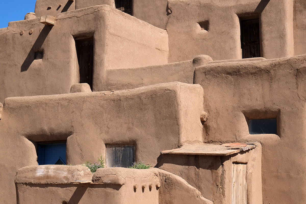
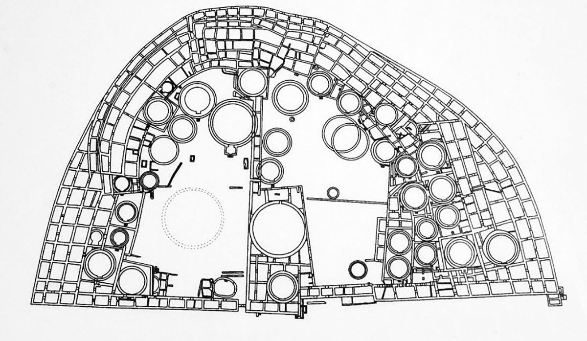
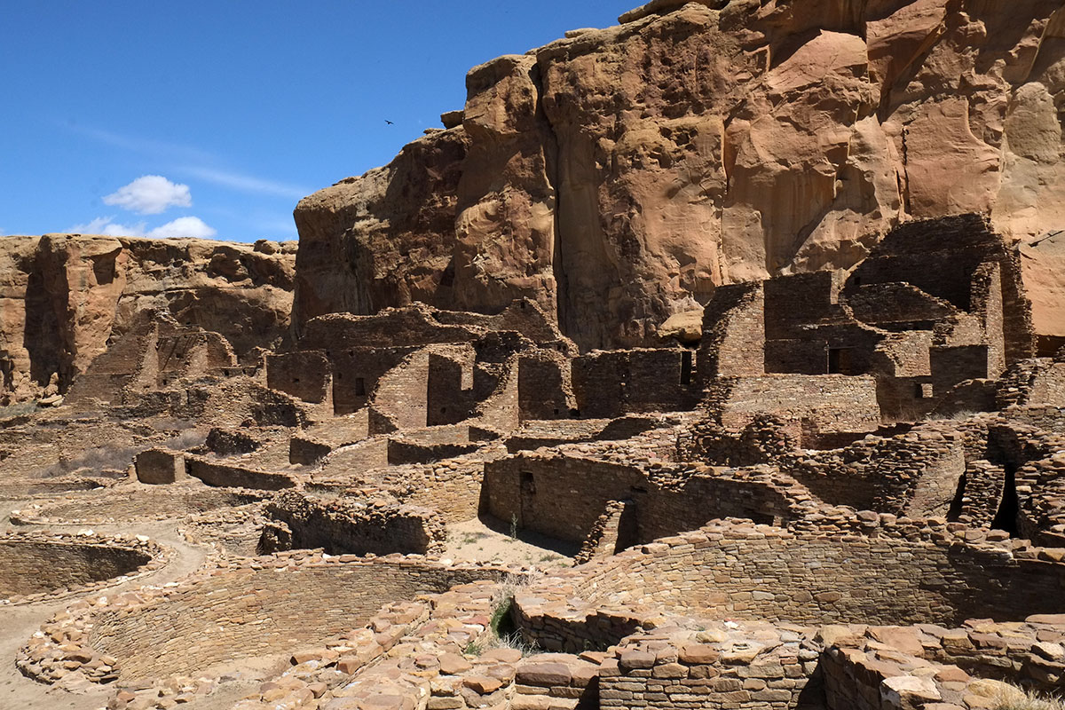
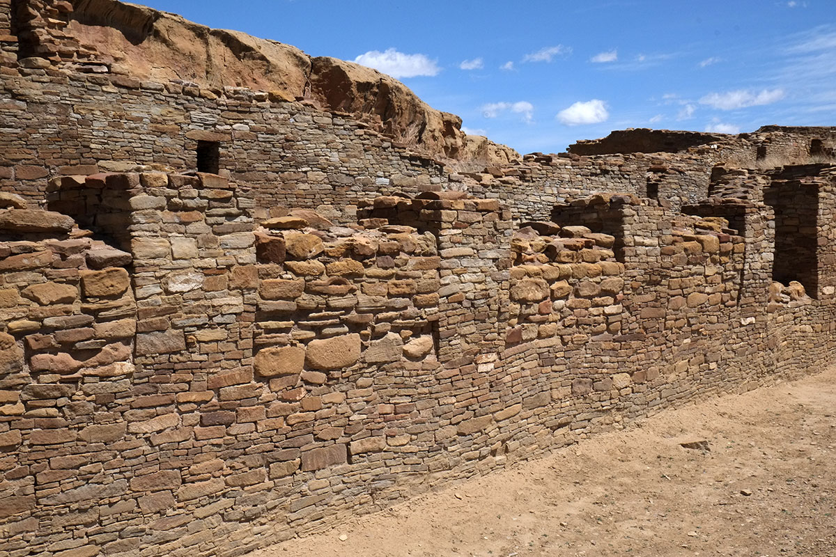
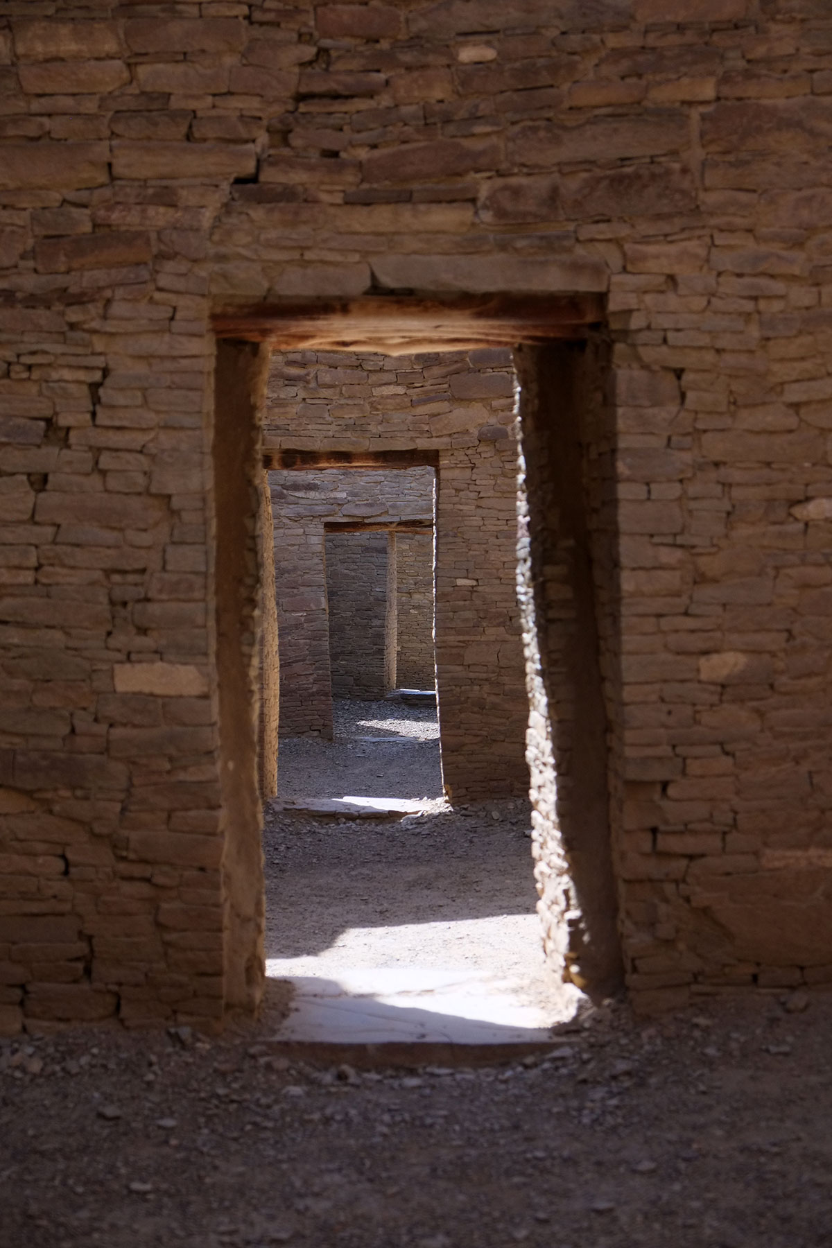
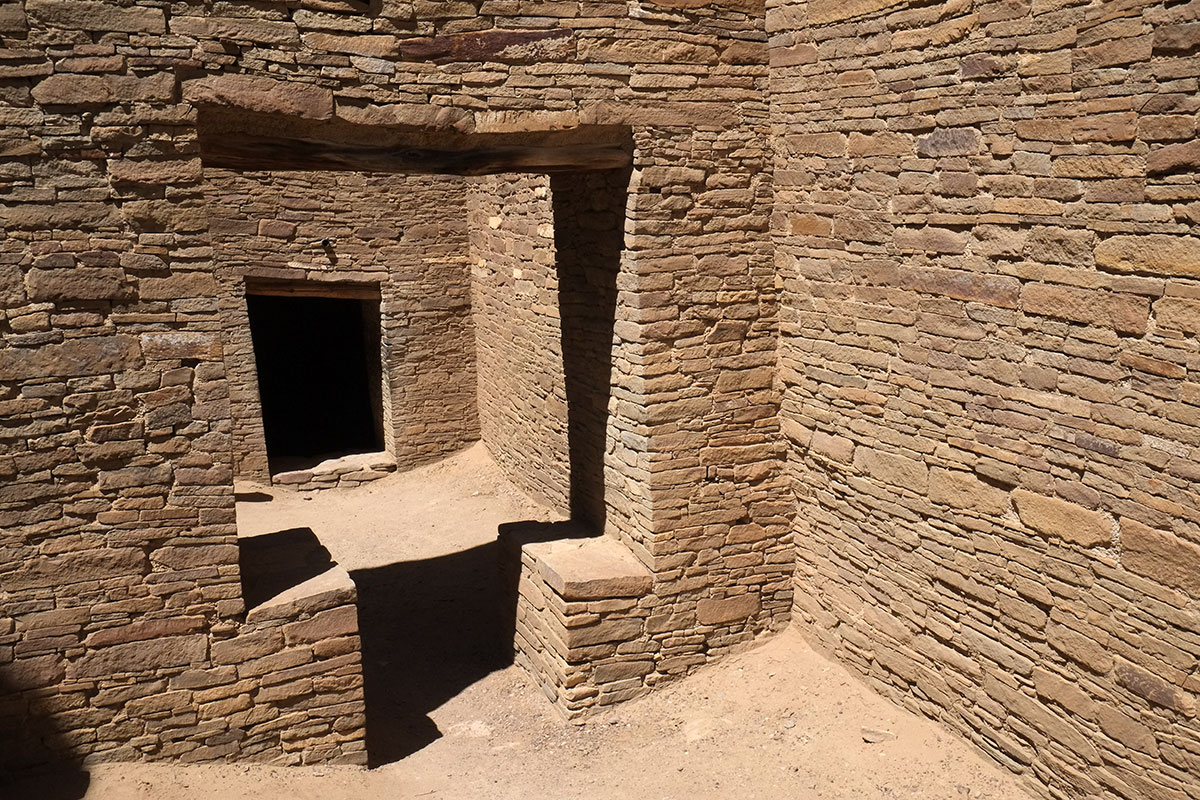
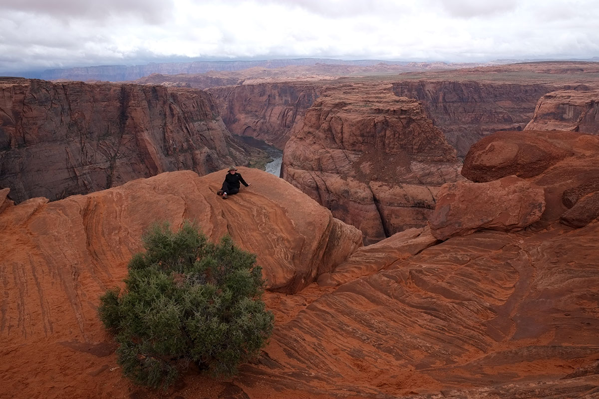
Dwelling – home – place: the cliff dwellings of the ancient Southwestern peoples strongly evoke these associations in most contemporary observers. How is it that the ruins of a civilization from 700 years ago resonate so intensely with us now, when our lives and our world in no way resemble theirs? The initial hook for me at Chaco was the plan – how the architectural order visible in that plan was riveting. But cliff dwellings appeal to normal people – not just architects – and this appeal comes from the image, not from the plan.

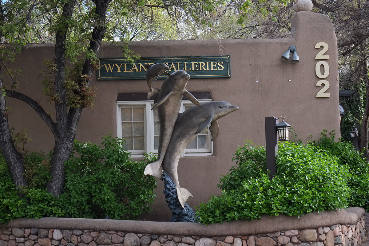
The first cliff dwelling I ever saw was Montezuma’s Castle (about an hour north of Phoenix), twenty years ago. It is the picture-perfect cliff dwelling, the small enclave for a few families, tucked into a small arch in a canyon wall. Different buildings have differently-colored masonry, so it is easy to imagine them as individual houses, rather than one large complex. Montezuma’s Castle is the dollhouse version of a cliff dwelling, the one a small child might draw.DSCF6944

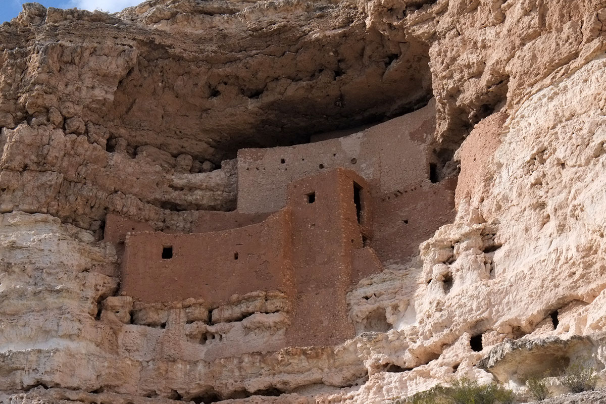
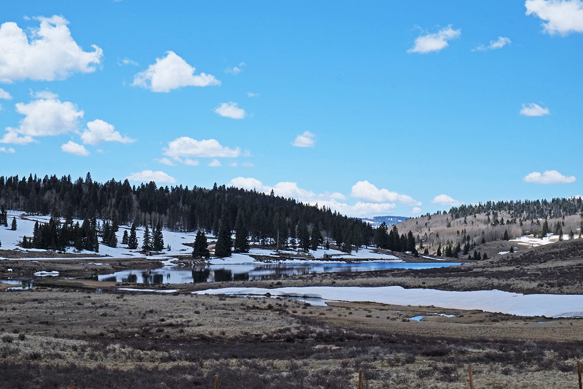
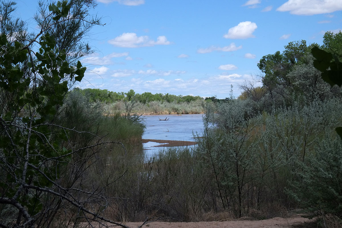
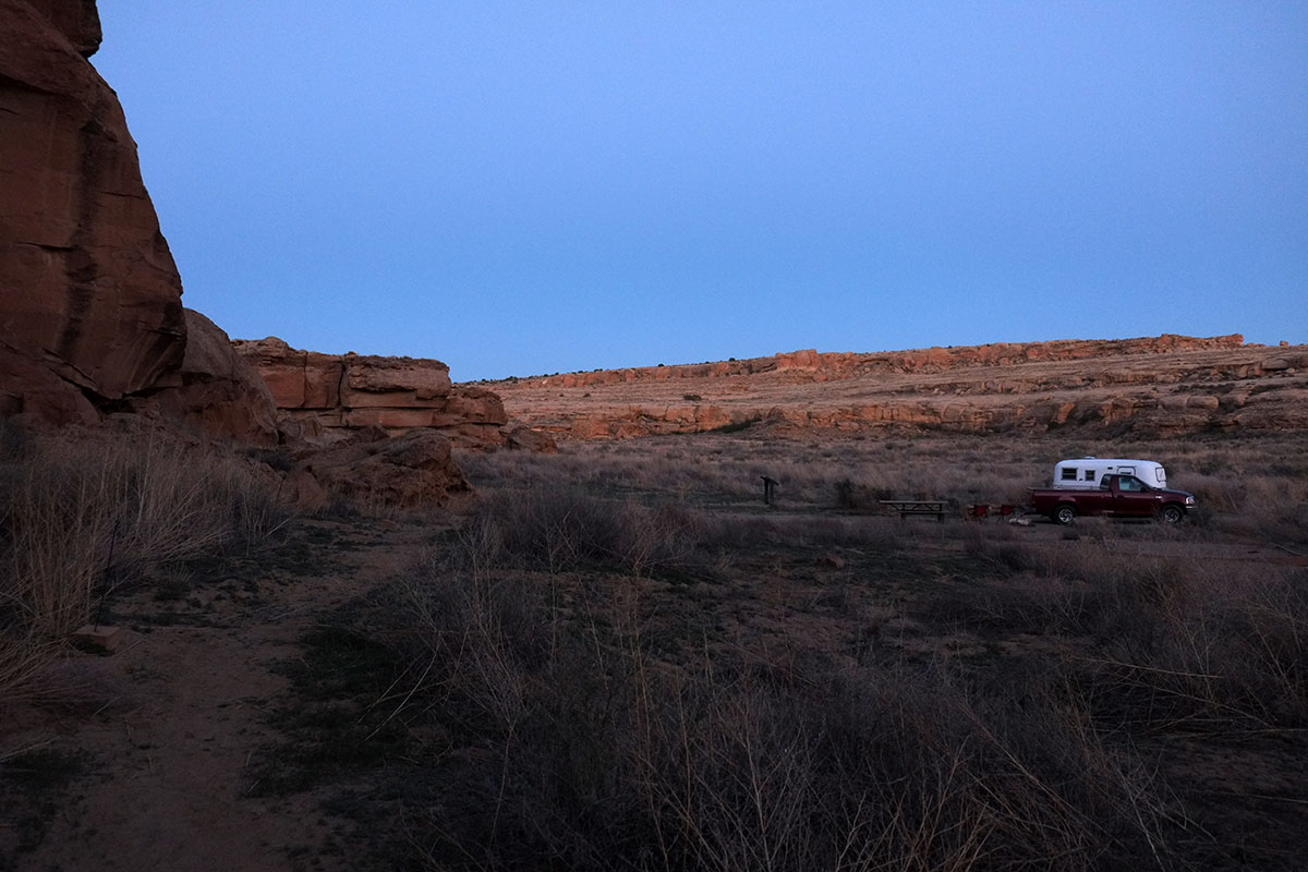
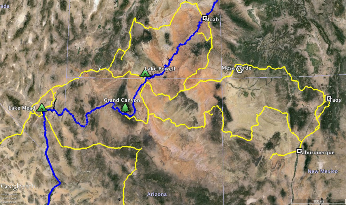
The cliff dwelling itself is intriguing, and the surrounding environment is gorgeous. You are traveling in the high fringes of the Sonoran Desert, and you then descend into a narrow canyon of the Green River. The desert is replaced by an oasis – a lush riverbottom of grasslands and shrubs, with cottonwoods lining the river.IMG_6203

It is cool and green, sheltered from the sun and wind – it feels like a tended garden more than a natural environment. I think this is much of the appeal of cliff dwellings – humans belong here. While we may appreciate the stark beauty of the desert – mainly because we know we can escape it back to our civilized comforts at a moment’s notice – we know at a visceral level that it is not a place for us, that we couldn’t last a day there unsheltered. The desert inspires awe, a word which in its original usage was understood to include a dose of terror. The canyon evokes a sense of relief, shelter from the heat, a “place” in the trackless wastes of the desert, where humans can abide.

It is physical shelter due to the change in microclimate, but also psychic shelter due to the sense of enclosure. The horizon out on the desert can be a hundred miles away – here the canyon is just a few hundred yards wide, putting a boundary around the inhabitation that sets it off from the infinite spaces above.

You can also see the harmony between the natural world and the built world. The cliff dwelling is the accent which marks our fitting into this environment. JB Jackson defined landscape as the sum of the natural environment plus the built environment, and nowhere is this more archetypally visible than here. Humans haven’t dominated the place – they have recognized the qualities of the natural world which will nurture them, and have built a small dwelling which enhances their viability functionally. It has been done so perfectly that it is apparent to all on a deeply intuitive level. Tourists stand quietly, marveling at the ruins above them.DSCF6946

We returned there one winter when Greta was three years old, and she was fascinated by it, wandering along the river path and gazing up at the ruin. This year, as we approached Montezuma’s Castle again, I asked Greta whether she remembered it. She said she did, vaguely. But as we entered the canyon, specific spots triggered strong memories for her. The path paralleling the river by the cottonwoods, the opening in the woods approaching the cliff, the view of the houses themselves – they all came back to her as they appeared. This place had been so different from anything she’d seen in her short life that these vivid impressions had been filed away, ready to emerge when seen again. A little, primal human responding to the primal, archetypal elements

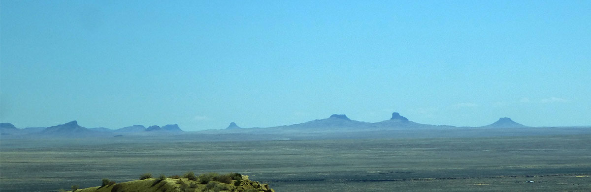
At Navajo National Monument we saw the remains of Betatakin from across the canyon. We weren’t allowed to enter the canyon, but even looking at it from above, the importance of the canyon microclimate was apparent.DSCF8099

As usual, the Park Service had an excellent sign explaining this – showing how the climate zones in a canyon were inverted from those seen on a mountainside, with the cooler weather, alpine vegetation at the bottom.DSCF8087Navajo-NM001

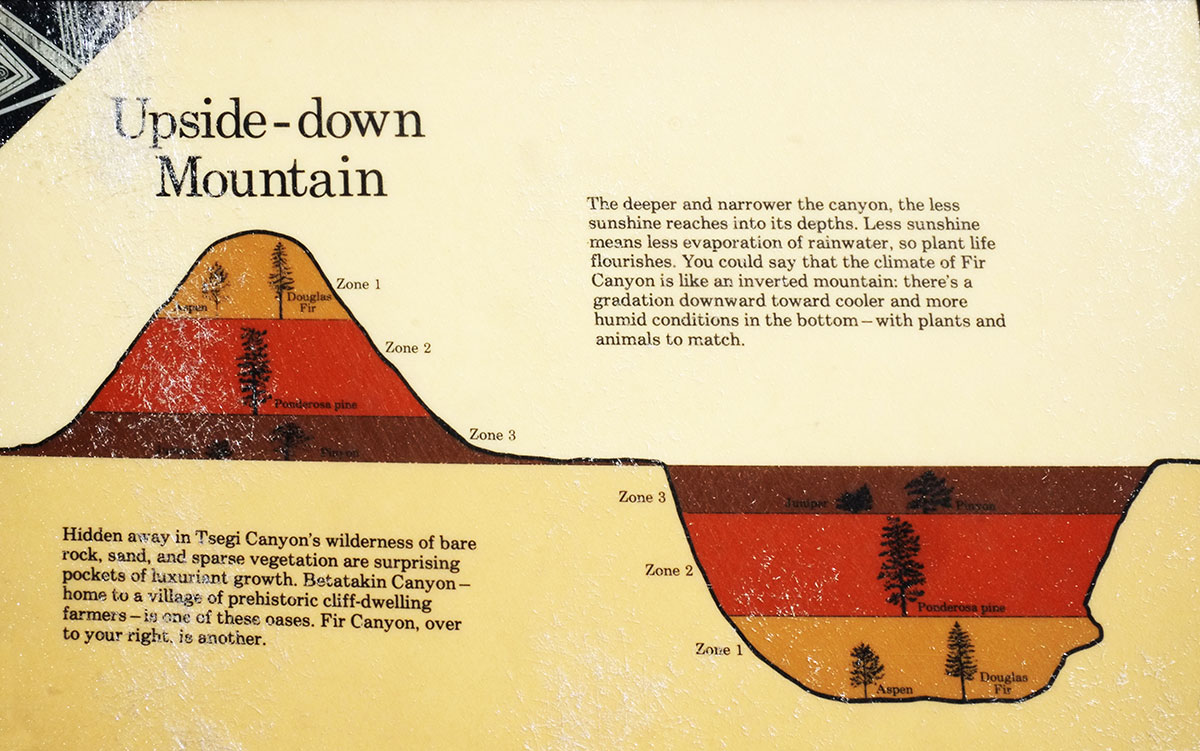
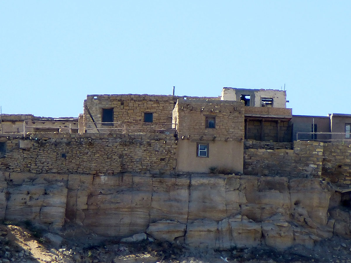
The village itself was tiny, tucked beneath the large arch across the canyon, exposed to the warming spring sun.DSCF8097

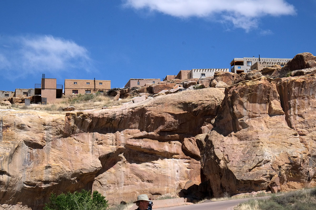
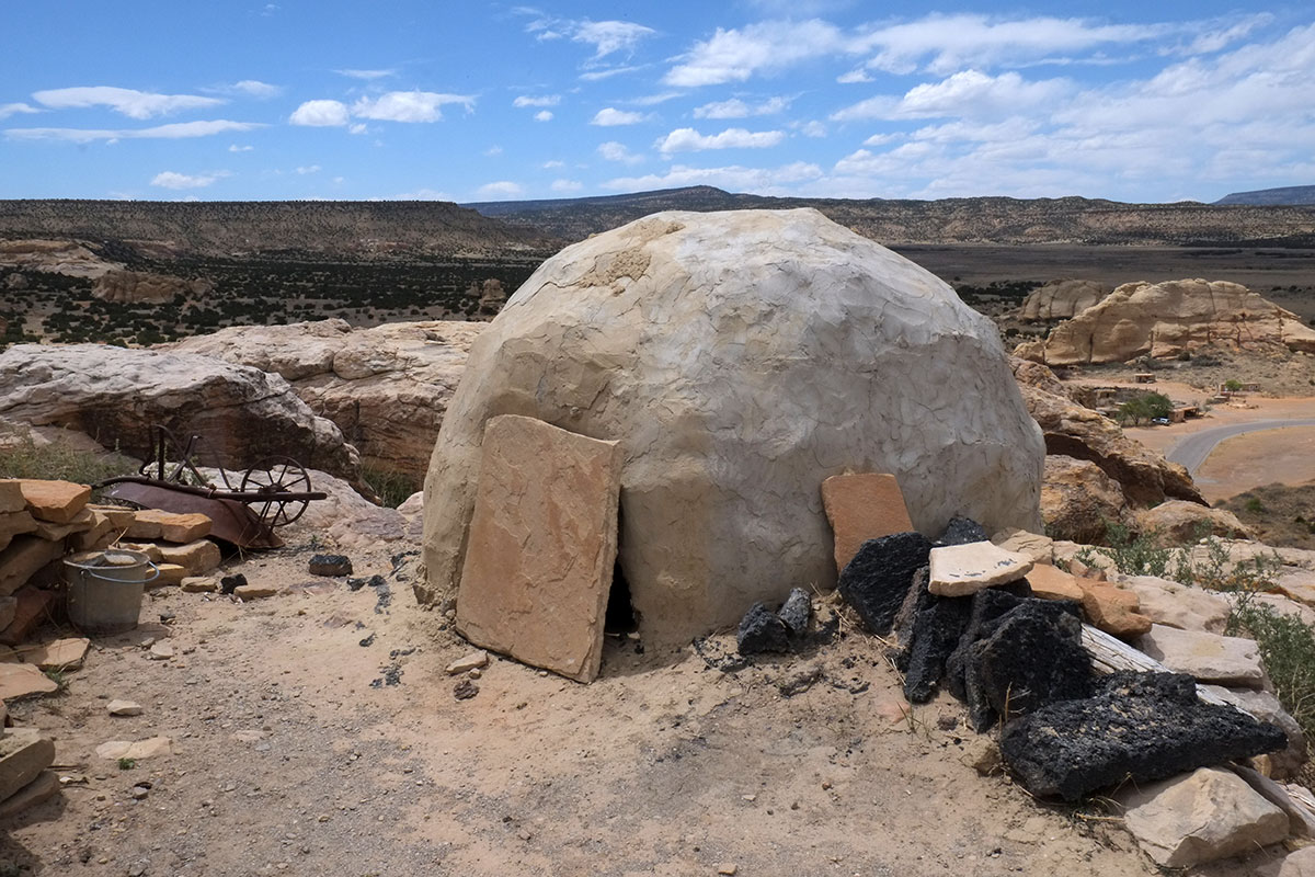
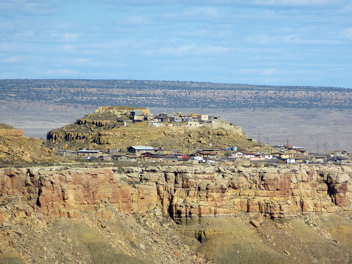
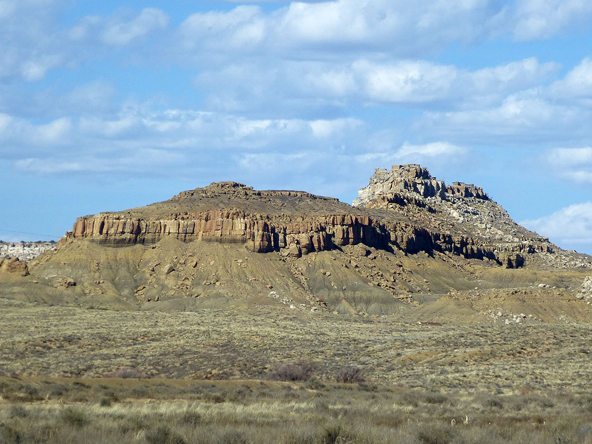
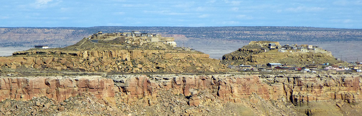
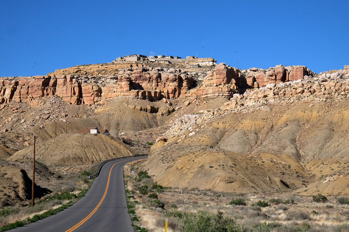
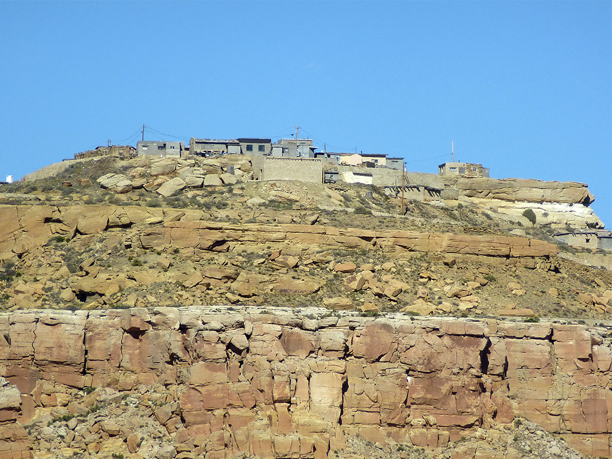
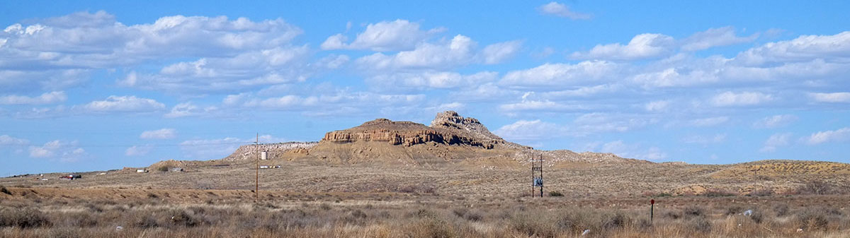
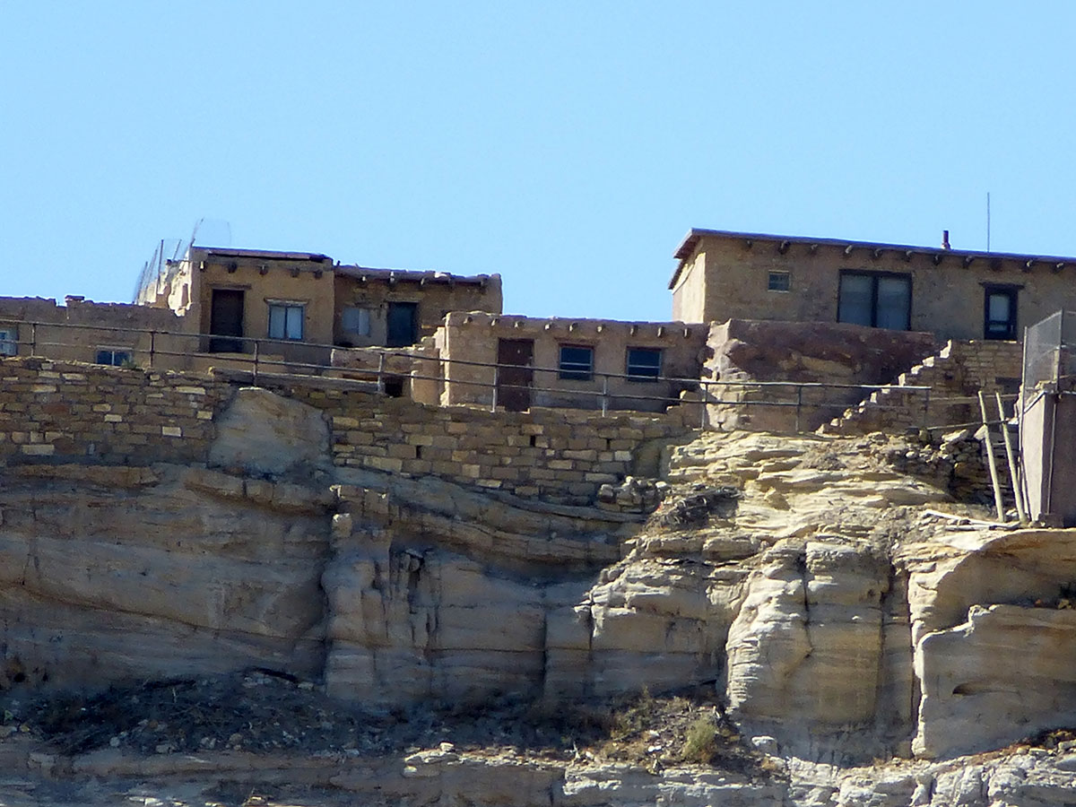
I started to wonder why we call these places cliff dwellings – canyon dwellings might be more accurate. They were never located on mountain cliffs looking across the desert, always in canyon walls.

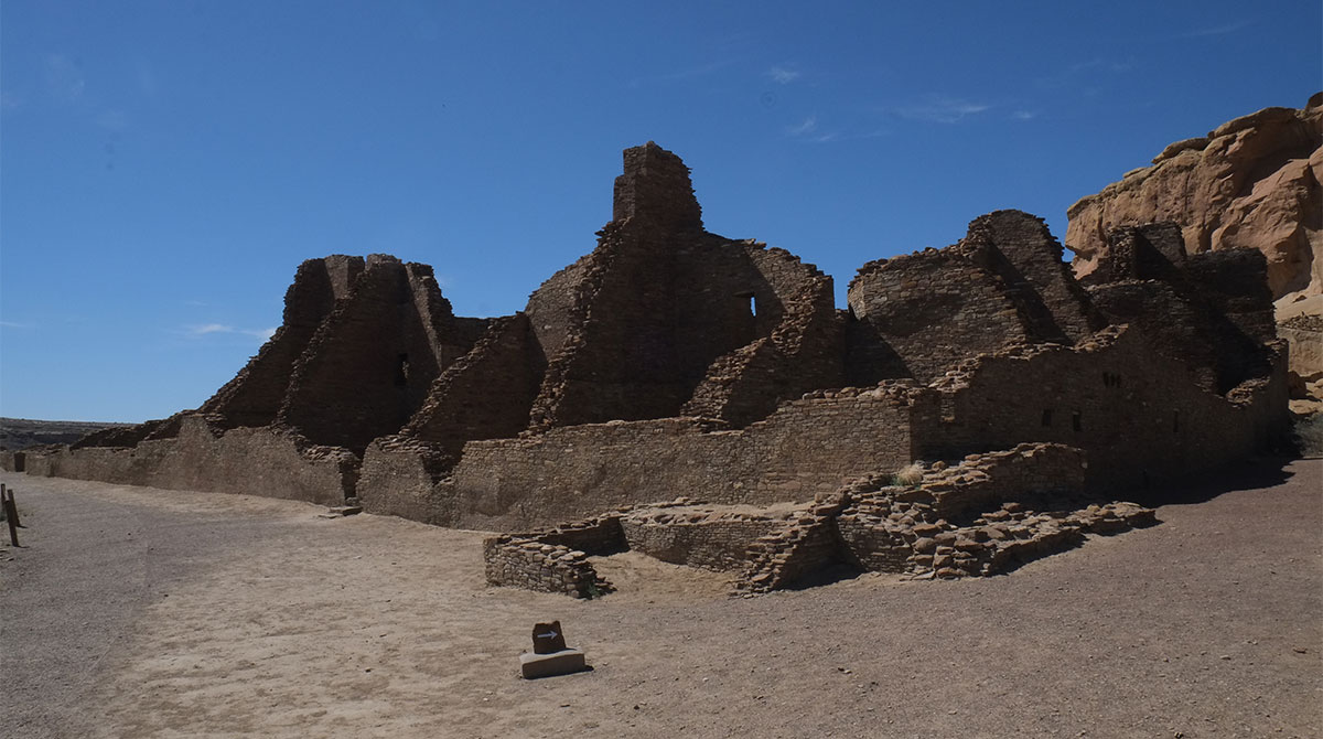
The cliff-dwelling civilization followed the era that was centered at Chaco Canyon. A variety of reasons have been proposed for the change – the climate becoming more severe, with persistent drought requiring dispersal to locations with more reliable water supplies; attacks from other tribes leading to building more defensible villages; a breakdown in the social order, etc. No one knows the main reason, and some archaeologists think it is most likely a combination of many of these reasons.

The primacy of the canyon location became even more clear at Tsegi (Canyon de Chelly), where the Antelope House is located at the foot of a cliff, but on the canyon floor, not in a recess. We wondered about its risk of being flooded, but if the buildings have been there for hundreds of years, they must have called that one right.95. Tsegi176DSCF8691

Just as no one has the definitive reason as to why people left Chaco-era settlements, no one knows exactly why these villages were built in canyon cliffs. They have many advantages – shelter from the high summer sun while being exposed to the warming winter sun, easily defensible from attackers, always located with a good water source, where groundwater seeped out from cracks in the cliffs, overlooking a canyon bottom where crops could be grown, or slightly below the canyon rim, giving access to farmland above. Again, probably a combination of these reasons.

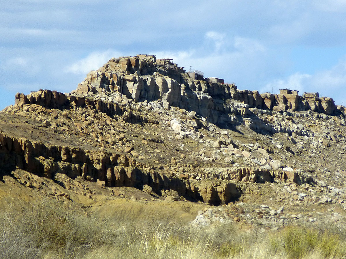
Access was Important – often from below as here at Mummy Cave at Tsegi. The “tower” form is apparent, although it is not known whether the tower function was critical, or whether it was just a vertical stack of rooms.DSCF8706MummyCave004

White Cliff House at Tsegi shows both ways the village on the canyon floor could be built – either in a arch above, or directly on the floor. There are a lot of these bottom-access villages at Tsegi – perhaps that meant that the canyon as a whole was defensible, and they didn’t have to rely on the inaccessibility of individual clusters.95. Tsegi185DSCF8814

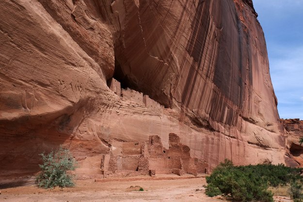
(Tsegi was one of the most extraordinary places we visited – for many reasons beyond the cliff dwellings – so I will put up a post just about it.)

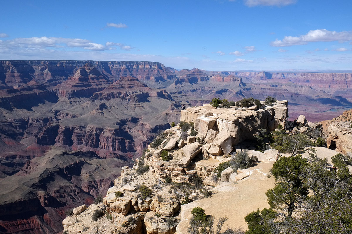
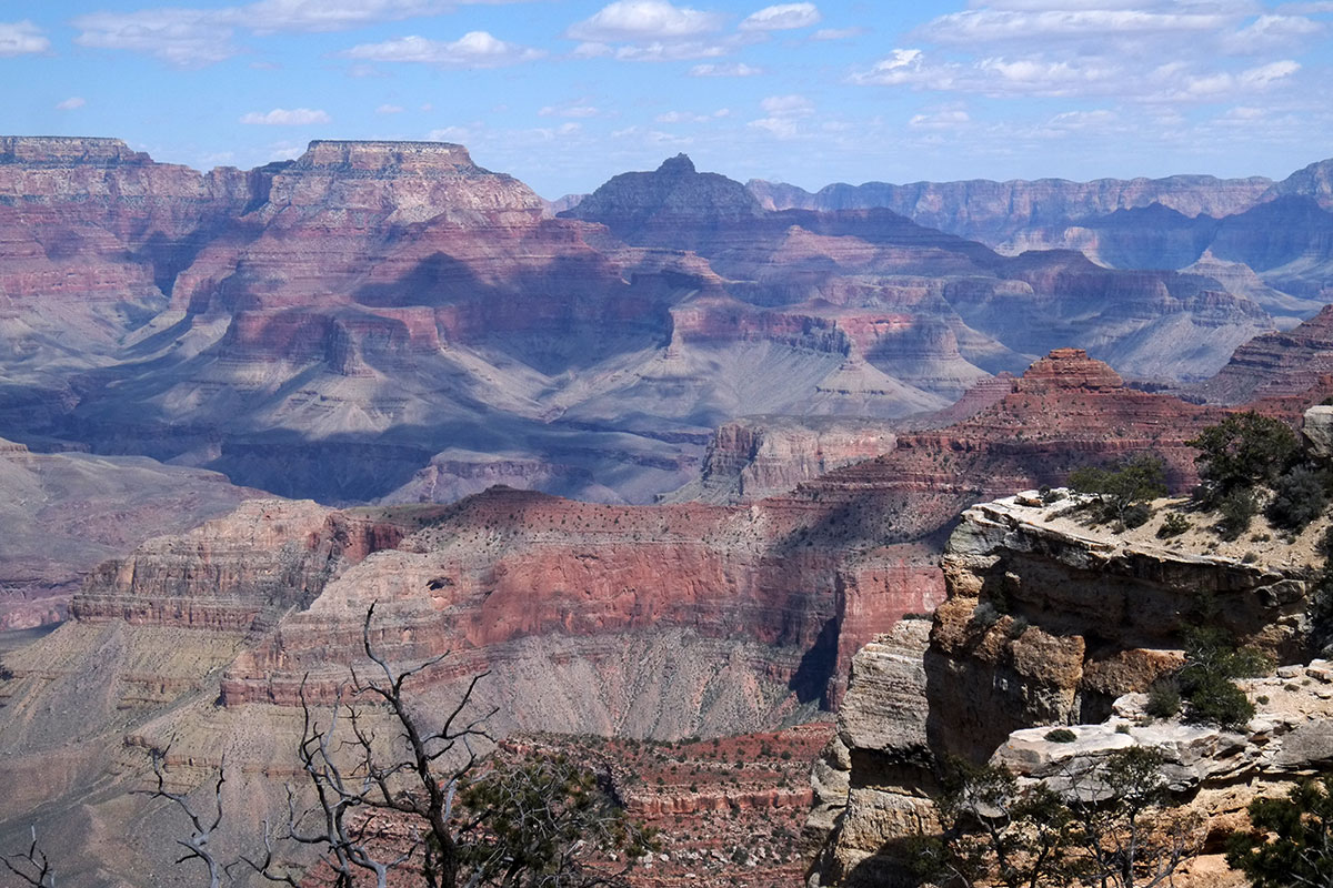
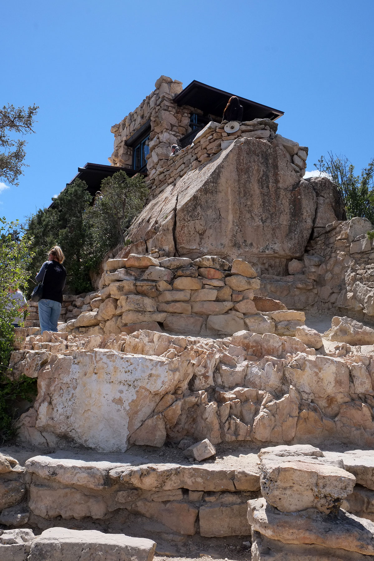
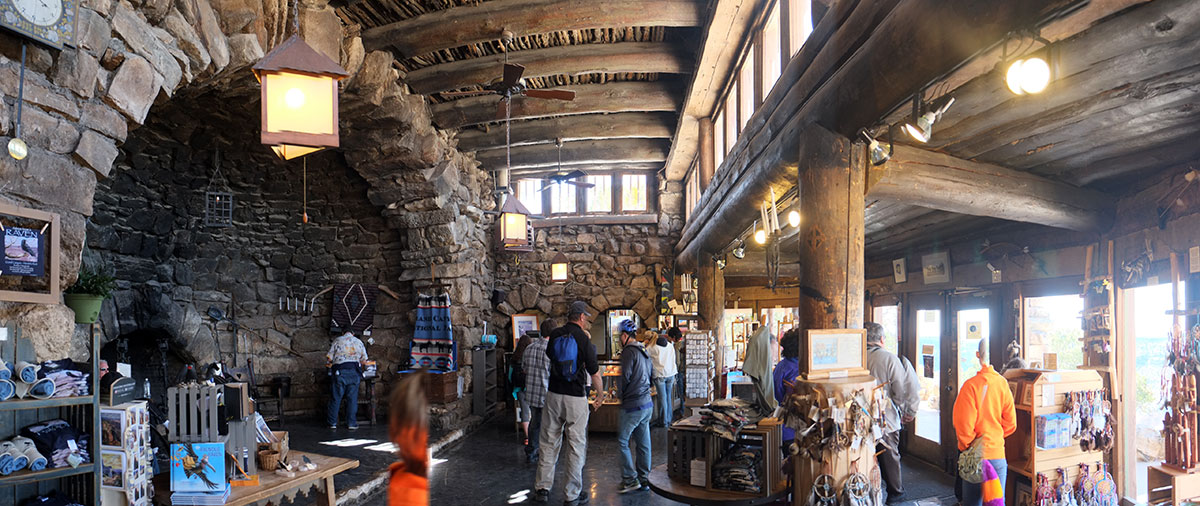
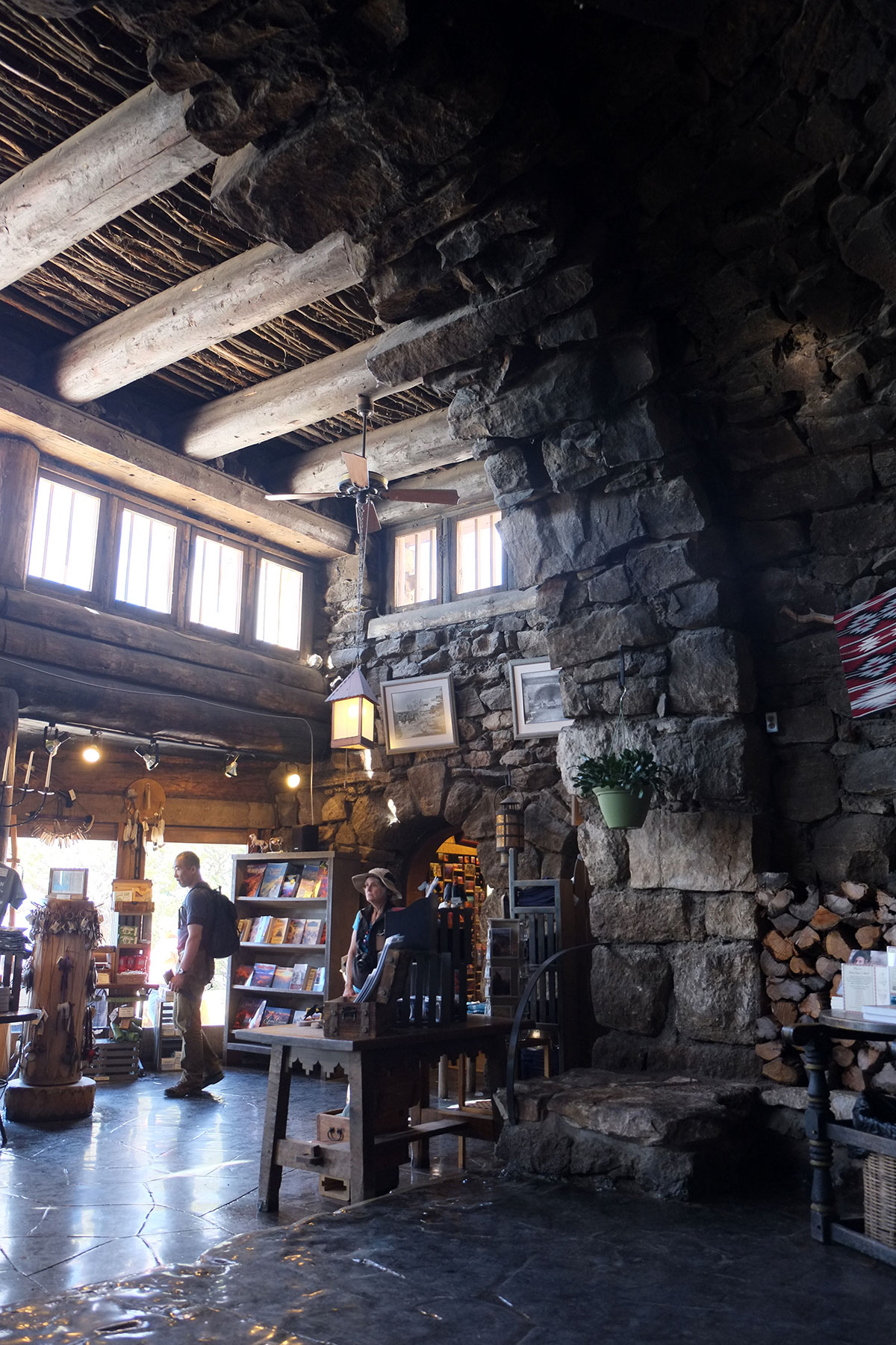
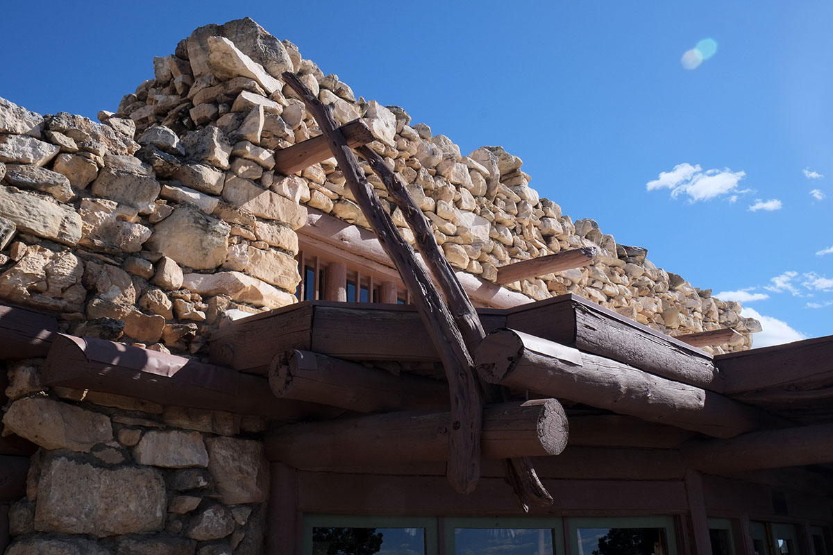
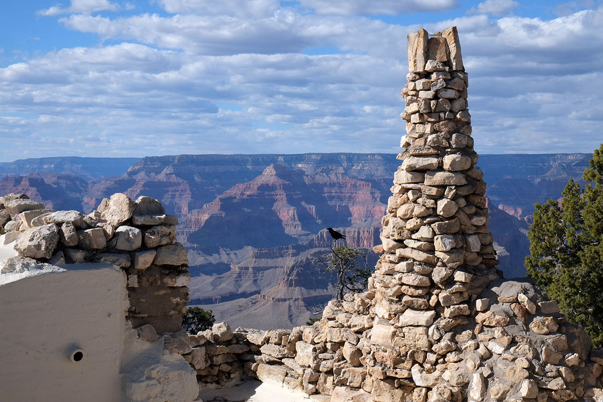
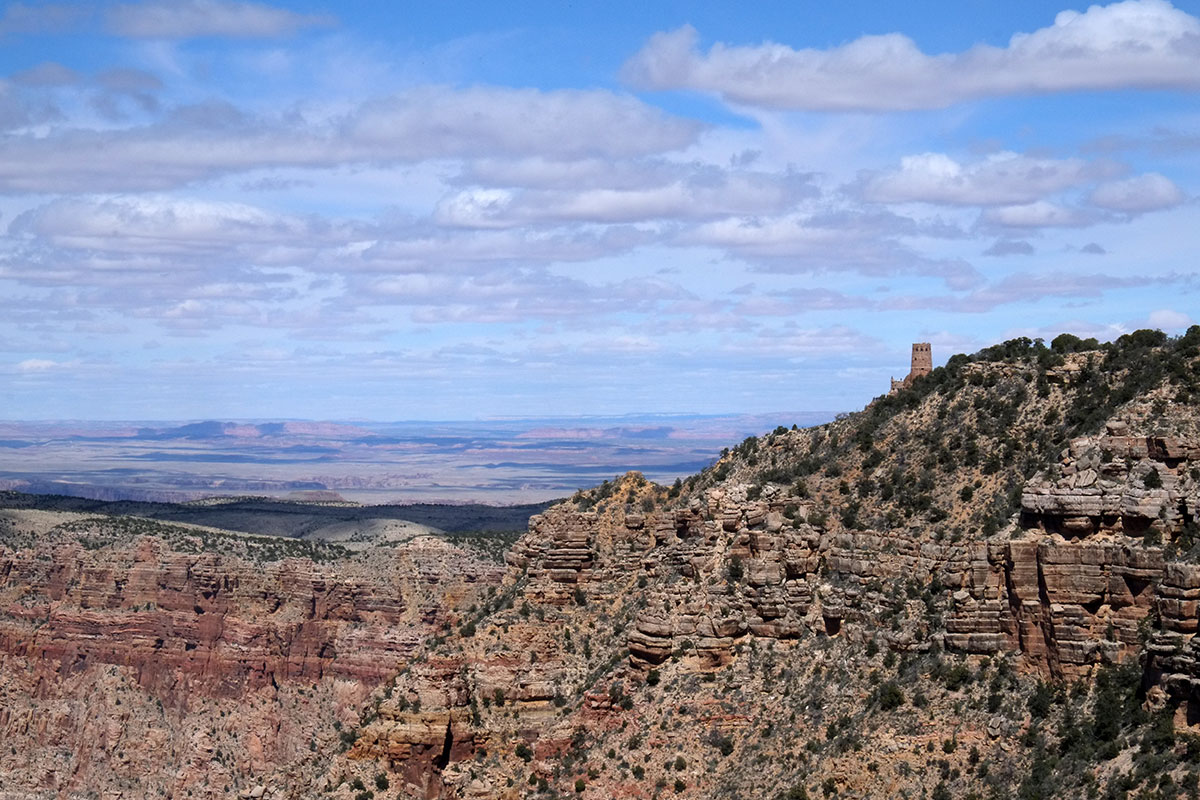
There are no cliff dwellings at the Grand Canyon – perhaps because it was just too big and deep to furnish the necessary microclimate that came with a smaller canyon. But there were ancient people there, dwelling in pit houses near the top of the rim. The Tusayan Museum has artifacts from this era thousands of years ago, including fetish animals made from reeds and willow twigs. They were simple and powerful, and again we northwesterners were astonished to see unrotted plant material that old.DSCF8611

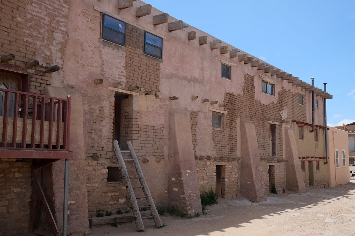
We finally arrived at Mesa Verde, which was the center of the post-Chaco civilization. I knew some vague things about Mesa Verde before visiting, but I was unprepared for its extent. Within the Park boundaries, there are 4500 archaeological sites – cliff dwellings, pit-house villages, farms, and great houses which resemble those left behind at Chaco. It is only 100 miles from Chaco, but it is located in a very different environment, a series of branching canyons on a ridge of the Rocky Mountains, versus the desert plain at Chaco.

The most-visited ruin is Spruce Tree House, misnamed after the large trees which grew in front of and sheltered it, which were actually Douglas Firs (obvious to northwesterners). The pit house settlements at Mesa Verde were on the canyon rim, and the cliff villages are right below the rim, and accessed from above. Normally one can hike through this village, but a large piece of stone detached from the arch a little while ago, and so we couldn’t go in.DSCF0353SpruceTree002

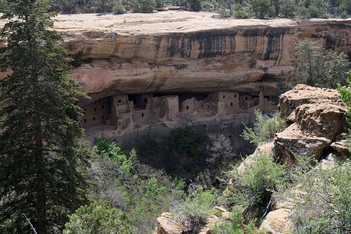
The Square Tower House.102. Mesa Verde047DSCF0457

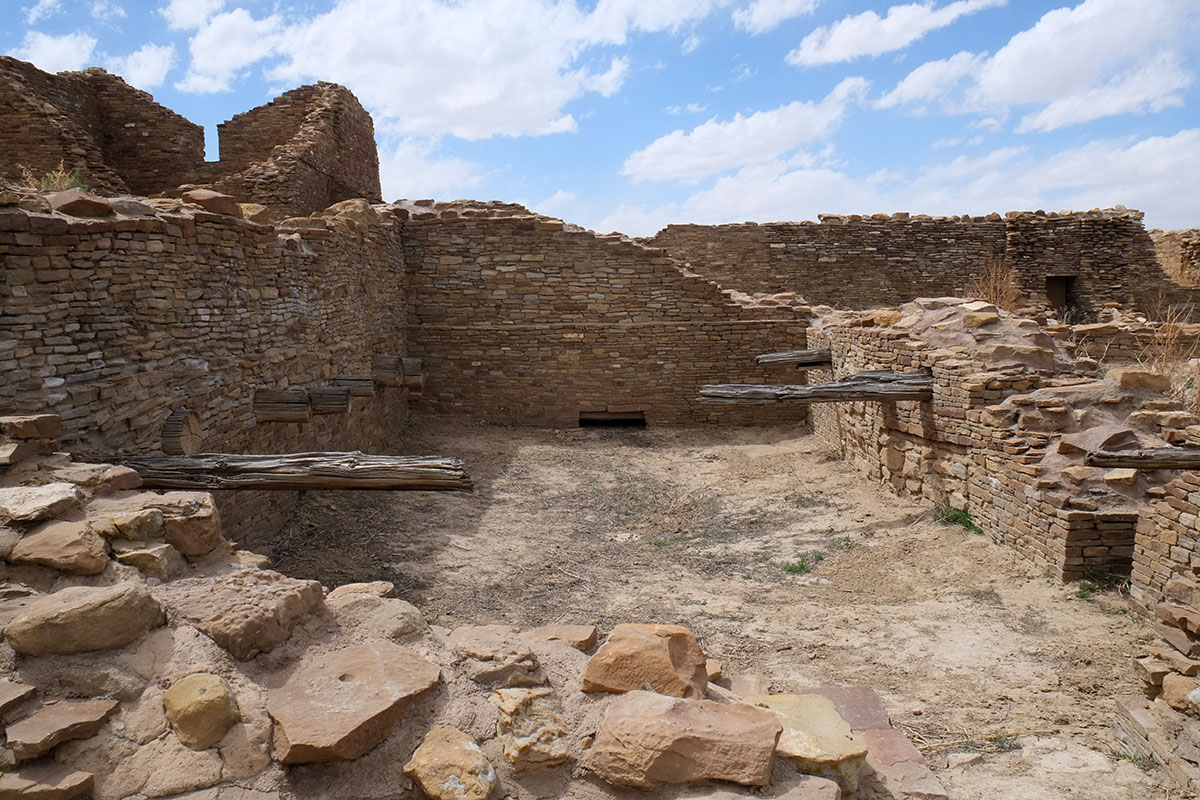
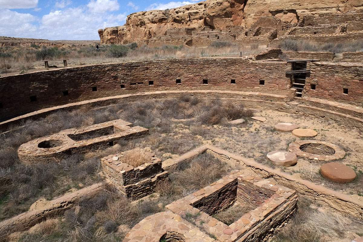
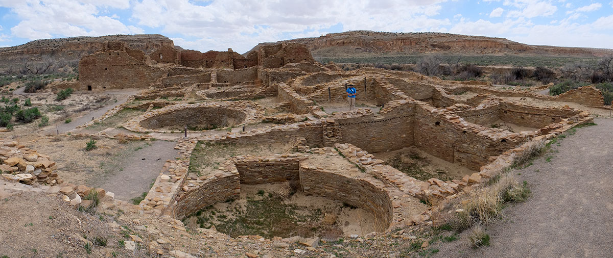
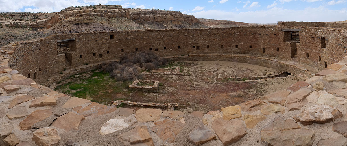
The nearby Cliff Place is the largest of the villages. You can see the pattern of plazas and paths, square rooms (probably private or used for storage, as at Chaco), and the round rooms, which are now thought to be shared, living and working rooms, rather than just used as ceremonial kivas. There are square and round towers.102. Mesa Verde044DSCF0371

102. Mesa Verde043DSCF0360

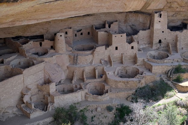
The most surprising experience was coming to this viewpoint and realizing how many cliff dwellings could be seen from one point – I have put yellow circles below the clusters, both above and below the rim.DSCF0462FireNew002m

This area comprises the Fire House and New Fire House to the left, with several other village in sight on the far canyon wall. Some of these are accessed from the rim, but the ones to the left also connect to the canyon floor, where it climbs higher.

Montezuma’s Castle is a relatively isolated village – certainly in communication with other villages, but alone in its own canyon. Mesa Verde is clearly an organized metropolitan area, with a system of villages and dwellings located at appropriate sites, all within close proximity. The Sun Temple is marked by the yellow dot just below the rim – it is a Chaco-style great house, and probably served as the center for all the villages in the area.

I began to wonder if the transition from Chaco to Mesa Verde might reflect some of the same processes that were seen in Europe in the Dark Ages. Did the environmental, social and political forces at the time make large, centralized settlements unsustainable, and so a smaller, decentralized village-based system sprang up? Or, closer to home, as some archaeologists have speculated that Chaco was the ancient version of Las Vegas, I wondered if Mesa Verde represents ancient sprawl?

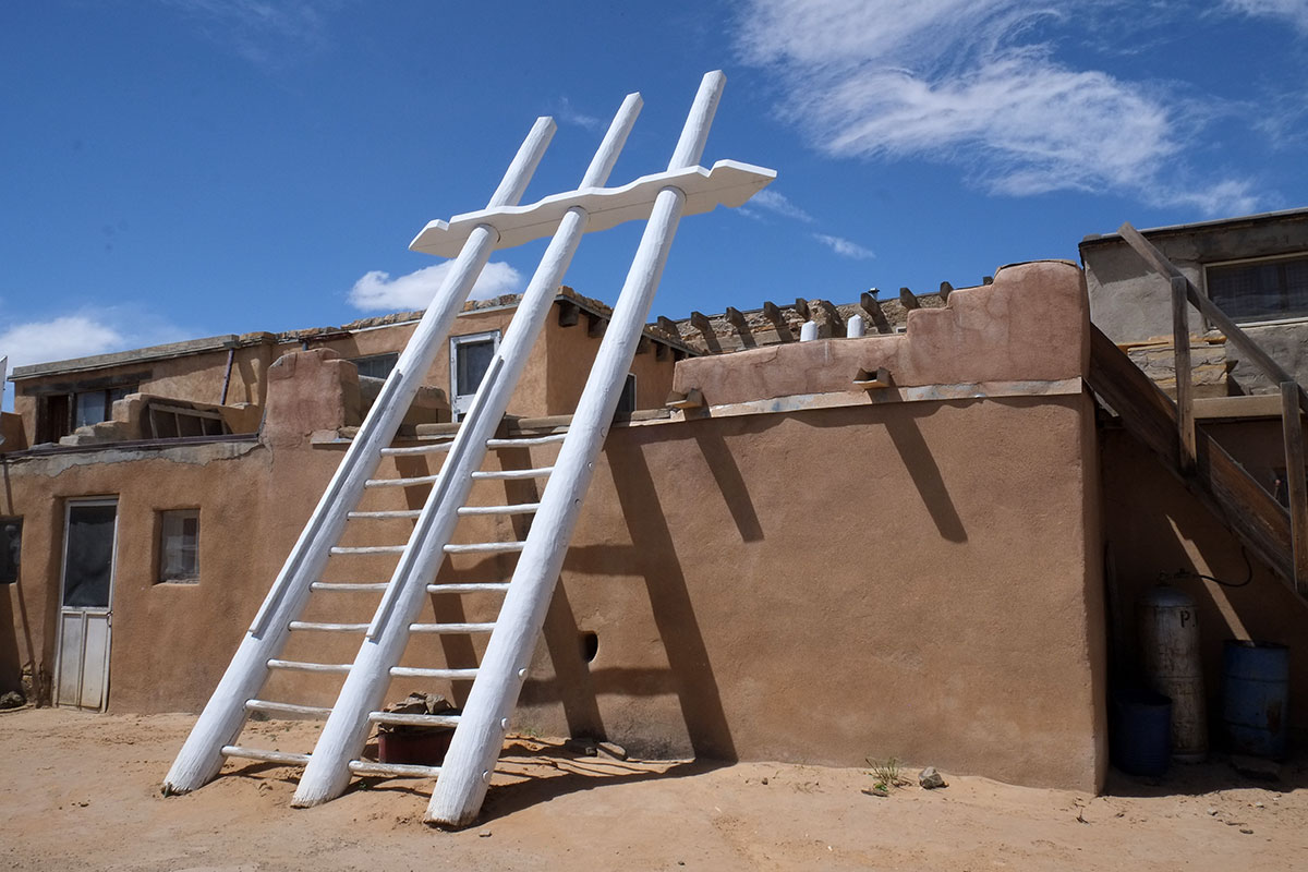
The most amazing thing at Mesa Verde is the chance to actually climb through a cliff dwelling. Unfortunately, three of the accessible villages only open after Memorial Day, but we were able to visit the Balcony House. We were part of a large group of tourists led by a ranger. When you buy your tickets, they are very explicit about the obstacles that you will encounter – after walking down metal stairs attached to the canyon wall for five stories, you hike along a path and approach a 32-foot tall ladder up to the village (marked in yellow on the right side of the photo below). When exiting the village, you have to climb through a 12-foot long tunnel/chamber, which at its tightest point is 18 inches wide and 27 inches high. Then you climb another ladder, up to footholds cut into the cliff, with a chain to hold onto and a steel fence to keep you from falling to your death (marked in yellow on the left side of the photo below). Given my claustrophobia and Greta’s fear of heights we carefully considered it, and decided we just couldn’t pass it up. When we joined out group, we thought that if we were worried, these people should have thought about it a lot more -there were quite a few typical American tourists, overweight and out of shape and very casually dressed (rock climbing in sandals?), and we wondered if some of them would actually be able to fit through the tunnel.DSCF0449BalconyHouse074p

This is the first ladder, leading to the village:DSCF0385BalconyHouse012

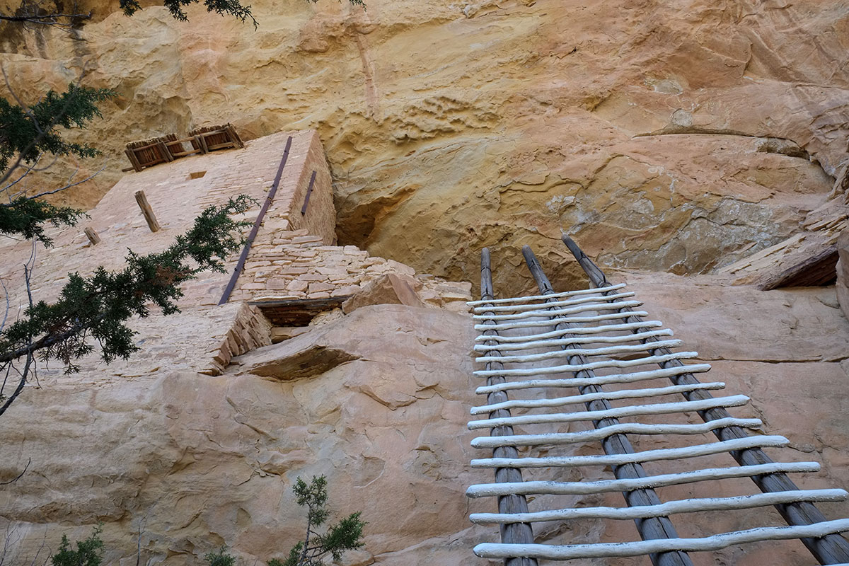
We got past that fine, surrounded by people who were determinedly not looking down. Next was the narrow, defensible entryway.DSCF0387BalconyHouse014

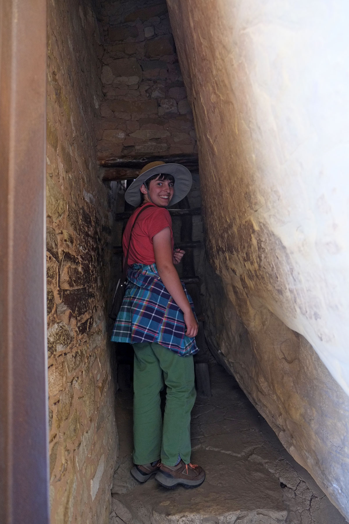
Which led to the first of two plazas – surrounded by buildings under the overhang on three sides, and open to the canyon to the east.102. Mesa Verde045DSCF0397

DSCF0393BalconyHouse020

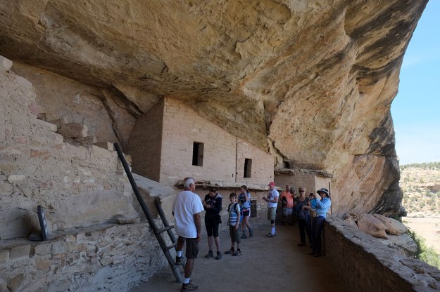
It was incredible to be standing there, knowing that 1000 years ago the residents had been right there, going about their business of grinding meal, cleaning animal carcasses, living normal lives. In the second courtyard, there is a large beam cantilevered out from a building – it is thought that this was used for hanging carcasses to dry, away from vermin (and res dogs).DSCF0429BalconyHouse056

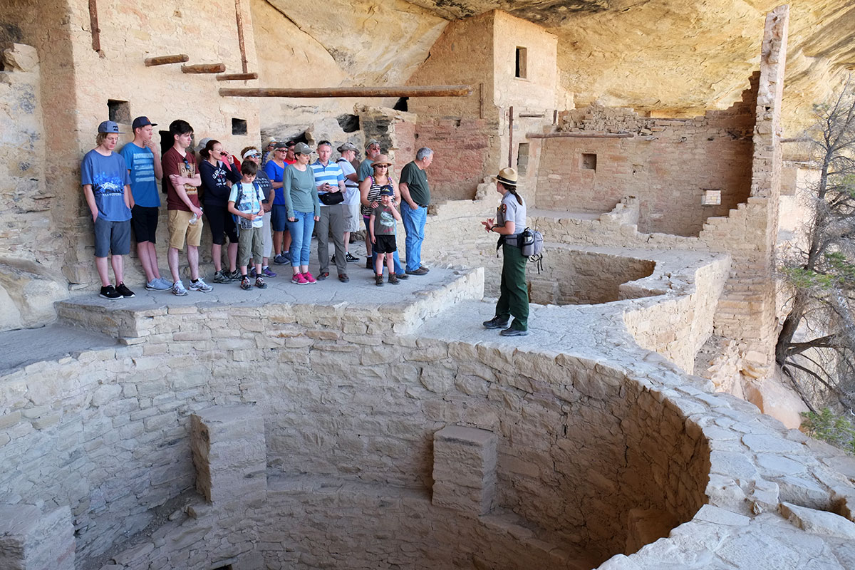
The group is standing beside one of the round rooms in the plaza – entered from above, probably better heated due to its shape and location, and perhaps used for daily activities.DSCF0399BalconyHouse026

The view from the second plaza – across Soda Canyon. We don’t know if the Ancestral Puebloans appreciated views, but the modern Americans certainly did. Beyond the beauty, this picture points out another of the reasons we find cliff dwellings so meaningful – refuge and prospect. These factors probably come from a time in our evolution when they were critical to our survival – the knowledge that you were in a safe, protected spot, and able to see things coming from a ways off – either things you might eat, or things that might attack you. We may not have quite the same primal requirement for these conditions, but modern humans tend to really like places with these qualities. We wondered whether the Park Service might initiate some Air Bnb opportunities in their cliff dwellings.DSCF0412BalconyHouse039

The way out: it wasn’t a tunnel so much as a small chamber, with narrow deep doorways at each end. Here is 100-pound Greta squeezing through, and when I followed her I had to twist my torso to fit my shoulders through. We had made sure we were near the front of the line, as I had no desire to be in the middle when some large people got stuck ahead and behind me. Everyone made it through, but it was quite a while before some of them emerged.DSCF0440BalconyHouse066

This is looking down at the final ladder and the hewn footholds in the cliff. This was the most terrifying part for many people, and the camaraderie exhibited, as people in distress were exhorted and cheered on, was very commendable. We didn’t leave anyone behind.DSCF0445BalconyHouse071

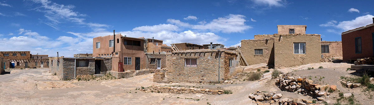
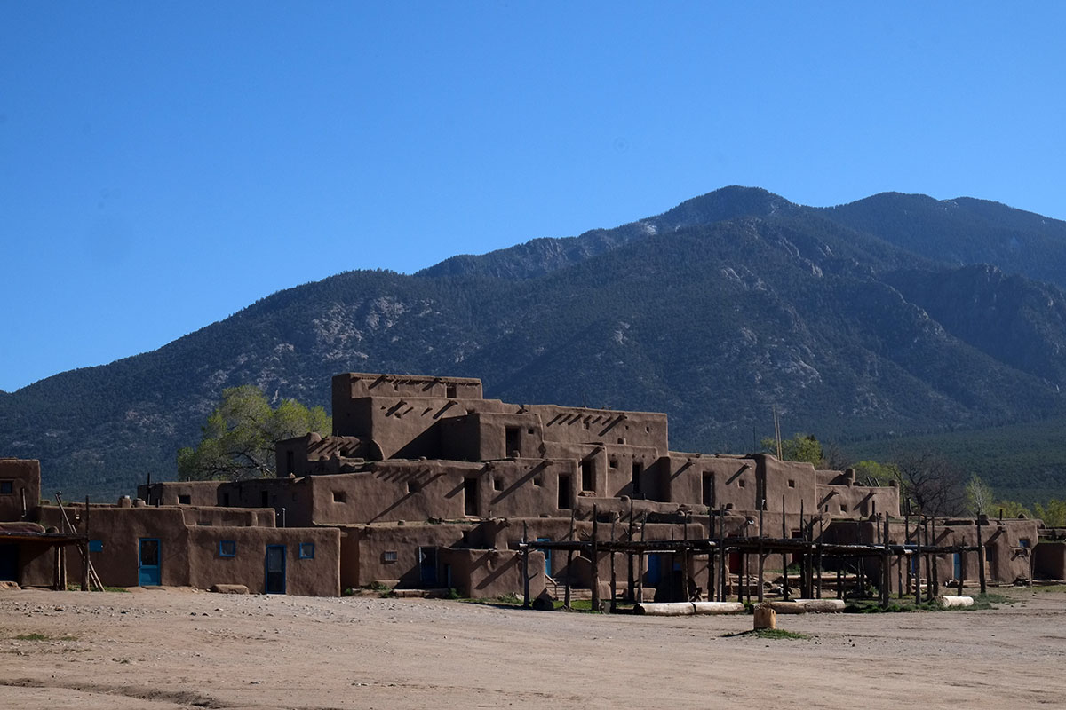
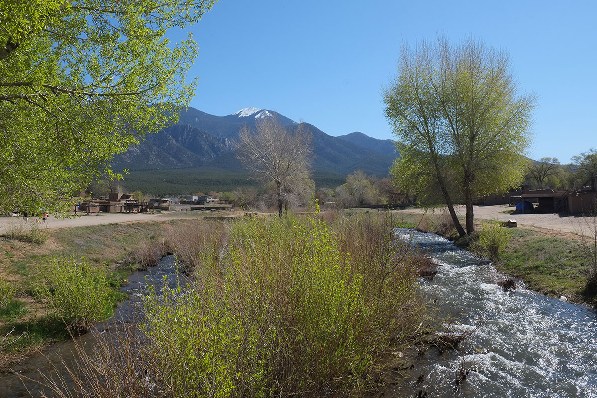
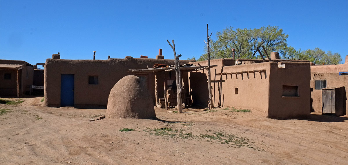
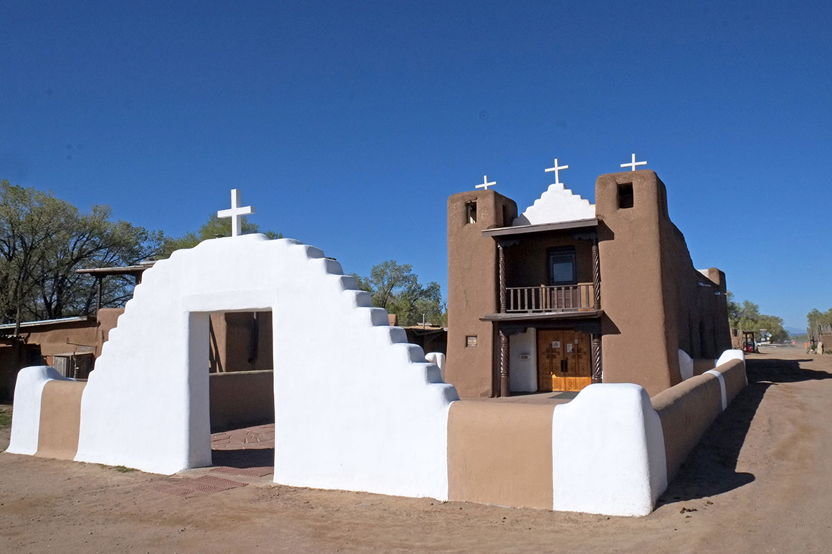
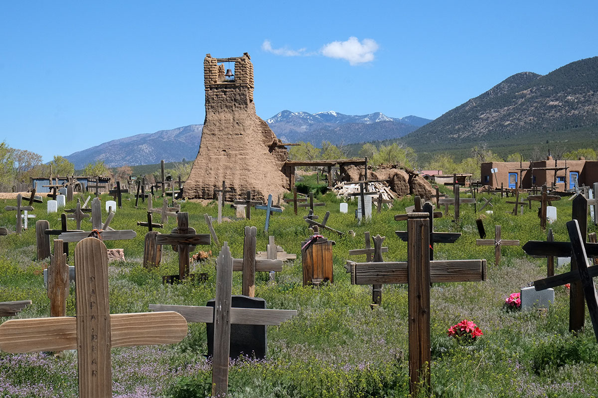
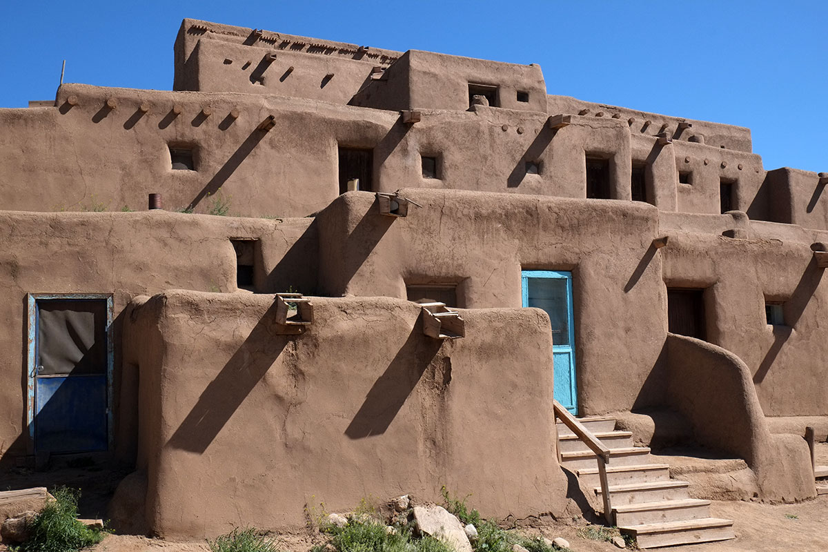
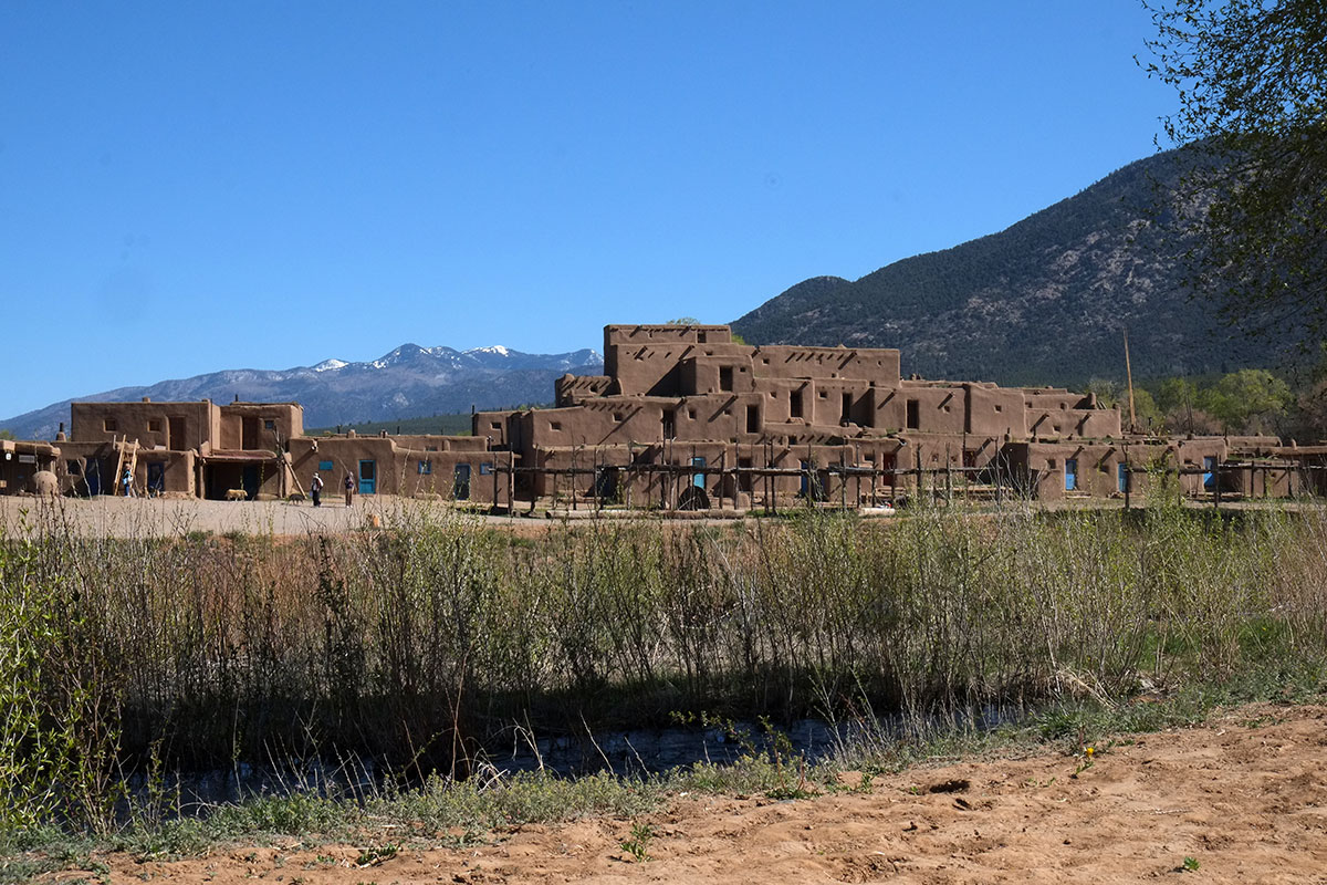
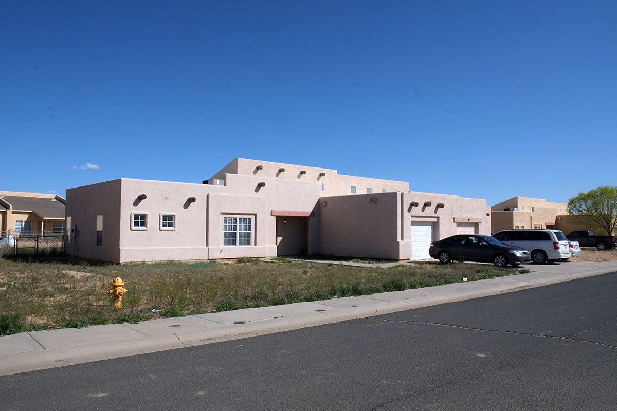
The Southwest had many highlights for us – the landscapes and National Parks, the ancient ruins, some of the towns, the pueblos – and one of the best parts has been acquiring a rudimentary understanding on how all of this fits together. It is wholly different from where we have ever lived – climatically, culturally, historically – and by seeing these cliff dwellings within their environmental and historical context, it all started to make sense. 20 years ago I had visited the Hopi reservation, seeing villages that were, unimaginably, 700 years old. But now, seeing how humans have lived here through different eras even further in the past, the more recent settlements and cultures make more sense. There is an astounding, unbroken chain of people moving from somewhere else to construct the Chaco culture, then on to the cliff dwelling era, and then on to the pueblos, which remain into our time.

More Pueblos

DSCF0290The Hopi Pueblo is extremely isolated – in the middle of the Navajo reservation in northeast Arizona – but most of the other pueblo villages are more accessible, clustered near the Rio Grande valley in northeastern New Mexico. Since this area also contains the population center of New Mexico – from Albuquerque through Santa Fe to Taos – these pueblos attract many more tourists, and they have clearly learned how to manage this tourist influx to their benefit – providing income for the tribe, while minimizing the intrusion upon their way of life.

Acoma Pueblo is about 60 miles west of Albuquerque, and their village on top of a mesa, “Sky City” (they clearly hired a branding consultant before the other pueblos) has many similarities to the Hopi mesa villages – masonry and adobe houses tightly clustered around plazas, with a very defensible location hundreds of feet above the valley floor. There has been this ongoing dispute between Acoma and Walpi, as to which is the oldest existing settlement in the US, or the oldest continuously-inhabited, etc. The different clans own the houses in Acoma, just as in Walpi, but Acoma seems to have a more organized approach to actually living there. All the members of the tribe have more modern houses in the valley, but they sign up to be in residence on the mesa top for a year or so, living without running water or modern utilities.

98.Acoma018DSCF9655

As you enter the Acoma reservation, you first spot this mesa ahead, a striking and isolated element in the horizontal landscape. We were told that the Acoma people first considered this as the site for their village, but that two people were struck by lightning after climbing the mesa, and this was not taken as a good sign.DSCF9488

To visit Acoma you head to the Sky City Cultural Center, a new building at the foot of the mesa, which has a museum, meeting center, café and gift shop. The architecture is based upon the traditional Puebloan forms, with a series of boxy volumes that contrast in size and color. It is at a much bigger scale than the adobe buildings, and reminded me of some of the recent National Park buildings which work in the local vernacular, in a much more thoughtful way than you see in commercial buildings ineptly imitating the style.DSCF9672

You must visit the village as part of a tour group, and take a bus ride up the road to the top.98.Acoma019DSCF9652

However, visitors are allowed to walk back down the ancient pathway at the end of the tour if they wish. It is easy to see how defensible this route is, and also how tiresome it would be to carry everything up.98.Acoma020DSCF9643

The houses are set around medium-sized plazas, and most are in very good shape, with a combination of older building fabric and newer elements, such as windows.DSCF9633

There was a lot of construction going on while we were there, and in a very organized manner. It is clear that there is much greater concern for the historical integrity of the new building than at Walpi, and this might be directly due to the huge numbers of tourists who visit here. The tourists are probably much more interested in seeing authentic-looking buildings (rather than ones with obvious Simpson Strong-Tie connectors), and the tourist income can pay for those careful renovations.98.Acoma022DSCF9542

Narrow streets run between the plazas in the village. The Hopi mesas are pretty narrow, and small villages are very near each other, whereas Acoma is one, much bigger settlement (Sky City, not Sky Village).98.Acoma021DSCF9532

The traditional ovens were everywhere on the edge of the village.DSCF9528

Acoma is noted for its multi-story construction. This is the back side of the biggest building, facing onto a street, while the other side faces a plaza, and is stepped back with roof-top terraces.DSCF9575

The mesa is a big solid rock, so excavating kivas into the ground would have been difficult. So here they are built of masonry above ground, but still entered in the traditional way through the roof. These ladders are a recent reconstruction – when the native religion was being actively suppressed by the Spanish and the Americans, the big ceremonial ladders were a tip-off to the authorities, as well as a visible symbol. So the residents used less conspicuous ladders that could be hidden, and posted a lookout.98.Acoma023DSCF9600

Most of the buildings show the wear of time,DSCF9544

but there are some new buildings. They are clearly based upon the same premises as the old style, but are not pretending to be ancient. Acoma felt more like a European village, where you can sometimes see this blending of old and new in a vernacular tradition.DSCF9534

The Catholic church, San Esteban del Rey from 1640, is by a large plaza and cemetery on one side of the mesa. While we were told the church is not used for any religious services, our guide was clear that we couldn’t take photos of the church interior, or of the cemetery, and implied that most of the current tribe members shunned the Church in favor of their traditional beliefs. When she was pressed by a tourist for some more detail on this, she just said, We don’t talk about that. It seemed to me that there was a big difference between Hopi and Acoma here – they didn’t want to discuss their beliefs, but they were generally unconcerned about photographs in the village, whereas with the Hopi it was the opposite. (The Hopi talk about their legends to a certain degree, but obviously there are many secret parts they’re not mentioning.)DSCF9621

The questions of the tourists strongly reflected the preoccupations of modern Americans – sex and money. Acoma Pueblo is matrilineal, so the tourists were very interested in how that affected marriage conventions, divorce, and especially, disposition of property after a divorce. What struck me as strange was that all of these questions about Acoma society could be answered by reading a book, whereas the one aspect of their culture that required a visit to comprehend was the nature of their physical settlement. Yet I didn’t hear one question about the village or its buildings, which reinforced my feeling that Americans are generally completely oblivious to the meaning of the built environment around them, focussing more upon the more abstract organizational and relationship issues. Americans don’t really care about the house as a physical artifact, they just want to understand what it’s worth and who gets it after the divorce.

One of the larger plazas was remarkable in that it had a tree, the first one we had seen on any mesa top. It was the urbanized version of all the garden valleys in the desert we had been seeing, the organic surrounded by mineral. It is adjacent to a small pool, which acts as a cistern.DSCF9612


Santa Clara Pueblo is located on the Rio Grande River, between Santa Fe and Taos, in what might be called the Pueblo Belt – many different, distinct reservations are adjacent here. We were attracted to this pueblo by their renowned, abstract black-on-black pottery, and we stumbled upon a small gallery run by a potter of about my age, who showed us his and a few others’ work. He took the time to explain how their firing process worked, which was amazing in the contrast between simple and rather ad hoc facilities they used and the incredible sophistication of the final products. They don’t have large, permanent kilns, but rather build a small one every time out of rocks and metal sheets, achieving the black finish not though a glaze, but by packing the kiln shut with dirt at the right time, so the fire is dampened and the pots are smoked. They then burnish the pots with a stick to get the shiny surface. It must have taken generations to get that process right, a process that must be learned by every new potter. The approach relies upon a complex series of steps that must be guided by experience and judgement, rather than complicated tools or equipment. We leaned a lot, and once again we found that buying some art (in this case a couple of extraordinary small pots for Linda) gave us a great excuse to spend time talking to some wonderful people.

The pueblo is not set on a mesa or hill, but right alongside the river. The buildings were adobe rather than stone, but still had the characteristic masonry forms, organized around plazas.DSCF0094

Being in a river valley there was much more use of organic material in the built environment,DSCF0102

and there was a relatively lush landscape everywhere. There was a newer part of town immediately adjacent to the old village, with schools, administrative buildings and detached houses. Some of the older houses were in disrepair and boarded up, but others had been recently rebuilt. Santa Clara doesn’t get the tourist throngs of Acoma, as it more resembles a normal western town, and isn’t the anomaly of a Sky City. But its location right on the Albuquerque-Taos axis makes it much easier for the residents to participate in the larger economy off the reservation, and so rather than the large-scale and highly-coordinated renovations we saw at Acoma, the work we saw here was at the level of the individual house, probably based on what one family was able to accomplish.DSCF0108

Finally we visited Taos Pueblo, a UNESCO World Heritage site located north of the city of Taos, which is the Mecca of pueblos for architects. It is mainly known for the large building on the north side of the village, a multi-story complex which antedates our own multi-family condos by at least 600 years. Architects tend to respond to the simple cubic forms – the irregular but similar volumes based upon the construction system with bearing walls and the span of small trees.DSCF0185

Everywhere I’ve travelled in the past 35 years, I’ve noticed a bias inherent in how architects and historians think about and document important places: there is always an emphasis upon the building as an object, but a relative disregard for the importance of the setting, whether urban or natural. The north building at Taos is truly remarkable, an incredible pile of abstract forms that gets at the primal idea of dwelling in the same way as do the cliff dwellings, but the natural setting is no less incredible.

When we first arrived at Taos, I couldn’t believe the backdrop of the mountains.100. Taos035DSCF0032

In the Northwest we’re used to seeing big mountains from in town, but those mountains are usually 50 miles away from the cities, which are set on the water. In all the cities in northeastern New Mexico, the cities are right at the base of the mountains, and their visual presence dominates the place. This is even stronger at Taos Pueblo, and not just due to proximity. These mountains were the traditional preserve of the Pueblo, containing their sacred Blue Lake, but they ended up being part of the National Forest system. The Taos Indians fought a protracted legal battle to get them back, which they eventually won in 1970. So the overwhelming beauty of the city of Taos has really been preserved by the Pueblo, which has kept the mountains free of development (or logging).

When we see the mountains behind the pueblo, it is not merely the visual background/foreground relationship which gives it power. It is knowing that there is a deep cultural connection between the natural world and the built world, that the pueblo was built where it was to have that relationship to the mountains.100. Taos037DSCF0173

This relationship is then strengthened by the stream that comes from the mountains, and runs through the center of the pueblo. There are obviously great practical benefits to having a stream in the middle of your village, but once again, the power derives more from the symbolic relationship than the pragmatics. The mountain – the stream – the people: the primal aspect of dwelling in a specific place on earth couldn’t be made any stronger.DSCF0199

As with any great work of art, analysis can’t begin to capture the multiple layers of meaning implicit in the work itself. You can dissect the pieces to try to explicitly understand what is going on, but you just experience it more directly. Taos Pueblo is simply one of the most beautiful places built by humans I’ve ever seen, and we wandered around happily for hours, soaking up every aspect and detail.

Across the steam is the southern side of the village, which is not a monolithic wall, but a more typical pueblo arrangement of low houses around small streets and plazas.DSCF0242

The smaller-scale elements of day-to-day life are apparent – doorsteps, ovens, raised platforms used to keep carcasses and animal hides away from vermin and dogs.DSCF0209

There is a church near the stream too, which seems to be more active and integrated into the life of the village than at Acoma.DSCF0172

However, this is a newer church, built in 1850. The first church was destroyed in the Pueblo Revolt of 1680, and the remains of the second can be seen below, standing in the middle of the cemetery. Taos was the center of a revolt resisting the transfer of power of when the territory was ceded to the US in 1847. The governor was killed, and the rebels retreated to this church, which was destroyed in a bombardment, killing all those within. The ruins now stand as a simple memorial.DSCF0298

The kivas and traditional ceremonial spaces are located towards the edge of the village, on both the north and south sides. Taos gets a lot of visitors, and they are explicit about which areas are off limits.DSCF0225

I haven’t seen many places in this country where there is such a complete or beautiful expression of people inhabiting a place, with their complex culture and history being made visible, accomplished with an abstract, built formalism that clearly says that residents are claiming this place,100. Taos038DSCF0262

DSCF0289

DSCF0259

while also integrating so seamlessly into the natural world.DSCF0201

Taos was right up there with the places we most wanted to visit on this trip, but the experience of seeing it was so much better than we anticipated. And seeing several pueblos led to a much better understanding of them all – before visiting we mainly could see the similarities among them, but now it is apparent how they are all clear and vivid places, something you have to directly experience to understand.

Taos

100. Taos035DSCF0032

The urbanized corner of northeastern New Mexico (the part of New Mexico that has three actual cities) affords a pretty wide range of urban experience, given how small the cities are. Earlier in our trip, we’d gotten pretty blasé about medium-sized cities American cities – they started looking more like examples of a standard type, rather than really distinct places (JB Jackson’s essay on “The Stranger’s Path” comes to mind again). The major independent variable seemed to be the ratio of pre-war size to current size, with the cities that were bigger in the past often having a historic core that gave them some character, whereas the cities dominated by post-war growth all just looked alike. The New Mexico cities have all kept their pre-war cores, and they maintain a strong identity despite the more recent sprawl. Most interestingly, they are all really different from each other. Albuquerque is the relatively big, diverse city. Santa Fe is the boutique city of government, arts and wealthy visitors. Taos is the funkier town up in the mountains, which has its overlay of tourism and artiness, but in a less rarified way than Santa Fe. It also has the outdoor-activity jumping-off place feel to it, but at a lower level than places like Moab and Jackson. And with the Taos Pueblo just north of town, the native culture is more noticeable than in the bigger cities.

100. Taos034DSCF0040

Each of these cities sits right where the high desert meets a mountain range, but in Taos the contrast is stronger and the connection to the mountains feels more immediate. Taos Mountain, at the end of the Sangre de Christo Mountains, dominates the views in the area, including the downtown. After a couple of months in the dry and usually hot Southwest, Taos felt different to us – a high-elevation city in the Rockies, near the desert, rather than a desert city from which you can see the mountains. It might have been the altitude, or the fact that it was cold and snowing, in May.

The downtown architecture is similar to that in Santa Fe, with a mixture of adobe and faux-dobe. The atmosphere is probably regulated as closely as in Santa Fe, but without the overlay of serious wealth, it doesn’t feel as precious.DSCF0014

The historic plaza is surrounded by shops selling Indian crafts, outdoor equipment and a nice hotel. On a cold Sunday afternoon, it was deserted. We assume that in the summer, it and the surrounding shopping streets would be full of tourists.DSCF0034

DSCF9970

Moving away from the commercial core into the residential areas, there are some beautiful places, with adobe houses set in a landscape with trees and grass, something we found really appealing at this point.DSCF0020

Once again the simple vocabulary of the Puebloan style allows for variety of expression within the few rules, the elevations respond to interior needs, and the casual arrangement of the whole is held together by the discipline of the style.DSCF0004

There were older houses where the plasticity of the material was exploited – I became very fond of lumpy, curvy architecture with little attached blobs. Making these forms out of adobe and stucco makes a lot more sense than going to the extreme lengths current high-style architecture does, with its torturing of steel frames and metal panels into curvilinear forms which are only obtainable through the application of advanced computer modeling technology, computer-controlled fabrication, and tons of money. Here, there was probably a rough sketch from the architect, and a couple of good masons.DSCF9981

DSCF9991

From everywhere in town, there were these intermittent views out to the landscape, such as here across a pasture to the smaller mountains to the south.DSCF0001

And then there were the random building agglomerations which made us feel that we were back in Eugene, but with stucco.DSCF0306

That feeling continued into the art world. Santa Fe had lots of outdoor art, all of which tried to seem very serious, even when it was pretentious and bad. Taos had more of the funky sculptor-puts-things-in-front-yard aspect to it, and the contrast between the sublime and the ridiculous again made us feel at home.DSCF0048

At Rancho de Taos, just south of the city proper, we saw the mission church made famous by Georgia O’Keefe.DSCF0059

Even 100 years after this was discovered by O’Keefe and other modernists, and even after knowing what to expect from seeing their representations, the church is riveting in its stark, geometric forms. The simple shapes, the play of light and shadows over the surfaces – it’s obvious why it was a revelation and inspiration to them. The clarity present here, due to the demands of the material and the vision of the artisans who knew how to use that material, stands in contrast to the self-conscious striving for technical difficulty and obscure meaning in the current milieu. Our appreciation of this architecture may sometimes be overly naïve and romantic, but seeing this church in person reinforced how powerful simple and clear forms can be.DSCF0052

100. Taos036DSCF0069

Taos is in an incredible landscape, so we spent a couple of days exploring outside the city. We took the much-recommended “high road” back south towards Santa Fe, which was a combination of broad perspectives over the high country of mountains and ranchland,DSCF0075

and small towns that at first glance were completely casual and untouched by the larger regional culture, but if you looked more closely you could always find a few artists’ studios mixed in.DSCF0078

Santuario de Chimayo is an old mission church, which is reputed to have holy soil with curative powers. We read some disclaimers from the Church on how the soil doesn’t have any power beyond its ability to focus believers’ faith in God’s power to heal, and so only indirectly leads to miraculous recoveries, etc. But everywhere we looked there was lots of evidence of a strange, fantastic mysticism,DSCF0089

with shrines that showed the devotions of Hispanic pilgrims,DSCF0086

and even those originally from Viet Nam, now living in this very different world.DSCF0085

Greta was nonplussed by all of this. Even I, who went to Catholic school for 12 years and was quite used to little old ladies lighting devotional candles at Our Lady of Sorrows, found this strangely alien and fetishistic, having more in common with the traditional practices we’d been coming across at the pueblos than with doctrinaire Catholicism. We’d been hearing about the syncretism in Southwestern religious beliefs, but this was the evidence we’d seen that this was a living system, not just a curious bit of history. Greta is a child of the Enlightenment and lives in the secular atmosphere of one of the most irreligious states; most of what she knows about Christianity has come from watching Monty Python’s Life of Brian, and she had no idea what this was all about. Like many teenagers these days, she reads a lot of fantasy, but coming face-to-face with actual, iconic expressions of non-rational religious faith (that weren’t in a folk art museum), was completely outside of her prior experience. But we both really liked this painting of the Mission which was in the lobby; probably we’re both more comfortable with magical realism than mystical religion.DSCF0087

While the high road to Taos is relentlessly beautiful mountain terrain, we found the “low road” to be equally beautiful. It goes through the more densely populated corridor along the Rio Grande, and provides access to many pueblos (and casinos). When the main highway and the river diverge, we turned off onto a dirt road along the river, the lower reaches of which were peaceful and calm, with a range of good camping opportunities.DSCF0136

DSCF0138

Eventually the road climbed up the western canyon wall, and we hiked into the canyon on an escarpment, leading to this view. We then realized that this was the second time we’d hiked into a deep canyon on the Rio Grande – the first was two months earlier, in Big Bend, way downstream.DSCF0144

The road climbs up to the desert plain above, until it reaches this bridge which spans the Rio Grande, and we then took the highway which led back into Taos.DSCF0157

Taos was our gateway back into high mountain country. We hadn’t seen what we westerners would call real mountains since Big Bend a couple of months before, and we hadn’t been in the Rockies since leaving Yellowstone in September. When we left we drove north and west towards Mesa Verde, and truly appreciated the landscape of mountains, conifers and snow.DSCF0310

DSCF0313

We crossed a mountain pass at 10,000 feet, and went through small towns and ranchland nestled in the foothills, an amazingly different environment from the one in which we’d spent the past few months. We would soon head back through the desert on our way west, but for a few days we were back in the more familiar and comparatively lush world of precipitation, vegetation, and snow-capped mountains.DSCF0316

Santa Fe

DSCF9696

We’d been wandering around in the desert for over a month, camping in National Parks, Indian reservations, and strange, raw cities like Gallup and Page, so we were looking forward to getting back to civilization. When we got to Albuquerque Greta immediately tracked down a banh mi restaurant, the first thing we’d eaten in a month that wasn’t either our own minimal cooking, or Mexican. Albuquerque turned out to be the kind of medium-sized, complex city that we enjoy, and we were looking forward to the two other urban outposts in northeastern New Mexico – Santa Fe and Taos – which we knew would be very different. I had briefly been to Santa Fe once before, and was anticipating that it would have some things in common with other places we’d seen on this trip – small, beautiful destination cities for the well-heeled.

Santa Fe has an extraordinarily beautiful landscape, where the high desert runs into the Sangre de Christo Mountains. It is surprisingly small – with a population of about 70,000, even though it is the state capital. Perhaps this reflects the unusual statistics of New Mexico – it is the fifth largest state in area, but has only 2 million residents (half of whom live around Albuquerque). So there probably just aren’t that many state employees, leading to the happy circumstance whereby the city is not dominated by massive, boring boxes of bureaucrats.

Driving into town from the southwest, we passed through the moderate amounts of recent sprawl, and then saw our first tip-off of what was to come:DSCF9963normal sprawl, except in style.  A Burger King in tasteful, earth-toned stucco, with some historicist detailing. Years ago, I had read a Calvin Trillin article about Santa Fe, focussing on how all these Anglos moved there from the East and then tried to out-Hispanicize each other – reporting their neighbors if they could see stylistically non-conforming parts of their houses – but I hadn’t realized the extent of this hegemony.

We arrived in the historic center of town in a thunder snowstorm (at the end of April), and were immediately struck by how different it was from every other small city we’d seen in the past three months.DSCF9804

There were no jarringly bad modernist buildings – but there were no good modernist buildings either. Everything was low in height, covered in stucco within a narrow color range, and detailed in a Puebloan manner. We subsequently learned that this style is sometimes called Faux-dobe, and this conformity was written into local law when New Mexico became a state, in 1912. (Interestingly, this was one year before the first zoning ordinance in the country was adopted in New York.) At that point Santa Fe only had about 5000 residents, so this regulation has been in place for virtually all of its growth. In the 1930s the “Territorial” style was also included, incorporating those white-painted elements we’d seen on the Burger King.DSCF9787

The town is centered on the historic plaza,DSCF9792

with the restored Governor’s Palace along one side – the historical source of the required look,99. Santa Fe025DSCF9788

which is even applied to parking garages.DSCF9795

Santa Fe is uniform, but not just stylistically: everything is also neat, clean, well-tended, and expensive-looking. We hadn’t seen a town like this since Seaside, Florida, and it was particularly noticeable after three months back travelling in the West. As a transplanted Northeasterner, it took me a while to get used to the ad hoc quality of the built environment in the West – everything is new, most of it built rapidly during booms, when very little attention was paid to its quality. This was undoubtedly true of much new construction in the East also, but there has been enough time for subsequent waves of redevelopment there, with many of the crappy old buildings being replaced, and a few good old buildings preserved. Most western cities are still composed of predominantly first-growth buildings, (often badly remodeled).

This casual, haphazard quality can be seen in individual buildings, but also in the overall appearance of the landscapes and cityscapes. Driving through the rural South, we were surprised to see that every highway was lined with litter and even larger discarded items, something you just don’t see anymore in other parts of the country. In the Southwest, where nothing rusts or rots, it became extreme – it seemed that most yards were full of discarded cars, appliances and furniture. I’ve always attributed this lack of concern for the built environment to a sort of environmental Manicheanism – Westerners have grown up in this huge, amazing natural landscape (which they either want to exploit or preserve), and the built world is just instrumental – it exists to support human life, but it is otherwise not worthy of attention. After a while travelling in the West you stop noticing the quality of the settlements, just nasty little smudges by the side of the highway.

Santa Fe doesn’t have this quality. The environment may look more causal and “authentic”, without the hyper-manicured fussiness of much recent, edge city development, but it clearly has been considered and tended. This is largely due to the intentional planning and architectural rules put in place over a hundred years ago. Not only did they establish stylistic uniformity, but they show that Santa Fe is a city which has always cared about how it looked. These rules, based in ideas coming from the City Beautiful movement, consciously guided development in Santa Fe throughout its whole subsequent history, while most of the West just sort of happened. The “Santa Fe Style” may be visually apparent, but Santa Fe would still look different from the rest of the West, even if they had picked a different style – the presence of codified intention is what mattered.

More recently, one can see the same approach playing out in Seaside, Florida, where a clear and rigorous set of development rules and standards produced a well-considered and tended environment, notably devoid of all the standard, tacky seaside development seen everywhere else in the Panhandle. These are harmonious, planned environments, where people have thought about the qualities of the whole, and not just a few individual buildings. After 30, or 100 years, the effect of these rules is very clear in the physical, built world, and perhaps less obviously, also in the social and economic worlds: these kinds of planned, controlled environments attract rich people, from the very rich down to the upper-middle professional classes. I’d guess the top 5%.

Rich people live in nice places, and if you’re travelling around the periphery of the country, looking for good architecture and towns, you see a lot of them. There are obviously big cities and metropolitan areas, where the wealthy neighborhoods are part of the overall mix, but then there are these smaller places where rich people have decided to go be rich together – Martha’s Vineyard, parts of Maine, Charleston, Naples, Seaside, Carmel. There is a concentration, a disproportionate amount of affluence in these places, which dominates many aspects of the local culture, including the built environment. Some of these places are old, where well-off people have recognized pre-existing qualities, but a few are relatively new. In Santa Fe, you can see the interaction between the planning context and the stratification of the real estate market playing out: the design regulations produced a harmonious, integrated environment, which eventually attracted rich people. Then the environment evolved to accommodate the lives of the rich.

These places have a few common characteristics: beautiful natural environments, probably the main factor attracting the wealth originally. They usually had a more vernacular existence before the wealth arrived – a fishing village, an artists’ colony, ranches near big mountains. Compared to other locales in the area, everything is very well-tended. As time goes on, and as the culture of the elite becomes more widespread and global, these places are becoming more like each other – the same expensive stores and essentially similar houses are found in all of them. We are used to seeing the placelessness of the American mass market spreading across the landscape, but the same process has happened with the ecological niche market of the wealthy. They may have been attracted by the unique qualities of a certain place, but that has often now been overwhelmed by the universal culture of wealth and consumption. We visited many of these places hoping to see the particular nature of each one, but we found ourselves first having to plow through the sediment deposited by the river of wealth, to find what lay beneath.

Downtown Santa Fe has the same expensive stores (mostly housewares and clothing) found in all these other places, but is overlaid with the local shopping specialty – Southwestern art. The downtown is full of native art galleries, where the work ranges from cheap souvenirs to extraordinary. We had been buying art in the pueblos and reservations from the artists, so we largely ignored all the downtown shopping, but we gladly partook of the other retail focus – good restaurants. Even more than in Albuquerque, there was a variety of food beyond Mexican, and we sated ourselves with excellent Italian meals, anticipating our imminent return to the desert and campground cuisine. I am often bemused by the consumption preferences of the well-off, but that doesn’t mean I don’t share more than a few of them.

The same goes for my appreciation of the built environment. In Santa Fe I missed the messy vitality of Albuquerque, but I appreciated the consistent, understated beauty of the place. It was so uniform that it felt Disneyfied, but as in Disneyworld (or Las Vegas), I had to admit that the formal quality of much of it was quite good. The stylistic vocabulary allows for quite a bit of expression within it. And compared to the pseudo-Craftsman allusions that have overtaken most of the Northwest, I prefer the elements of the Santa Fe Style. There are the predictable romantic excesses, but many good architects have worked here, and the language of simple volumes and flat planes punctuated by crisp openings, highlighted by thoughtful craftsmanship, and based upon a vernacular with actual historical and environmental roots, is vastly superior to our recent national stylistic homogeneity, with its pretentious proliferation of superfluous gables and its cacophony of materials.99. Santa Fe028DSCF9937

A convention center wants to be mainly big rooms with blank walls; here is a convention center that manages to not blight the downtown:DSCF9800

DSCF9945

Another notable, and peculiar, wealth effect in Santa Fe is the art market. We were told that it is the second largest in the country, which I found hard to believe, until a stroll up Canyon Road, past the 100 plus galleries, made me reconsider. The work is what you find in all places where rich people need to furnish their homes, ranging from silly through tastefully titillating, solemn and ponderous, to quite good; most of it figural, and all of it expensive.DSCF9921

99. Santa Fe027DSCF9928

DSCF9932

The sheer amount (and size) of it was amazing, and much of it must end up somewhere else; rich people must buy art while they are in Santa Fe, and then ship it to their other houses. I’m hoping this is the case, because the idea of having dolphin sculpture on your terrace in the desert is just too weird.DSCF9955

The best part of the art scene are the museums, which are clustered in an area called Museum Hill. There are two museums of Native American art and culture, and the Museum of International Folk Art. This contains the collections of several donors, the centerpiece of which is the wing housing the collection of Alexander Girard. Girard was the great modernist interior designer (who worked with Charles and Ray Eames and other mid-century designers), and who collected extensively on his travels, all around the world. The works are fantastic, and the installation was designed by Girard himself, in a manner which emphasizes how a visual designer would be inspired by, or make use of the imagery and ideas he’s collected. It’s not an overly scholarly installation – pieces are sometimes grouped by country, or time period – but the overwhelming principle seems to be what fits together visually, and how larger installations be assembled from many parts, often creating a narrative tableau.99. Santa Fe030DSCF9726

DSCF9724

His sense of humor is evident, as where he constructs a pueblo with figures from different cultures,DSCF9729

Including the serious cultural tourists.DSCF9733

There are no labels on the walls – you pick up a spiral-bound booklet when you enter, and you can look up the origin, date and name of the numbered pieces (if known). In general I like this approach – as at the Judd museum in Marfa, it puts the emphasis on looking at the art, and not on reading about the art. However, there were a few pieces which could probably use a bit more explication.DSCF9761

But then there are the pieces you just really like, and don’t care that much when or where they are from. Like much great art, there is a direct and immediate appeal through the image itself, making interpretation or analysis unnecessary.DSCF9765

The contemporary art world appears at SITE Santa Fe, an arts center in the railyard district. It is a big warehouse building, seemingly designed by a succession of architects, and it has a history of working with well-known architects and designers to produce its installations. There were several installations in place when we visited, of which we understood about half, the other half being of the type where you’d have to read a long discursion on the history of the artist’s work and how this particular piece fit into that oeuvre and the current art scene in order to get it.

Much of the gallery was taken up with an exhibit about the New York-based design/build firm SHoP architects (which caused Greta to audibly moan when she realized she’d been sucked into architecture-world again.) The focus was on the materials, detailing and tectonics of their work (rather than completed buildings) and the ideas that have developed through their work could be traced in the parti models,DSCF9851

detail models,DSCF9866and full-size elements exhibited. SHOP has just designed an extensive remodel /addition for SITE, and the new entry piece was mocked-up full-scale in the gallery.  DSCF9847

The design looks very good – keeping large, flexible gallery spaces, while inserting some special-use rooms, a courtyard and a stair to a rooftop terrace.  Strong, abstract spatial organization, and much attention paid to materials and detailing.

The railyard district is the one place in the center of Santa Fe where modern and industrial buildings are allowed, reasonably reflecting the historic character of that part of town and providing some relief from Adobe World. We went across the street from SITE to the Santa Fe Farmers market, and immediately felt that we’d stumbled into another one of those wormholes in the space/time continuum that we’ve been finding occasionally on the trip: we were clearly back in Eugene. It had the same range of organic foodstuffs, funky handcrafts (but with more turquoise), aging hippies (though better dressed), and new-age silliness that we were used to.DSCF9873

We did dig through all the turquoise and silver jewelry at the market to find something we knew Linda would like, a bowl formed from a mild steel sheet that had TIG-welded surface patterning applied and had then been formed in a hydraulic ram, by an artist who grew up on a farm in North Carolina and had then spent 20 years in Brooklyn. She said Bernie Sanders’s daughter is her best friend, and she’s been selling her bracelets online to raise campaign funds, at Bangles for Bernie.DSCF9825

We’d never seen local heritage turkeys before in Eugene, but we probably could have. Only eating a green chile croissant grounded us back in Santa Fe.DSCF9829

Continuing with the cosmic dislocation /art scene theme, we ventured to a new art space we’d heard about, the House of Eternal Return, a 20,000 square foot installation in a former bowling alley, produced by the local art collective, Meow Wolf, and funded by George RR Martin. Greta loved the whole afternoon we spent there and has blogged about it here.99. Santa Fe029DSCF9906

The project has a loose conceptual framework, upon which individual rooms and installations (probably by individual artists) have been hung. I enjoyed some of the installations, but found others to be of the overly obscure and self-referential variety, full of imagery that could only be meaningful to the artist. But I particularly liked the self-aware artist’s sensibility that showed through from time to time, as in this parody of a local alternative newspaper / arts section, where the interviewed artist states “I’m just demanding the resources and affluence that enables me to rehash concepts that I was not originally there for, but that I think I understand.”DSCF9903

I found it intermittently cool, but had to retreat outdoors a few times, suffering from dizziness probably caused by a combination of outgassing new materials, and recovered memories of too many Saturday afternoons spent at six-year-olds’ birthday parties in bowling alleys and paintball emporia.

For a small city, Santa Fe has an incredibly wide range of culture (high and middle-brow), places, activities, populations, and contradictions. It can feel overwhelmed by wealth from elsewhere, but at least here (compared to every other small wealthy place we’ve visited), that wealth has spawned some remarkably serious institutions, and not just an orgy of private consumption. There are art venues for the commercially successful, for the critically acclaimed, and for those who aspire to one or the other.  We didn’t have time to visit all the museums, and we were in the wrong season to attend the noted opera, so we’ve got a few good reasons to return someday.

We ended up with a feeling similar to what we felt in Marfa – part of the attraction to the place was the official institutions, sights, art, culture, etc. But part of the attraction was just the weirdness and gestalt of the place – the genius loci, to be pretentious. I’m not sure how that came about in Santa Fe – the landscape is literally awesome and sometimes terrifying (as in this view southwards from our campground, of a distant thunderstorm that Greta was convinced was the Glow Cloud from Welcome to Nightvale),99. Santa Fe032DSCF9814

but much of the rest of the environment is not mysterious at all, or unusual in its origins:  the city was rationally planned and controlled throughout its development – it is not the product of deep ancestral roots, centuries of organic growth, and cultural blending. It attracted an economic and cultural elite, whose way of life has pretty much overwhelmed the local culture everywhere else it has touched down. It has many ridiculous aspects, such as pseudo-historical architecture and acres of pretentious art. It has a dense core, but everyone lives out in car-based suburban sprawl of varying degrees of interest. Somehow out of all that not-very-special background, a unique place has emerged, and it’s a lot more interesting, engaging, and worthwhile than I would have predicted.

Albuquerque

97.Albuquerque013DSCF9424After the surreal experiences of Phoenix and Las Vegas, it was nice to get to Albuquerque, which feels like a real city (but with a few surreal buildings).

Of course, this raises the question of what are the defining characteristics that lead to being considered a real city by me?  An important one is that it needs to be old enough to have had some history – that it isn’t just the slight densification of postwar sprawl we now sometimes call Edge City.  Albuquerque still has what is referred to as its Old Town – with the plaza and some buildings remaining from the era of Spanish settlement in the 18th century. 97.Albuquerque009DSCF9253

When the railroad arrived in the 1880s, it didn’t pass within miles of the Old Town, so a new downtown grew around the station a couple of miles away.   This core of Albuquerque was built during the first half of the 20th century – it has a regular grid, and it has classic commercial and mixed-use buildings from this era.  Central Avenue, the main east-west street, was part of the old Route 66, and there are many remnants from this era.

DSCF9456

The Kimo Theater, in the style of Puebloan Deco, has recently been restored. DSCF9356

We were told by several of our informants in the local culture that the most important establishment in the city, the heart of Albuquerque, is the Frontier Restaurant.  It is located miles east of downtown on Central, right across from the UNM campus.  Open from early to late, it is the favored haunt of architecture students, and a wide range of locals.  97.Albuquerque015DSCF9690

The food is a mixture of diner and Mexican, and the decor is remarkable, DSCF9406

and amongst the 13 portraits of John Wayne (Greta located 6) was this one, executed in the medium of common nails.  Lichtenstein with a hammer.  DSCF9404

A second characteristic of a real city is that it shouldn’t have completely obliterate its past.  We did pass many remnants of the pre-war era, but Albuquerque did have its phase of urban renewal, where they bulldozed areas, and produced the strange juxtapositions and anti-urban buildings that urban renewal always seemed to cause.  DSCF9471

97.Albuquerque010DSCF9259

The downtown is going through an actual period of renewal at this point.  After decades of neglect, business and people are starting to repopulate it.  There are some big mixed-use buildings, some a little overwrought, but shops and restaurants and people on the street are in evidence.  97.Albuquerque014DSCF9470

A third, and equally subjective, criterion is that cities that feel real to me have maintained this balance between the old and new.  In 1950, Albuquerque was about the same size as Phoenix, with 100,000 or so residents.   Since then, Phoenix has grown to 1.5 million, and its region to over 4 million.  Albuquerque now has under 600,000 residents, and the region has about 1.2 million.  So on a percentage basis, the older parts of Albuquerque form a much higher percentage of the total.  The outer sprawl of Albuquerque is organized much the same way as in Phoenix, but in Phoenix, there doesn’t seem to be much else besides the sprawl – the vestiges of the old downtown are hard to find, and everything has been subsumed in the sprawl.  In Albuquerque, you go through neighborhoods of varying ages and characters – it isn’t the postwar monoculture.

A fourth characteristic that gives Albuquerque much of its character is its natural context.  The Sandia Mountains rise just to the east of the city.  They provide a stunning backdrop, visible from almost everywhere, and they also limit sprawl in that direction.  Here you can even see them from way out on the mesa west of the city.  DSCF9680

The sprawl is limited to the north and south by native pueblos, and that points out what might be an important factor in a real city:  limits.   Just as downtown Portland is bounded by the river and the hills, and Seattle is hemmed in by water everywhere, physical limits seem to encourage using land somewhat sensibly, higher land values, more density.  Phoenix is the counter-example – the “Valley of the Sun” is tabula rasa, a giant blank desert which with minimal defining characteristics.  Geographical constraints to growth might be a good predictor of urban quality.

The Rio Grande River flows through Albuquerque, west of the downtown.  With its flood plain it is a pretty wide boundary, requiring major bridges / causeways to cross.  But it is a fantastic resource, with miles of trails and open space along it.  For a medium-size city, Albuquerque has a huge amount of open space close by.  DSCF9345

We initially thought that these might be the first evidence of Trump’s proposal to harden our border along the Rio Grande, but then we figured out they probably had to do with catching debris during a flood. DSCF9339

This was right near Antoine Predock’s Rio Grande Nature Center, from the 1960s, which shows the young architect in a funky, antiheroic phase of design.  The building is a giant duck-blind, setting into the landscape to further the experience of being inside and looking out, rather than making an exterior statement.  DSCF9315

The inside is pretty funky too – all curvy-rampy, and with some articulated gestures towards solar heating that I just can’t believe really work.  DSCF9330

Across the river we visited Predock’s La Luz housing project, also from the 60s.  It clustered townhouses in one area, and preserved a large amount of open space on site. The buildings are typologically standard, but the unit designs are quite beautiful.  97.Albuquerque011DSCF9280

It’s interesting to see how dated these buildings look urbanistically.  Fifty years  ago, this was cutting-edge environmentalism – clustering housing to conserve open space.  But now we look at them and see a project that is still pretty low on gross density, and completely car-based.  The building and site design are both well-done (if a little fanatical about privacy at the expense of community), but at the scale of the city, it doesn’t do anything better than other housing developments of the era.  It’s a good lesson in how quickly the issues can evolve, and how we can’t ever be too smug that we’ve figured out all out.

On the east side of town, we visited some excellent buildings.  This 1956 building is the first active-solar heated building in the world.  It was the office for Paxton and Bridgers, a local engineering firm.  Coincidentally, Frank Bridgers was my dad’s best friend in World War II, when they were both in the Army Corps of Engineers, stationed in Shanghai.  (Frank’s daughter Lynn was my pen pal when I was a little kid, and she provided me my first insights about life in Albuquerque.)   DSCF9441As I looked at this elegant building, I pondered the ironies of how careers develop.  Both Frank Bridgers and my dad were smart young engineers, starting their firms after the war, responding to the trends in development that would provide professional work.  As a mechanical engineer in the desert, Frank thought about the extremes of the environment and pioneered solar design, while my dad was a civil engineer who started his firm in the booming northeast, and designed some of the earliest shopping centers and malls.  My dad and I sometimes talked about what had happened.  As he said, suburban growth looked like a positive thing in the 1950s, when it was still very limited.  In hindsight, it’s clear that such a development type wasn’t going to scale up very well without causing big problems, but that wasn’t apparent to many people at the time.

We also found Bart Prince’s house, a tour-de-force that just looks even better to me now than when I first saw it 20 years ago.  (After 25 years of teaching, I think I have a much higher tolerance for crazy ideas now.)  I normally rail against crazy, architectural-statement, object buildings.  But if you do them this well, I’m all for it.  97.Albuquerque013DSCF9424

Rob Peña just told me that once he was talking to Bart Prince, who had just designed a house for his own father. His father told him straight out that he didn’t want a hot-dog-in-the-sky to live in.  DSCF9411

He also remodeled the house next door, which is were he seems to live now – we caught a glimpse of him getting out of his car and heading inside.  DSCF9433 Otherwise, it’s a completely normal bungalow neighborhood.  Which is probably a good thing.

We spent some time on the University of New Mexico campus.  John Gaw Meem was the campus architect, and the dominant style is Pueblo Revival – beautiful solid buildings, which make more sense in this environment than glass boxes.  DSCF9375

There is a way in which the language for these buildings doesn’t feel alien or forced, as do many of the other historicist campuses we visited.  Perhaps it s the simplicity of the adobe-generated forms, something that modernist architects have responded to for a hundred years.  DSCF9368

They also haven’t enforced a complete stylistic rigidity – brutalist 60s buildings work with variants on the vocabulary.  DSCF9367

One of the best is the architecture building designed by Predock about ten years ago.  It sits on Route 66 on the edge of campus, with an exterior that combines solid wall areas reminiscent of the rest of campus, with well-shaded curtain walls.  97.Albuquerque012DSCF9357

The interior is quite beautiful – elegantly but simply detailed exposed building systems, and a section which allows for circulation spaces and studios to open up and have light penetrate from many directions.  DSCF9400

The transparency between spaces is handled well – there’s a balance between spatial openness and separation – it doesn’t fall prey to the One Big Room problem of Gund Hall.DSCF9397

Albuquerque felt like a good place to live.  A much more livable climate than the more southern, lower-elevation Southwestern cities.  A mix of old and new, wth some pleasing grittiness.  A remarkable natural setting.  Some very good architecture (and food) spread around.  It is another one of the medium-sized, regionally-oriented American cities which work well for the residents, as they haven’t been ruined by the flows of global capital.

Chaco Canyon, and the seduction of the plan

96. Chaco003DSCF9175

The compulsion to visit a place:  what triggers it?  Travel is often arduous, time-consuming and expensive, yet we feel ourselves irresistibly drawn to certain places, no matter the difficulties.  For many, it’s an image of the place: sunlight glinting on the peaks of the Himalayas, the clear blue water of the Caribbean, or the Vermeer painting (that you need to see larger than a postcard).  For others, it’s the map – that intriguing road over the ridge and down into the plain with the city in the distance.  Or perhaps the food:  you’ve had a taste of a cuisine, but know you’ll never understand it until you head to the source.  Or a movie: set in Paris is the 30s, or New York in the 40s.  It could be the history – Jesus lived there, or Napoleon, or your ancestors.  The music – where the legacy of Mozart or Louis Armstrong continues.  A cultural event:  running with the bulls, or Mardi Gras.  Or the stories – the England of Austen or the San Francisco of Hammett.

For architects, sometimes it is the plan.  it may seem strange to others, but the beauty and the order of a place is sometimes revealed in a plan, in a way that is different from a view.  A view shows you only a glimpse from one point, in one direction;  a plan shows the underlying logic and design of the whole.  Architects spend years of their lives studying plans, and we get pretty good at understanding the spatial reality of a building from looking at a two-dimensional plan view, something that you will never really see, even if you visit the place.   We can fall in love with the concept for the place through the plan, and then need to go there, to see how the experience grows out of that concept.

There are plans that everyone recognizes.  Versailles.  St.Peter’s.  The Darwin D. Martin House.  Chartres.  Then we all develop our personal obsessions;  I had the plans of Jørn Utzon’s Fredensborg and Kingo housing project hanging on my walls for a decade before getting to see them in person.  We had already hit a few plan-obsession destinations on this trip – mainly the Kahn buildings – but there was one more critical site waiting on the Colorado Plateau:  Chaco Canyon.

pueblo_bonito_plan

The plan to which I’m referring is the floor plan of Pueblo Bonito, the largest of the great houses at Chaco.  Before I knew anything about the the history of this place, I found this plan completely fascinating.  There’s the repetition of the small quadrilateral rooms which form a field for everything else, the irregular perimeter, the two almost symmetrical plazas, and the irregular distribution of round rooms.  The non-geometric qualities of this plan might have driven earlier architects nuts, but there’s a way in which the balance between order and random, regularity and exception, figure and ground, resonates with the way we see the world in the 21st-century.

If Chaco were not so compelling, we might not have bothered to go.  It is in the middle of nowhere – 400 miles from Phoenix, 200 from Albuquerque.  It’s 100 miles from Gallup, which is already in the middle of nowhere.  And then there’s the road in – 20 miles of the worst dirt road I’ve ever seen, much of of it washboard, on which we had to drive about 3 mph.  We had just heard from someone we met at Canyon de Chelly that when she drove in the week before, much of it was mud where the road crossed flash flood zones, and people had abandoned their trailers in the middle of the road.  96. Chaco002DSCF8895We were lucky it was dry when we arrived, but it still did some damage to our trailer – loosened every screw, broke the door off the refrigerator, and caused what is referred to in our family as the Nutella Incident.

The recompense for all this effort was getting to a place that is only visited by people who are engaged enough to make the trip.  There were no monster Rvs in sight, no services or food available – a pristine place where the quiet and darkness of the night sky were amazing.  It must be the only national park which has prehistoric stone houses right in the campground. DSCF9027

There is a lot of confusion in the general culture about the inhabitants and history of Chaco Canyon, or as it is technically now known, Chaco Culture National Historical Park.  The name emphasizes a critical aspect if its history:  Chaco was not one settlement area, it was the center for a culture that spread hundreds of miles out across the ancient Southwest.  This culture peaked in the era from the 800s to the 1100s, at which point Chaco went into decline, and other areas became more prominent.  The ruins at Chaco are the oldest and most important remnants of this ancient civilization, our Machu Picchu or Chichen Itza.

The canyon itself is rather wide and only a couple of hundred feet deep.  As a geographical feature, it is not as notable as such spectacular canyons as Zion or Canyon de Chelly, and it doesn’t seem to possess as many natural features that would single it out as being a great location for concentrated human settlement as they do.  We’re not sure what it meant in the culture a thousand years ago – there is no written record.  But the archaeological evidence at Chaco is clear that it was the center – hundreds of thousands of artifacts were found (most of which are now stored at museums in New York, Washington, etc.) that show the power and wealth concentrated here – cloaks made from the feathers of parrots, sea shells from the Pacific, human remains interred on beds of thousands of pieces of turquoise, rooms where exotic birds from Central America were raised.

What can be seen at Chaco now are the ruins of over a dozen “great houses” and smaller buildings.  The largest is Pueblo Bonito, which had over 600 rooms on four levels.   DSCF9061PuebloBonito103The function of great houses is not completely clear.  They could have been the residences of the most important people – not many people actually lived in them relative to their size;  they weren’t apartment houses. Each one might have been associated with a certain clan.   They might have been religious cultural or commercial buildings.  One of the theories about Chaco is that it was the ancient version of Las Vegas – the big city in the desert, to which people from other places travelled to congregate, have fun and spend money.

What is know in amazing detail is the physical history.  To someone who lives in the Northwest, the strangest thing about the desert is that wood doesn’t rot.  The beams in these ruins are original, and they are mostly over 1000 years old.  DSCF9202

The science of dendrochronology has now compiled such a complete database of the past millennia that the precise dating of any piece of wood is possible by looking at the sequence of growth rings.  They can tell to the year when a tree was cut down.  They also know where these trees came from, and it wasn’t from around Chaco – hundreds of thousands of trees were cut down in the mountains over fifty miles away and carried to Chaco (they didn’t have horses).  DSCF9180

While most of the ancient floor and roof construction has been destroyed over the past thousand years, some has not.  The ceiling construction in the this room is original.  DSCF9082PuebloBonito124

The masonry has been dated with precision too, with five different techniques identified, corresponding to different eras.  Here at the Chetro Ketl great house you can see how the openings in a colonnade from one era were filled in later with a different technique.  DSCF9098

Greta and I are both skeptical about overly-definite conclusions about the past drawn from scant archaeological findings;  David Macaulay’s Motel of the Mysteries is one of our touchstones.    So we were pleased to find that recent archaeology has become more careful about this.  The best example is how the understanding of the prominent round rooms in Southwestern architecture has evolved.  They are commonly called kivas, as that is the Hopi name for their own round, ceremonial rooms, which are obviously descended from earlier rooms in places such as Chaco.   96. Chaco006DSCF9101But that association of form with use was inappropriately applied to prehistoric structures – we don’t really know that all these rooms were ceremonial.  So now they are generally called “round rooms”, and while some, such as the one shown here at Chetro Ketl might be considered ceremonial due to their size and location, smaller ones embedded in the fabric of the building might have functioned simply as gathering rooms, or easily-heated rooms where people would congregate.  (I tend towards the theory is that it may have had a lot to do with the difficulties in roofing larger rectangular rooms in wood.)  DSCF9206

The largest round room is Casa Rinconada, essentially a big room with a few surrounding support spaces.  DSCF9218CasaRinconada002

Visitors are given great freedom to wander around the buildings in Chaco – entry is not allowed to various buildings or sequences of rooms, but there are many spaces which are completely open. We took a few excellent guided tours, and then returned to the same houses on our own, to spend time in and photograph the parts that most interested us.  DSCF9073

DSCF8927PuebloBonito002

DSCF8985PuebloBonito055

DSCF9129ChetroKetl034

96. Chaco005DSCF9078

Beyond the ruins, the experience of camping at Chaco is worth the trip alone.  It is astoundingly isolated and quiet, and the few other people around were remarkably inconspicuous.  Our campground was one of the most primitive and beautiful of our trip,DSCF9030

and it was extraordinary to sit there in the evening, looking across the canyon to Fajada Butte (seemingly a very important ritual site, based upon evidence of building and astronomical alignments), realizing that we were seeing essentially the same landscape as the original residents 1000 years before, sitting outside their house fifty yards away.  DSCF9034

Chaco is where we began to understand the complicated. but not so mysterious, fate of this civilization.  We used to call these people the Anasazi, but that term fell out of favor a while back, as it was a Navajo word, meaning roughly, alien ancestors.  As the Navajo got here fairly recently, why should their word be used?  It is now well-known that the People Formerly Know as Anasazi are in fact the ancestors of the Hopi, Zuni, and other modern Puebloan tribes.  We can’t use the word Hisatsinom, which is the preferred Hopi term, as there are other distinct language groups among the descendants, and no one word bridges these languages.  So Ancestral Puebloan is indeed the most accurate and respectful way to name them.

The mystery of why they left Chaco is still there, but there are many clues.  A drought probably contributed, and as this location became less viable, the centers of this civilization moved on to the later cliff dwellings, which had environmental as well as defensive advantages.  At a certain point, those cliff dwellings were abandoned too, and the modern Puebloan villages, such as the Hopi village of Walpi on First Mesa, were founded about 800 years ago.  When the Hopi have been asked to explain what happened in the past, they generally say, you know, it was just time to move on.

How did my fascination with the plan play out?  We learned that we could hike up the canyon wall to see Pueblo Alto, a great house located on the canyon rim.  From that trail, we would be able to look down upon Pueblo Bonito.  We started up what is actually one of the ancient pathways into the canyon, with narrow passages and stairs, some of them hewn out of the rock by the residents.  There was a view of Kin Kletso:96. Chaco00796. Chaco191DSCF9160

and then the path narrowed considerably, to a slot in the cliff, one which could easily be guarded against enemies.  DSCF9158

Shortly beyond where this photo was taken, Greta yelled “Snake!” and jumped back.  We watched the snake for a while, which was not moving very much, weaving back and forth at the narrowest part of the passage.  P1090240

After watching it for a few minutes, we couldn’t tell what species it was, and Greta, our family naturalist, noted that there were indeed poisonous snakes in the region that were not rattlesnakes.  (We showed this photo to a ranger the next day, who said it was probably a bull snake, not moving much because it was still cold.)  I halfheartedly ventured that we might chimney-climb above the snake, supporting ourselves on the rock faces above, but Greta was having none of it, so we turned back.

We took this as an omen.  Apparently many Hopi do not like to visit Chaco, feeling that there are   good reasons that their ancestors left, and that there is some bad juju there.  We felt that if you are venturing on an ancient path, made narrow and defensible by its builders to protect the settlement below, and if at the narrowest point a strangely-behaving snake plants itself in your way, you should pay attention.

I didn’t get the plan-view from above of Pueblo Bonito, so I don’t know if it would have caused a personal architectural epiphany.  Maybe I wasn’t ready to have it, so the guardian snake intervened.  But as I had been wandering around Chaco, the importance of the plan receded in my mind.  I have found that preconceptions about places often turn out to be inaccurate, or at least misleading, when the place is actually visited.  The experience of moving through a complex, three-dimensional place encompasses so much more information than can ever be adequately represented in two dimensions that this is necessarily so.  My earliest fascination with Chaco was with the pattern of the plan, and now I can add to that the very different experience of moving through those spaces that were inhabited one thousand years ago.  I went to Chaco with a limited understanding of  the underlying, abstract complexity of the physical structure; I left with a much deeper (but still rudimentary) understanding of the complexity of the history and culture that had produced the place.  Perhaps I can return when I have a better understanding of how that process of production happened.

Hopi Pueblo

MishongnoviP1090059

We live in a new country, with few places where the evidence of the distant past can be seen; when there are traces, they are seldom older than a couple of hundred years. The vast majority of our surroundings are quite new, and we live modern lives within that familiar context. So when Americans travel abroad, we often aim to see older places, cities and landscapes where traces of earlier eras survive. In first world locations, such as Europe, there is the strange contrast between the remnants of older cultures and normal modern life, not that different from ours. But sometimes we can experience not just the physical remains, but ways of life that are remnants of an older culture – perhaps in the food, customs, festivals, or folkways.

If we want similar experiences in our own country, the only place to go is the desert Southwest. The ruins of the ancient civilization there are the only widespread, significant remains of a pre-modern, non-European culture we have. But these ruins have been empty for over 700 years – the original inhabitants moved on – their descendants are no longer there. If we want to see the living, cultural descendants of this civilization, we can visit the pueblos.

As we wandered around the Southwest for seven weeks, we traced the migrations of the ancient native peoples through space and time. Our path wasn’t direct – we skipped around and circled back a few times to avoid winter weather in April. But their path was not very direct either, as they moved and their habitations evolved, partly driven by changes in the climate. There were early traces of inhabitation in pit dwellings, which then coalesced in the great center at Chaco Canyon. Chaco was abandoned, and the residents shifted into cliff dwellings, scattered over a wide area, but likely centered at Mesa Verde. The cliff dwellings were slowly abandoned too, and these ancient people moved south to the 21 different Pueblos, where they remain to this day.

Twenty years ago I had visited the Hopi Pueblo and been astonished. I remember standing on the edge of the cliff on First Mesa, looking across the desert to the San Francisco Mountains in a snowstorm and thinking, am I really in the United States in the 20th century? It was the most alien place I’d ever been, one where the history, culture, environment and language had nothing to do with the ones in which I lived, and it seemed bizarre that these people and I were now part of the same country; thinking of the US as an empire rather than a nation began to make a lot more sense. One of the major goals of this trip has been introducing Greta to very different ways of life, and life in a pueblo struck me as one of the most extreme outliers we could experience.

The Hopi reservation centers on the three mesas, (more accurately well-defined escarpments from one higher table land), completely surrounded by the Navajo reservation. The original villages were built on these mesas over 700 years ago, and have evolved over time – buildings come and go, and whole villages have disappeared too. The buildings are masonry, usually made from the local stone; when you look at one of the mesas from a distance, it is often hard to see where the native stone ends and the buildings begin, as here at First Mesa,

94. Hopi166P1090101


unless you zoom in closer.WalpiP1090085

There is strong sense of the buildings being of the earth. Local stone, adobe, and trees for roof framing (which had to be transported long distances).

The Hopi have not allowed visitors to take photos in their villages since around 1907. As early visitors often came to witness ceremonies and dances, the intrusive taking of pictures disrupted the rituals, and the Hopi wisely banned them altogether. (In fact, they banned all recording – including sketching and note-taking.) While residents of all historic venues have to put up with tourists poking around, it was probably extremely annoying here, as the Hopi themselves were the subjects of the photos as well as their surroundings.   So while I was somewhat frustrated by the photography ban (couldn’t they just let serious architecture professors take photos?) I respected their decision, and was frankly amazed that they had figured this out so long ago. So all the photos I have from the Hopi reservation were taken from long distances, well outside the villages from the highways below. However, the Hopi aren’t worried about earlier documentation (you can buy books of older photographs which show the villages quite well), or rigorous contemporary research (there is a project at the University of Redlands which is building three-dimensional digital models of the villages, including historic reconstructions).

We first visited Shongopavi on Second Mesa, driving through the newer areas on the outskirts of the village and walking in to the historic center. The houses are tightly clustered, one or two stories, sharing common walls. They surround small plazas, which are the sites of dances and ceremonies. The buildings are loosely rectilinear, but there is no rigidity to their location – there may be a more or less regular street wall line, but buildings set back various amounts. There are irregular passageways and alleys, and you simply find your way through the connections.

As soon as we arrived we were checked out by a few calm reservation dogs, who lost interest and wandered off. As we walked through one plaza, a young man named Benedict left his house and welcomed us to his village, explaining a bit about their life, and how he was working with youngsters to get them farming in a traditional manner. Eventually he asked if we’d like to buy some art, showing us some beautiful colored drawings he’d done of Hopi legends and spirits (kachinas). This established the pattern we’d find at all the other villages – many of the Hopi are artists, and make a living by selling drawings, and especially kachina carvings, to the tourists who come by. Greta and I are not really souvenir collectors (except for rocks and shells), but this was different; the work was really beautiful, and it also gave us an opportunity to talk to the artists themselves, who explained the meaning of their work and the processes they used. We met Robert on the other side of the plaza, a man of about my age who was watching one of his grandchildren. We were invited into his house, then we walked over to another house where he had more carvings stored. We ended up buying a lot of art on the Hopi reservation (and the other pueblos we visited), always from the artists themselves.

Talking to Robert was also our introduction to how the Hopi seem to feel about historic preservation. His house was a one-room masonry house, probably a couple of hundred years old, but it actually belonged to his wife’s family – the Hopi are matrilineal. Robert belonged to a different clan, and had moved there from another village on Second Mesa when they married. Robert remarked that his wife, as head of the clan, thought they should have a bigger, newer house, and she hoped to tear this house down and build the new one. We noticed that some of the nearby houses were newer, and often built of concrete block. I asked him how they felt about this, and he was unconcerned – it appeared that the physical house didn’t matter that much to them, but the location on the plaza did – that had been in the clan for a long time.

94. Hopi172P1090061

We headed over to the other Second mesa villages, Sipaulovi and Mishongnovi. All of the mesa tops can now be reached by roads built in the late 20th century.94. Hopi171DSCF8634

Again we wandered around quietly, trying to not intrude too much on people’s lives, although we did run into the only somewhat threatening res dog of the whole trip. As we passed a cluster of little kids, one small girl spotted the two palefaces in their big sunscreen hats, and excitedly called out, Hi cowboys! As we headed up towards the end of one small street, a woman came out of her house and told us we shouldn’t go that way, which was again something we encountered a few times. There are important ritual areas near the villages (especially some cemeteries) which should be avoided and certainly never photographed), but they don’t make a big deal out of it – no signs or barriers. They just politely but firmly say you can’t go there.94. Spipaulovi169P1090109

We also had a nice conversation with a high school boy who was weeding the plaza in front of his house in the photo above. He asked where we were from, and then asked what Oregon was like. I told him that we lived on top of a hill about the same height as his mesa from which we too could see mountains in the distance, but that our house was also surrounded by 100-foot-tall trees. He just stared at us in amazement. We then finished off the afternoon in a conversation with three guys who were probably high, and who had spotted us while driving by in their muscle car. They offered to show us around for $20, but I said we had already walked through the villages and were heading back to the motel. One pointed out that they could take us to forbidden places, such as the cemetery by the Corn Rock, and we could even take photos. I said we had been told that was explicitly forbidden, but he said it would be okay if we were with them. Eventually we negotiated a deal whereby they would leave us alone for $10, which seemed like a fair price for admission to their village.

The next morning we went to Old Oraibi on Third Mesa, where a much more respectable woman offered to guide us around, explaining the locations of the kivas, ovens, houses, etc. She pointed out the old mission church below the village (seen to the left in this photo) which had been burnt out in one of the not-infrequent revolts of the Puebloan people against the Spanish. Throughout the trip we became aware of the complex relationship between Puebloan people and the Catholic Church. It ran the gamut from devout Catholicism, to complete disavowal and a return to traditional practices, but many people seemed to fall somewhere in the middle, partaking in the traditional Hopi rituals while still attending the church.OraibiDSCF8640

In Oraibi we were also able to buy a Hopi staple, parched corn, from the aunt of our guide. Kernels are heated in a pot packed with sand, and the corn expands, but not nearly to the extent of our popcorn. It was somehow more satisfying and tastier than popcorn, and is taken along by the Hopi as a snack when they are heading out into the fields to work. When we mentioned this later on First Mesa, our guide was surprised to hear someone was selling this, and thought she might have to head over herself to track it down.

Walpi, at the end of First Mesa (about six miles from Second Mesa), is the oldest of the Hopi villages. We drove up a precipitous road to the top, then passed through the villages of Hano and Sichomovi. (Hano is inhabited by Tewa people, who have lived next to the Hopi for 600 years, but still speak their own language.) You must have a guide on First Mesa, so we met her at a small parking area before the narrow ridge into Walpi; if you pulled your truck a little too far forward you’d plunge a few hundred feet off a cliif on one side of the mesa, and if you backed up a little too far, you’d go off the cliff on the other side.94.-Walpi165DSCF8666

The site is extraordinary – First Mesa is like a ship in the desert, and Walpi is the bridge deck at the top.94. Hopi167P1090094

You can see 60 miles southwest to the San Francisco Mountains, or to the buttes in the southeast where the Hopi catch eagles for their feathers.P1090056

Beyond the narrow entry ridge, Walpi itself is just two streets wide, with one main spine of buildings up the middle, and a few other houses located on the east and west edges, along with the kivas and plazas. Around a half-dozen houses share each of the plaza areas.94. Hopi170P1090073

No one now lives in Walpi full time; when I was there twenty years ago I met an old woman who must have been one of the last residents. The different clans own the individual houses, and they congregate there for important festivals and occasions. There were two young artists we spoke to, who were using what I believe to be the Fire and Coyote clan house as their studio, to the left in the picture below. It was a narrow room, with windows looking across the plaza and desert to the east, and windows in the opposite wall looking out to the sunset in the west. It was a mixture of very old masonry and newer renovations, and they had plans on how they were going to fix it up further, some of which had to do with the pleasures of sitting outside on the west side barbecuing in the evening.WalpiP1090075

The nearby Snake clan house had been damaged by fire when a propane stove was installed incorrectly, and it was being rebuilt. I was surprised to see that a porch section, where the floor joists had probably been four-inch diameter trees was now being constructed with badly-sawn 2x6s and Simpson joist hangers. The same lack of interest in historic methods and materials we had seen in Shongopavi held true at this even older location, perhaps the oldest continuously inhabited village in the country. I couldn’t figure it out – many of the Hopi are fine artists, creating carvings, pottery, paintings and prints, but this widespread focus on artistic production didn’t extend to architecture. It may be due to poverty – selling art to tourists brings income, whereas restoring a house accurately would just cost more money. At Ebey’s Landing on Whidbey Island, many of the historic buildings are on active farms, where the owners can’t afford to restore or even maintain them in an appropriate way, so a fund has been established to provide grants for preservation work. Perhaps an arrangement like that could work here – gifts and ticket sales to tourists might generate enough capital.

This contrast between the incredible physical location, and the lack of economic opportunity in that remote location was evident throughout the reservation. Many buildings were in an extreme state of disrepair, and selling artwork and handcrafts was clearly a major source of income for many residents. Many of the younger Hopi we spoke to had spent years off the reservation – working jobs in Phoenix or Albuquerque, or in the military. The problems of rural areas in America are magnified here – by a more severe climate, extreme isolation, and limited employment opportunities.DSCF8660

There are signs of growth and development – a new school, a medical complex, plans for a new commercial center down the road from First Mesa. But all of this redevelopment is down below the mesas – the population in the traditional villages continues to decline. There are real disadvantages to living on top of a mesa – lack of running water and other creature comforts, lack of privacy, small cold houses. The newer housing down below is fairly standard for detached American houses, although somewhat inflected towards a more traditional Hopi style. The development pattern is typically western American too – large lots with small houses surrounded by many vehicles. The traditional day-to-day life in a small village has mostly disappeared, revived only for festivals and special occasions. But even if they are living in new buildings below, the Hopi are maintaining their traditional life in many ways, in the landscape where they’ve lived for 700 years. Just staying on the reservation is in itself a huge commitment, not succumbing to the attractions of modern life in a big city. Perhaps this move down from the mesas is just the latest stage of the Puebloan people responding to changes in the environment – from Chaco to cliff dwellings to the mesas, and now into suburbia.

CulturalCenterDSCF8647

We stayed in the motel at the Hopi Cultural Center for three nights – there’s no camping on the reservation, and the nearest spot off the res was 70 miles away. It was another opportunity to talk to the Hopi, as the place wasn’t just full of tourists, and conversations with local residents in the lobby late at night (where the wifi was strong) were really informative. The Hopi have a devotion to their separate culture, which gets defined in many ways, large and even small: Arizona doesn’t observe daylight savings time, while the Navajo do, but the Hopi, wholly contained within the Navajo reservation, don’t. We started to pick up on the cultural distinctions which we outsiders don’t often hear about. They live between two very different worlds, and while maintaining their own society, still seem very open to the outside world.

The Hopi we met were all remarkably friendly and welcoming, willing to explain aspects of their culture to us, maybe because it was April and they hadn’t gotten tired of tourists yet. But the more we learned of the culture, the more clear it became that we would never really be able to understand anything about it in a deep way. I’ve been rereading Reyner Banham’s America Deserta recently, and at one point he observes that native culture is essentially foreign and completely incomprehensible to him – there is no way he could ever comprehend what is going on. I think this is true – the natives have to understand enough about the American mass culture to survive within it, but I can’t imagine being able to understand this culture without being part of it. The paradox is that this is the one place in the US where we can go to see a non-European physical environment, inhabited by the current members of that culture, but there is still no way that we can truly experience it except as foreign tourists. But even being able to witness it from the outside was very satisfying.

There was one cultural event which we only learned about at the last minute, and unfortunately had to miss. Sitting in the lobby before we left I spoke with one of several young Jamaican guys I’d seen around the night before. He turned out to be a member of a reggae band that was going to perform the next night at the events center on the reservation. I later spoke to the young woman at the front desk about this, and she said, yeah, the Hopi really like reggae. There would be two bands at this concert, and there would be a traditional Hopi dance in the intermission in between. I mentioned how I’d seen these guys the night before and how I could tell they were from somewhere else. She looked at me quizzically, and I said, I thought that maybe they were Navajo. She cracked up and said, no, couldn’t be, the Navajo just like heavy metal.

The Grand Canyon (it’s all about the architecture)

93B.Grand Canyon02293.Grand Canyon137DSCF8425

The Grand Canyon is the Champion of One-Liner National Parks:  It’s the biggest canyon you can imagine, and it’s the biggest single thing you will see in any National Park (oceans don’t count).  When you first see it, you can’t really comprehend how big it is, until you spot some scale element at the bottom, such as a cabin, or a group of hikers.  (I’ve always thought they should build a replica of the Empire State Building in it.)   For the average visitor, this is why it is also the most boring National Park.

The Grand Canyon raises exactly the same tourist problem that became clear to us at Canyonlands. There are two distinct modes for visiting:  either you do the easy tourist daytrip, or else you commit to a multiple-day backcountry trip.  We would have loved to take a rafting trip through the Grand Canyon, but we realized that would have to be planned years in advance, and that was not our modus operandi this year.  We really didn’t want to commit to hiking down to the bottom, since our earlier altitude-related incidents made us leary of a 5000-foot climb back up with decreasing oxygen levels.  So we were stuck in the South Rim tourist world, which was not so bad since it was April and not the high tourist season of summer.

We decided to hike as much as we could, instead of driving or taking the shuttle bus along the rim, but even though it was beautiful, it got pretty boring.  The problem is the scale of the place related to the observer.  In Antelope Canyon, you walk ten yards and the view changes completely.  In Zion Canyon, you walk a mile and the view transforms slowly but appreciably, constantly revealing new aspects.  At the Grand Canyon, you walk two miles along the rim and nothing changes at all.  It’s like looking out the window of a space ship.  This explains the density of tourist-oriented alternative activities (such as shopping and eating) at the Grand Canyon, to give people something to do after they’ve looked at the view for half an hour.

I’ve been taking landscape photographs for almost fifty years, and the main thing I’ve learned is that the most overwhelming, giant landscapes make the worst photos.  Your eye is different from a camera, and the experience of seeing the Grand Canyon is very different from looking at photos of it.  But going to see it was on the checklist:  we knew that Greta had to see it, but we didn’t have to spend much time there.  Check.  Here is another picture to prove we were there.  DSCF8568

We had reserved a campground spot for a couple of nights, so how were we going to fill the time?  We fell back on our old standards of taking photos of tourists taking selfies, and looking at architecture.  Luckily, the Grand Canyon has some of the best and most important National Park rustic architecture that exists.  Mary Colter was the head architect for the Fred Harvey Company, the concessionaire for the Santa Fe RR and the Grand Canyon.  She designed the buildings on the South Rim from 1908 through 1937, and her work helped to set the style of “Parkitecture” that is seen throughout the system.

Her first commission was the Hopi House, which is a shop that sells authentic native craftwork.  It was also built by Hopi craftsmen – the quality of the masonry is exquisite.DSCF8472

Colter didn’t just make conventional buildings that imitated motifs of historic Puebloan edifices or cliff dwellings – she actually incorporated traditional construction techniques.  But in the best way of complementing the historic structures, she also didn’t slavishly copy them.  Rather, she studied the formal language which underlay them, and produced her own innovative designs using that language.DSCF8513

Her smaller buildings were destinations on the rim drive for tourists – places where they could rest and have refreshments. The Lookout is perched on the rim itself, growing out of the cliff in a way similar to that of the Hopi mesa villages.  (The interior is a gift shop at this point, which obscures the quality of both the spaces and the finishes.)  DSCF8454

93B.Grand Canyon03293.Grand Canyon147DSCF8530

The Hermit’s Rest is at the west end of the Rim Drive.  The plan and its volumetric expression are incredible: a lower porch zone, a higher wide & shallow nave, and a huge apse / inglenook. The spatial invention is amazing – taking traditional elements as a jumping-off point for explorations in space, structure, light and materials.

93B.Grand Canyon04093.Grand Canyon155DSCF8585

DSCF8578

The outside is not very visible nor emphasized – it’s mostly just the skin surrounding the interior volumes – but if you climb up the rise behind you can see the fun she had with the chimney.DSCF8574

93B.Grand Canyon04293.Grand Canyon157DSCF8600

The Bright Angel Lodge is straightforward in its use of structure, and (once again) amazingly detailed stonework.  DSCF8469

DSCF8449

I have never seen stones of this size used in a fireplace.  DSCF8519

The cabin area of the Lodge uses a kit-of-parts of a few cabin types, articulated in a a few different material types, combined in a site plan with small entry spaces and carefully-considered landscaping.   I had stayed in one of these small cabins over 20 years ago, in January, and still remember the pleasure of seeing the snow-clad Canyon in the moonlight, before heading across the icy walkways into my cozy cabin with a fireplace.  Taking a closer look at the architecture this year I was even more impressed. DSCF8557

DSCF8563

The most spectacular of Colter’s buildings is the Watchtower, at the east end of the South Rim.  The form refers to an element sometimes seen in cliff dwellings, though there the towers are always part of an ensemble tucked beneath the cliff.  Colter had the audacity to put this right on the edge, where it affords tremendous views and becomes that small scale element needed to understand the size of the canyon, without being obtrusive.  DSCF8403

The texture, craftsmanship, balance between rhythm and disruption, evocation of ruins without being too coy.  93B.Grand Canyon02193.Grand Canyon136DSCF8617

DSCF8388

The tower has a series of viewing levels, all decorated by native craftsmen.  93B.Grand Canyon01993.Grand Canyon134DSCF8389

There is a large round room adjacent to the tower base, which plays with kiva-like elements.  The use of wood framing actually shows how pre-historic rooms would have been roofed.  DSCF8619

DSCF8620

Just as seeing a broad range of Donald Judd’s sculpture in one place leads to a deeper understanding of it than seeing one isolated piece in a museum every once in a while, seeing this collection of Mary Colter’s astounding talent in one location allows you to appreciate the themes, subtleties, variations and development throughout her career.  She was lucky to have the opportunity to work on one of the most astounding sites in the world, and we’re lucky that she was one of the few architects around who probably wouldn’t have screwed it up.  For me, there is just the right balance of being respectful of the site and local vernacular traditions with a tremendous personal vision and design integrity.  For Greta, it was just the latest example that no matter where we went, I’d find some architecture to look at.

Intercepting the Colorado

91.NE Arizona023DSCF8157

We spent six weeks knocking around the Southwest, which basically means six weeks in relationship to the Colorado River – approaching, skirting, crossing, paralleling, viewing from afar, photographing, contemplating.  The Colorado and its tributaries organize the landscape on the Colorado Plateau, but unless you take a raft or kayak trip down the river, you seldom see it, as the river runs through deep canyons, across fairly impassable deserts.  It touches civilization at three points – at Moab, at Page / Lake Powell, and at Lake Mead / Las Vegas.  You can also glimpse it intermittently from far above at the Grand Canyon.  So those of us who are road-travelling have a very different perception of the river than those who are able to make river trips. They see it as a wilderness phenomenon, whereas we only saw the river where civilization had the biggest impact possible on the Colorado – where it was dammed.

Colordado-River

Our first contact was at Hoover Dam, where the river was dammed in the 30s, to form Lake Mead, without which Las Vegas (and many other desert communities) could not exist.  I had always realized that without this water the desert could not be settled, but it had not occurred to me that the electricity generated by the dam was the other half of the equation.  The photo below shows the relationship between the dam and the Black Canyon which it crosses.  The most notable new feature is the white ring seen above Lake Mead:  this marks the 150 foot drop in the level of the lake since 1983, due to the continual and increasing droughts in the Southwest.83. Hoover dam092DSCF7026

We toured the interior of the dam, seeing the turbine room and the tail races.  83. Hoover dam089DSCF6971

83. Hoover dam088DSCF6968

Hoover Dam is also always packed with tourists – even on a weekday afternoon in March.  It is very close to Vegas, so when families there get bored with the surreal built environment of the casinos and hotels, they day trip to Hoover Dam.  (Note:  you have to wait on line for a long time – and pay a lot of money – to see these spaces, but they are not notably different from the turbine room that is easily seen at Bonneville Dam on the Columbia.)  Every morning we stayed at Lake Mead, we heard a flock of helicopters approaching, as the richer tourists would fly in from Vegas to see the dam from the air.

The outdoor electrical infrastructure at the dam is even more impressive.83. Hoover dam095DSCF7034

We were walking across the top of the dam around 5:00, when these golden doors opened, and a crowd of men with lunch boxes appeared.  This is the workers’ entry to the dam – certainly the grandest one I’ve ever seen.  83. Hoover dam090DSCF7012

The top of the dam has a two-lane roadway which used to be the main highway into Las Vegas from the southeast. But post-9/11 security concerns led to the construction of this new bridge, which carries the highway traffic.  One can still drive across the dam (and go through a security check) but only to reach the visitor parking lots on the Arizona side.  83. Hoover dam087DSCF6965

As you walk up onto the bridge, there is a lot of information about the building of the bridge, so much so that even bridge geeks like me and Greta ignored much of it.  But this jumped out at me:  never before has the work of the construction manager been glorified in a bronze plaque!  83. Hoover dam094DSCF7033

I can almost hear the arguments leading to this one – how the documentation about bridges is always about the structural engineering, and not about the management of complex processes.  It’s great that this is included, but at a certain level I still can’t believe it.

The 180° panoramic view from the bridge, showing the approach roads to the dam.83. Hoover dam091DSCF7022

We stayed at the Boulder campground on Lake Mead, where you can see the extent of the lake. After spending weeks in the desert, seeing this much water is surreal.  There is a bizarre contrast between the cliffs which were formed by the Colorado, but which have been dry desert stone for millennia, and this brand new, enormous body of water, which in the summer is covered with water skiers, jet skiers, pontoon party boats and houseboats.  As someone who has spent his life in rowboats and sailboats in salt water (and who can barely acknowledge motorboats as real boats), seeing big, ugly, unseaworthy boxes floating on this lake offends my maritime sensibility.  But then I look at these astoundingly beautiful cliffs and canyons and think, it would be a lot more fun to explore them while sitting on a boat drinking a beer than it would be to hike in across the hot, parching desert and climb down cliffs full of rattlesnakes and scorpions.83. Hoover dam096DSCF7048

This gets at the essential quality of all this development in the desert – its complete artificiality, perhaps the clearest example we have of the domination of nature by humans in the 20th century.  I am used to thinking of Las Vegas in this way, but it applies equally to Lake Mead.  On this trip we’ve tried to approach the experience of places in the most direct, historically-based way possible – always trying to get out of the car and walk whenever we can, seeing how the pieces of the puzzle of human inhabitation fit together, and how humans necessarily had to acknowledge and integrate with the natural elements in a location to survive.  But out here in the desert, this is just not possible.  If you know what you are doing, and you prepare and are really careful you can survive for a while camping in these areas.  But everything in the environment is essentially hostile to humans, as opposed to our home in the Northwest, which is a remarkably benign environment.  It struck us repeatedly what a rich and technologically advanced civilization we are a part of:  we take it for granted we can easily head out into an environment such as this, survive, find it enjoyable, and just leave whenever we want.  We felt this again while driving the impossible roadway of Highway 1 on the California coast, or seeing the bridge over the Pecos River in Texas, or the levees up the Mississippi.  Our engineering feats have been astounding, and have made almost all of our national landscape accessible to anyone who feels like going there.  It is only fairly recently that we have started to see the costs and limitations inherent in what we’ve engineered.

83. Hoover dam097DSCF7056

The contrasts in the imagery can be compelling, such as with the air-conditioned survival boxes lined up against the forbidding cliffs of the desert.  I realized that we stayed in this same campground in 1978, but the shoreline then was right at the edge of the campground.  With the 150-foot drop in water level, that shoreline is now 1/2 mile away.83. Hoover dam098DSCF7059

We entered the zone of influence of the Colorado again in Hanksville, Utah.  It was a 40 mile drive to a launching ramp on the Colorado above Glen Canyon, so we were treated to the strange site of large houseboats stored in the desert.  DSCF7687

The Colorado briefly touches civilization in Moab, 50 miles above the confluence where it is joined by the Green River.  These are major wild sections of both rivers, so Moab is an important jumping-off point for rafting trips through deep, inaccessible canyons.

Cutting southwest at this point, through the Navajo reservation and Monument Valley, we arrived at Page, Arizona, where the Glen Canyon Dam was built across the river to form Lake Powell.  Three weeks later we crossed through his area again, as it is really the only route between Canyonlands and the Grand Canyon.  The second time we passed by Four Corners, where we participated in all touristically-appropriate activities.  It is a place where the contrast between the natural world and the abstracted, human-made world is vividly apparent.  In an area with impassable wild rivers, cliffs and deserts, the boundaries between four states are arbitrary straight lines intersecting at one point.  We did appreciate the further irony that this intersection of four US states is actually in a  Navajo nation park, and you have to pay an entrance fee to visit it.  91.NE Arizona013DSCF0493

The Glen Canyon Dam was built 20 years after the Hoover Dam, and its water and power supported the great explosion of human settlement in the southwestern deserts.  There is again the pairing of the dam with a separate bridge, although here the bridge was part of the original plan.  91.NE Arizona020DSCF8119

91.NE Arizona021DSCF8125

91.NE Arizona019DSCF8117

The nearby town of Page began as the settlement for dam workers in the 1950s, and remnants of its origin can be seen in such wonderful places as:  91.NE Arizona025DSCF8199but it is otherwise largely devoid of charms.

The landscape here shows the same intense contrasts as at Lake Mead – a huge expanse of water surrounded by cliffs – and it provides the same recreational activities.  Both times we stayed here the light was spectacular – the landforms of the Southwest are magnificent, but they are equalled by the skyscape.91.NE Arizona028DSCF8349

91.NE Arizona029DSCF8360

Our campground at Wahweap was one of our favorites on the trip.  I liked the views, but Greta was mainly preoccupied by the many jackrabbits that had overrun the place.  91.NE Arizona026DSCF8209

Outside of Page is the Horseshoe Bend on the Colorado, a spectacular attraction for tourists, and one where, since it is on Navajo parkland and not National Park land, the safety precautions are nonexistent.  91.NE Arizona023DSCF8157

Greta was careful with her photo poses here, as were many other tourists.  91.NE Arizona022DSCF8145

We could never figure out why, but these Japanese cowboy bikers were very insistent that Greta pose with them.  We think maybe they liked her hat.  91.NE Arizona024DSCF8163

At no other point on our trip were the contrasting pleasures of the natural and built worlds more apparent than at these points where civilization intersected with the Colorado River.  We were deeply affected by our experiences in the pure landscapes of the southwestern deserts – the landforms, views and earlier human habitations were literally awesome, and our subjection to the (admittedly minor) physical effects of the environment – the heat, the sun, the dryness, the difficulty of movement – contributed to our visceral understanding of the meaning of the places;  we wouldn’t have understood them in the same way if we had simply hopped out of an air-conditioned car to see them.  But after a few weeks in the desert you come to one of these massive, artificial lakes in the desert, and you can’t believe how beautiful it is.  Even if you have theoretical problems with them and the  whole way of life they have made possible, your initial reaction is that of all humans when confronted with a large body of water, especially in the desert:  they are giant oases, and I even began to think that a houseboat trip would not be so bad.

But at these same points the unavoidable – and now obvious – consequences of our activities are made visible.  The Colorado River was dammed, which both collected the water and generated the electricity which made large-scale inhabitation of the desert possible in a way unprecedented in human history.  That type of settlement is now one of the prime causes of climate change, which is contributing to the ever-deepening droughts of the southwest, which have caused the water levels behind the dams to drop substantially in the past 30 years.  Last week there was a good  New York Times article on how the changing conditions in the Southwest have gotten to the point where the decommissioning of the Glen Canyon Dam is being considered, which would let the Lake Powell water flow unimpeded into Lake Mead, leading to one possibly full reservoir instead of two half-empty ones.  But as a ranger explained to us about the already exposed lake bottom at Lake Mead, the pre-existing desert ecosystem would not spontaneously regenerate on land that has been underwater for decades – an invasive landscape of tumbleweeds has already taken over there.

Already the demands of these desert settlements for water and power have outstripped the capacity the dams can provide, and other facilities, such as the Navajo Generating Station outside Page, have been built to accommodate them, putting out yet more carbon.  91.NE Arizona027DSCF8327

We have had this immediate experience of the paradoxes of history a few other times on this trip – visiting the slave quarters at Southern plantations, or seeing the causeways that reach the port of Fourchon in southern Louisiana.  In each place we were confronted with the visible evidence of huge societal undertakings where the seeds of their own destruction were inherent in their foundations.  These places in the desert have provided yet another poignant stop on our Climate Change Farewell Tour, and the sense of their strange beauty is only deepened by an understanding of their larger impact on our world.


Architecture in Utah

On the second day of this trip, we ran into some spectacular grain elevators in Idaho, a state not renowned for its architecture – sometimes great vernacular buildings just pop up in unexpected places.  It happened again today, in Hanksville, Utah.  Take a close look at this gas station / convenience store.  (You can click on it to blow up the picture.)  DSCF7690

It is the clearest, most iconic illustration I’ve ever seen of the difference between an architecture of mass, and one of frame.  The giant gas station canopy is of steel, while the convenience store is actually located in a cave under that hill.  It is of such primal, elemental clarity that I literally couldn’t believe it at first.  It looks like it could be a thesis project at half the architecture schools in this country (except that it has right angles).

Unfortunately, the owners seem to not have recognized the inherent qualities of this theoretical gem, and the interior does not make the most of its situation:

DSCF7694

I asked if I really was looking at a drop-in suspended ceiling in a cave, and the proprietor said yes.  At least I can say that I’ve seen that, which is weird enough in itself.  Apparently this building is pretty well known – they’ve shot photos for a Mercedes catalogue here, as well as scenes for low-grade horror movies in the back room.  She also said that there’s a Japanese theme hotel that has a photomural of this on the wall of a room.

The other notable building we passed was near the town of Antimony.  Located on a rushing creek.  It looks something like a grain elevator, but I can’t say that I understand it.  Insights would be appreciated.

DSCF7659

DSCF7664

DSCF7663